
Here's the trip stats for doing Madulce Peak as a day-hike via Santa Barbara Canyon (I'll get to the rest of it in a minute):
Started from Willow Flat: 04:15, ended at 15:15.
Time to summit: 5:40
Total time: 11:00
Elevation Gain: > 4,000 ft of unmaintained trail
Total Distance: 22.5 miles

Waking up at 2AM isn't any fun at all, but I had to do it. I needed an early jump on a long trail day, and it takes two hours to get to Santa Barbara Canyon from Ventura. Coffee in one hand and the other on the wheel I roll up Highway 33. I was bleary eyed and sleepy until I almost pasted a 3-point buck at Wheeler. It was close. Not so sleepy after that.
When I stepped out of the truck I was immediately taken with the crystalline skies. Dark black, pierced by glittering stars and hung with a half moon. A beautiful morning for miles.
 |
| A look back down Santa Barbara Canyon. |
Santa Barbara Canyon is not a new trail for me. I went through there recently and remarked at that time that the trail was brushy and can be tricky in a couple spots, but the route to Madulce Station was pretty easy to follow. Nothing has changed in that regard. Travelling up this canyon is best done quickly. Most of the route is close and overgrown, denying the hiker any real views. It's not all that pretty anyway. The canyon is full of wild rose, sage, manzanita and miscellaneous chaparral. There are a handfull of nice places to pull out along the way, mostly through the forested portions. This canyon is dry as a bone at this time. For older trip report (Santa Barbara Cnyn/Upper Sisquoc/Judell Cnyn).
Eventually the canyon terminates in a short but steep climb which has been labeled "heart break hill" by Conant on his map of the region. This climb does have one interesting feature in that the hiker ascends what is basically a knee-deep gully for a time. Beware of "sucker trails", paths that have been created by animals and immortalized by people taking said path in error, or in hope of an easier way up this grade. Several of these sucker trails deviate from the real route. Just assume when going up this hill that you should just keep going up until there isn't any more up.
 |
| Taken about 5 minutes out from Madulce Station. |
I rolled into Madulce Station at 7AM, just in time for breakfast! I sat in the sun for a few minutes nibbling on mandarins, just enjoying myself. The best campsite here is actually a couple hundred yards further up the trail toward the peak. I would have taken my break there but that site doesn't get any morning sun. There is no water in the creek at Madulce right now. The old spring box against the hill has been demolished and seems to have become a bear wallow. I got going again after a half hour.
 |
| The sign at Madulce Station, which points you... |
 |
| ...directly into this. And the best part is, the sign is right. |
As you can see from the pictures above, the road up Madulce from the Station is the road less travelled. The first mile up from the Station is pretty brushy, and some people have reported route finding issues. Eventually the trail climbs west out of the Madulce drainage, taking the north side of the creek. This portion of the route cuts through fire damaged area and deadfall trees criss-cross much of the trail. Another mile of climbing through charred cedars leads to a shady junction marked by a good old-fashioned fireproof sign which seldom points in the right direction. Here's where I was was finally going to get a taste of the unknown, the last two miles over to the summit.
 |
| The trail forks high on Madulce, east (left) to the peak, and west (right) to Alamar Saddle. |
"Over" to the summit might seem confusing but that's the way of it. This final leg to the summit traverses back east across the north side of Madulce, gradually losing 300-400 feet of hard earned elevation for the first mile. The final 8/10ths of a mile are pretty tough, earning all that lost footage back plus more. Route finding on this last leg to the summit can be an issue. The route is fairly well marked with trail ducks and survey tape but the actual trail is a mess. The trail is seldom more than a foot wide path of slightly tamped pine needles. There are several washed out sections and many deadfalls to contend with. I mentioned sucker trails before, they are quite prevalent on this last step to the top. This route has a number of switchbacks that are just as vague and indistinct as the rest of the trail. Animals and hikers have zigged right past the zag and ended up heading some direction that doesn't necessarily get you where you want to go. It pays to be awake and aware during this part. Also, I found that staying on route while descending was a bit more difficult than on the up, for some reason. Anyway, staying on route requires some diligence.
 |
| A view northeast toward Cuyama Peak. |
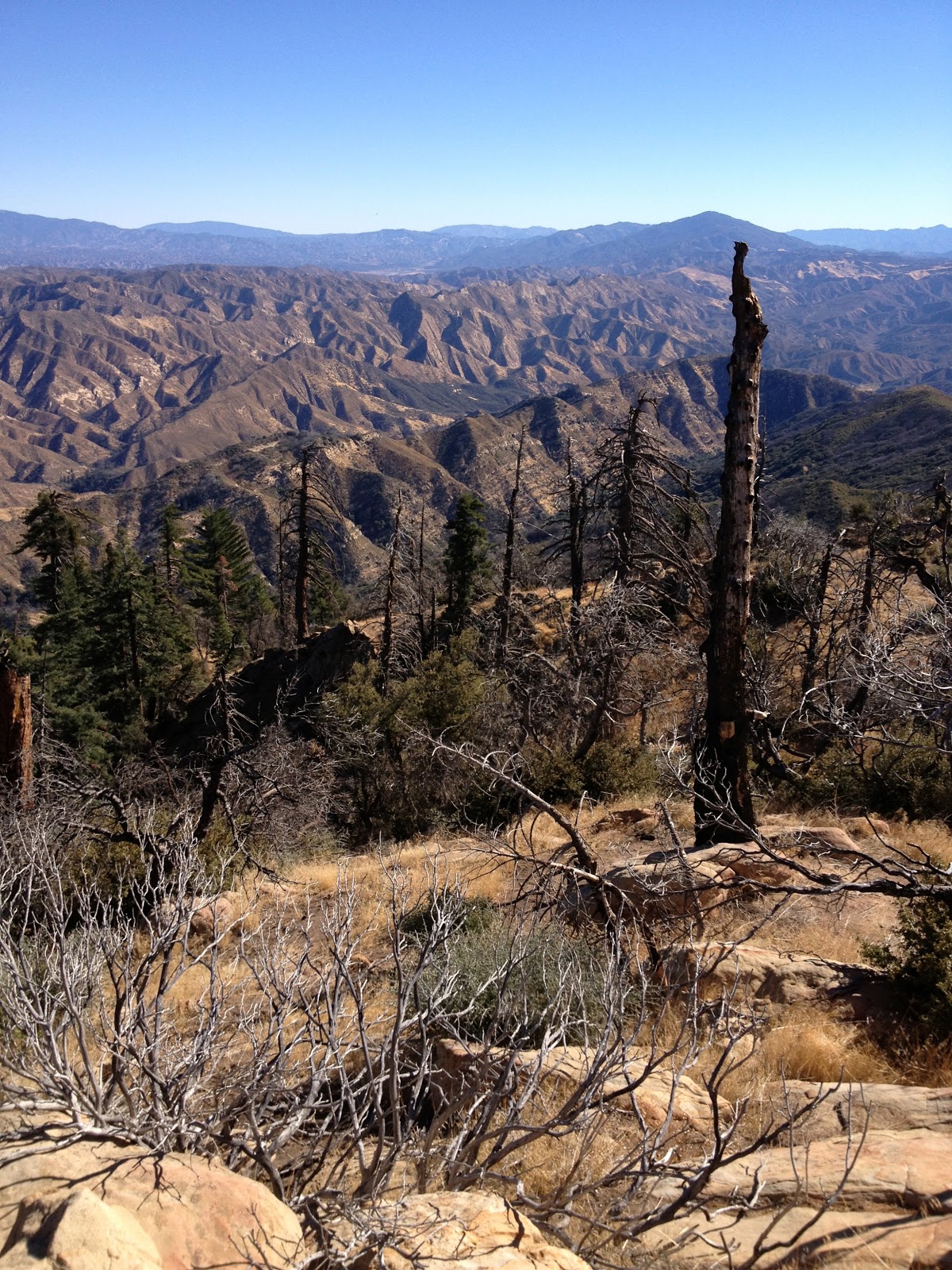
I summited 5h:40min after starting from Willow Flat, and what a view. And what a great peak. This summit is way worth doing. It's out in the sticks, and on a day like I had the views are pretty wild. Views of all the Channel Islands, Pine Mountain Ridge, Don Victor Valley, Alamar and Samon Peak. Views down into the Dick Smith and San Rafael. This peak used to have a fire lookout on top and all that remains are the base pillars and a couple slabs of concrete. I spent an hour on top, enjoying the morning and brunch with a view.
 |
| Madulce Summit. |
 |
| A view west toward Santa Barbara. |
 |
| ENE to Cuyama Peak. |

 |
| ESE toward Reyes. |
 |
| Madulce Peak Summit Register. |

 |
| Looking west to Alamar Saddle and Samon Peak. |
 |
| Thank you Zaca Fire. |
 |
| Break time in the shade at the high junction. |


Somewhere in the day I encountered the skeletonized remains of a small bear. All that was left of the poor critter was a scattering of bones and brown hair. The scavengers had done their job well. It was impossible to speculate on the cause of death.
 |
| Bear remains. |


This hike was a really nice day, and the peak was a fun and engaging climb. I'm glad that after walking by the turnoff for the peak four times previously I was finally able to dedicate some time to just doing the peak. It turned out to be a great day.
Below: this one's for you, Chris ( he comments on this blog fairly frequently). How'd you like the Upper Sisquoc?


