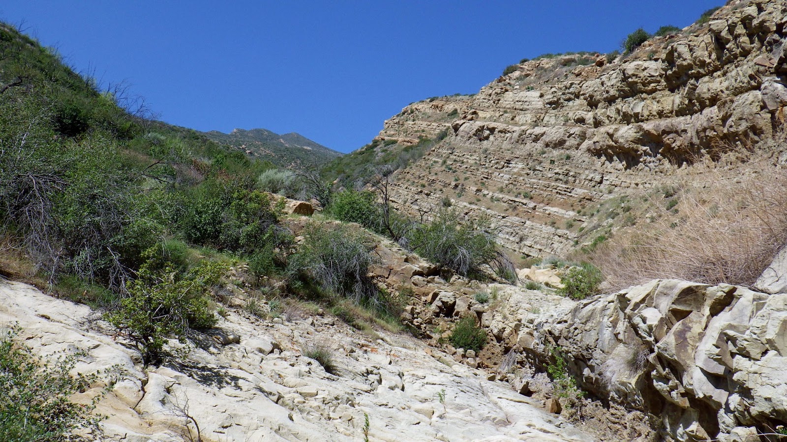
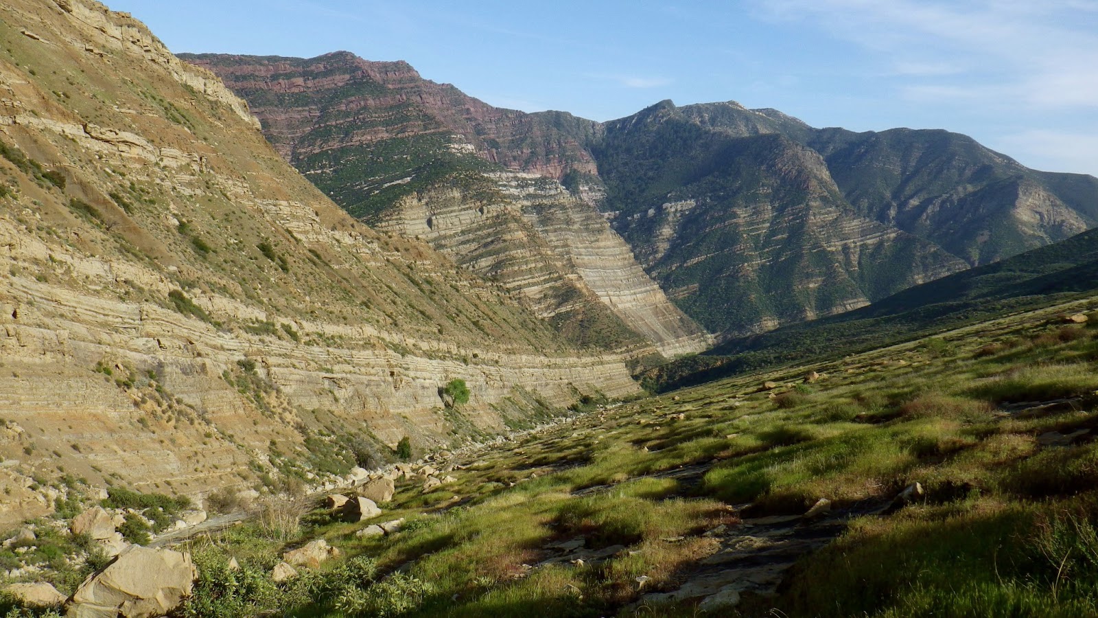
Tuesday, April 2, 2013

A slice of the Piru Backcountry, 03/30/13

A beautiful morning above Lake Piru and Blue Point (front left).
It's good to hear from old hiking mates, and even better to get out and eat some brush with them. Though he and I intermittently communicate, I haven't been out with Nico in almost a full year. We were overdue for teaming on something so I was happy to hear he had a day open and that his idea for the day had the potential to satisfy several long standing questions I've had about the backcountry to the west of Piru Lake.

The bright green lines show our route up the Pothole Trail and our eventual return down Reasoner Canyon.

Nico, high on the the Pothole Trail.
We started walking a bit after 5 in the morning, pounding Piru pavement under a blanket of low clouds and fog. I was a bit surprised at where we were forced to park due to gate closures. We later understood that the lake was so low that the upper boat ramp and the road to it were closed, which added 1.5 miles to what I figured our walk in would entail. Lame. We should have brought bikes, though that damn lake road is pretty steep in places. So after 4.6 miles of muffled and misty pavement plodding we finally encountered the take off for a neglected route called the Pothole Trail.

If not for the pretty clouds this shot would be looking down Reasoner Canyon  onto  Lake Piru.

The Pothole Trail is an old path that ascends west out of Piru Lake, climbing a tough 3 mile ridge before turning north and dropping into Agua Blanca Creek near the Devils Gateway. Agua Blanca Creek and this Pothole route to it are seldom travelled. The trail is named for a pair of grassy depressions just south of Devils Gateway. The first such "vale" is called the Pothole, it is about 5 acres and on the eastern side is a spring (I have no current info on Pothole Spring). Nearby is a smaller but similarly grassy bowl called the Devils Potrero. Nico and I didn't walk down into the potreros so I can't say what that's like, but the potholes/potreros looked pretty much like a place to keep passing through, if you read me.


So getting back to the climb out of the lake, let me tell you that it isn't a giveaway. This Pothole starts climbing very quickly, the terrain being steep and staying that way. Most of the route is overgrown with knee high weeds and brush. The soil is loose and the trail is undefined. It is pretty much a deer trail at this point as it is pretty obvious that very few people use this trail anymore. The low clouds held off the first rays of morning light while we climbed the steep path away from the lake. We'd moved quickly and had ascended above the clouds by sunrise. Looking back down our path we saw a sea of rugged ridges, their valleys deep in shade and hidden by clouds. We watched the first rays hit the small summit called Blue Point. The skyline to the north was dominated by the incomperable Cobblestone Peak. It was a very nice morning for a walk.

Cobblestone Peak and an old OHV sign.
We proceded up the ridge for a further mile until we reached a well marked junction where the Pothole turns north and descends into the potreros. We took a long break here, taking in the views to the north. Nico was hiking well and I was doing alright. It had been an unusually stressful and sleepless week and I judged that I was only at about 75% of normal. After some calories we turned our backs on the Pothole Trail. We had other business in the area.


Nico and I headed south on an ancient jeep road, still climbing. Eventually we ended up wandering westward for a ways, spent a couple hours in the upper parts of a nearby drainage. Saw a lot of interesting rock formations and brush and stuff. We learned quite a bit about that area and yes, I'm being kind of vague about this part of the day.


After a few miles of off-trail, and with no nearby water sources, we decided to turn it around. We returned to the northwest rim of Reasoner Canyon and started down that long grade toward the lake. This was the same overgrown jeep track that eventually meets Pothole trail at it's highest point. This route was long, hot, brushy, and at time difficult to figure out. Twice we thought we'd gotten off route when in fact it was the crazily wide switchbacks that threw us off. In the end we cut those switchbacks pretty easily, but the going was brushy. 

Nico, on the ridge west of Reasoner.


Nico descending through Piru high country.

Soon we dropped into a pretty series of hilltop meadows scattered with old oak trees. A short time later we were back on Piru pavement, just in time for the hottest part of the day. On the walk out we saw just how low the lake is and how little water is coming down Piru Creek. We got a good look back at some of what we'd accomplished, felt pretty good about it. By the time we reached the truck we had banged out 22-23 miles and over 5,000 feet of elevation gain in just 10 hours.

Pleasant meadows above the Lake.

Piru Creek is a trickle.

Cattle and kids on the upper boat dock.

Pothole Trail ascends the endless left leaning skyline.

Piru Creek isn't, and the Lake is a puddle.

Just a warning for those going out this way... Piru is not a nice area, by which I mean that any time you are in the neighborhood of Cobblestone Mountain and Piru Creek one should expect everything to be a little rougher, pricklier, hotter, drier, and buggier than one would normally anticipate. Travel in the area just seems harder than in other parts of the SLP. Also, the snakes are really out now, and so are the ticks. I brushed around three dozen of those creepy parasites off me throughout the day (they give me the willies). And it now appears evident that water (the lack of it) will be a major factor in our backcountry this summer. Plan accordingly.

I had a really nice day, don't feel like I worked too hard despite having started the day with an energy deficit. It was good to hang with Nico again and hear all his tales of what he and other trail burners are getting done in the SLP. Many people are doing extraordinary and athletic things in the Los Padres, whether it's peakbagging, mountain biking, big mileage ultras, or thrashing through the "impassable" old trails. There's lots of people out there doing big things.
Pretty pit-viper

Road miles.

Monday, March 25, 2013

Devils Heart Peak via new route: Coronary Couloir, Class III, 03/23/13

The Longest Day.
22 miles in 21 hours.
12 miles navigating the Sespe.
Summit Devil's Heart.
First Ascent Coronary Couloir.
Still haven't found the Breaking Point.
No longer wish to.

Detail of entire route. Click any image to enlarge.

Detail of Devil's Heart Peak, Coronary Couloir, Class III

The urge to climb Devil's Heart goes back to my excursions on Topatopa Peak and Sulfer Peak. From Sulfer Peak I first saw the huge gash on the eastern side of DHeart that presented a possible route to the summit. From atop Topatopa's rusty tower I had been able to see straight down to DHeart's rocky crown and I understood then that just this little distance between the two peaks nudged Devil's Heart into an even more select handful of uniquely remote SLP peaks. Peaks that nobody does. 

I still consider myself a mountaineer and climber first. If an alpinist wants to go somewhere, he finds a route that'll get him there. Alpinists don't think like hikers and therefore they are not constrained by need for trails. They have the keys to their own freedom. They will generally pick the cleanest, most direct, and most aesthetic ways to reach their goals. This is how the idea for Coronary Couloir was born.


My window of opportunity for accomplishing this goal was narrowing. The further we moved into spring and summer, the less likely I was going to be able to pull this off. I'd tried to get others to line up with me for this weekend's effort but to no avail. This last weekend was simply the best time that I could make this work. I'd have most of a full moon, low water levels, and perfect temperatures. I couldn't put this off any longer in the hopes that conditions would be as favorable sometime later. Time to go.

I started from the Tar Creek trailhead a 05:00 on Saturday morning. Scorpio hung low in the southern sky, arcing above the ambient light of Los Angeles. The morning was cool, the scent of chaparral and glint of starlight my only company. That, and the crunch of my footsteps. I felt good, like I could do this thing I'd laid out for myself. I descended into Tar Creek and turned downstream, following that canyon down to it's terminus on the Sespe, where the real work would begin. 
First light on the Sespe Rock Garden.
Those of you who've travelled down the Sespe probably recall that it felt long and arduous, a combination of swimming, wading, rock hopping and creek bed slogging. That it didn't seem to end. That you probably didn't want to see another rock for a while. Now take all those recollections and apply them to going upstream. Against the current, scrambling up rocks instead of down them. I knew this next 6 miles were probably going to be the most tiring work of the day. And it was. Late in the morning, still wandering up the Sespe, I got my first look at Devil's Heart.

Tevas and Seal Skinz. A good combo for this creek stuff.


Water levels in the Sespe were okay, which worked out well for me.
The first glimpse of Devil's Heart, high and left.


Done with the creek for a while. Next, the summit.

 I had finally passed through the aquatic boulder garden known as Sespe Creek, reaching the bottom of the drainage I'd be ascending at around noon. I was feeling pretty battered by this time, "beat to shit" might be a better way to put it. Under the blessed shade of a tall maple I recharged myself with a massive infusion of carbs, protein and water. After filling my water bag I rose on trembling legs, swayed into my pack and got going.

The entry to the Coulior.


I started up a broad gully that soon became bunched up with brush and trees. The first of the three stages that this route can be broken down into was somewhat frustrating. I found out the hard way that this lowest section of the drainage is where multiple smaller drainages converge before pouring down a brief set of slabby chutes. The chutes were easy, but above them I wasted time and energy mucking around in the runoff branches before identifying the right way into the endless open booked chute above. Eventually I scrambled out of the brush and up a loose face, cracking a smile as I looked up to see more than a mile of gentle skyway arcing to the summit.

Slabby chutes, lower section.
Looking back down the brushy and confusing lower section.
I had cleared the first obstacle and gained access to a really beautiful and unique slice of the Los Padres. All of a sudden the day had been worth it. I climbed a V-shaped chute, the left side of which sloped into the drainage at a friendly angle, an open sheet of sandstone graced with patches of green and golden grasses. Rugged bands of sedimentary rock hugged the right hand side of the massive "V" all the way up. Moving a bit higher I climbed out of the gully's scattered brush and entered the giant chute  For the first time this day I was really having fun.
Grand Scale. Still some brush in this lower part of the Couloir.


A wide open path almost all the way to the summit.
This thing just keeps going...


...and going...
...and going.
After the long and gentle, open and carefree ascension of that pleasant drainage I was unenthusiastic about what I was certain would be a final, brutal brush fight to the summit. But I had it to do. I peered upward through salt crusted sunglasses and suffered the days first real moment of self doubt. Brush. Overhead brush. Fuuuuck. I continued upward as the drainage narrowed to a rocky, brush choked gully. This went on for a while before I was able to find a steep exit which might take me to through the brush to the summit. I off-routed myself by exiting too soon, climbed a couple hundred feet through some brush before realizing that I'd left the the drainage too soon. Cursing myself I reversed that elevation and put myself under the summit. I nearly quit then. After a check of the gps, I rallyed for the last brush haul to the summit.

After the second moment of despair, the gps told me to keep going.


Pinpointing when is the right time to leave the gully and push for the summit can be difficult. 


Finally, the last bit to the summit.
Looking toward Filmore. Sulfer Peak in the foreground.


Left: Cobblestone Pk. Right: Whiteacre Pk.

Like, Yay! It's like, 3pm and I'm like already halfway thru my day!
The summit of Devil's Heart is small, rocky, encrusted with condor piss. There is no benchmark or register. I stayed less than 10 minutes, taking time only for a few pictures and to leave my calling cards. I cannot speculate on what date this nob might have last been visited. I can't find one shred of evidence that anyone has ever been here. Upon summiting my priorities shifted. My new goal was to get back to Tar Creek as quickly as possible before I found myself thrashing about on the Sespe at night. Time to go.

Descending the couloir.
I turned tail and fled back down the peak. My new mantra, "Gotta get out, get the fuck outa here." I found my stash of extras I'd left on the Sespe, switched back into my water shoes and resumed travel. Going downstream was a big plus. I was probably taking half the time to descend what I struggled to get up this morning, oh so long ago. I kept moving, replaying the mantra. Somewhere in the early evening I got "Invisible Sun" by The Police stuck on an endless loop in my head. It could have been worse (it can always be worse). I was using the headlamp and moonlight an hour before reaching the old Tar Creek Trail, relying on the gps to help me find it. Nightfall on the Sespe was truly a beautiful and unique experience, one I took pains to notice and appreciate despite my own pain and fatigue. I won't forget that night walk down the Sespe.

What I would like to forget is the hike out on that old Tar Creek Trail. I got all jacked up on that stupid trail and lost the route several times, costing an extra hour of effort and misery. A sea of brush in the moonlight looks exactly like that, a rolling sea of brush. And if the trail isn't obvious, it's easy to wander off.


I'm not going to attempt to give you a complete rundown of the aches, miseries, agues, and trauma incurred during this effort. Most of you who've been in that neighborhood can look at the map, put two and two together, and figure out that this wasn't easy. But the route is good, or, parts of it are great and the rest of it goes.

A special thanks, to Davi Rivas and Darren Ogden who were awake and concerned when I was finally able to contact them at 02:30 on Sunday morning to say I was fine. They'd actually thrown packs together to come looking for me if I hadn't been heard from by first light (which was the deal). Also, thanks to Nico for being my third back-up man.


Sunday, March 17, 2013

Monte Arido Peak [HPS] and Old Man Mountain [HPS], 03/14/13

Alright kids, I am back in the miles. This ridiculous day, linking these two peaks together, has been on my list for quite a while. I was inspired in this by the adventures of Der Uberhiker, Bob Burd, he of the monster mileage link-ups (dude's a machine). Anyway, this 26 mile day is a killer. 
Over 7,000 feet of elevation gain anyone?

Check out this elevation profile.

Just a hint of Jameson. Monte Arido Road.


It was a cool morning, crystal clear and starry. I left the parking lot at 5am, headlamp leading the way through a darkened Matilija Ranch. I warmed up quickly and found my stride for a few minutes before hanging a left onto the pitch black single-track of the Murietta Trail. I worked my way up the canyon trail's twisty and rock strewn path, crossed Murrietta Creek once and continued through to Murietta Camp. From there the path narrowed into a mildly brushy trail which twisted through the black forest. The rocky track climbed out of the canyon and I was soon deposited on Murietta Road. Oh, good. Let the true slog begin. It was all uphill from here.  
Cara Blanca from Monte Arido Rd
Murietta Road offers an unyielding uphill grind. I settled in for the next few hours of relentless uphill, setting a ground eating pace that I could maintain. As I passed Murietta Spring the starry sky was suggesting the first vague hints of the coming sun. The air shifted and a gentle breeze slid down the canyon. I killed the headlamp as I crested Murietta Divide and hung a right (N) onto Monte Arido Rd. The trudge up Murietta had only been the warm up for the miles to come. It was time to get out of this forested canyon and start working on the mountains.

A look south across the Murietta Divide at Peak 4864 and Divide Peak.
Monte Arido Road climbs out of the Divide quickly, mercilessly. It's lower portions weave through an impressive band of boulder fields, climbing onto the southern slope of Old Man Mountain. As I gained elevation I earned views of Jameson Lake and I could just make out El Montanon (Santa Cruz Island's high point) peaking out of the marine layer. Eventually the road turns west, traversing across Old Man's southern flank (and losing a couple hundred feet in the process) before wrapping around to the northern side of the peak. Grudging every inch of that downhill across the sunny southern slope, I continued around the back side of the peak, in the steeps again. After I passed the Junction for Old Man's summit run I'd be in new territory. The sun was up and the day warming to a beautiful sunrise, the birds were up and about, and from where I stood at that junction for Old Man...well, it looked even steeper than everything leading up to this. It was time to sit down for a bit of breakfast in the sun.

The view uphill from my breakfast stop. There's a couple more miles of the same right behind what's visible.
Done with my break, it was time to bang out the last 3 miles to the top of Monte Arido. I had a minor argument with my body about this new round of climbing. I won, of course. 
Monte Arido is one of those routes that put a hill in front of you, and just when you're nearing the top of the hill and are thinking that hey, maybe this thing'll level out, it crushes you with successive views of more horrific climbs to come. This part of the day was not fun. I put my head down and paced it out, banging away at the odometer, finally rounding the bald plateau of Monte Arido's summit just before 10AM, making it an even five hours from Matilija.

Monte Arido summit
I spent some time on top, sucking in carbs and water. The day was getting pretty warm now. I'd never been up here so I took some time to appreciate the views of all the familiar landmarks I now viewed from this new vantage. The summit itself is pretty boring, just an anonymous and uninformative benchmark and a coffee can register that bore the signs of someone's anti-Sierra Club ire (see below). I myself have observed that that organization's lobbying arm sometimes picks the wrong battles, expending influence and donor dollars to irritate, rather than work with the various parties in a given issue toward a rational and effective solution. It's one of those "Me thinks though dost protest {about the wrong things} too much." issues. But that's just my observation. At the local chapter level I think the organization is a harmless social club that does some good things with, and for, ecologically aware people interested in furthering their outdoor experience. 

The Sierra Club does have it's detractors. Monte Arido Summit Register.


Monte Arido Summit Register.


Monte Arido register, my map and trail journal.

I reluctantly got myself put together for the knee-jarring descent off the summit, back down the way I'd come, headed toward Old Man Mountain. As I descended I was given great views into the Matilija watershed and of the twin summits of Old Man. Eventually I was back at the take-off for the summit of the old fella. Oh good (again). Another half mile of brushy climbing, this time on a wildly zigzaggy route ending on a few feet of rocky mountain top. I started up the trail and as I climbed I got a good look into Old Man Canyon. I involuntarily shuddered, remembering my descent of that hellish drainage (below). 
Rain catch, Monte Arido Rd
Old Man Canyon. Not recommended.
Old Man Mountain from the north, The right-hand peak is the summit and the route climbs the right of the picture.
Old Man Summit Register

This is a good view of the way up Monte Arido. Taken from Old Man.

The day was really heating up and those little black bitey flies were out in force on the summit so I vamoosed outa there, descending to the road where I found a nice patch of shade to park it for a bit. I nearly fell asleep, jerked awake, and swayed to my achy feet. May as well get this over with, I thought. On that note I began the long and pounding slog down these hills I'd climbed. As I walked I remarked to myself that this beautiful, 85 degree day was probably going to be the day I saw my first rattler of the season, and I was right (below). Aside from that, it was a long and unremarkable slog out to the ranch.

Old Man Mountain's pointy sister peak.


FYI: Water levels are well below normal for this time of year (but what's "normal" anymore?), and those flies? Those little black bitey bastards? It's going to be a buggy early spring. The whole day took just under 11 hours to complete.
My first rattler of the season.