Showing posts with label Chief Peak. Show all posts

Wednesday, January 23, 2013

Chief Peak, Ojai's summit. 01/20/13

Chief Peak, viewed from the east while walking Nordoff Ridge Rd.
You know what? The flu sucks, that's what. I feel like Mike Tyson had a go at my kidneys and then threw me in the dryer for an hour. Ughhh. 

Before being struck down by that nefarious pathogen I was having a pretty good life. On Sunday Ruth and I hiked the unrelentingly steep and rocky Horn Canyon Trail, followed the road over to the Chief and climbed that too. I've pretty well documented Chief and it's attendant trails and I'm just extra sick right now so I'm taking the lazy way out (pictures and captions). I do have to congratulate Ruth, topping out on the Chief is a tough day.

Climbing out of Horn Cnyn.

I was a bit surprised by the degree of brush above the Pines Camp. Parts are wide open but other parts were pretty brushy.
The most direct way up Chief's climbs the south facing shoulder.
Ruthie starting up Chiefs...
and a little further along.

Reyes and Hoddock Peak on the left, Piedra Blanca in the middle and Thorn Point on the right.
During our time on the summit a pair of crows entertained us with aerial hijinks.

Ruthie pulling over the top.
One of the two benchmarks on the Chief summit.
Chief Peak's rocky summit.
Lake Casitas, Santa Cruz Island, from the summit.
Santa Barbara from the summit.
The serpentine coils of the Nordoff Ridge Rd.


The route up Chief follows the left-hand skyline. The alternative is to walk all the way around to the eastern side of the peak and ascend from the road on a well established trail.
Afterthought. Thorn Point Fire Lookout from Chief Peak.


Tuesday, March 13, 2012

The Ojai Triple Crown, a 28 mile masochistic odyssey


Welcome to the 2nd (apparently) Annual Ojai Triple Crown. Take Hines Peak, Topa Topa Peak, and Chief Peak, and do 'em all in a day. Here's the stats, and I'll fill in more below:
Miles:  28.9
Elevation gain for the day:  >7,000 feet
Time from start to finish:  12:40

I start walking at 04:30, an hour made even more distasteful by the time change. It is cool and very dark. Patches of luminous moonlight filter through the trees overhead, but the trail remains a black tunnel extending before me. My headlamp is not necessary, but I employ it anyway. The last several times out I've seen cat tracks and this is on my mind in this darkest hour before dawn. Cat eyes reflect light, thus the headlamp. I feel I am moving at a glacial pace, easing through a black world of small rustles and faint breezes. My surgically enhanced night-vision is voided by the headlamp. Every few minutes I pull a "Crazy Ivan", check my six, sweep my backtrail and the surrounding forest with the light, sometimes stopping just to listen. This is not paranoia, this is prudence.
Last year, on the inaugural slog, I didn't quite know how I would feel or how long the day would take, and as a result, I was more concerned with time. I prosecuted it like a war. On that occasion, I felt like I did myself a disservice, like I rushed the day and consequently paid for it in post hike shin-splints and fatigue. Today I choose not to worry about it. I note only the main points, the start and end times and the summits. I strictly ignore my watch for the rest of the day. Time doesn't matter. I concentrate on efficiency, taking constant systems readings, fine tuning my gait, focused entirely on how I feel. I realize that, if I do this "wrong" I could be paying for days afterward. However it turns out, I have to be able to work tomorrow. There is a real world and today I walk it's trails, for tomorrow I pay it's bills in an alternate, less enjoyable reality.

Above and below, Chief Peak at sunrise.

I shiver for a moment in the dark hollow of White Ledge. So far I am feeling this. This crazy thing I've set out to do. I strap into my pack and tackle the stretch before me. Some time later I take off the headlamp and restore my knife to it's usual location on a back pocket ( I had had it clipped to a glove). I'm warmed up now and my pace feels normal for me and, though I don't care, I am sure that I'm already an hour behind last year's time. I pause for a moment under Topa to stash Gatoraid and a PB &J sandwich. No sense carrying these items up Hines if I'm just coming back this way in a few hours. I leave a similar cache at the saddle that separates the two peaks. I am in the weak morning sunlight now. Hines peak is obstructed from view by a lesser hill but that is where I aim myself and that is what I'll climb.

The moon sets on the flank of Topa Topa.

As the miles unfold before me, and Hines Peak gets larger in the windshield, my mind travels down various paths of it's own. I am in synch with myself and my environment. Things are clicking now. Samadhi. My life's true soundtrack sings to me, the crunch of soft footsteps and the whisper of a breeze in my ear. The trail is a lonely space, a laser line through my immediate universe. Where it leads, I go. Soon I stand before the steep slope of Hines. I imagine myself on that unremarkable summit of sticks and stones. I will myself there and I am.

An ancient bit of detritus, found on Hines.
I sign the log atop Hines for the nth time and remind myself that this place needs a new summit journal. The sun is higher now, but brings little warmth. The Stillman apparatus is running at all systems nominal. I note the time in my journal and exit the peak. On the trail again, my mind wanders it's myriad planes while the legs pump and the eyes rove. I retrieve my cache No.1 and move south toward the summit of Topa. Three crows pinwheel across the summit as I roll up to the stone bench. They call to one another as they swoop and dive. I am not alone here. I ingest the contents of my cache, converting carbohydrates and protein into glucose. Installing fresh reactor rods. I take in the view, which, given today's aims, is somewhat dispiriting. The conical summit of Chief Peak is so very far away. The chance to turn back, to call it a day and be self-satisfied, to retreat, lies just below. So easy to return the way I came and stop this madness before someone gets hurt. Clearly I have sat upon this bald summit long enough. My mind is trying to kill me.

A look back towards Topa taken from afar.
Regulation Time Out. Topa Topa.
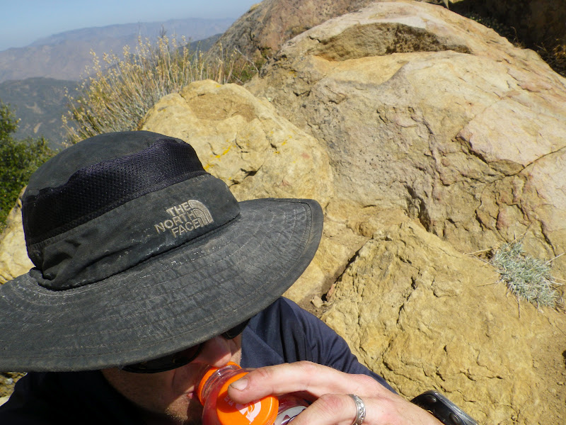
Rehydrating the organism. Chief Peak.

As I descend Topa the breeze stiffens and my crows are kiting away. It is just me and the winding vagaries of the Nordoff Ridge. I retrieve my second cache of food and fluids. The miles unwind below me. I am well into this now, having long since passed any egress that would allow an easy out. I pass the radio towers, and a little later I turn a blind eye to the junction pointing down Sisar Rd and Horn Canyon. I will be there soon enough, yet there remains business to conduct. The way lies west now, across the great, looping turns of the road. Chief is before me now, seperated from me by a deep cleft. The road continues it's inane series of twists and turns, doubling the distance between me and my omega point, the zenith, the last of the up. I soon stand below the ragged scar which ascends Chief's southern ridge. Soon after I stand above it looking down, down to the Ojai Valley which is obscured in a gauzy haze of moisture. I enjoy my break on the summit. I realize that I feel remarkably good. I have benefited from a disciplined approach to water and calories, reaping the rewards of experience. Many more miles to go, though, before my distant terminus.


My friends, the crows, have returned to honor me with their croaking seranade. My mind again wanders where it will while I trudge down the long slope. The crows have now startled a large red tailed hawk and are harrying her across the sky. I am descending quickly now. I pop my ears. The trail wends its rocky route and I follow. Down low, less that a mile from the truck, I encounter the first humans of the day.  I catch their scent, smell their shampoo and deodorant long before I see them. They are loud and shuffling creatures, enjoying their brief foray into the woods. They are entirely oblivious to my presence until I am already upon them. I see them through cat's eyes. They behave like prey. They are those who do not see and cannot hear.

Here's what helped cut the mustard:
Water {3.75 Litres}
Gatoraid {1 Litre}
5 Hour Energy {2}
PB & J Sandwiches {2}
Tiger Milk Bars {2}
Cliff Bar {1}
GU or Accel Gels {6}
Advil {1600mg)
and as always, everything I would need to survive for 24 hours if I had to.
By the way, that whole "not looking at the clock" thing paid off. I knocked 20 minutes off the last time I did this, probably because I wasn't even trying to. And by the way, I feel capital.

Thursday, November 3, 2011

Chief Peak via Horn Canyon, 10/28/2011

Above: Ojai, from above Horn Canyon
Below: Chief Peak from the east
I've taken myself off the DL. Back to the dirt. I chose my trail with a wry touch of trepidation. Just about any real day hike in the Southern Los Padres is going to be steep and tough, but Horn Canyon Trail's first four miles are a doozy even by the standards of it's sister trails. I've always leaned toward the school of "go big or don't go" and since I figured myself to be pretty out of shape after months of not having fun, what better way to test myself than a burly 15 mile round trip?


I started up Horn at dawn. I moved through the low forest of beech and oak, enjoying the quiet murmur of the creek, listening to the waking birds. It was crisp, cold really, so I moved fast in order to warm up. Soon I was feeling pretty good and as the trail got steep I was in fine form. I gotta say I felt mustard. I think I was on a pretty good buzz just being out on a trail alone. I didn't even notice the steeps until I realized I was already walking into The Pines Camp.

The Pines is a sweet little campsite tucked in a fold of the great big hill that looms above Thatcher School. The camp is nicely shaded with several species of pine, and a few of the trees have probably been planted there as seedlings. Several of these trees have bear markings on them. A spring box is tucked in the brush on the west side of the camp and is mostly used for horses. The horses, which I've never encountered, have their own picket posts and a bit of grass to crop. Within the past several months somebody has gone to a great deal of effort, crafting log benches for the site. It's pretty nice but the best features of the camp are the wind protection and the sunrise. The mornings here are golden and warm, but I kept on walkin'.
In a little less than 4 hours I was on the summit. Not bad time-wise. I lingered on the top for over an hour. It was too nice a day to just sign in and bail. A long lunch and a cat-nap later I was scrambling down to the fire road.
Above: Ojai, Ventura, and the Channel Islands form Chief's summit

Below: The Sespe. Nuf said.
So here I am, feeling pretty good about my over-all fitness and very happy with my cardio. Smiles all the way around right? Telling myself that I'm a super great guy in super great shape until...I tried to get outa bed the next morning. What the hell did I do with that god damn oil can?!? And where's my Motrin?! And glucosamine?! Hell, bring me a dead shark and I'll eat it's raw cartilage! I had aches that I didn't never have, ever. This, in a word, sucks. So I have a ways to go to get back to the type of shape these hills require.

Below: I saw the tracks of many deer. Guess the deer of D-13 have had an easy hunting season so far. Also, I saw a very large red tail hawk, and from about fifteen feet away I spooked a pretty Coopers hawk with a lizard in it's mouth.


Below: The Pines Camp


Sunday, January 16, 2011

Peakbagger's 1 day Ojai Triple Crown. Sisar>Hines>Topatopa Bluff>Chief>Thatcher. 28 miles, 7,000 feet of up, 13 hours.

Must start 2011 with a bang. My sick mind devises a linkage of peaks which, perhaps has been done, but I've never heard of it. This route starts in the dark at the Sisar Road trailhead and ends in the dark at Thatcher School, between which, I will ascend Hines Peak, Topa Topa Peak, and Chief Peak. These peaks are all very familiar to me and to the blog, but lately I have been thinking about high mileage linkages and it occurred to me that these three peaks could be put together as a 28 mile one-day walk with 7,000 feet of ascent for a little spice. Crazy right? Yesterday I did it.


The day started at 03:00 when I woke up and couldn't go back to sleep. So I got up and hydrated. Drank a bunch of coffee too, of course. A bit after 04:00 I left the house and drove up to Thatcher School in Ojai. My good friend Cliff Griffiths is an early riser and he agreed to meet me at Thatcher and give me a ride into Upper Ojai and all the way up to the Sisar Rd trailhead. Thanks again, Cliff! As we bounced up Sisar in his pick-up we got a sign that this would be a great day. A pair of handsome juvenile foxes crossed the road in the glare of the headlights. Cliff went on to Tar Creek that day and I started what I'm now calling The Triple Crown.
I started in pitch black, walking through an eerie wood, the cold breeze creating a multitude of small noises. Little things stirred outside the cone of light from my lamp. It was chilly and I moved quickly. I made good time as the sun rose. I stopped only briefly at White Ledge before moving ever upward to the bench on the ridge. Here I stashed some hi-tech muscle recovery drinks. My plan was to pick them up on the return trip toward Chief Pk.
I continued east up the fire road to the saddle and started strolling toward Hines, the plan being to knock out the toughest and the tallest peak first. After a break at the Ladybug junction I made short work of the climb up Hines, which was mostly free of snow. I did the usual summit thing: pictures, logs, texts and such while taking in the incredible panorama on this extraordinary January day. The descent was uneventful and I was on my way to Topa Topa.

Done with Hines, sitting atop Topa. Taking in calories and caffeine and NSAIDs and water. Absolutely blocking all thought of distance or time. Those are irrelevant. I will get there when I get there and it will be what it is, but I will get there.
I trudged through the endless miles of ridge road until at last I was at the ugly base of Chief Peak. It's pointy summit protrudes into the fading sky. It tries to look bigger and tougher than it really is. Chief peak is a fraud, it ain't hard. It's just one step after another like this whole damn day has been. My mind is in control. I climb the peak, sit on it's summit, breath it's air. 7 miles to go.

I descend from Chief to the road as the sun begins to set, and ramble through the next many miles. I pass through the Pines and know that I am close. I notice that I have a moon shadow. I take a break to stare at this bright 3/4 moon and the winking stars and I realize that this day has been one of the best days I've had in a while. Every part of the day was beautiful, mild, clear and bold. I realize that I feel pretty good for having walked 26 miles so far. Yes, a very good day.
With a bright light over my left shoulder I decided to walk the remaining 3 miles to the truck without using my headlamp. It was just too fine an evening to use artificial light, even in the darkest forest bottoms. I walked quietly to the accompaniment of frogs and crickets and even negotiated Horn Canyon's 4 creek crossings without difficulty, which considering my proclivity for falling in moving water is surprising. This was a really nice night walk.
Well, I done it! Here's the time-line:
Sisar Road (start): 05:35
White Ledge Camp: 07:05/mile 4.5
Bench on the Ridge: 08:10/mile 6.5
Saddle: 09:05/mile 8
Lady Bug Junction: 09:55/mile 11
Hines Peak summit: 10:30/mile 11.5
Topa Topa summit: 12:15/mile 14
Chief Peak: 15:10/mile 20
Horn Canyon Trail: 16:40/mile 24
Thatcher School: 18:35/mile 28 Total Time: 13:00 hrs
__________________________________________