Showing posts with label Sespe River Trail. Show all posts

Saturday, January 17, 2015

The TWO?!? Harris Tunnels?!?, Red Reef Trail


First off, I want to say that I'm so friggin' happy to be back on my feet that I want to do a little happy dance. But Homie don't dance, so instead I did 20 miles. Ha! Take that influenza virus!
Like most men I'm an absolute child about being sick. I hate it. Every sniffling minute of it is one big pity party.  But that's behind me now and to celebrate I bring you all an interesting riddle, one discovered quite by accident, as fortune would have it.

Apparently there are two (!) Harris Tunnels!
I did not know this.


Before I get to the Tunnel stuff I have to mention a few things about the day. Basically, the morning was glorious. Not surprisingly the Piedra Blanca/Sespe trailhead was packed with vehicles. I pulled into the last available slot and left the lot at 0700. Within a mile I was feeling perfect, just humming along. The sun was coming up, cresting the ridges downstream. Little birds were fluttering about, chirping. The morning air was brisk enough to require a little extra insulation. A quiet rushing noise rose from the creek on my right. A gentle sunrise breeze rose. The morning crystal clear. Things were as good as could be.  


I trucked right through the early miles, looking forward to reaching the junction at Bear Creek, where the Sespe Trail stars getting really scenic. Along the way I noticed numerous tents camped in the many unsanctioned sites sprinkled along the length of the creek. Here and there a thin streamer of smoke would curl out of the cottonwoods as I silently passed early risers. Clearly there were many, many people camping along the river this morning.

Eventually I reached the stretch of trail that crosses back to the north bank and starts a repetitive cycle of gently looping climbs and dips that circle around low shoulders of the hills above. Atop each little rise was a fresh view of the dramatic landscape ahead. It's easy for me to forget how pretty this stretch of country can be, how colorful the geology, how brightly the early sun beams off the serpentine curves of the Sespe. Eventually I reached the junction for the Red Reef Trail. I crossed the Sespe heading south and started up the tight little canyon which that trail ascends.


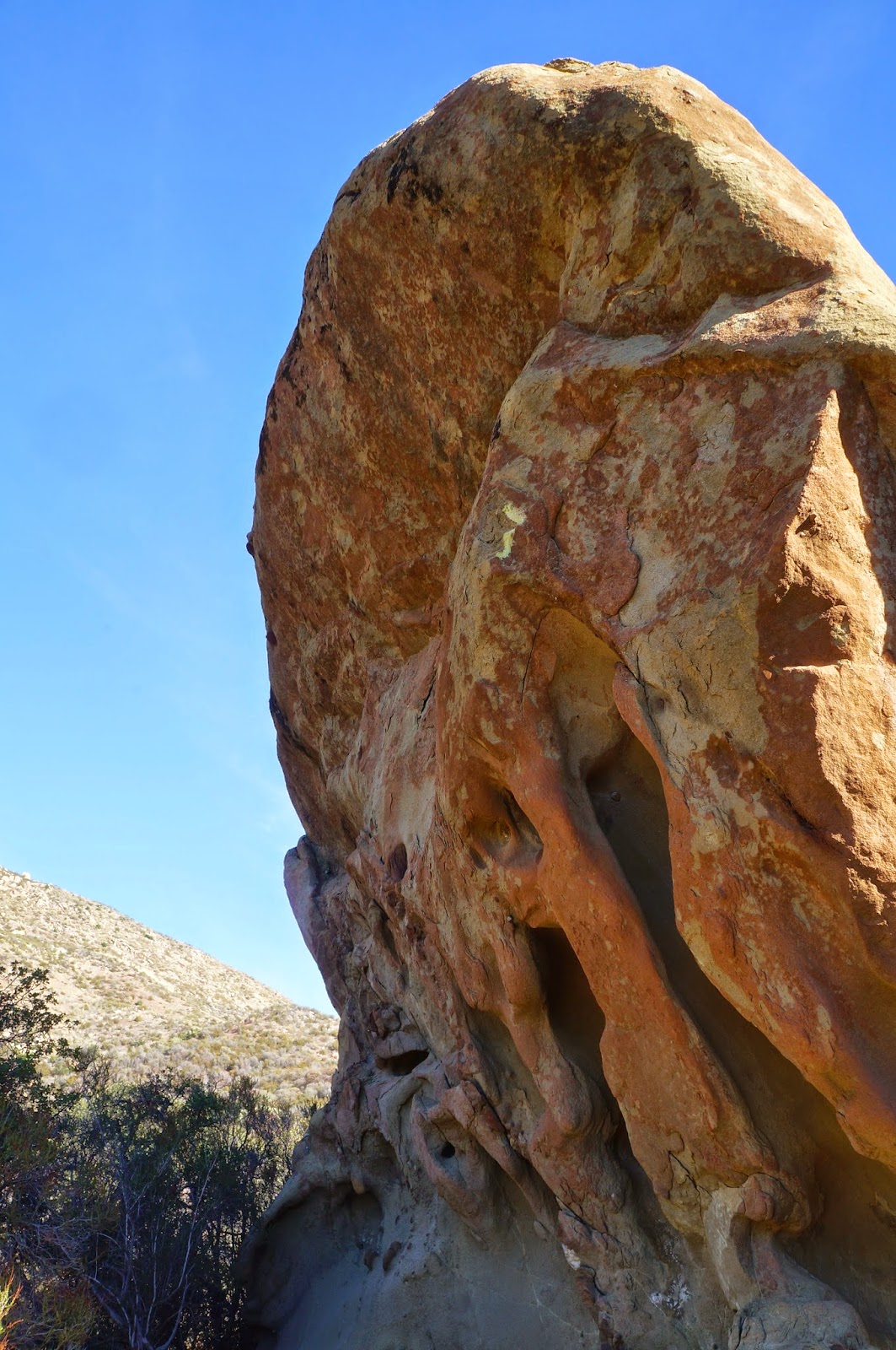
About a mile up the trail the canyon narrows dramatically, framed on either side by steep bands of red sandstone. The trail runs next to a small stream and sunlight dapples through the oak trees and occasional spruce. The canyon gets even tighter and around a twist in the trail one approaches what everyone knows as the Harris Tunnel.

This unusual feature was necessitated by the geology of the canyon. Over time the little creek had eroded a notch for itself in a huge, upthrust strata of sandstone. For the creek this was a completely sufficient solution but getting horses through the rocky creek would be a non-starter. The answer to this problem came in the form of drill holes bored in the rock on the east side of the problematic creek, these holes being packed with a judicious amount of dynamite or blasting powder. The result is a brief tunnel about 8ft high and 8ft wide. A rider would have to dismount and lead the horse through but otherwise the problem had been solved.  

This project was completed in 1907 by TJ Harris and RJ Harris. Says so on the wall of the tunnel, chiseled in their own hand. Another fun fact, there is an old site in Middle Sespe called the Harris Ranch, clearly the two are related. And that should be it right? Not so fast...

The south facing view of Harris Tunnel.
Harris Tunnel, looking north.


I stopped for a late breakfast at an open spot on the creek, got bored, and started doing what I'm programmed to do, which is to start poking my head in holes and scrambling over rocks and busting through brush and generally being a boy. An hour later I was a couple hundred feet up the east slope of the canyon wall when I spied what really looked to me like an old trail. Hmm. I dropped down a little bit and yeah, this wasn't some animal track. This was a real trail. Or, as I found out, remnants of a real trail. I picked up the path and started following it north toward the Sespe. It was overgrown and perilously washed out in places but a few minutes later I rounded a turn and twenty feet away was another tunnel. A big, round tunnel through red sandstone. I was a bit surprised to say the least. From this distance I could even see the marks left by the rock drilling for blasting. I wandered over to this feature and had a look see.

The first thing I did was walk through the tunnel and out the other side. I followed the forgotten trail a bit until it became impassable before returning to my find. First, this tunnel was actually two arches of rock. I concluded that the center of the roof had caved in at some point and made a natural skylight. Again I noted the bore holes. Unlike the Tunnel everyone agrees is "Harris Tunnel", this one didn't have any names chiseled into it, though I did find this one to be the more architecturally and esthetically pleasing to the eye. Pretty dang cool if you ask me.

Here's what I'd like to know: does anybody out there know the story behind this second tunnel? It's just a guess but I'm pretty sure this tunnel precedes the one on the Red Reef.

The "other" Harris Tunnel.


After that I couldn't think of anything else to do here so I went back down to the Sespe. It was so pretty in the creek there that I was reluctant to just cross and get back on the highway-like Sespe Trail. Besides, I could hear people on it from a quarter mile away. Sounded like it was crawling with tourists. I decided to stay in the creek for a while and avoid the masses. The day was warm by now and I stopped to splash my face and take in the sights. I'm glad I did because I was most of the way back to Bear Creek by the time the creek forced me back up to the main trail and into a mass of trudging troglodytes, slouched over with ill adjusted packs, yammering about how being in the great outdoors is so stress relieving. Blechh!

I'm not exaggerating when I say that on my way out I passed at least seventy (70!) people on the trail! I'm not exaggerating because I was counting heads and gave up at seventy! By my estimate there were probably close to two hundred people strung out along that trail and planning on an overnight stay. Probably a hundred people fighting over dipping a toe in the single pot of scummy, sulphury water at Willet Hot Spring. Ahh well, I'm sounding curmudgeonly. Must be my age or something. Pretty good to be back at it though. Take care. See you out there. And don't get that virus that's making the rounds, it's bad for your health.


Thursday, December 25, 2014

No Name Canyon


I need a break from the Sespe for a bit. I've logged four recent trips into the Trout Creek morass and added this (today's) bit of scrum to the mix. Off-trail drainages have been a recurring theme lately. Partly I figure it's wise to knock these places out before the marijauna growing season starts up again.  Encounters of the narco kind aren't my idea of fun, and I've concluded that every little drainage in the SLP, no matter how remote, hosts such sites. Also, these drainages are kind of fun in their own sadistic way. But they sure do dish out a beating. 

The itinerary for this day included an exploratory recon up an unnamed drainage on the south side of the Sespe and just west of Bear Creek. This gully has caught my eye on occasion. The entrance from the Sespe is framed by a clustered jumble of highly eroded red-brown formations. This feature is fairly easy to thread but it does narrow down to a neat little slot. On either side of the slot are pocketed strata which rise like a small gorge to either side of the gully's outflow. In other words, this slot is a natural gate.

I, and Josh Weir, slipped through the gate and proceeded a mile up an extremely brush choked gully. Due to the recent rains, and the fact that this gully drains off a northern slope, every rock was slicker than snot. Muddy feet and slick rocks made for a tough go. The day was not without injury. As the drainage continued its winding course upstream we gradually passed into a zone of oaks scattered with a few sycamore trees. The brush remained a persistent hazard and we were often forced out of the creek onto muddy slopes in order to bypass particularly troublesome tangle or deadfall. 

After a while the trees grew taller and more abundant. The way forward became dark, dank and wet, the rocks blanketed in green moss. The gully steepened and water cascaded down numerous little falls. We climbed upward between immense boulders, sometimes over or under them. We slipped on slick rocks and dead leaves. Our pants were soaked and muddy from the knee down. 

We eventually climbed into a huge and deeply shadowed gorge of grey stone. This feature is very visible from the Sespe Trail and forms a dramatic "V" over the drainage.  Near vertical cliffs rise above a small hollow for several hundred feet on each side. The small space in between these walls was crowded with oaks, sycamores, and large boulders. Several old spruce trees grew in the upper part of the gorge. 

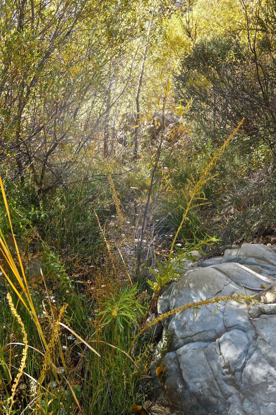
Farther up from the spruce trees the drainage devolved into a mess of manzanita and scrub oak, so we returned to the little hollow in the bottom of this upper gorge. We sat under the trees and had some breakfast and conversation, though Josh talks enough for both of us and I was mostly content just to listen. A quiet breeze stirred the sycamores and dried leaves rustled and fell. The little creek burbled through the rocks. Upstream a jay squawked. It was a good morning, grey and overcast, moody. Excellent exploring weather.


A view across the Sespe to Thorn Point.


Sespe Creek after the rains (and below).

Thursday, November 27, 2014

Wasting Away Again In Manzanitaville


Mike Shields enjoying the natural wonders of Trout Creek.

Happy Thanksgiving everybody. I just got back from shooting some fish off County Line, which is how I am recovering from this strange odyssey of brush ninja meanderism. Salt water immersion is good for a minor case of poison oak. Nothing from this day is worth a recommendation. Some days are just like that. I contemplated not even posting this one but figured that I could write this as some kind of public service "don't go here" announcement.

Thorne Point, from above the Sespe.

The green line follows this day's wandering weirdness. Don't try to make sense of it.
The day was initially about a resumption of my exploration of Trout Creek.  I have (or had) a reason for this recurrent interest in an otherwise unpleasant drainage. In light of my recent experience there I am still undecided about wether to give up on that particular notion. Mike has his own interest in the area, a lingering and unresolved matter which I'm sure is nagging at him like a toothache. For the time being I'll remain vague about these concerns, hopefully maddeningly vague.

We pretty much went all over most of the terrain in this photo.
Back to the day in question, we pounded down the Sespe River Trail out of Rose Valley. Mike had identified an old dozer track that looked like a promising way to access the upper half of Trout, so we kept on truckin' right past where Trout empties into the Sespe. Mike's guess was good, a stout little climb which put us over a ridge and into a scrum of brush which we descended into the middle part of Trout. By the way, Trout Creek is a misnomer... there's no trout there.

We headed up Trout for a bit before climbing out of the west side of the creek to investigate a bouldered flat, didn't find anything of interest, dropped back into the creek and proceeded further upstream. Things got ugly mighty quick. "Ugly", in this case, is a descriptor which I've employed as an understatement. Take the ugliest horse you've ever met, mate it with a triceratops, expose the offspring to gamma radiation while in utero, name the baby Bertha, and then you see the analogy I'm trying to make. Even in this remote and thoroughly fucked up drainage we found a marijuana grow site.  It's true. These people have staked a claim in every watershed in our forest that doesn't have a trail running up it. 


Green Hell.
Another pot site. 
We traveled far up Trout until we were basically under Thorn Point, not that we could see any of that peak through the jungle we had ensnared ourselves in. By that point we were fed up with vines and sticks and brush and deadwood, and without any real goal for being there we started questioning why this had happened to us in the first place. I mean, we're intermittently nice people! What did we do to deserve this? With that thought we turned it around.

Sadly, descending and escaping from the creek led us in a whole other direction, one which changed the type of brush but not the quantity. I swear, this forest has developed a taste for human blood. So, stupid guys that we are, we worked up this bright idea to pioneer a new route out of this mess and back to the Sespe. We worked eastward up a twisty wash, crawling on hands and knees through numerous brush tunnels, fighting tooth and claw to advance our new found cause. My rich and colorful brush dialect became a monotonous kind of droning, accented by the sounds of lumber snapping and nylon shredding. We escaped from this pernicious gulch, climbed to a saddle, and there before us was a hideous sea of brush. Before continuing we turned back the way we had come and issued a big "Fuck! You!" in that general direction. We dropped off the saddle and in about ten minutes found ourselves reversing the same kind of crap we'd been doing all day. Another inglorious gully. I hung back for a bit and watched Mike struggle with this latest iteration of hell. I have to say it was great entertainment, though Mike didn't appreciate my laughter. Sorry Mike.

Some time later we encountered a deer track that diagonaled up and out of our little Eden. We'd had enough. Follow the deer. This path was better than many of the regular trails in our forest. In short order we topped onto a slender dragon's back ridge which descended steeply into the Sespe. This was easy street and it wasn't long before we turned west on Interstate Sespe headed for home.


Deer tracks, the handy bypass routes of the SLP.

Tuesday, November 4, 2014

A Descent of the West Fork of Piedra Blanca Creek


Amazing.
Jaw dropping.
5 Stars.
A virginal forest of arboreal delights.
I think I'm in love.
Can it get any better than this?

Click any image to enlarge it. I think you should.

This descent has been on my list for quite a while. For years I've not been shy about asserting that the Reyes Ridge hosts the best of our forest. There are beautiful places and hidden gems all over the place, but the high country between Pine Mountain and San Rafael Peak are where my heart lies. Cedars and pines and dark hidden places and moss lined creeks and rocky buttes and blue jays and bears... my kind of paradise.


In an enduring effort to know this region as well as anybody I've been eyeing a number of places that people just don't go, which leads to what went down on this day. Jack Elliott and I left the Sespe/Piedra Blanca trailhead on a crisp and clear sunrise. We burned up the miles through the Piedra Blanca and Twin Forks campsites, downshifted up the grinding climb out of the creek, and crested into Pine Mountain Lodge two and a half hours later. We stopped at the old campsite for a time, steam rising off our backs,  sweat turning to frosty wet in the forty degree air. After a bit of breakfast and some basking in the chill sun we tightened everything down for our real raison d'etre.  I had an inkling what this descent would be like, but in the end my own preconceived ideas fell far short of the gorgeous reality below.


We followed the sandy wash out of Pine Mtn Lodge, headed downstream and west. In short order we were oohing and aahing at the huge trees, shallow pools, and sculpted slabs framing either side of the creek. It seemed that we were instantly transported into a primordial forest of Disney-like character. I was just beaming inside. Oh hell yes. This place was a true beauty. We continued downstream through a subtle turn to the south, sunlight dappling through the forest canopy, water trickling beside us, and soon we reached a small branch coming in from the west. Here the creek was a shallow brook  turning back to the southeast, coursing through grasses, huge cedars, alder and spruce everywhere, massive boulders randomly parked along the stream. Heavenly. All through this uppermost portion of the creek we'd had little trouble, a well worn bear trail guiding the easiest path forward.


 Deeper into the southeast turn of the creek we emerged from this eden into a new iteration, a broad avenue of boulders framed by cedar forested slopes. Electric green moss grew on many of the larger boulders. Birds zipped through the trees. Gravelly sinks lay where water would pool in wetter years. We rock hopped along, pausing frequently to just take it all in. Occasionally a natural dam of deadfall wood presented a worthy obstacle but by and large we just bounced along unhindered. And it just kept going.


We gradually descended into another elevation of forest, a different stretch populated by old growth trees, alder, spruce, and cedar, but more densely spaced than in the previous mile. Again there was water in the creek. This was a magic mile which provoked many more exclamations of goodness. Somewhere in it I rounded a large tree and just 50ft away was a big ole bear (below). I hand signaled Jack and together we watched that bear for a while. He knew we were there and moved up the slope a bit, completely unalarmed by our presence. At one point he turned around to look straight into us for a good 15 seconds before vanishing into the forest. In the creek below, the water was muddied, and big wet paw prints revealed where he'd come from.

Bear.


A bit later we encountered a fractured cliff face which was easy to descend. Water dripped from cracks all along the base of this falls, and lush ferns grew out of the rock on its shady side. In the center of the falls was a deep and mossy grotto. It was early afternoon by this time and we broke for a snack. I observed that this drainage just seemed to go on and on without end. Neither of us were disappointed by this, but we both knew that somewhere below, once we'd descended into the chaparral zone, things were bound to get ugly. An hour later we encountered a 30ft waterfall which was easily bypassed, but that falls seemed to be a message that the beautiful sights and scenes were about to come to an abrupt end. Indeed, soon after we were in a scrum of extraordinary proportions.


Somehow we prevailed over the forces of nature. Undoubtedly the prodigious use of profanity helped grease the way. Suffice it to say that the last hour before popping out at Twin Forks was unpleasant, wet, and tiring. I got garroted by a thorny vine, slapped in the eye by a tree branch, poked in the eye by another, and was totally ensnared in a brush trap which, while fighting out of it, rudely ejected me face first into a pool of water. Good times. A small price to pay however, considering the forested Disneyland we'd beheld.

*The terrain in this drainage is not technically all that difficult, but a good head for solving descent "puzzles" would be helpful in saving time and energy. That being said, this drainage feels long. Hell, it is long. We were both pretty worked by the time we popped back out onto the PB trail. There are consecutive miles of boulder hoping, scrambling, down climbing, up climbing, butt sliding, crab walking, elbow crawling, tree climbing, log walking, and brush fighting involved. Before we even entered the brush zone just the realities of this rocky descent had beaten us up but good. Given the nature of the terrain I would advise following parties to be on guard for that insidious sloppiness that comes with being tired, for there are one million and one ways to injure oneself in an environment such as this. But go, go and leave no trace. The beauty here rivals anything in our forest.