
While scrolling through maps, hunting for obscure places I haven't yet visited, the name "Black Bob Mine" caught my attention. Even more interesting, a study of satellite imagery showed several small structures and a primary building at the site. Furthermore, there appeared to be a trail which descended from the summit just west of Tecuya Mountain. This point could be accessed via Forest Rte 9N21, and though numerous questions remained, I felt I had enough beta to make the jump.


The first thing I noticed upon arriving at that "trailhead" just west of Tecuya was that there wasn't any trail. I found this strange because the trail shown on the topo had indicated that this was where I ought to start. Whatever. I dropped over the edge and started a rapid, steep, dusty and loose descent into a mixed forest of scrub oak and jeffery pine. 15 minutes later I stumbled upon a narrow and twisty motorcycle track which I guessed was what had become of the trail. Following this route led deeper into the forest, down the spine of the eastern ridge of Black Bob Canyon. Visibility was consistently obscured by the density of the forest, though at several points I had partial views right (E) into Dead Man Canyon and deep into Tecuya Canyon. The track continued to descend at a very steep rate, and I came to appreciate that getting a motorcycle up or down this route would require considerable skill, and would be pretty damn athletic.

 |
| A look (kind of) into Tecuya Canyon |
After forever the ridge sort of settled down into a rolling bit of hilly scrub and yucca. At a break in the brush I was able to lean over the lip and get a glimpse into Black Bob and was heartened to see, far below, a tin roofed structure that looked an awful lot like what I expected to find. I continued down the ridge on the MC trail, long after the point that I felt I had passed the cabin somewhere below, and now behind me. I had started wondering if this MC trail actually went down to the cabin when I came a cross a short stretch of barbed wire stranded on ancient wood posts. Following the fence line led to a small clearing where the trail continued north down the ridge, but to the left I saw a smaller track take off into the forest. Aha!, I thought, here we go.

This slender thread of a trail cut back to the south, steeply descending across the rippling eastern slope of Black Bob Canyon. I dropped through yucca spotted desert, a steep angle falling away beneath my feet, following the curves of the canyon. This went on for a good bit before I rounded another barb wire festooned turn and there below me, tucked under some oaks, lay a tin roofed two story cinder block shanty and two out-buildings.

Approaching the house I passed the remains of an old table saw. The small out-building I had initially taken for an outhouse was actually a generator shack. The lower level of the cabin was actually a double bay of garage type space. Rusty mining equipment, spare parts, wire, barrels, and several dozen 5ft drills were strewn about the space. I hiked upstairs for a look.
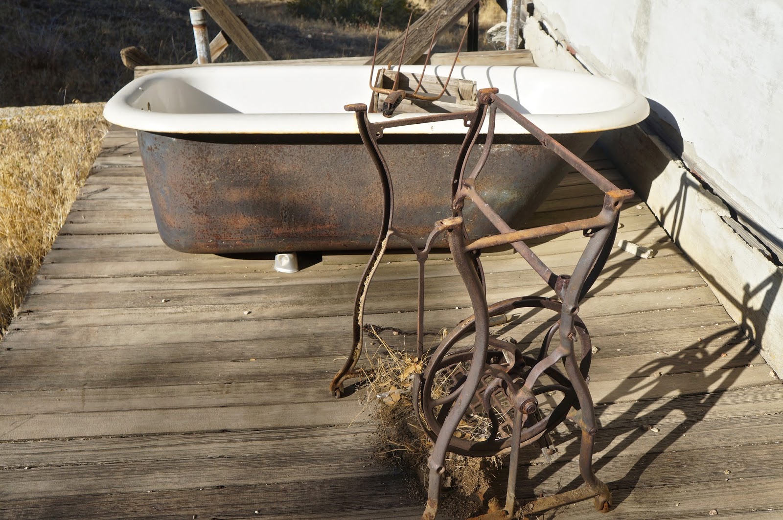 |
| An old tub and a stand for a push-pedal sewing machine. |
The house was a simple affair, one small bedroom, a tiny living space, a kitchen and a cramped bathroom. The whole house was strewn with the mouse tattered remains of a life long abandoned. Ancient publications, old spice jars, box springs, busted furniture, a pot belly wood burner, can openers, coffee cans, rat poison... I could go on and on. The old wood burning stove had been modified in an ungainly MacGyverism so that it used propane. Half-assed electrical work dangled from the ceilings. A 1960s fridge tilted into a corner. Mouse droppings everywhere. I stepped outside to an adjacent cold storage, cut into the hillside just behind the house. In this space were numerous intact jars of visibly recognizable foodstuffs, preserved by hand. Home-canned cauliflower, beans, carrots, fruit, etc..., still recognizable through the dust of ages.
Having looked all over the place I concluded that the last time anybody had actually resided here had been right around 1970.

 |
| This is the stove that had been converted to LP. See the gas line running just in front of the burner top. [Lorinda has informed me that this gas conversion was a new phenomena in stove tops beginning in the late 1920's] |


 |
| What this old contraption could be was beyond me. (Lorinda informed me it is a road grader) |

I had passed an old iron sign as I walked up to the house, and during the whole time I'd been poking around this sign had been tickling the back of my brain because I knew nothing about any "hiking trail" out of this canyon other than the route I took to get there. Such a route was not to be found on current topo maps. But this sign was firmly sunk in the ground in the opposite direction I'd approached from. Hmmm. The trail beyond the sign headed up canyon in the direction I wanted to go, and looked at first glance like a real phenomena. What the hell... I gave it a go, and was quite pleased with the result, for a while at least.

So my new exit trail meandered into the forest, headed straight up the floor of a narrowing Black Bob Canyon. The first "plus" was that I was climbing the canyon under a canopy of old oaks, and the shade was much appreciated. The second "plus" was that this hike out was kinda pretty. I'd been enjoying myself for quite a while when the track suddenly broke out of the forest and threaded through a small vale of chokecherry, the berries ripe on thorny vines. Minutes later the track to an abrupt right hand turn and started clawing a direct line up the western ridge of Black Bob. This climb was a haul, gnar, 2,000ft in less than 2 miles. I trudged up from the canyon floor, exchanging oaks for pines, and popped out on the forest road just a short 3rd of a mile from where I'd parked.
This had been an interesting little day. There is essentially zero information on-line about the who/what/and when of this mine, though it sure made for a remote excursion.


 |
| Chokecherry meadow. |
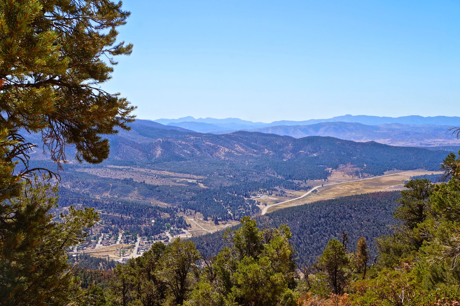 |
| Cuddy Valley from Tecuya Mtn Rd. |


.jpg)
.jpg)
.jpg)
.jpg)
.jpg)
.jpg)
.jpg)


