Saturday, September 27, 2014

Black Bob Canyon


While scrolling through maps, hunting for obscure places I haven't yet visited, the name "Black Bob Mine" caught my attention. Even more interesting, a study of satellite imagery showed several small structures and a primary building at the site. Furthermore, there appeared to be a trail which descended from the summit just west of Tecuya Mountain. This point could be accessed via Forest Rte 9N21, and though numerous questions remained, I felt I had enough beta to make the jump.


The first thing I noticed upon arriving at that "trailhead" just west of Tecuya was that there wasn't any trail. I found this strange because the trail shown on the topo had indicated that this was where I ought to start. Whatever. I dropped over the edge and started a rapid, steep, dusty and loose descent into a mixed forest of scrub oak and jeffery pine. 15 minutes later I stumbled upon a narrow and twisty motorcycle track which I guessed was what had become of the trail.  Following this route led deeper into the forest, down the spine of the eastern ridge of Black Bob Canyon. Visibility was consistently obscured by the density of the forest, though at several points I had partial views right (E) into Dead Man Canyon and deep into Tecuya Canyon. The track continued to descend at a very steep rate, and I came to appreciate that getting a motorcycle up or down this route would require considerable skill, and would be pretty damn athletic.


A look (kind of) into Tecuya Canyon
After forever the ridge sort of settled down into a rolling bit of hilly scrub and yucca. At a break in the brush I was able to lean over the lip and get a glimpse into Black Bob and was heartened to see, far below,  a tin roofed structure that looked an awful lot like what I expected to find. I continued down the ridge on the MC trail, long after the point that I felt I had passed the cabin somewhere below, and now behind me. I had started wondering if this MC trail actually went down to the cabin when I came a cross a short stretch of barbed wire stranded on ancient wood posts. Following the fence line led to a small clearing where the trail continued north down the ridge, but to the left I saw a smaller track take off into the forest. Aha!, I thought, here we go.


This slender thread of a trail cut back to the south, steeply descending across the rippling eastern slope of Black Bob Canyon.  I dropped through yucca spotted desert, a steep angle falling away beneath my feet, following the curves of the canyon. This went on for a good bit before I rounded another barb wire festooned turn and there below me, tucked under some oaks, lay a tin roofed two story cinder block shanty and two out-buildings. 


Approaching the house I passed the remains of an old table saw.  The small out-building I had initially taken for an outhouse was actually a generator shack.  The lower level of the cabin was actually a double bay of garage type space. Rusty mining equipment, spare parts, wire, barrels, and several dozen 5ft drills were strewn about the space. I hiked upstairs for a look. 
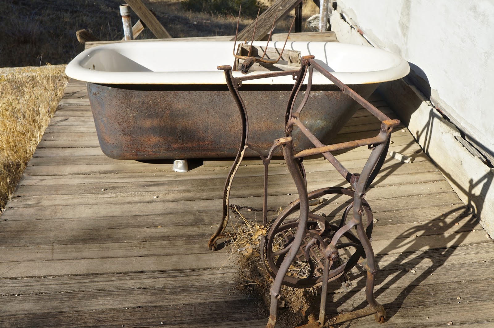
An old tub and a stand for a push-pedal sewing machine.

The house was a simple affair, one small bedroom, a tiny living space, a kitchen and a cramped bathroom. The whole house was strewn with the mouse tattered remains of a life long abandoned. Ancient publications, old spice jars, box springs, busted furniture, a pot belly wood burner, can openers, coffee cans, rat poison... I could go on and on. The old wood burning stove had been modified in an ungainly MacGyverism so that it used propane. Half-assed electrical work dangled from the ceilings. A 1960s fridge tilted into a corner. Mouse droppings everywhere. I stepped outside to an adjacent cold storage, cut into the hillside just behind the house. In this space were numerous intact jars of visibly recognizable foodstuffs, preserved by hand. Home-canned cauliflower, beans, carrots, fruit, etc..., still recognizable through the dust of ages. 

Having looked all over the place I concluded that the last time anybody had actually resided here had been right around 1970.


This is the stove that had been converted to LP. See the gas line running just in front of the burner top.
[Lorinda has informed me that this gas conversion was a new phenomena in stove tops beginning in the late 1920's]


What this old contraption could be was beyond me. (Lorinda informed me it is a road grader)


I had passed an old iron sign as I walked up to the house, and during the whole time I'd been poking around this sign had been tickling the back of my brain because I knew nothing about any "hiking trail" out of this canyon other than the route I took to get there. Such a route was not to be found on current topo maps. But this sign was firmly sunk in the ground in the opposite direction I'd approached from. Hmmm. The trail beyond the sign headed up canyon in the direction I wanted to go, and looked at first glance like a real phenomena. What the hell... I gave it a go, and was quite pleased with the result, for a while at least.


So my new exit trail meandered into the forest, headed straight up the floor of a narrowing Black Bob Canyon. The first "plus" was that I was climbing the canyon under a canopy of old oaks, and the shade was much appreciated. The second "plus" was that this hike out was kinda pretty. I'd been enjoying myself for quite a while when the track suddenly broke out of the forest and threaded through a small vale of chokecherry, the berries ripe on thorny vines. Minutes later the track to an abrupt right hand turn and started clawing a direct line up the western ridge of Black Bob. This climb was a haul, gnar, 2,000ft in less than 2 miles. I trudged up from the canyon floor, exchanging oaks for pines, and popped out on the forest road just a short 3rd of a mile from where I'd parked.

This had been an interesting little day. There is essentially zero information on-line about the who/what/and when of this mine, though it sure made for a remote excursion.


Chokecherry meadow.
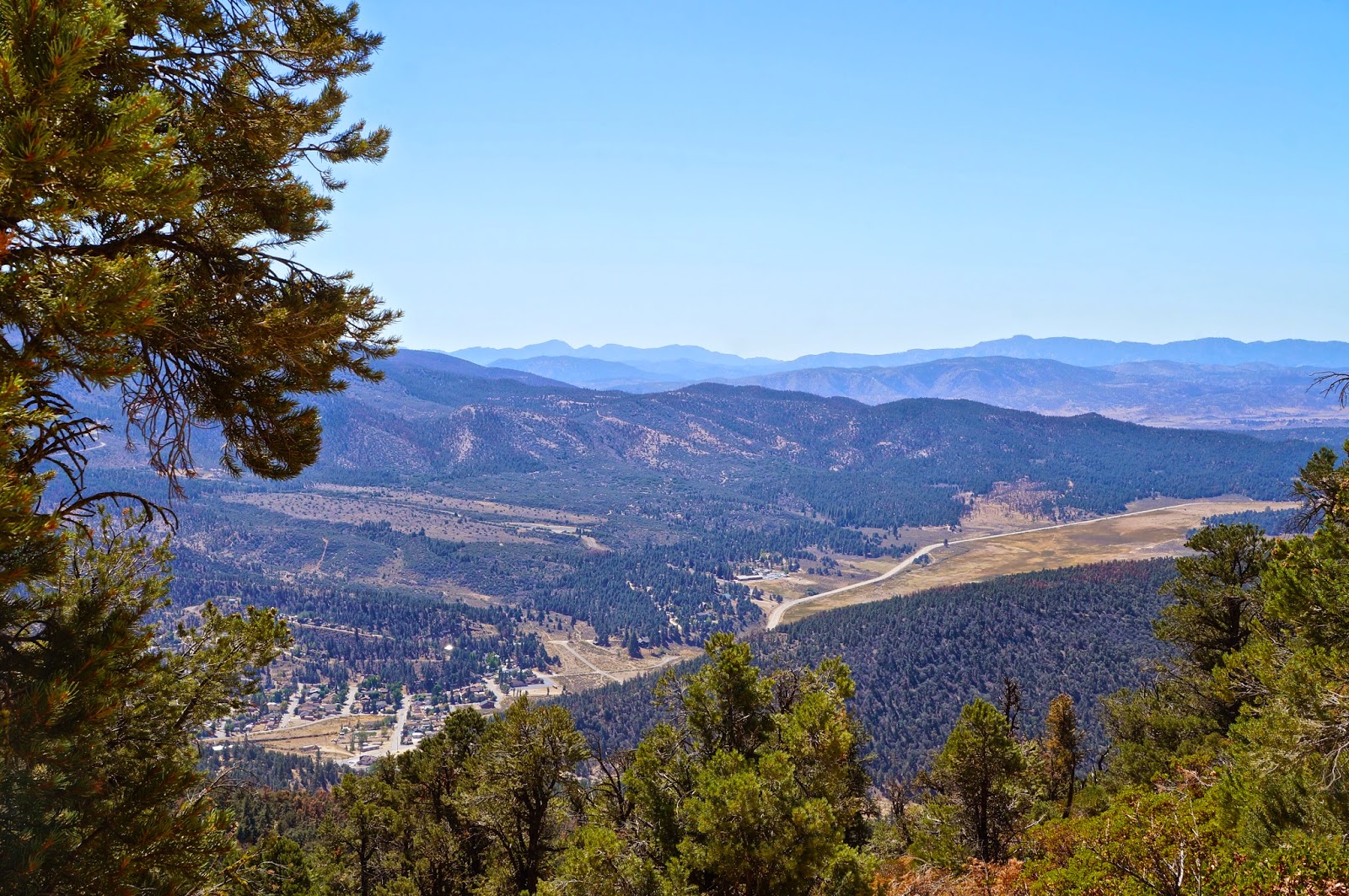
Cuddy Valley from Tecuya Mtn Rd.


Monday, September 22, 2014

Snooping around in Stone Corral

Sulfur Mountain from the Alder Creek Trail.
This hellion of a summer is drawing to a close at the same time that my house remodel is wrapping up. I am very pleased about both these circumstances. It's definitely time for me to get off my butt and resume business as usual.

A step in re-acquiring my taste for brush was initiated this last weekend when I spent some time tromping around in a little visited landscape of brush and rock called Stone Corral. I had genuine motives for looking the place over; I'd always been interested seeing the Stone Corral view of Topatopa and Devils Heart Peaks, been curious about some of the drainages pouring into the Sespe from there, and generally curious about what (if anything) there might be hiding in the rocks and gullies that I've always been to busy to explore. Also, this was a bit of recon for future, as yet unformed plans.

The views across the Sespe were indeed remarkable. The rock formations and gullies were entertaining and somewhat interesting, though nothing about the area is truly intriguing. By the end of the morning I'd had my fill and was content with the day. But it had been good to be out and getting scuffed up again. In those rare moments when the household hammers have fallen silent I've been working up an enticing list of things I'd like to accomplish and places I'd like to see in the coming months. Hope you'll stick around for the stories.

Epic in scale, Topatopa Peak as seen from Stone Corral.
A nice little mule deer, spooked out of a gully by my approach.


Topatopa and the Stone Corral drainage.
A look northwest toward Thorn Point, San Rafael Peak and McDonald Peak.


Saturday, August 30, 2014

Grouse Mtn, Sawmill Mtn, and Sheep Camp

The view into Pine Mountain Club from the Cerro Noroeste trailhead

Finally. A day without some superseding priority. But too hot for any low-land trails. So up to 8k and the rolling forest between Mt Abel (Cerro Noroeste) and Mt Pinos. The Tumamait, one of my favorite standard trails in the SLP

I prefer to start this route from it's western trailhead at Mt Abel. A rapid descent into a dense cedar forest ends in a moderate climb up the western flank of Grouse Mountain. The trail ascends through a thick collection of spruce, pine, and cedar and during this climb I spooked a pair of young deer who quickly disappeared into the woods. The air here is simply delicious, dry and richly scented with pine. New growth saplings have sprung up everywhere, mostly spruce. Eventually the path levels off, passing beneath the summit of Grouse, where a simple rock cairn indicates the use trail to the summit. Cresting the peak I spooked a pair of young deer. The view from the top looks southwest over an ocean of trees toward Reyes Peak. Looking northeast through the trees one can see my next stop, Sawmill Mountain.


View south from the western trailhead.
New growth spruce.

The use trail ascending through cedars to the summit of Grouse.
The view toward Reyes Peak from the summit of Grouse.

The rounded summit of Mt Pinos, from the west.


On the way to Sawmill I spotted a pair of older does. I paused to watch these graceful ladies fade into the woods before resuming the gentle climb up to the summit. On arrival I realized that the prayer flags adorning the summit cairn were looking pretty sad, so I set about restringing the whole arrangement. This is a unique little spot. The cairn, the open views to the north, the ever-present breeze, all of it combines to make Sawmill feel very different than the typical Los Padres summit experience. Granted, there's nothing difficult about getting here, but some places don't need to put one through their paces to be rewarding.

View from Sawmill. The big peak dominating the right side of the frame is Antimony. Following that ridge left and past the nameless middle hump, one can see Eagle Rest Peak.
The newly rehabilitated cairn on Sawmill.

On the return trip I detoured down the trail which leads to Sheep Camp, Lilly Meadows, and all the way down to the Boy Scout Camp in Lockwood Valley. It had been many, many years since I'd seen Sheep Camp and fond memories came percolating up from the ether. This is one of the quintessential Los Padres campsites, a small vale tucked beneath whispering cedars, graced by a flowering meadow beside a seasonal ground spring. A short climb above the camp reveals stunning westward views, a primo sunset spot. Sheep has a well deserved reputation for beautiful seclusion. It is also a notorious wind tunnel, but today was perfect. After a walk around I sat very still on a log, just enjoying the place. Within about five minutes the character of the place came alive. Dozens of little birds, woodpeckers, and jays forgot that I was there, and a chorus of chatter quickly rose to ridiculous heights. A couple chipmunks darted out from behind a large cedar and a huge gray squirrel descended from a hidden perch. I took it all in for about twenty minutes before turning back uphill to the main trail.

A mild, pleasurable day. One without challenges, struggle, or oppressive heat. Sometimes this prickly forest of ours is a real giver.


The trail down to Sheep Camp.
Sheep Camp.
And the meadow immediately below Sheep Camp.
Cuyama Wash dominating the distant view, from somewhere east of Grouse.
The San Emigdio Mesa and Cuyama Badlands, taken from Cerro Noroeste Road.

Sunday, August 17, 2014

Dry Times: East & West Forks Lions Creek

East Fork Falls

As the drought has unfolded I've developed a curiosity about which of our backcountry water sources   are still producing some flow. Granted, most drainages out there are stunningly dry, but I've seen a couple places lately that have withstood the trend to a degree. With a half day of free time on my hands I decided on a quick circuit between the east and west forks of Lions Creek. 

In a normal year there are pleasant falls up both forks, happily little gushers crashing into turquoise pools framed by cobbled conglomerate rock. Both falls are sheltered by magnificent old sycamores which caste a deep and dappled shade over the bubbling creek as it descends the rocky drainage. On a warm spring day each of these becomes an Eden of sorts, beautiful little gems of the Los Padres. 

I was hoping. But it was not to be. As a man once said, "Wish in one hand and shit in the other and see which one fills up first." So no, there isn't any water at either falls. Immediately below East Lions there were a few stagnant pools of buggy water. The story at the West Falls was little better. No flow over the falls, but in the forested creek below there was a stretch of trickling ground water, feeding several shallow pools. A six inch trout swam unhurried laps from from one end of his 15ft puddle to the other. Water walkers, dragonflies, butterflies, and an itinerant Anna's hummingbird completed the scene. In the overhead canopy a gentle breeze ruffled the leaves, a dove flapped from branch to branch. I leaned back against rough bark and listened to the forest for a bit before gathering myself for the return trip. She told me she is thirsty.

East
East
The Creek descending from East Fork Lions.

This is the time in summer when the prickly stuff blooms.
The creek below West Fork Falls (and below).


Thorn Point from the Lions Connector Trail

Wednesday, August 13, 2014

Then and Now: Painted Rock, Carrizo Plain

Painted Rock on the Carrizo, circa 1929.

 The Carrizo Plain underwent increasing settlement by white ranchers and farmers during the first two decades of the 1900's, peaking by the late 1920's. In the years that followed many ranch and farming operations failed and were consolidated with their more successful neighbors. Eventually these too folded and today the Carrizo has become a patchwork of land that is either government owned, privately held, or held in trust. The designation of the Carrizo as a National Monument has had various effects, one of these being the increased recreational traffic associated with Monument status. Hunters, birders, rock art and history aficionados, hikers and road trippers can all find something in the Carrizo worth seeing, and many of these folks walk out to Painted Rock for a look at some Chumash rock art.

Painted Rock, always one of the principle attractions of the Carrizo Plain, has had a tough go. The art there has most definitely suffered at the hands of generations of visitors. Seeing the site as it is today is still a mystical experience, the paintings there so grand and complicated as to inspire those esoteric questions: Who were these people? How did they live? What were their beliefs and what gods held sway in their lives? And most of all, what does all this paint I'm looking at mean? Unfortunately, there is a type of person that doesn't ask those questions and derives no intrinsic value from what they are viewing. Often, those types of people suffer from an irresistible compulsion to commemorate their brief passing in such a way that they destroy a part of something that has historic/cultural value and ethno-religious significance. It's a tagger mentality, but the crimes are worse (remember when the Taliban turned their tank guns on two ancient stone Bhuddas? Same sort of deal.) The damage done to native art sites cannot be taken back, nor can it be repaired.

Case in point: Painted Rock. Monogrammed initials, some quite nicely rendered, can be found chiseled clean through art elements here. Many date back to the early 1900's, but there are examples which precede even those. Hundreds of bullet scars pock these walls, each shot having shattered the fragile sandstone on which these pictographs are painted. There are signs of deliberate chiseling, as if to remove a flake of painted rock for one's own keeping. I imagine that in most cases such efforts resulted in a crumbling fragment of painted stone much smaller than initially intended. There are numerous examples of inartfully scratched names and dates, and in an ill considered trend among archaeologists of the 1940's-1950's, many of the paintings have been outlined in white chalk. This practice was done to maintain some semblance of the image as it faded due to natural occurrences such as wind or sun exposure (also, see comments below, where I learn something I didn't know). Sadly, calcium carbonate (chalk) is actually harmful to many of the paints the natives used.

To illustrate what has been lost at this site, compare the black and white photos from a 1929 publication by Julian Steward with the contemporary photos taken by myself and Michael Shields. The comparison is quite sad really.

The same panel as above, seen today.


A different portion of the panel as seen in 1929.

And today.

Campbell Grant's painting of the main panel at the Painted Rock. Click to enlarge


So these images represent a potent example of why I don't share site directions or locations. Some good tips for those beginners seeking out the painted sites would be to approach the art slowly, when inside caves or overhangs be extra careful of where you put you head and butt so you don't bump into any art above or behind you, try to stay at least 3ft away from the art, be careful not to kick up any dust which might adhere to the images, and certainly never touch, cough, sneeze, or breath on the art. In other words, be respectful, use common sense, and maybe ask yourself some of those esoteric questions.

*Thanks to Mike Shields for scrounging up the old photos.

Monday, August 11, 2014

Photography Showing at Anacapa Brewing Co., Downtown Ventura, Starts 08/22/14


On Friday 08/22 I will be hanging over 25 of my best photos at Anacapa Brewing Co. in downtown Ventura.

While many of these images have been seen on this blog, many have not. I've worked hard to put together a good show which (hopefully) has something for everyone. There's going to be some good stuff there. All of these photos will be for sale with the only aim being to break even on the printing/mounting cost. I hope you'll be interested enough to drop by, have a burger and a brew, and enjoy some of the fruits of one of my favorite hobbies. The show will run for about a month.