Monday, November 28, 2011

Piedra Blanca East, a scrambler's delight, 11/27/11

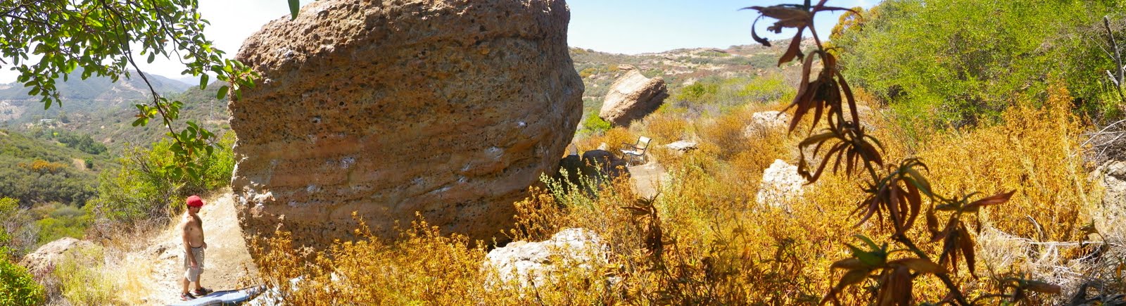
Free day! No demands, no responsibilities, no "to-do" list. What to do? I have planned for some time to re-visit an area of the upper Sespe River valley known as Piedra Blanca, or "white rock". PBlanca is a collection of crumbly sandstone formations most easily accessed from the Sespe trailhead at the bottom of Rose Valley Rd. PBlanca is just a fun place to hang out and explore. The rock formations are many and varied and the summit of each can be obtained with a little ingenuity and effort. One will likely donate some blood in the chaparral, but that can be said of most places in the Southern Los Padres.
The trail that brings one to the formations is called the Gene Marshall Piedra Blanca trail. According to Eric at Ventura County Canyoneering Club, this trail was named after a popular child's doll from the 1950's, of the same name. Apparently, in 1983 Congress decided to name the trail after either the doll, or a man of the same name who contributed to the creation of what is now considered to be the Sespe Condor Preserve. Eric is usually right about these things and I haven't found much to corroborate or refute these claims, so I will plagiarize him in regards to the progeny of the trail's name. This is an easy trail and a person will be among the formations in under a mile.
Below: Looking NW at Piedra Blanca Creek and an area called Twin Forks

The coolest thing about PBlanca, the thing that gets me is that this site has been used more or less continuously by humans and their ancestors for nearly 8,000 years. Pygmy Mastadon and Sabertooth Cat remains have been found the immediate area and numerous archeological artifacts from the Chumash era have been recovered. I personally know a man who has found 7 grinding dishes and other artifacts in the heart of Piedra Blanca. These, of course, have been reported to, catalogued and collected by the appropriate antiquities agency. This site was an absolutely ideal gathering locale for aboriginal hunter/gatherers offering fish, game, berries and acorns, year round water and plenty of sun/shade. A number of Chumash petroglyphs and at least one large petrograph can be found less that a half mile from the formations (but I don't tell). Parts of Piedra Blanca Creek are littered with ancient seabed fossils. It's a neat kind of place.
Needless to say, I have an affinity for rock formations and enjoy finding ways to get on top of them. During my travels this day I poked my head in any number of cracks and holes, just to see if I'd find something of interest, which is exactly what I got when a huge barn owl panicked and flew right by me (some day I've gotta write about my numerous, strange encounters with owls, and I could share the story of the large Inuit owl tattoo on my shoulders). This owl stuff has been happening to me all my life, it's worth sharing.
On today's exploration of PBlanca I was wishing to be thorough, so I have divided the area into two distinct sections which I am calling the East and West Spurs. I went East today. I ranged out to the distant eastern edge of the spur, working back to the middle. In the course of the morning I was able to get on top of every significant formation on that side of the area, circumnavigating most of the piles and large formations. Aside from the owl and the wild views I saw numerous doves and jays. Came across some pretty tracks in an arroyo, Mama coyote and her two pups.
I had a very enjoyable morning. Obviously the place is very photogenic and worth a visit. I'll come back soon with the West Spur, and in the near future I may share thos pictographs I mentioned.

Monday, November 7, 2011

Chorro Grande Trail to Reyes Peak, aborted. 11/05/2011

Last Friday SoCal got it's first taste of the coming winter. A trough of arctic air blew through with some disorganized precipitation leaving the high country coated in a rime of frost. On a very chilly Saturday morning, in the pre-dawn, Cliff Griffiths and I found ourselves crunching up the relentless uphill of the Chorro Grande trail. We aimed to do the 20 mile round trip to Reyes Peak. It wasn't to be, for a couple reasons, but I had a great morning regardless.

Above: Cold start. Cold trail.

It was cold, cold hiking. We blazed right up to Chorro Springs, our longest stop being no more than a couple minutes. As we banged out the steep miles I noticed that Cliff was starting to lag a bit. He was breathing a little hard and didn't look like he was having all that much fun. When we reached Chorro Grande Springs, Cliff admitted that he wasn't feeling real hot, and that his throat was scratchy. His wife has been sick for a few days so it was pretty obvious that he'd gotten typhoid or scarlet fever or something. Cliff hated to say it, but I could tell he wasn't up for much more.

We took a nice break in Chorro spring's sheltered dell. A hundred feet above our heads we could see frosted trees being blown about by a persistent forty mile per hour wind. We sat on a snowy stump next to the spring, having brunch. The muffled roar of the wind blasting the Pine Mtn ridge, just 2-300ft higher than where we sat, put the rest of the day in perspective. Even if Cliff had been feeling good, the constant icy gale would have cut us to ribbons. So it was just as well that weren't going up into that hell.
Above: Cliff grinding out the steep.
The temperature at the springs was in the high twenties and after a while the cold started to seep into our bones and it was time to roll back downhill. I was already thankful that we were headed out. Too damn cold for a rational person, which of course, I am not. But still...
Above: Frosted Pines above our heads.
Below: Chorro's spring trickles from under this giant boulder.
Below: Pine Mountain Ridge

Thursday, November 3, 2011

Chief Peak via Horn Canyon, 10/28/2011

Above: Ojai, from above Horn Canyon
Below: Chief Peak from the east
I've taken myself off the DL. Back to the dirt. I chose my trail with a wry touch of trepidation. Just about any real day hike in the Southern Los Padres is going to be steep and tough, but Horn Canyon Trail's first four miles are a doozy even by the standards of it's sister trails. I've always leaned toward the school of "go big or don't go" and since I figured myself to be pretty out of shape after months of not having fun, what better way to test myself than a burly 15 mile round trip?


I started up Horn at dawn. I moved through the low forest of beech and oak, enjoying the quiet murmur of the creek, listening to the waking birds. It was crisp, cold really, so I moved fast in order to warm up. Soon I was feeling pretty good and as the trail got steep I was in fine form. I gotta say I felt mustard. I think I was on a pretty good buzz just being out on a trail alone. I didn't even notice the steeps until I realized I was already walking into The Pines Camp.

The Pines is a sweet little campsite tucked in a fold of the great big hill that looms above Thatcher School. The camp is nicely shaded with several species of pine, and a few of the trees have probably been planted there as seedlings. Several of these trees have bear markings on them. A spring box is tucked in the brush on the west side of the camp and is mostly used for horses. The horses, which I've never encountered, have their own picket posts and a bit of grass to crop. Within the past several months somebody has gone to a great deal of effort, crafting log benches for the site. It's pretty nice but the best features of the camp are the wind protection and the sunrise. The mornings here are golden and warm, but I kept on walkin'.
In a little less than 4 hours I was on the summit. Not bad time-wise. I lingered on the top for over an hour. It was too nice a day to just sign in and bail. A long lunch and a cat-nap later I was scrambling down to the fire road.
Above: Ojai, Ventura, and the Channel Islands form Chief's summit

Below: The Sespe. Nuf said.
So here I am, feeling pretty good about my over-all fitness and very happy with my cardio. Smiles all the way around right? Telling myself that I'm a super great guy in super great shape until...I tried to get outa bed the next morning. What the hell did I do with that god damn oil can?!? And where's my Motrin?! And glucosamine?! Hell, bring me a dead shark and I'll eat it's raw cartilage! I had aches that I didn't never have, ever. This, in a word, sucks. So I have a ways to go to get back to the type of shape these hills require.

Below: I saw the tracks of many deer. Guess the deer of D-13 have had an easy hunting season so far. Also, I saw a very large red tail hawk, and from about fifteen feet away I spooked a pretty Coopers hawk with a lizard in it's mouth.


Below: The Pines Camp


Tuesday, October 25, 2011

I'm not dead. It's been quite a summer though.

This last couple of months have sucked. I want to thank those that expressed concern over my absence from the blog and assure everybody that I'll be back on the dirt later this week.

At the beginning of August I had an accident (that part is unsurprising) which resulted in what is called a "Tripod Fracture". The Tripod Fx is a heavy duty facial injury most commonly associated with a crushing blow to the cheek bone (think: bar fight) in which three facial bones are fractured (see red highlights below). I wish I had been in the bar fight, at least I could have gotten some licks in. Sadly, my story is less dramatic, bordering on the mundane. I got tangled up with the dog while working in the garage. He went one way and I went over him the other way and in the process I did my best to break my wife's Infinity with my head. I contacted the drivers side rear-view mirror with my cheek. Infinity makes superior car mirrors.


The recovery from this has been long and at times miserable. Initially, my face was swollen up so bad I could scarcely open my left eye. I had spectacular bruising to the left side of my face. At the time of injury I had been nearly knocked out and over subsequent days I had post-concussion syndrome (headaches, headaches, nausea and more headaches). Of course, this was all compounded by the facial injury and instability of the cheek... very painful. I experienced bony crepitus in the form of creaks and pops to the sinus (unpleasant). The CT Scan of my head also showed a large quantity of blood in my left maxillary sinus which took a while to either drain (as bloody post-nasal drip) or reabsorb.

A few weeks ago, long after I thought that I should be feeling better, I experienced a change in my symptoms. The headache returned with a vengeance my eye blackened up again, and my fractures again felt unstable. In a word...hell. After my headache had worsened for the fourth straight day I was concerned enough to go get scanned again and revisited the appropriate specialists (I don't recommend ever letting a doctor scope your sinus). Naturally, I'd developed sinusitus and a sinus infection. This can be a serious problem: think fractured bony sinus, with an infection that can get between the crack and go to the brain. This is a problem that should never be ignored and I wound up on more narcotics and antibiotics.

Let's see, what else happened... After the initial injury I was starting to feel better and went bouldering with Dave Rivas on 09/11 and got a bad case of contact poison oak from handling some of his gear. So add a round of steroids to the misery.

In the midst of all this I've managed to complete (and personally did 70% of the work) a house remodel: brand new kitchen, brand new laundry room, and a host of upgrades to the rest of the house. My home, at least the inside of it could model for a Pottery Barn catalog.

So, with all this bullshit I have either not had the time or not felt well enough to enjoy being outside since mid-summer. I have run out of things to fix around the house, I'm feeling outa shape and soft, and I'm eager to get back to "normal". I think I'm good to go, so I look forward to doing some local exploring in the coming weeks.

Again, I'd like to thank those of you kind friends that wondered if ole Crash Stillman had actually managed to remove himself from this mortal coil. The Devil ain't got me yet!

Saturday, September 17, 2011

Minnie Holland Rocks, 09/11/2011

On September 11th, Davi and I braved Hwy 1 and the hordes of flag sporting Harley riders for a little boudlering on some out of the way rocks off the Mulholland Highway above the Santa Monica Mts. The spot is named "Minnie-Holland" rocks.

These are a scattering of 5 or 6 decent rocks with highish top-outs. The rock is the same pockety stuff found all over the range: Camarillo Grove, Purple Stones, Echo Cliffs, Malibu Creek, etc...

We had a real fun day falling off rocks when we didn' manage to get up them. Sun, coastal breezes, and a little climbin'.
At the end of it, I'd gotten a nasty dose of contact poison oak. The stuff had apparently been all over Davi's gear and it stuck to me. I got a bit steamed about that, but hey, I should have known better than to haul around his gear given that doesn't get poison oak and therefore doesn't even think about such things. My bad luck, but let's not detract from a fun day.

Wednesday, August 31, 2011

Further examination of the Topatopa Bluffs, 08/31/2011

I can think of no reason that a human being would have for going where I went today. And I have the cuts, scrapes, and bruises to prove it. I guess I should back up a bit and explain.

Below: click on the pic to see where I went, and will not need to go visit ever again.
Back on the 27th of July I went up Topa for a preliminary recon of the top of the Bluffs. This was to be the first step in a plan to find a way to the bottom of the bluffs, and then establish a climbing route back to the top. This was actually a serious idea to me, for some time. I have now been thoroughly disabused of that notion (hubris?). Suffice it to say, that after today that plan has been scratched.

Yesterday I drove up to Ojai and the overweight bureaucrat behind the desk at the USFS office gave me a permit and the gate combo for Nordoff Ridge Rd. This morning I drove up and hiked all over the top of Topa. I can now say that I know the top of that mountain as well as any and better than most. I descended to the edge of Topa Topa's three major prominences and descended the two drainages that bisect them. I can assure anyone with the same crazy idea I had that just getting down the bluffs will end in bloodshed and frustration, as it did for me.

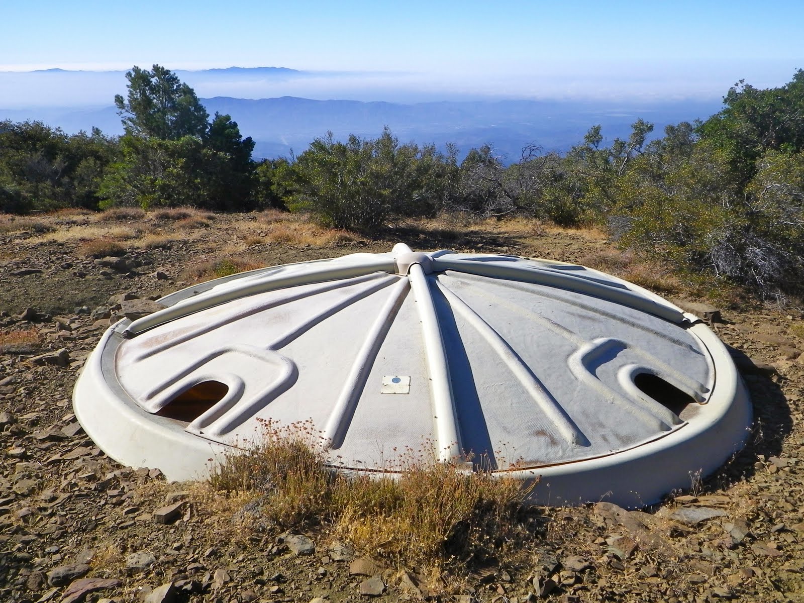
Below: back in 1983 an equestrian club put this UFO looking water trap up on top. I'd known about this for years, even though it is now off the beaten path and can be difficult to find.

Below: Every way I tried to get down became a brush fight that I eventually lost, and I'm a tenacious guy. Who is now covered in scratches.

Below: Just one of the day's numerous insults.

So what did I learn today? First, I'm not doing that again. Second, and obvious (now), I am not going to put up a new route on the face of Topa. And third, all deer trails end with you wondering what the hell the deer was on when they went there. This is an apt lesson, and the irony does not escape me.