Did you ever get the distinct sense that you are in a place that nobody else ever visits? A place that is actively erasing all evidence of man's passing? If you haven't, and wish to, visit the Upper Sisquoc River Valley. Or, try.
I'll explain.
 |
| I seldom carry a handgun, but for this one I did (a Sig Saur .40cal, high velocity, big punch). This place is too remote, too wild, and I was too alone. It's a safety device. They say you never need a gun until you need one... |
This little excursion began at around 8pm last friday when I drove over the mountains to north side of our coastal range, to the shining metropolis of Cuyama. From Cuyama I turned south and headed into Santa Barbara Canyon under the full moon light. I spent the night in the bed of the truck, and it was cold. Around 5am I just couldn't stand it anymore and, cursing myself for not using a bivy sack, I jumped in the truck and ran the heater high. Later, as I brewed coffee in the pre-dawn light, I listened to KNX 1070 tell me why I had been bashing a layer of ice off my sleeping bag. I could have told them all about the NOAA frost advisory for the high deserts. By 07:50 the caffeine was doing it's thing and I got started on a rather long and difficult day.
 |
| Trail, SB Canyon |

Santa Barbara Canyon and the trail to what used to be Madulce Station are still popular enough that this route is reasonably un-brushy (at least there is a trail to follow). The trail gently ascends the canyon floor for about 6 miles, passing through chaparral and cottonwoods. Several portions of the route pass through large thickets of chokecherry, a nasty plant whose thorns are the envy of de-clawed cats everywhere. At about the 6th mile in, the trail jacks up steeply and ascends an unpleasant but short hill. I do not know why, of all the evil hills that exist in the SLP, the map has a name for this one, but it does, and that name is "Heartbreak Hill". Bullshit. I can name a dozen more deserving hills without even thinking. In fact, I am insulted for those other hills! But then it is possible that such a name was coined by some true event. Possibly an older guy had an aortic aneurysm and the hill diagnosed it and killed him at the same time. Or perhaps a young couple, out on their first romantic backpack together, discovered that half-way up that hill was about as much as their relationship could bear, and one of them was left in tears while the other went for the car. Who knows? But it's lame. Strike it from the map, I say!


After cresting the so-called Heartbreak Hill, my trail wound around the top of said hill and then dropped into Madulce Station. This site used to be a pretty cool place, and until the early nineties, an old cabin and a USFS structure for trail working tools stood under tall pines. The cabin was intentionally torched by a crazy person who had made it his home. The USFS shed burned down in the Zaca Fire of 2007, but it may as well have been burned down by the US Forest Dis-Service themselves, because they long ago divested themselves of any trail maintenance responsibilities, and since they no longer use tools, the rangers don't need a shed for them. Madulce used to be a key stop for horse packers headed down the Don Victor Valley. Now it's a boring little camp with too much sun and too little water. After a short break I strapped in for the grind up the north side of Madulce Peak.
 |
| Real trail or animal Trail? One, neither, or both? It was like this nearly all day |
 |
| Trail? |
As you can probably tell from the pictures above and below, the day got hard. It seems that of those who do make it as far as Madulce, few continue up the mountain. The route is steep and sustained, and overgrown to the point that trail-finding became more than just a passing "Hey, what the hell?". This issue with route finding became the all encompassing theme of the rest of the day. For the most part, this entire route passes through Zaca Fire territory, and five years later the recovery has begun. All the grasses and shrubs are aggressively vying for sunlight, and the matchstick trees, charred and bare, are falling everywhere. It was like barging through a skeleton forest. Happily, the undergrowth thinned a bit as I gained elevation but clearly, these trails are going to seed. Example: I found a 3 foot tall pine sapling growing right in the middle of what used to be a well used horse trail.
 |
| Trail losing and finding became the primary motif for day one. |
 |
| Some remnants of snow hanging on in the shade. |
 |
| The Alamar Saddle and Madulce Peak. Views to Santa Cruz (Island). |
 |
| Madulce Peak is center right. Taken from Buckhorn Rd. |
Two thirds of the way up Madulce Peak the trail splits, one way continuing up the peak, the other follows the Madulce ridge to the Alamar Saddle. I was already 10 miles into my day and was having way too much fun just staying on route to detour another mile (+) and 500' up to the summit. It was across the spiny ridge and up onto the road at Alamar for me. From here I headed south on the road for another mile before stepping off to descend into the upper Sisquoc River Valley.
 |
| Now entering the Upper Sisquoc. |
 |
| The first half mile down the Sisquoc River trail is very nice. |
Here's where the day started getting really interesting, the Sisquoc. First, I noted that there were no human foot prints on this trail. As the path slid down through oak and pine forest it occurred to me that the trail was unusually springy (un-tamped), and that great drifts of fallen leaves blanketed the trail inches deep. I soon realized that nobody ever comes here. Within a mile I had renamed this place the "Forgotten Canyon".
As soon as I rolled into Upper Bear Camp that last thought was made abundantly clear. This little hollow was a sweet campsite in the not too distant past. Though the historic ice-box stove is still intact, nothing else about the camp is the same. There are saplings growing in the best tent site. Fallen trees are strewn about the site, and grasses have reclaimed what was once hard-pack. Upper Bear camp has gone native through complete neglect.
 |
| Upper Bear Camp used to be a nice little place to camp. |
Speaking of going native, the valley below Upper Bear Camp has gone completely to the wild side. These miles were just ridiculous. Forget any idea of trail. The valley floor has become a laboratory for what grows strongest fastest. Manzanita, sage, a billion types of weeds. Every passing animal has made a better trail than the one I keep looking for. I have climbed over so many charred deadfalls that I soon find myself streaked with greasy soot. This forest of tree bones is very much alive. Numerous birds call out warning of my passing, which the grey squirrels pass along. A large red-tail circles.
Oh yeah, I did manage to find find remnants of trail, a fragment here and there, but nothing that lasted for more than a few feet. I stuck mostly to the compass and made my own path of least resistance. I passed Bear Camp, which isn't much of a spot, though it does have an honest to god picnic table. I ruled out stopping here because there was very little water this high up the creek.
 |
| Bear Camp. Poor water right now. |
Between Bear and Lower Bear Camps is a neat stretch of creek-side waterfalls. This is a very pretty section of trail, forested, with the pleasant sounds of water. To the right is the Sisquoc, which tumbles down several 40 foot ladders, with a few smaller falls in between. At the bottom of this series of falls lies a small pull out with a fire ring, a log bench, and a sign which indicates that one is now in Lower Bear Camp. I decided that I'd gone far enough for one day. This had already been a 8 hour trail day, 8 hours to go 12 miles. That is highly unusual for me, taking that long to get anywhere, and speaks to the day's difficulty in route finding.
 |
| Above and Below: water falls of the Upper Sisquoc |
Lower Bear Camp is no garden spot. The site was covered in a thick blanket of leaves and I had to clear a number of fallen limbs before I could set up shop. Again, nobody ever goes here, or so it seems. All day long I'd had been seeing fresh bear sign, and the prints of every other local critter, and I was counting on getting "beared" in the night. Using the fallen branches I set up a kind of brush corral around the perimeter of the camp. I figured that might give me a little warning if a bear came wandering through. After an uneventful evening I banked a big, smoky fire for the night. I just wanted everybody in the canyon to know that I was here, that there was a stranger in the neighborhood.
 |
| Lower Bear Camp, remote and forgotten. |
 |
| Below Lower Bear I ran across several faded pink ribbons, someone's attempt to reestablish trail. |
 |
| Bear Prints, they were everywhere. |
 |
|
|
|
| More trail hunting between Lower Bear and Heath Camps. |


My night at Lower Bear passed without incident and I was up and headed downstream for Heath Camp by 08:00. This next 3.5 miles into Heath were, again, all about trail finding. More bionic plant life, more fallen matchstick trees, more time lost while route finding. About a half mile from Heath Camp the trail opened up and before long I rolled into the place. Heath Camp is named after a polygamist Mormon guy who retreated from public scorn by setting up shop in the wilds with his small tribe. There is some interesting history there.
Heath is basically a flat at the junction of the Sisquoc and Judell Canyon. The Sisquoc runs east>west while Judell ascends a rugged little canyon to the north. Somewhere up there, at the top of Judell, lies the Buckhorn Road and way back to Santa Barbara Canyon.
 |
| Kittie Print. |
After a nice break at Heath, spent lounging in the morning sun, it was time to find out what Judell Canyon was made of. As it turns out, this is a pretty enjoyable canyon this week, by which I mean that everything is green and the creek is running. Some parts of this trail are shady and quite pleasant, the trail in nice shape. I did encounter the tracks of 2 individuals, though the prints were weeks old. After a few easy miles the trail gets down to the business going up, but even then the route is pretty easy and the switchbacks up the canyon are intelligently designed. It didn't seem like very long before I was looking at a distant, rolling ridge. And, even better, Buckhorn.
 |
| Trail? |
 |
| You just have to love this bear clawed sign. I wanted to take it home. |
 |
| This little 18"er was my first rattler of the season. I did not want to take him home. |
 |
| The last real switch backs ascending Judell Canyon. A nice route. |
Having ascended Judell, and looking at Buckhorn, I traversed a rolling field of flowering weeds. Soon I ambled past Oak Spring and continued up to the road. Once there, the rest of the day was a long roll down the hill into Santa Barbara Canyon where I'd started the day prior. This part of the day went smoothly and before long it was all over..
Just to hammer home the difference between the two days, let's look at the times. Yesterday I'd murdered myself, taking 8 hours to muddle through just 12 miles. Today, 16 miles took just 6.5 hours. That ought to put things in perspective, should you all have a desire to repeat this route.
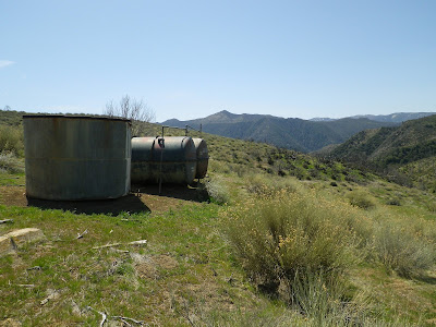 |
| Old tanks at Oak Spring. |
 |
| The rolling high country of Buckhorn Rd. Serious cat country. |
 |
| The long grade down to Willow Flat in SB canyon. Cuyama Peak, center left. |
 |
| The historic Santa Barbara Canyon Ranch. No trespassing. |
This turned out to be a great trip. This route is a journey through a wild place reverting to a primordial state. The real satisfaction though, stems from the nature of the hike: tough, rugged, remote and forgotten. It's a long way from anywhere and isn't on the way to anything. Just another lost canyon. I had a great time.