Sunday, February 15, 2015

Mockingbird Cave


There is painted beauty hidden deep in the heart of Riverside County. I had to go see this for myself because I don't normally associate Riverside with the word "beauty".

This site is located in a spring fed gulch amid a moat of fancy horse properties. Scrubby oak trees and tall stands of  cat tails frame the tepid stream from the spring. A scattering of granitic boulders and several larger formations dot the slopes on each side of the spring. One such formation is a collection of ground level boulders crowned by two large capstones, and beneath these are two very colorful panels of polychrome art.

Large circles or shields accompany a number of crosshatch designs. Several elements here appear (at least to me) to have a celestial connotation. The work is bright and colorful, rendered in red, white, and a blue/black.

On the opposite side of the creek is a flat granite slab with four bedrock mortars. This slab, just feet from the spring, has been described as a "birthing rock. A short pillar beside the the slab has two faded red pictographs of diamond chains on golden water streaks.  A short distance away is an additional BRM.

I was impressed with this site. The colors remain bright and crisp. Obviously any site with a consistent water source would have been an invaluable commodity in this desert region, and the depth and development of the BRMs speak it's prolonged use.


Exploring Lower Piru Creek


Sure feels like it's spring in mid-February, don't it?
I guess that three storms is the only meaningful precipitation we're likely to get this "winter" so better make the most of it. 

The Piru watershed seems to be the place where one can take every uncomfortable and unpleasant thing the SLP has to offer and upsize it. Ticks, poison oak, venomous reptiles, brush, heat, rough terrain, etc... Piru has it in spades. 

I was joined by Nico and Stephen for a combo cycling/off-trail exploration of the Blue Point/Canton Canyon arena. We mountain biked far into Canton, which is a dramatic dry wash of a place. An old jeep track weaves up the north side of the wash. There are sporadic groves of oaks, and lots of intriguing rock formations, even the remains of an old inholding. The trail is good enough that cycling is is an easy ride. We spent a good deal of time checking out the various rock formations with an eye to rock art, to no avail. 

Another part of the day was spent exploring the remains of the long decommissioned Blue Point Campground. We explored up the eastern draw which empties into Piru Creek. Here we found overgrown conditions and a nice collection of large sandstone wind caves. Done with this particular area we splashed back across Piru Creek to the road and explored a similar series of caves on the western side of the creek. The campground itself has gone completely feral over the years and it occurred to me that the USFS ought to just take everything out and let the area revert to it's primordial self. 

Further up the road we met and chatted with the long time owner of Wheeler Ranch, Joe. He's a nice older guy, was curious about what we were up to. He seemed real relaxed, and if you've seen the beautiful little spread his charming cabin sits on you'd understand why. We did a bit of exploring atop a mesa which overlooks his place.

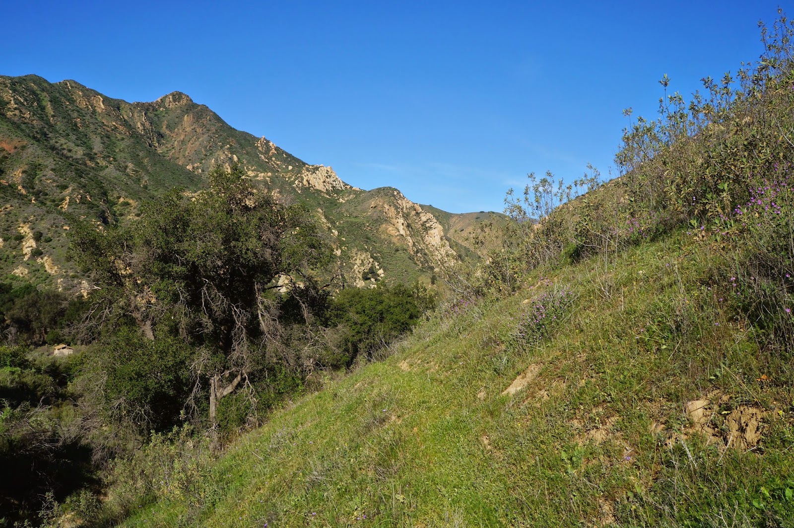
If you're into Piru and flowers, nows the time to be out. Dozens of species of flowering plants have been tricked into an early spring bloom. The hillsides are green and lush. The birds are out. All in all it was a beautiful day for a mellow tour. Just beware, people are already reporting rattlesnakes being out and about.


Wheeler Ranch from across the way.
The lone sycamore at the mouth of the truly grand Canton Canyon.


Wednesday, February 11, 2015

Off Trail in the Cuyama Badlands


This isn't really a post about a trip report. It's more an explanation of what I've been up to.

The photo above was taken on the way to somewhere in the Cuyama badlands, a day which offered a beautiful, rain spattered hike into the colorful ridges and gullies beneath the north slope of Sierra Madre Ridge. The point of this hike, besides the adventure and exercise, was to find a little known rock art site. A Chumash rock art site.

A few weeks ago I was asked what percentage of day trips I go on that never make it onto this page. At the time I said 30% but looking back over the last few months the number is actually closer to 50%. What's missing you ask? The answer to that is that I am no longer going to post anything related to Chumash rock art, and in fact I have taken down all my posts to this page which related to Chumash rock art. There are several reasons for this change.

The most persuasive reason I have for changing my approach to what I post is that I have gradually come to understand that the rock art in the Tri-Counties region has exactly nothing to do with my cultural heritage. I'm not Native American, have never pretended to be Native American, and have no desire to emulate the local Native Americans. But that doesn't mean that I don't have a conscience. There are plenty of areas in Southern and Central California that have highly publicized and easily accessible rock art, and I've seen a lot of it and will continue to post such sites, but I've also been at this long enough that I have begun to sense a subtle difference in perceptions and attitudes toward Chumash art versus similar art by other cultures. 

This difference is difficult to define or quantify but it's there. I think it largely has to do with the competing priorities between the Nuevo Chumash, the Forest Service, the elites within academia, and lay enthusiasts. While it is the lay enthusiasts (like myself) that scour the internet and academic papers for information on these sites, and actually do the difficult work to go out and see them, there is no real effort to use such people as a resource. In fact, the moment one of these lay people starts publishing Chumash art on the internet they find themselves pressured to remove those postings by Chumash advocates and academics. It is easy to understand the Chumash point of view, but the barely veiled hostility and a general air of exclusivity excreted by those in academia toward those who are actually putting in the effort to see these sites as they exist today is rather repugnant. To the best of my knowledge there is no coherent effort to incorporate the more accomplished of the lay people into any effort to protect or document or preserve these sites. An example of such an organization would be the long defunct Partners In Preservation. Instead of being invited to contribute, the lay "experts" out there are dubbed pariahs the moment they step out of the closet and publish. This syndrome is very cliquish, very elite, and very off putting.  I find those attitudes a distraction from my overall purpose, which is to document adventure and discovery within the Southern Los Padres.

There is a lot that people such as myself might be able to offer given the opportunity and a minimal amount of training.

When I first began posting Chumash art on this page I took a lot of heat from various quarters. I rapidly evolved my approach to publishing, justifying my continued publication of the art at such sites by not using the site's given name or any identifiers (landscape or otherwise) which could be used as an aid in finding these sites. Within a relatively short period of time the hate mail stopped but word of my activities continued to be muttered about within the "in" crowd. Even those measures that I implemented to protect the locations of sites was insufficient to quell the attitude that I was some renegade guerrilla of the rock art world (that's a laugh). I have allies and ears, and word would reach me that this or that individual had said something uncomplimentary about my activities and that those sentiments were circulating within certain circles. Whatever. I work with heart surgeons. I have a thick skin. But I'd be dishonest if I didn't admit that this high school b.s. never got to me.

I write this not in an effort to garner sympathy but quite the opposite. Rock art has been very good to me. I've made numerous contacts and gained new friends because of my interest in rock art. Many of the people I correspond with have attitudes similar to those I've expressed here. I appreciate their ongoing support and friendship. I will continue to ferret out the locations of these sites, hunt them down and photograph them, but I won't be posting anything from these sites on this page anymore. This is my decision and a conclusion I reached on my own, that being that this is not my cultural heritage and my editorializing on such art is unnecessary.

I'd like to reassure the readers of this page, many of which who have been with me the whole time, that I'm not going anywhere and that I will continue to bring the forest to this page. It's going to be the same quality of stuff I've posted all along, minus the rock art. Understand that if you see a gap in postings it's likely I've been out tracking down local rock art. 

P.S. This little rag I put out turned over 250,000 hits this week. That's not half bad for a niche blog that doesn't use web exposure services or host ad space. I appreciate your interest, your comments, and the friends I've made along the way. Thanks.

Sunday, January 18, 2015

Access Lawsuit: Matilija Canyon


The access problem at Matilija will finally be going to court, or at least to negotiated settlement. The first I heard of this happy development was a 15 second blurb on KCLU and then in an article in the VC Reporter. The issue of private property rights versus access to Matilija which the public has enjoyed since the early 1900's will finally be decided. Back in 2009 the land owner, Mr Buz Bonsall, decided to deny access through his property. This created enough of an uproar in the community that the Forest Service and access advocacy groups got involved and things settled down for a while. But the issue has continued to simmer without any clear resolution.

During the 2009 crisis I used this blog to pen a rant about public access to the Forest in general and against Mr Bonsall in particular. The writing was juvenile and provocative but with a title like "The Matilija Nazi Drops The Hammer" the post continued to generate a huge number of hits and responses for the next few years until I took it down. Some time after that writing he started pestering Craig Carey for my phone number which Craig, to his credit, wouldn't have handed it over even if it had been in his possession to give. But Buz wanted to talk to me. Eventually I called just to see what he had to say. I remember the conversation clearly because a.) he sounded drunk, and b.) he just rambled on and on and I couldn't get any sense of what the hell he wanted. It was very strange.

 In the years since I have received tales of Mr Bonsall verbally accosting people and intimidating folks just out for a day by the creek. In one such confrontation, a friend of mine, out for the day with his gal, was approached by Bonsall and two other men. Bonsall made it crystal clear that they were on his land and that he considered them trespassers. While I haven't had such an experience myself, I have heard various versions of stories like this (some of which have a more menacing tone) from people I associate with. I have also noticed that at least one of the signs which the Forest Service posted in 2009 in an effort to ensure that visitors stayed on the fire road leading to the canyon proper had been vandalized and "No Trespassing" had been written where the map was supposed to be. 

Getting back to the law suit, I get the impression that this could have been settled fairly equitably back in 2009. First, a bypass trail from the parking area could have easily been created. A foot bridge could have been built to cross Matilija Creek and a trail could have been created which ascended the opposite side of the creek from Mr Bonsall's ranch house and out buildings. This project would have been fairly cheap and the Forest Service could have used volunteers to construct the trail, and nobody would be walking right through the driveway of Bonsall's ranch residence anymore. For whatever reason this type of solution was never enacted, but the land owner is the one with the perceived rights and the perceived grievance so I suspect that Mr Bonsall was not interested in anything that resembled negotiation toward a solution for any party but his own.

To shed some more light and perspective on this development I will laboriously type every single letter of the article Lawsuit filed over access to Matilija, 01/15/15 VC Reporter, written by Chris O'Neal.

_____________________________________________
Group claims substantial evidence that
trail should be open for public use

     A coalition of conservation groups and Ojai residents calling themselves the Keep Access to Matilija Falls Open has filed a lawsuit against the owners of land they say should be open to the public.
     The lawsuit filed in Ventura County Superior Court is aimed at restoring public access to the falls, which the group says has been difficult since 2009, when the owner of the property crossed by the trail leading to the falls began confronting hikers and posted "No Trespassing" signs.
     Jeff Kuyper, Los Padres Forest Watch executive director, says the trail has been used by locals and travelers alike, dating back over 100 years.
     "People have used it since the 1900s and there's always been a trail there from since anyone can remember," said Kuyper.
     In 1979, the land was purchased by current property owner Buz Bonsall's family, but it wasn't until 2009 that Bonsall began attempting to keep hikers off the trail, according to Kuyper.
     "Some people felt that they were being harassed for something the public has been doing for over a century," said Kuyper. In a press release about the lawsuit, the group claims that Bonsall "began to aggressively confront hikers and took steps to prohibit access in the area" and threatened to cite hikers for trespassing.
     The coalition said that it believes that the group has strong evidence that a permanent public easement through the property should be granted. In California, all that is required to determine where an easement should be placed is that the land had been open and accessible to the public for a period of five years, uninterrupted. Alistair Croyne, conservation director with Keep Sespe Wild, says there is ample evidence that this has been the case.
     "That area has been popular with Ojai residents for over a hundred years," says Croyne, who says it's been difficult finding people who remember hiking on the trail before 1979 [*I can help with that], but there are documents, maps and guides that detail the trail from decades before the purchase. "It was a surprise to everybody when the property owner started to turn people back who were hiking up there."
     "I think the landowner trying to stop access now sort of flies in the face of public access that has been established," said Ventura County Supervisor Steve Bennett, who represents District 1. "The best outcome is the landowner and the group negotiating an appropriate settlement that everyone can live with."
     Kuyper says that the lawsuit is a last resort and that negotiations began several years ago but the parties failed to reach an agreement. Kuyper is unsure of the reasons for the property owner's actions, but guessed that it was due to the increase in traffic.
     "People learn about a relatively easy waterfall to access - whenever you have more people you tend to get more trash and a small amount of people who don't respect the area," said Kuyper. "That can give everyone a bad name."
     Bonsall has 30 days to respond to the lawsuit. In the meantime, Kuyper hopes the two can come to an agreement.
     "It's always easier to sit down at the table and see if a solution could be worked out, but we just weren't able to get anything down in writing," Kuyper said.
     Bonsall declined to comment.
_____________________________________________


So I'd like to offer a toast to these champions of freedom and liberty, and you all should too. If this writing gets back to the pro-access side of the argument and it is determined that I can be of any assistance, by all means, contact me. My first recollection of Matilija was an outing with my father and another guy. I was five years old and it was 1978. Anyway, I really appreciate these efforts and I'm glad there are people and organizations with the will and the resources to secure access for the rest of us.


Saturday, January 17, 2015

The TWO?!? Harris Tunnels?!?, Red Reef Trail


First off, I want to say that I'm so friggin' happy to be back on my feet that I want to do a little happy dance. But Homie don't dance, so instead I did 20 miles. Ha! Take that influenza virus!
Like most men I'm an absolute child about being sick. I hate it. Every sniffling minute of it is one big pity party.  But that's behind me now and to celebrate I bring you all an interesting riddle, one discovered quite by accident, as fortune would have it.

Apparently there are two (!) Harris Tunnels!
I did not know this.


Before I get to the Tunnel stuff I have to mention a few things about the day. Basically, the morning was glorious. Not surprisingly the Piedra Blanca/Sespe trailhead was packed with vehicles. I pulled into the last available slot and left the lot at 0700. Within a mile I was feeling perfect, just humming along. The sun was coming up, cresting the ridges downstream. Little birds were fluttering about, chirping. The morning air was brisk enough to require a little extra insulation. A quiet rushing noise rose from the creek on my right. A gentle sunrise breeze rose. The morning crystal clear. Things were as good as could be.  


I trucked right through the early miles, looking forward to reaching the junction at Bear Creek, where the Sespe Trail stars getting really scenic. Along the way I noticed numerous tents camped in the many unsanctioned sites sprinkled along the length of the creek. Here and there a thin streamer of smoke would curl out of the cottonwoods as I silently passed early risers. Clearly there were many, many people camping along the river this morning.

Eventually I reached the stretch of trail that crosses back to the north bank and starts a repetitive cycle of gently looping climbs and dips that circle around low shoulders of the hills above. Atop each little rise was a fresh view of the dramatic landscape ahead. It's easy for me to forget how pretty this stretch of country can be, how colorful the geology, how brightly the early sun beams off the serpentine curves of the Sespe. Eventually I reached the junction for the Red Reef Trail. I crossed the Sespe heading south and started up the tight little canyon which that trail ascends.


About a mile up the trail the canyon narrows dramatically, framed on either side by steep bands of red sandstone. The trail runs next to a small stream and sunlight dapples through the oak trees and occasional spruce. The canyon gets even tighter and around a twist in the trail one approaches what everyone knows as the Harris Tunnel.

This unusual feature was necessitated by the geology of the canyon. Over time the little creek had eroded a notch for itself in a huge, upthrust strata of sandstone. For the creek this was a completely sufficient solution but getting horses through the rocky creek would be a non-starter. The answer to this problem came in the form of drill holes bored in the rock on the east side of the problematic creek, these holes being packed with a judicious amount of dynamite or blasting powder. The result is a brief tunnel about 8ft high and 8ft wide. A rider would have to dismount and lead the horse through but otherwise the problem had been solved.  

This project was completed in 1907 by TJ Harris and RJ Harris. Says so on the wall of the tunnel, chiseled in their own hand. Another fun fact, there is an old site in Middle Sespe called the Harris Ranch, clearly the two are related. And that should be it right? Not so fast...

The south facing view of Harris Tunnel.
Harris Tunnel, looking north.


I stopped for a late breakfast at an open spot on the creek, got bored, and started doing what I'm programmed to do, which is to start poking my head in holes and scrambling over rocks and busting through brush and generally being a boy. An hour later I was a couple hundred feet up the east slope of the canyon wall when I spied what really looked to me like an old trail. Hmm. I dropped down a little bit and yeah, this wasn't some animal track. This was a real trail. Or, as I found out, remnants of a real trail. I picked up the path and started following it north toward the Sespe. It was overgrown and perilously washed out in places but a few minutes later I rounded a turn and twenty feet away was another tunnel. A big, round tunnel through red sandstone. I was a bit surprised to say the least. From this distance I could even see the marks left by the rock drilling for blasting. I wandered over to this feature and had a look see.

The first thing I did was walk through the tunnel and out the other side. I followed the forgotten trail a bit until it became impassable before returning to my find. First, this tunnel was actually two arches of rock. I concluded that the center of the roof had caved in at some point and made a natural skylight. Again I noted the bore holes. Unlike the Tunnel everyone agrees is "Harris Tunnel", this one didn't have any names chiseled into it, though I did find this one to be the more architecturally and esthetically pleasing to the eye. Pretty dang cool if you ask me.

Here's what I'd like to know: does anybody out there know the story behind this second tunnel? It's just a guess but I'm pretty sure this tunnel precedes the one on the Red Reef.

The "other" Harris Tunnel.


After that I couldn't think of anything else to do here so I went back down to the Sespe. It was so pretty in the creek there that I was reluctant to just cross and get back on the highway-like Sespe Trail. Besides, I could hear people on it from a quarter mile away. Sounded like it was crawling with tourists. I decided to stay in the creek for a while and avoid the masses. The day was warm by now and I stopped to splash my face and take in the sights. I'm glad I did because I was most of the way back to Bear Creek by the time the creek forced me back up to the main trail and into a mass of trudging troglodytes, slouched over with ill adjusted packs, yammering about how being in the great outdoors is so stress relieving. Blechh!

I'm not exaggerating when I say that on my way out I passed at least seventy (70!) people on the trail! I'm not exaggerating because I was counting heads and gave up at seventy! By my estimate there were probably close to two hundred people strung out along that trail and planning on an overnight stay. Probably a hundred people fighting over dipping a toe in the single pot of scummy, sulphury water at Willet Hot Spring. Ahh well, I'm sounding curmudgeonly. Must be my age or something. Pretty good to be back at it though. Take care. See you out there. And don't get that virus that's making the rounds, it's bad for your health.


Thursday, December 25, 2014

No Name Canyon


I need a break from the Sespe for a bit. I've logged four recent trips into the Trout Creek morass and added this (today's) bit of scrum to the mix. Off-trail drainages have been a recurring theme lately. Partly I figure it's wise to knock these places out before the marijauna growing season starts up again.  Encounters of the narco kind aren't my idea of fun, and I've concluded that every little drainage in the SLP, no matter how remote, hosts such sites. Also, these drainages are kind of fun in their own sadistic way. But they sure do dish out a beating. 

The itinerary for this day included an exploratory recon up an unnamed drainage on the south side of the Sespe and just west of Bear Creek. This gully has caught my eye on occasion. The entrance from the Sespe is framed by a clustered jumble of highly eroded red-brown formations. This feature is fairly easy to thread but it does narrow down to a neat little slot. On either side of the slot are pocketed strata which rise like a small gorge to either side of the gully's outflow. In other words, this slot is a natural gate.

I, and Josh Weir, slipped through the gate and proceeded a mile up an extremely brush choked gully. Due to the recent rains, and the fact that this gully drains off a northern slope, every rock was slicker than snot. Muddy feet and slick rocks made for a tough go. The day was not without injury. As the drainage continued its winding course upstream we gradually passed into a zone of oaks scattered with a few sycamore trees. The brush remained a persistent hazard and we were often forced out of the creek onto muddy slopes in order to bypass particularly troublesome tangle or deadfall. 

After a while the trees grew taller and more abundant. The way forward became dark, dank and wet, the rocks blanketed in green moss. The gully steepened and water cascaded down numerous little falls. We climbed upward between immense boulders, sometimes over or under them. We slipped on slick rocks and dead leaves. Our pants were soaked and muddy from the knee down. 

We eventually climbed into a huge and deeply shadowed gorge of grey stone. This feature is very visible from the Sespe Trail and forms a dramatic "V" over the drainage.  Near vertical cliffs rise above a small hollow for several hundred feet on each side. The small space in between these walls was crowded with oaks, sycamores, and large boulders. Several old spruce trees grew in the upper part of the gorge. 

Farther up from the spruce trees the drainage devolved into a mess of manzanita and scrub oak, so we returned to the little hollow in the bottom of this upper gorge. We sat under the trees and had some breakfast and conversation, though Josh talks enough for both of us and I was mostly content just to listen. A quiet breeze stirred the sycamores and dried leaves rustled and fell. The little creek burbled through the rocks. Upstream a jay squawked. It was a good morning, grey and overcast, moody. Excellent exploring weather.


A view across the Sespe to Thorn Point.


Sespe Creek after the rains (and below).

Thursday, December 18, 2014

Busting Sticks Over Frazier Park

Last week, before this latest series of rains, I wanted to do a little exploring in the high country north of Frazier Park (AKA Tecuya Ridge). Of course the roads that ascend to the ridge will be closed for the next several months so getting up there is a bit of a hike in itself. I looked the maps over a bit before settling on a direct but steep climb straight up from Frazier. 

The morning air was crisp and cold at the time I set out, the sun just climbing over the eastern hills. After a mile of mixed road and motorcycle trails I had hit the wall atop my selected canyon. This little bit was where things would begin to feel like work. The climb was stiff, gained 1,000ft in 0.5miles, but after clearing the canyon I had a gentle ascent through rolling grasslands and deadfall trees which led to the ridge crest.

This portion of Tecuya Ridge had burned in a brief wildfire which started in late October of 2011. Though the fire had been quickly contained, a large swath of the ridge had gotten scorched and now, three years later, the grasses and desert scrub were retaking the south facing parts of the ridge while those mature ponderosa and jeffrey pines that had survived the blaze on the shady, north side were rebounding with greenery. I landed on the motorcycle track that traverses the ridge and paused for a little breakfast.

The birds were out, the breeze was cold, and I didn't have much of a plan other than to explore a bit. So that's what I did. I kind of roamed here and there, over hilly shoulders and into shadowed canyons, stopping frequently to admire trees or to listen to the breeze, to watch paired ravens play on the wind. The day was perfect that way, no need for a plan or a trail, time spent simply ghosting through the woods.

Looking down on Frazier Park from where I started, the fire station on West End Way.