Showing posts with label Thorn Point. Show all posts

Thursday, November 27, 2014

Wasting Away Again In Manzanitaville


Mike Shields enjoying the natural wonders of Trout Creek.

Happy Thanksgiving everybody. I just got back from shooting some fish off County Line, which is how I am recovering from this strange odyssey of brush ninja meanderism. Salt water immersion is good for a minor case of poison oak. Nothing from this day is worth a recommendation. Some days are just like that. I contemplated not even posting this one but figured that I could write this as some kind of public service "don't go here" announcement.

Thorne Point, from above the Sespe.

The green line follows this day's wandering weirdness. Don't try to make sense of it.
The day was initially about a resumption of my exploration of Trout Creek.  I have (or had) a reason for this recurrent interest in an otherwise unpleasant drainage. In light of my recent experience there I am still undecided about wether to give up on that particular notion. Mike has his own interest in the area, a lingering and unresolved matter which I'm sure is nagging at him like a toothache. For the time being I'll remain vague about these concerns, hopefully maddeningly vague.

We pretty much went all over most of the terrain in this photo.
Back to the day in question, we pounded down the Sespe River Trail out of Rose Valley. Mike had identified an old dozer track that looked like a promising way to access the upper half of Trout, so we kept on truckin' right past where Trout empties into the Sespe. Mike's guess was good, a stout little climb which put us over a ridge and into a scrum of brush which we descended into the middle part of Trout. By the way, Trout Creek is a misnomer... there's no trout there.

We headed up Trout for a bit before climbing out of the west side of the creek to investigate a bouldered flat, didn't find anything of interest, dropped back into the creek and proceeded further upstream. Things got ugly mighty quick. "Ugly", in this case, is a descriptor which I've employed as an understatement. Take the ugliest horse you've ever met, mate it with a triceratops, expose the offspring to gamma radiation while in utero, name the baby Bertha, and then you see the analogy I'm trying to make. Even in this remote and thoroughly fucked up drainage we found a marijuana grow site.  It's true. These people have staked a claim in every watershed in our forest that doesn't have a trail running up it. 
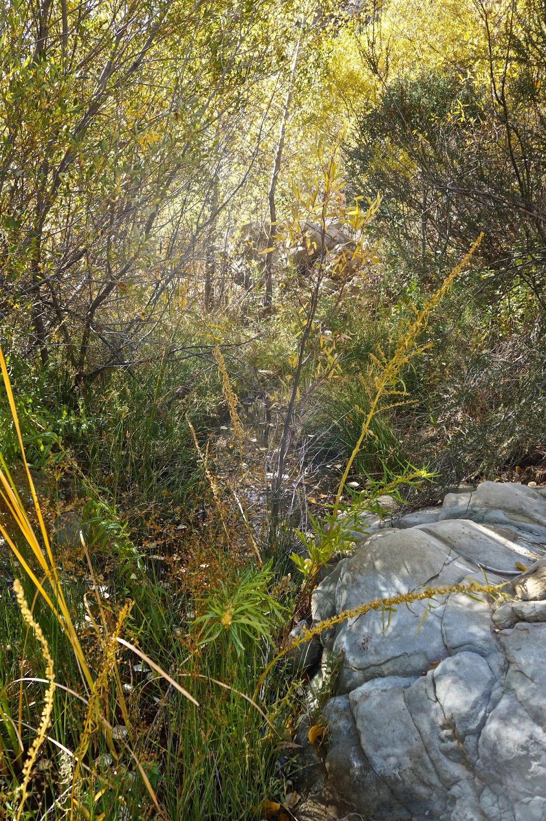


Green Hell.
Another pot site. 
We traveled far up Trout until we were basically under Thorn Point, not that we could see any of that peak through the jungle we had ensnared ourselves in. By that point we were fed up with vines and sticks and brush and deadwood, and without any real goal for being there we started questioning why this had happened to us in the first place. I mean, we're intermittently nice people! What did we do to deserve this? With that thought we turned it around.

Sadly, descending and escaping from the creek led us in a whole other direction, one which changed the type of brush but not the quantity. I swear, this forest has developed a taste for human blood. So, stupid guys that we are, we worked up this bright idea to pioneer a new route out of this mess and back to the Sespe. We worked eastward up a twisty wash, crawling on hands and knees through numerous brush tunnels, fighting tooth and claw to advance our new found cause. My rich and colorful brush dialect became a monotonous kind of droning, accented by the sounds of lumber snapping and nylon shredding. We escaped from this pernicious gulch, climbed to a saddle, and there before us was a hideous sea of brush. Before continuing we turned back the way we had come and issued a big "Fuck! You!" in that general direction. We dropped off the saddle and in about ten minutes found ourselves reversing the same kind of crap we'd been doing all day. Another inglorious gully. I hung back for a bit and watched Mike struggle with this latest iteration of hell. I have to say it was great entertainment, though Mike didn't appreciate my laughter. Sorry Mike.

Some time later we encountered a deer track that diagonaled up and out of our little Eden. We'd had enough. Follow the deer. This path was better than many of the regular trails in our forest. In short order we topped onto a slender dragon's back ridge which descended steeply into the Sespe. This was easy street and it wasn't long before we turned west on Interstate Sespe headed for home.


Deer tracks, the handy bypass routes of the SLP.

Saturday, November 1, 2014

A Preliminary Exploration of Trout Creek

Thorn Point cresting a sea of brush.

With only a half day to ramble, and responsibilities haunting my clock, I decided to do a brief recon of a little known and thoroughly feral drainage called Trout Creek. Anybody who's walked the Sespe River Trail has probably rolled right past this innocuous feeder creek without giving it a second thought. What makes it somewhat intriguing to me is that I'd never heard a single thing about it, even though it flows from directly beneath the prominent south face of Thorn Point. 

Now that I've spent a morning getting to know this little mess of a creek I am feeling compelled to go back and take a day seeing just how far up there I can get. I can say that the lower half of the drainage is a nightmare of brush, nettles, poison oak, tangled limbs and deadfall trees. It's not fun. It is, however, unique in one key way; there is no evidence of humanity in that drainage, not even the expected remnants of a Mexican grow operation. This in itself is remarkable given that every time in the last two years that I have felt I was sufficiently "up a creek" I have stumbled into the ubiquitous black irrigation hoses.

Though I only had a few hours to work with I was able to proceed upstream until I was at roughly the same latitude as the Piedra Blanca Rocks, which lie a a mile or so to the west. Perhaps the drainage opens up a bit beyond where I had to turn back. Perhaps not, and Trout Creek remains an extraordinarily clogged little stretch of forgotten drainage. In reflecting on the morning and it's unpleasantness I have concluded that I may not be quite done with this one yet

Thorn Point and Trout Creek.

Even the open ground was a morass of yucca and wild rose.
One of the nicer parts of Trout.
This is a bit more typical of this drainage.


Thorn Point, from where I had to turn it around.


Friday, October 3, 2014

Horse Thief Canyon and Environs


What a delicious day. Didn't feel that way when I woke up but man, what a great day this loop turned out to be. The Santa Ana winds were gusting out of the east, that strange quality of arid, lower latitude sky, the lengthening shadows of fall. All of it, combined with the terrain I chose to travel, made for a stunner of a day of off-trail antics.


Horse Thief Canyon drains off the eastern edge of the ridge on which Thorn Point sits. It twists and turns through eroded sandstone bluffs and feral meadows, eventually emptying into the southernmost part of Mutau Flat. The surrounding landscape is a confusing jumble of steep sided ridges, plunging gullies, sandstone cliffs, manzanita, and cedar, all overshadowed by the epic cliffs of Thorn Point. This area is one of the most dramatic landscapes in our forest, and one of my favorite places to roam.

Dropping off the other side of Thorn Meadow was like entering another world entirely.
The first falls I encountered (and below).

I took a very indirect route into Horse Thief, by design. An overview of the area directly east of Thorn Meadow (where I parked) shows a remarkable basin of steep drainages and deep washes. Some of these gullies have cut through bedrock resulting in dramatic waterfalls, seasonal and currently dry. I set out due east from Thorn, tracking up an old hunters route, climbing through loose soil and pines. Cresting on the ridge some 400ft above Thorn, the route faded, petering out into a thready animal track dominated by the paw prints of a passing cat. Rather than follow this ridge to a point where I might descend into Horse Thief I instead launched straight off the other side, carefully descending into a forested gully. Once reaching the floor of this mini-canyon I turned right (S) and back-tracked up the drainage a bit to a vertical dry falls. Done there I turned downstream and followed the gully roughly east encountering, a short time later, another hidden away falls draining in from the right. This was a very pretty hollow, shaded, framed by cedars, butterflies flitting here and there as they stooped to sip from a meager seep of water which eked out of the 30ft high falls. Ten minutes later I was again hanging a right, this time into a third branch gully. This was the one I'd come to see, a gracefully arcing amphitheater of cobbled sandstone, 40ft high and significantly overhung at it's deepest point. Climbing out and up above that dry falls led to a series of glaring white slabs  sculpted with shallow erosion channels. From here I connected a couple small ridges headed south, ultimately arriving at a photogenic overlook which provided keen views both up and down Horse Thief.

The second falls, the one with a hint of water (and following 2 photos).


The third falls hidden deep in an amphitheater (and below).
The slabs atop the third falls (and below).

With clear views into Horse Thief I decided to hook left on the ridge (E), paralleling the canyon from the ridge top.  Eventually I descended over a large butte of rock and dropped into a pretty meadow on the floor of the canyon. Here I continued east, following a deer track through dry grasses sprinkled with mature cedars. Lower down canyon I crossed the deeply cut wash, finding a tenuous animal track which climbed out the other side and up to another meadow. Blue jays squawked and a large squirrel bounded from tree to tree. This place had a primordial, untouched feel to it.  Really, I'd had that feeling ever since departing at Thorn, but this canyon felt truly wild. Needless to say I was enjoying myself immensely.

The first look up Horse Thief. Thorn Point dominates the skyline.
The meadows of lower Horse Thief Canyon.

On the canyon floor, untrodden meadows (and below).

Eventually I turned around and retraced my steps. I continued up the canyon past where I'd dropped in. The upper portion of Horse Thief narrowed considerably and gone were the broad meadows and open views. I was forced into the wash, wide and easily navigable. Later the wash started getting tight, and numerous smaller drainages had started showing up on the right and left. Manzanita and scrub oak started reaching into the drainage and I decided it was time to climb out of the canyon and exit the day. I picked a gully of crumbly gold sandstone that opened up after a hundred feet of brushy stuff, becoming a fun and semi-sketchy exit up to a point on the ridge where I could connect with my entry line and drop back into Thorn. 

Just had myself a super day out there. May you soon have the same.

A portion of my exit route.
A last look down Horse Thief Canyon.
And finally, looking down from the ridge into Thorn Meadow. The Mt Pinos ridge looms in the background.