Monday, February 24, 2014

Cobblestone Mountain via new route, "Redrum Ridge"


The idea for this new, southern approach to Cobblestone Mtn came from Jeff Cannon of Newhall. He thought that the route ought to be called the "Southwest Spur", which (no disrespect to Jeff) is kind of boring and benign, and while the climb up this ridge is many things, it is neither boring nor benign. After my attempt on Valentines Day (trip report) and again during this climb today, I was reminded that there is nothing humble about Cobblestone Mountain. I have now earned this route, and I am christening it Redrum Ridge. Those of you who haven't see The Shining can simply spell "redrum" backwards and it will all make sense.

There are two elements beyond human control that make this ascent possible. 1.) There needs to be water in Agua Blanca Creek for this to work. I went through close to eight liters of water for the entire day, 4.5 of which went down on the actual mountain. 2.) The temperature has to cooperate. The entire route climbs the southern aspect of the mountain. There is very little shade anywhere along the route, and this part of our forest tends to be devilishly hot even when other areas feel cool. If those items are in order then one can focus on the mountain.


Click any image to enlarge it.

I once again knocked out the eight miles to Ant Camp in rapid style, stashed some items, topped off on water, and set about climbing this thing for real. The use trail which crosses the meadow NE from Ant Camp leads to Agua Blanca Creek, and by crossing the creek and going downstream for about 150ft one arrives at the start of the route. The climbing starts immediately, ascending the left side of a steep canyon of grasses, yucca and low scrub. Gaining elevation, one eventually clears the canyon and begins to wrap around the upper portions of this first hill. It is best to angle NW across this slope until crossing a small gully, then up, up, up to the mother of all ridges.

This detail shows the lower portion of the climb ascending to the ridge.
The big slope which climbs out of the gully to the ridge is a grind. The slope is hot, loose, and a bit brushed up. This part of the climb is long and steep and it sucks. After attaining the ridge one gets a bit of a break. The top of the ridge from this point is large and rounded, and though it too is brushy, meandering upward through the scrub is not difficult. The route continues up this ridge, climbing two short steps before reaching the first red dot noted in the image below. To the north of this dot is a minor saddle where about 150ft of elevation will be lost. To minimize this loss, and to get some time in the shade on the north side of this lower part of the ridge, I shortcut across the northern aspect of the ridge below the red dot using a pretty good animal trail. Below, on the saddle is another opportunity for shade in some pines, a time to gather oneself before attacking "The Three Evils".

Detail of the mid and upper ridge.
Elevation profile from Agua Blanca to summit.

The 3 Evils. Three steps, each longer than the last. Each climbing at between 30 and 50 degrees for their entire length. This part of the ridge has a character all it's own. Steep, rough, rocky and loose, with old pines dotting the narrowing ridge. The first time I ascended these steps the experience was soul crushing. On this day though, I was out for revenge, attacking each step with raw determination and brute force. Hostility might be the best word for it. I knew what I was in for and I brought my game face. On a hard mountain this stretch was the hardest. One gets a bit of a break after topping out on the second step. Here the ridge turns northwest, cresting and dropping over a couple minor rises before settling once more into a steep climb which wanders around intermittent stands of charred brush. My tracks fell in amongst the tracks of an enormous mountain lion, and figuring he knew where he was going I let him lead me almost all the way to the summit.

Summit, from the lower ridge.
False summit, from the saddle below The 3 Evils.
The third of The 3 Evils.
Looking at the summit from the east.

At last I topped out. I didn't make a big production out of it and only stayed long enough to take a few photos. I noted that fewer than a dozen people had summited since Nico and I had in spring of 2012 (TR). Jeff Cannon had been there twice by two different lines. Not a popular peak. Hard country.


This climb takes some strategy. I was very disciplined about my approach to this one, as I am with any of the more brutal days I've put down in the mountains (Brutal means different things to different folks. It's all relative. This mountain is a brute.) I took only two real breaks during the entire day, 20 minutes on the summit and 20 minutes on the return leg back at Agua Blanca Creek. All other stops were held to under three minutes, just to blow and shake out. I used a lot of water, understatement. I used every trick I know of for staying motivated and physically on top, and was even better prepared for this go around than I had been on Valentines Day. This is a big day to swallow all at once, but it could reasonably be done with a fresh start from Ant Camp, meaning as an overnight. Despite what you may think, I truly loved this climb. Must be the masochist in me.


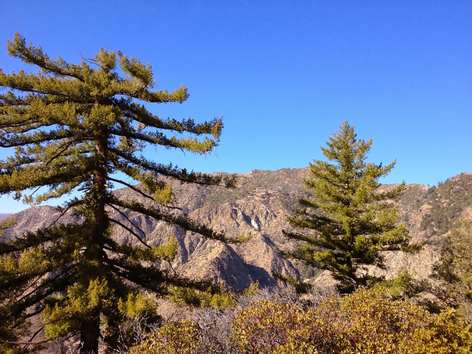
The lower aspect of Redrum Ridge.
Looking back down Redrum Ridge.
A view down the ridge from atop the first Evil

Here are my times start to finish. I was surprised by these numbers given the scope of the day.

Gate to ABCreek 2:15
AB-Summit 3:50/6:05
Summit-ABCreek 2:25/8:30
ABCreek-Gate 2:40/10:45 
GPS had it as nearly 26 miles on the day.


Saturday, February 22, 2014

Carrizo Plain, The Barrens


The Carrizo. Barren and desolate one day, alive with birds and flowers the next. And a place of endless fascination for me. Such a stark and elemental place, and oh so quiet. On a wide ranging day of exploration I retraced many of my tracks from previous explorations, seeing the familiar in a new shade of Carrizo. Saw the elk herd in the distance, foraging near one of the few reliable springs on the Plain. Saw old farm houses and ranch sites. Saw multiple rock art sites, new colors, a small shrine left by a latter day Native, and discovered a cupule and mortar site I had not previously known of. Saw a barn owl flap by, saw him glance over a shoulder at me with that ghostly, almond shaped face and bright black eyes. Saw a scruffy coyote trot away from me as I crested a small rise in the rippling land. Saw rusted trucks and tractors, miles of barbed wire. Saw a dusky grey fox slink across the grassless expanse. Saw a brilliant sunset from the crusted lunar surface of Soda Lake. And saw much of that through the lens of my camera. Enjoy.


Thursday, February 20, 2014

Trial and Error on Cobblestone Mountain, AKA "The Valentine's Day Massacre"


Back down in the shade, choking on a bad gamble.

So close!
What theee Hell! I keep having to do my summits twice to get it right. 
24 miles and +8,000ft and for what?
So I can do it all over again. That's what.

*This writing is purely cathartic and not meant to be a guide to this approach to the peak. I will provide a more specific route description when I am able to complete the route.
02/24/14 For successful trip report, visit: Redrum Ridge


Cobblestone, just across the way from the endless ridge out of Agua Blanca.

The idea here was to do Cobblestone Mountain from Tar Creek Rd via Ant Camp on Agua Blanca Creek. The route could be classified as Cobblestone's Southwest Spur and the idea for doing this actually came in the form of an invitation from Jeff C of Santa Clarita. He'd done a lot of legwork both indoors and on the mountain to identify this route as a possible way of reaching the summit. He'd invited me to join him and when our schedules didn't work out he gave me a green light to take a stab at doing it solo. I went. I lost.

A view down Agua Blanca from high on the summit ridge.

The day started with the eight mile slog into Ant Camp (at this time of year the road to Dough Flat trailhead is closed which adds an additional 3 road miles to each way). Ever since being approached by Jeff I had been obsessed with this plan. Cobblestone is one of the biggest, baddest peaks in the SLP and there is no easy way to get the summit. It's just all around hard. To be able to tick it in a day from the south would be a neat feather to put in one's cap. To that end I studied the route, made adjustments to gear, even trained two long sessions on the StairMonster early in the week, ate right, and really dialed in my nutrition for the days preceding the event. Somehow I blew through the first eight miles in 2:15. Everything was clicking.


I did some recovery work on Agua Blanca Creek, gassing up on quality calories and water. I stashed more recovery goods creekside and started on the "real" part of the day. The route ascends a ridiculously steep S-shaped ridge that climbs across the south face of Cobblestone and loops back west to the summit. Many portions of the ridge are steep and brutal. I fought through some brush on the way up the lower sections and achieved a part of the ridge that looked straight across and up toward the summit. Here it became glaringly obvious where the crux of this climb would unfold. East of the summit is a sixty degree climb of comprised of three individual steps which deposit one a mile east of and about 500 feet of elevation below the summit. After enduring that fight, which I can only describe as "evil", I was within an hour's work of the summit. By this time the temps were in the 80's and the day was still getting warmer. Whatever minute breeze I'd had abandoned me. I'd started up from Agua Blanca Creek with 4.5 liters of water and had gone through over 3. I sat down in the shade and did some hard calculations on my water situation and the prognosis wasn't in my favor. I had a choice to make.

Whiteacre Peak from the Southwest Spur.


I was faced with a gamble. I was at what I considered to be my "reserve" based on all the factors involved: temperature, distance to the objective, distance back to a water source on the creek, and how I was feeling. To make this choice responsibly requires a great deal of self honesty and experience in the heat. I thought about it and determined that I would gamble on there being water at Cobblestone Spring, which lies ENE of and roughly 500ft below the summit. I figured that though I was feeling pretty blasted by this point, if I could get some additional water I'd have no problem achieving my aims. I gambled and lost. I fought my way across the ENE slope, battling through ugly brush thickets until reaching what used to be called Cobblestone Spring. Nothing. Dry as a bone. That sealed the deal for me. The summit wasn't in the cards. I could not reconcile my goal within a margin of water safety that I could (quite literally) live with. With under a liter of water left I turned my back on the summit and started down.

The route follows the right hand ridge up and right before turning back left to the summit. Taken from the nasty little climb out of Ant Camp. 

Back on Agua Blanca I resuscitated myself with Water, water, calories, and water. One of these days, maybe after I knock this route out, I will explain what I use to restore life to my challenged system. It's a system that is well thought out and based on science and an understanding of sports physiology as it applies to endurance efforts. After that the day was just a long haul out to the truck. 

Hostilities will recommence shortly. 

Miles to go...


Saturday, February 1, 2014

Cara Blanca (SVS) via "Cara Mia" [Class IV]


Loose ends. Not a fan. 
A couple weeks ago I took a stab at the south face of Cara Blanca and was rudely denied access frustratingly close to the summit (trip report). During my hellish descent from that climb I traversed east across the peak to a rocky point I'd labeled "Sub-Peak 1". From this vantage I was able to peer down aspects of the eastern side of the peak and immediately discerned that the long shale slides that decorate this side of of the peak might afford me a second chance for the summit.

I studied the topos and imagery and concluded that two of these chutes would provide access to the upper reaches of the peak. The first chute looked as if it was a little more direct, but it's entire length appeared to be 100% loose shale and rock, tilted at around 60 degrees. Furthermore, this route had a couple of short vertical sections which might or might not be worrisome. The second option, just a bit more upstream, was steeper (65 degrees), but the shale gully terminated just 700 feet above the creek and segued into a relatively brush-free 800ft climb to a point about even with Sub-Peak 1. The lower portion of this route looked pretty challenging. Regardless of which route I took, the remaining 500ft of elevation and 0.3miles to the summit would be in the brush. I eventually selected the second chute as the route I'd climb.

Car Mia=Green, Descent=Red


 I had a good, quick run up Matilija. The weather was cool and breezy which suited me fine. Reaching the North Falls I scrambled up the rope to the right of the lower falls and continued up to the upper ones. This is where almost everybody stops because a.) it's a nice place, b.) not many folks know of or have any interest in what lies upstream, and c.) getting above these falls is a bit dangerous and difficult. 100 feet downstream from these falls is a steep shale slide with a sketchy one-move-wonder out of that gully and into some brush on the left. I cruised through this obstacle and continued into the untrammeled wilderness upstream. (**In trying to replicate this ascent, if you or anyone in your party is freaked out by or unable to climb this slide then this day isn't going to work out. This slide is a 50 foot primer for what lies ahead and is actually easier and safer than the majority of this route up Cara Blanca.)

Lower North Falls
Upper North Falls. The bypass gully is immediately right of where this photo was taken.
 I charged upstream and after a short time encountered a pair of easily bypassed waterfalls (neither of these are the famed "Lost Falls"). A short time later the creek went underground and I continued up the creek bed for a bit longer before passing under the first of the two gullies I mentioned earlier. In a few more minutes I was standing next to an old and bifurcated sycamore, gearing up for the day's real work.

The first falls above the primary North Falls. Pass it on the left.

The second falls, scramble low and left to get past it.

This bifurcated sycamore marks the start of Cara Mia.
Without making a big deal about it I just started up. The first 700 feet of the route were loose and steep, completely composed of talus and shale, and climbed at a pretty consistent 65 degree angle. For the first time this morning I was glad I'd worn my stiff mountaineering boots, which allowed me to kick through the shale to the denser substrate. I sent a few good sized rock tumbling down and was grateful that I didn't have a partner down there. I encountered several short, but sketchy sections of Fourth Class climbing up unstable rock funnels but the overall nature of this climb always came back to duking it out with the shale. By the time the shale climb was over I'd had about enough of it.


One of the Class IV obstacles.


The slide I was in eventually tapered into a small and awkward two-move scramble into a resiliant manzanita after which the day really opened up. I'd broken out of the gully and into a steep, grassy slope I started calling "Easy Street". For the next 800 feet I zig-zaged back and forth in tight switchbacks, paused often to suck air and enjoy the view. Higher up I was hugging a left-hand outcropped ridge of rock that stuck out just a few feet overhead. I passed the first big break in this outcrop and continued almost to its top where a second break in the stone allowed me to scramble up on top. From this point I traversed up and left through thick brush and eventually found a chink in the rock which allowed me to get up on the  actual summit crest. 

Looking down the portion of Cara Mia I labeled above as "Easy Street".

This represents the brushy traverse over to the crest from Cara Mia.

 At first the brush was so dense I couldn't actually see where I was on the peak, but using the two sub-peaks and a gps for reference I concluded that I was less than 0.2 miles and a little over a hundred feet of elevation gain away from the summit. Sticking to the crest was at times a challenge because of the brush, but portions of the narrow ridge were less brushy and I quickly busted onto the summit. I love it when a good plan comes together (insert shit-eating grin).


The above landmarks are noted on the route diagram (above)

A view down Matilija Canyon from the summit.
 This is a neat and rocky little summit, and small, occupying maybe 20sq/ft. There was no USGS marker, nor was there a summit register. I started wondering if there possibly a chance I could actually be the first person up here? That balloon popped when I saw worn and faded names scratched on a flat  piece of sandstone. Now, what the hell? E.L. Moody 1935?!? There were other carved names in about the same state of erosive wear but without dates to verify that state. Holy cow! After really looking around I feel pretty safe in guessing that mine was the first ascent of this peak since before the advent of television. And that's not a bad feeling. I scratched my name in there with those other hard old dudes. I also left a summit register and have taken the liberty of dedicating this summit in honor of Mr Kim Coakley for his SVS series of lost, forgotten, and hard as hell to get to places in the Southern Los Padres. I regret not placing SVS registers on Devils Heart Peak and White Ledge Peak, but this time I just had to. 

E.L. Moody, 1935


Cara Blanca, seriously seldom visited.

There is now a summit register under a cairn. Courtesy of Wonder Bread (coffee cans are sooo passe).

Monte Arrido Peak (left).
The tippy-top of the South Face.
Descending back the way I'd come and down to the point where I'd traversed over to the crest, I decided to take a chance and shoot straight down the epic 1,000+ shale slide mentioned as a possible ascent route. This went pretty quickly but I do need to mention that there really are some severe and sketchy drops on this descent. These are possible to downclimb with a judicious use of caution and a very light touch. I would not recommend this route as an ascent line. 

Other advice I'd give would-be second ascent parties is that this isn't a hike. It's really a mountaineering route. Treat it like one and you should be fine. For parties of two or more I would strongly recommend helmets. Getting brained by the guy above you isn't a recipe for success. Trekking poles are mandatory, and I already mentioned the stiff boots being a plus. If anyone eventually repeats Cara Mia I'd sure like to hear about it. -DS