Thursday, December 25, 2014

No Name Canyon


I need a break from the Sespe for a bit. I've logged four recent trips into the Trout Creek morass and added this (today's) bit of scrum to the mix. Off-trail drainages have been a recurring theme lately. Partly I figure it's wise to knock these places out before the marijauna growing season starts up again.  Encounters of the narco kind aren't my idea of fun, and I've concluded that every little drainage in the SLP, no matter how remote, hosts such sites. Also, these drainages are kind of fun in their own sadistic way. But they sure do dish out a beating. 

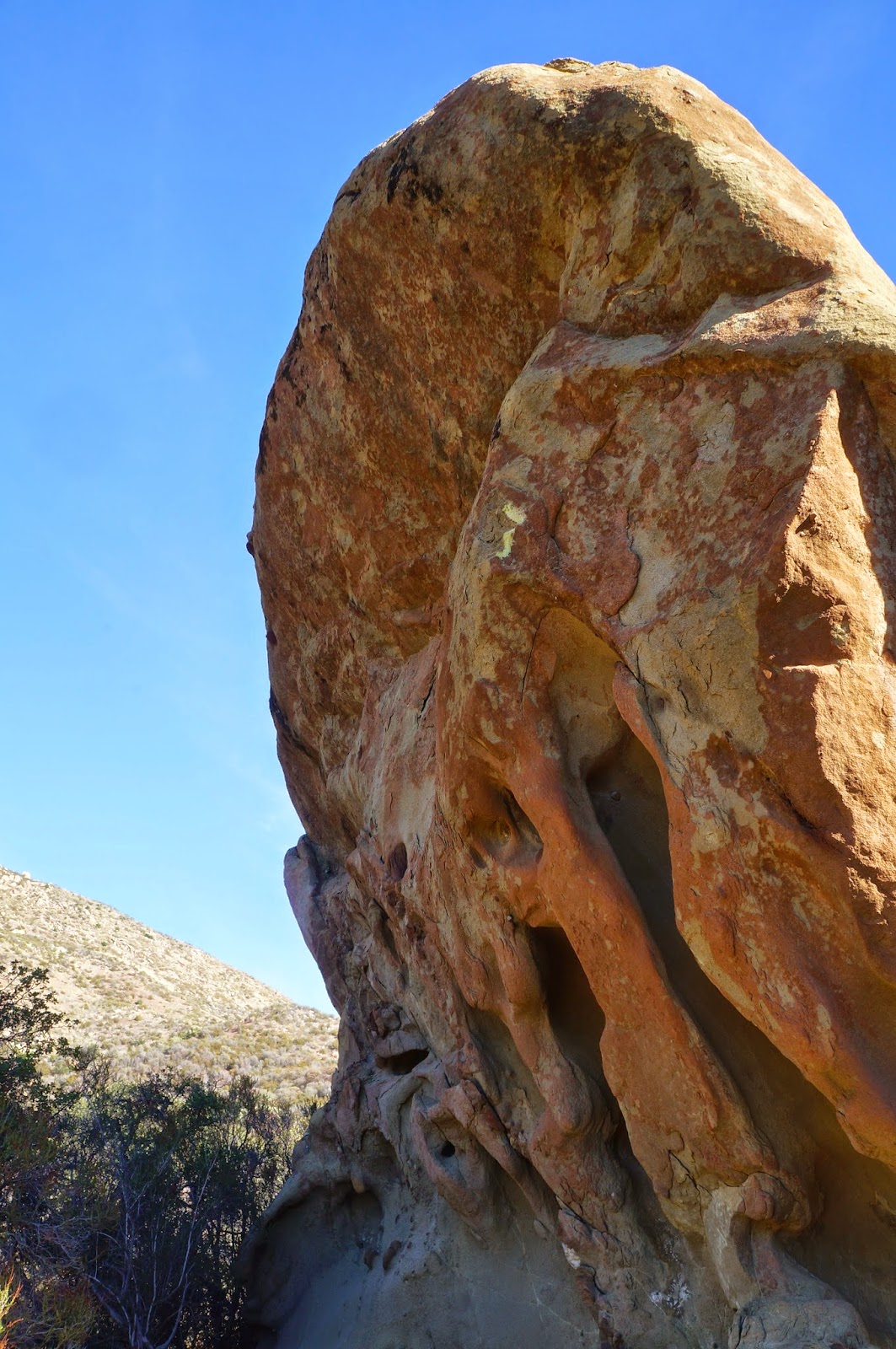
The itinerary for this day included an exploratory recon up an unnamed drainage on the south side of the Sespe and just west of Bear Creek. This gully has caught my eye on occasion. The entrance from the Sespe is framed by a clustered jumble of highly eroded red-brown formations. This feature is fairly easy to thread but it does narrow down to a neat little slot. On either side of the slot are pocketed strata which rise like a small gorge to either side of the gully's outflow. In other words, this slot is a natural gate.

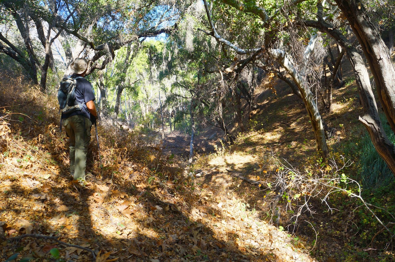
I, and Josh Weir, slipped through the gate and proceeded a mile up an extremely brush choked gully. Due to the recent rains, and the fact that this gully drains off a northern slope, every rock was slicker than snot. Muddy feet and slick rocks made for a tough go. The day was not without injury. As the drainage continued its winding course upstream we gradually passed into a zone of oaks scattered with a few sycamore trees. The brush remained a persistent hazard and we were often forced out of the creek onto muddy slopes in order to bypass particularly troublesome tangle or deadfall. 

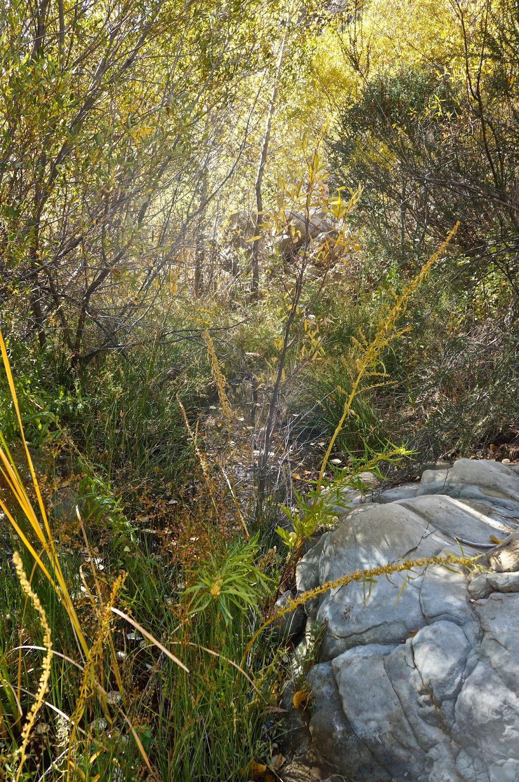
After a while the trees grew taller and more abundant. The way forward became dark, dank and wet, the rocks blanketed in green moss. The gully steepened and water cascaded down numerous little falls. We climbed upward between immense boulders, sometimes over or under them. We slipped on slick rocks and dead leaves. Our pants were soaked and muddy from the knee down. 

We eventually climbed into a huge and deeply shadowed gorge of grey stone. This feature is very visible from the Sespe Trail and forms a dramatic "V" over the drainage.  Near vertical cliffs rise above a small hollow for several hundred feet on each side. The small space in between these walls was crowded with oaks, sycamores, and large boulders. Several old spruce trees grew in the upper part of the gorge. 

Farther up from the spruce trees the drainage devolved into a mess of manzanita and scrub oak, so we returned to the little hollow in the bottom of this upper gorge. We sat under the trees and had some breakfast and conversation, though Josh talks enough for both of us and I was mostly content just to listen. A quiet breeze stirred the sycamores and dried leaves rustled and fell. The little creek burbled through the rocks. Upstream a jay squawked. It was a good morning, grey and overcast, moody. Excellent exploring weather.


A view across the Sespe to Thorn Point.


Sespe Creek after the rains (and below).

Thursday, December 18, 2014

Busting Sticks Over Frazier Park

Last week, before this latest series of rains, I wanted to do a little exploring in the high country north of Frazier Park (AKA Tecuya Ridge). Of course the roads that ascend to the ridge will be closed for the next several months so getting up there is a bit of a hike in itself. I looked the maps over a bit before settling on a direct but steep climb straight up from Frazier. 

The morning air was crisp and cold at the time I set out, the sun just climbing over the eastern hills. After a mile of mixed road and motorcycle trails I had hit the wall atop my selected canyon. This little bit was where things would begin to feel like work. The climb was stiff, gained 1,000ft in 0.5miles, but after clearing the canyon I had a gentle ascent through rolling grasslands and deadfall trees which led to the ridge crest.

This portion of Tecuya Ridge had burned in a brief wildfire which started in late October of 2011. Though the fire had been quickly contained, a large swath of the ridge had gotten scorched and now, three years later, the grasses and desert scrub were retaking the south facing parts of the ridge while those mature ponderosa and jeffrey pines that had survived the blaze on the shady, north side were rebounding with greenery. I landed on the motorcycle track that traverses the ridge and paused for a little breakfast.

The birds were out, the breeze was cold, and I didn't have much of a plan other than to explore a bit. So that's what I did. I kind of roamed here and there, over hilly shoulders and into shadowed canyons, stopping frequently to admire trees or to listen to the breeze, to watch paired ravens play on the wind. The day was perfect that way, no need for a plan or a trail, time spent simply ghosting through the woods.

Looking down on Frazier Park from where I started, the fire station on West End Way.


Thursday, December 11, 2014

Trout Creek, Round 3


Really, there's not much left for me to say about Trout Creek, that unpleasant and overgrown minor drainage which has occupied far too much of my time of late. It is rare when I'll divulge the reasons behind an exploratory recon, especially when there's a possibility that such intelligence gained might result in a larger "win", but since I am now pretty convinced that this idea of mine isn't worth doing I'll go ahead and spill the beans: 

I've been looking for a direct way to ascend the south face of Thorn Point, in a day.

I think I could probably do it, but it would likely be dangerous, would require a partner and a second vehicle at Thorn Meadow, and I'm pretty sure it wouldn't be "fun". I've learned through these explorations that Trout Creek has a deficit of redeeming qualities. I think I ought to shelve this idea, for a while at least. My hit list has too many other interesting ideas to justify spending any more time on this project.

The South Face of Thorn Point


Tuesday, December 9, 2014

Deer Creek, Santa Monica Mountains


Here's a day that deviated dramatically from the original plan. Jack Elliott and I had traveled down to County Line with the intention of going spearfishing but upon arrival the conditions were junk. The water was choppy, the kelp laid over in the current, and the water clarity wrecked by a heavy shore break. Fortunately we'd both brought our dirt kits for Plan B. 

I'd once heard a rumor that there was a something or other, Chumash in nature, somewhere up Deer Creek Canyon. Most of the drainages along the Central California Coast which empty to the sea used to be ideal real estate for Native living. The combination of fresh water and ocean access, a temperate coastal environment, and easy access to the hills made this coastline a highly desirable and seemingly easy place to forage, fish, and live... at least until the Spanish arrived with their crucifixes, slavery, and exotic pathogens, that is.

Most of the creeks which empty to the sea bear the signs of long-term Chumash habitation, some as year round villages, some as more seasonal or transient sites. Many of these village sites are under brick, mortar, and asphalt, as in the low lying coastal areas of Ventura, Carpinteria, and Santa Barbara. A common sign of long term use in such areas are large scatterings of seashell and bone shards called midden piles. A look at these coastal middens give an immediate insight into aspects of the native diet and food resources. A middens pile in these coastal environs will be riddled with fragments of clam, mussel, and abalone shells. 

So having shelved our original plan for the day we drove to the top of Deer Creek Canyon and weren't all that surprised to stumble into such a place shortly after ducking into the canyon. Sea shell shards were strewn among the leaf litter in a wide circumference around two bedrock mortars. This site lay on a small flat, nicely shaded by mature oaks, and immediately adjacent to the watercourse. After a wider sweep of the area we determined that there was no accompanying rock art in the vicinity. We returned to the truck and drove back down Deer Creek Road a little bit and pulled out. Here we walked over to the rim of the canyon for a better look at the lower aspects of the drainage, just to get a better idea of wether we'd missed any significant rock formations lower down the creek. Several hundred feet below us we spied a cluster of large boulders begging for a thorough look. We walked back up to the truck, kitted back up, and dropped off the rim of the canyon into a scruffy terrain of rocks and brush. 

Arriving at the boulders in the creek we scoured them for any signs Chumash, to no avail. Being kind of dumb people we decided "What the hell? Why not finish out the canyon?". Now, the dominant life form in Santa Monica Mountains watersheds is, you guessed it, poison oak. In short order my prognosis was grim, I'd have to drown myself in a bath of Tec-Nu solvent for a day or so. Of course, lucky devil that he is, Jack seems immune to that infernal plant. Jerk. We finished out the canyon fairly quickly, mostly because it wasn't any fun and there wasn't anything of interest worth stopping for. Arriving at the bottom of the canyon we emerged back onto Deer Creek Road. This left us an unpleasant two mile road climb back to the truck, and naturally, being so close to LA's unkind masses, a desperate thumb hung at oncoming cars did no good whatsoever. Humbug.


Poison Oak Paradise.


Thursday, November 27, 2014

Wasting Away Again In Manzanitaville


Mike Shields enjoying the natural wonders of Trout Creek.

Happy Thanksgiving everybody. I just got back from shooting some fish off County Line, which is how I am recovering from this strange odyssey of brush ninja meanderism. Salt water immersion is good for a minor case of poison oak. Nothing from this day is worth a recommendation. Some days are just like that. I contemplated not even posting this one but figured that I could write this as some kind of public service "don't go here" announcement.

Thorne Point, from above the Sespe.

The green line follows this day's wandering weirdness. Don't try to make sense of it.
The day was initially about a resumption of my exploration of Trout Creek.  I have (or had) a reason for this recurrent interest in an otherwise unpleasant drainage. In light of my recent experience there I am still undecided about wether to give up on that particular notion. Mike has his own interest in the area, a lingering and unresolved matter which I'm sure is nagging at him like a toothache. For the time being I'll remain vague about these concerns, hopefully maddeningly vague.

We pretty much went all over most of the terrain in this photo.
Back to the day in question, we pounded down the Sespe River Trail out of Rose Valley. Mike had identified an old dozer track that looked like a promising way to access the upper half of Trout, so we kept on truckin' right past where Trout empties into the Sespe. Mike's guess was good, a stout little climb which put us over a ridge and into a scrum of brush which we descended into the middle part of Trout. By the way, Trout Creek is a misnomer... there's no trout there.

We headed up Trout for a bit before climbing out of the west side of the creek to investigate a bouldered flat, didn't find anything of interest, dropped back into the creek and proceeded further upstream. Things got ugly mighty quick. "Ugly", in this case, is a descriptor which I've employed as an understatement. Take the ugliest horse you've ever met, mate it with a triceratops, expose the offspring to gamma radiation while in utero, name the baby Bertha, and then you see the analogy I'm trying to make. Even in this remote and thoroughly fucked up drainage we found a marijuana grow site.  It's true. These people have staked a claim in every watershed in our forest that doesn't have a trail running up it. 


Green Hell.
Another pot site. 
We traveled far up Trout until we were basically under Thorn Point, not that we could see any of that peak through the jungle we had ensnared ourselves in. By that point we were fed up with vines and sticks and brush and deadwood, and without any real goal for being there we started questioning why this had happened to us in the first place. I mean, we're intermittently nice people! What did we do to deserve this? With that thought we turned it around.

Sadly, descending and escaping from the creek led us in a whole other direction, one which changed the type of brush but not the quantity. I swear, this forest has developed a taste for human blood. So, stupid guys that we are, we worked up this bright idea to pioneer a new route out of this mess and back to the Sespe. We worked eastward up a twisty wash, crawling on hands and knees through numerous brush tunnels, fighting tooth and claw to advance our new found cause. My rich and colorful brush dialect became a monotonous kind of droning, accented by the sounds of lumber snapping and nylon shredding. We escaped from this pernicious gulch, climbed to a saddle, and there before us was a hideous sea of brush. Before continuing we turned back the way we had come and issued a big "Fuck! You!" in that general direction. We dropped off the saddle and in about ten minutes found ourselves reversing the same kind of crap we'd been doing all day. Another inglorious gully. I hung back for a bit and watched Mike struggle with this latest iteration of hell. I have to say it was great entertainment, though Mike didn't appreciate my laughter. Sorry Mike.

Some time later we encountered a deer track that diagonaled up and out of our little Eden. We'd had enough. Follow the deer. This path was better than many of the regular trails in our forest. In short order we topped onto a slender dragon's back ridge which descended steeply into the Sespe. This was easy street and it wasn't long before we turned west on Interstate Sespe headed for home.


Deer tracks, the handy bypass routes of the SLP.

Saturday, November 22, 2014

Busted.


Some of you have noticed that the post detailing the descent of Deadman and Tecuya Canyons has been removed. Several days after posting that trip I got nasty-grams from both the Kern County Sheriffs Department and the Wildlands Conservancy (AKA the Wind Wolves Preserve) because I'd been trespassing on their land the moment I stepped foot into Tecuya Canyon. The ensuing conversation with the manager of the Wind Wolves wasn't particularly harsh but it was made crystal clear that if I set foot in the place again without prior authorization they will prosecute. I'd always wondered how zealous those folks were about their patch and now I know. Apparently they take their mission seriously.

This is by no means the first example of me being called out for providing evidence that I'd been somewhere I shouldn't have. Also, I'm beginning to think that various groups and agencies, or activists within them, are paying some attention to whatever mischief Stillman is up to. There have been plenty of days in the sticks that I've chosen not to share and this day should have been one of them. The takeaway from this episode is, a.) know when you're trespassing, b.) don't put it on social media, and c.) if caught, play nice and don't make things worse than they already are. Undoubtedly someone will comment that the real lesson is not to trespass in the first place... well, duh.  
I still think there are too many fences in the world.