Sunday, January 26, 2014

Devils Gate and Environs


Some days are just for exploring. 
It can be awfully nice not to have a stated goal, just to go see what's what and come home with sore legs and some nice pictures.

Downstream of Devils Gate.

Devils Gate on the Lower Sespe marks the end of wilderness on that waterway. I'd say that the Sespe from Alder Creek to Devils Gate is the only true and untrammeled wilderness along it's entire length. Chalk that up to it's rough and remote nature, I've been through there a few times, but on those prior occasions I was generally too thrashed to pay much attention to my surroundings. The Sespe between Tar Creek and Devils Gate is somewhat tiring and difficult to navigate due to thousands of gigantic boulders. Good route finding skills can spare the traveller a lot of effort but it's a tough stretch whichever way one goes. I call this stretch of habitat the Sespe Rock Garden, and there are some truly titanic examples in there. I'm going to have to schedule a day to go back and just shoot artsy black&white photos of rocks and water.  This is also prime real estate for many species of migratory waterfowl, and this day's showing was good. Somehow the water levels are holding up, the pools are deep, and the many small cascades are still kicking, the trout still swimming.

Devils Gate from upstream.


I was joined on this day by a fellow named Mike who I've linked up with recently for some rock art stuff. He was game for some exploration off and above the creek so that's what we did. We selected a random rocky drainage to climb and get above it all. No real idea what we'd find, if anything. We sure didn't expect to stumble into a few acres of pristine oak forest well above the Sespe, but that's what happened. We had some fun rockaneering the immense talus below this eden, climbing for a good 1,000ft before the land leveled off and we found ourselves traipsing through the trees. I have to say it was really neat to uncover this totally unexpected little gem (which is why they call it "exploring"). After a nice lunch and with nothing else to see up there we dropped back down to the Sespe where I stripped and ducked in for a quick bath. The rest of the day we spent fooling around near the Gate. All in all, a fun day of exploring for exploration's sake. Enjoy the photos.


Mike, gettin' sketchy.

A thin slice of paradise.


One of the many naturally occurring oil seeps in the Lower Sespe.

Friday, January 24, 2014

A Look Inside A Mexican Grow Operation

               
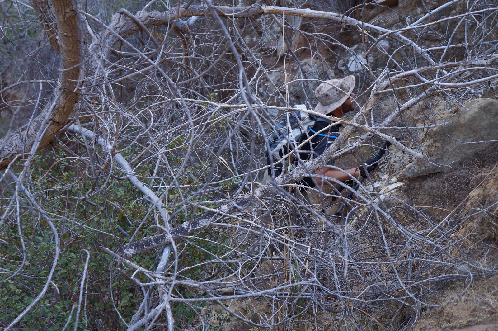
I spend a lot of time off trail. So do Mexican pot farmers (Narcos). Over the years I have run into numerous (>30) sites where these people have left behind their hoses and bits and pieces of things which indicated prior grow operations. They seem to be everywhere in the Southern Los Padres. At times I think these people know more about our forest than I do.

It alway starts with finding a hose.
As I understand it, the way these operations work is that the cartels select people (almost always Mexicans, as opposed to El Salvadorans or Hondurans, etc...) to perform this task. The reason for choosing a Mexican is that the cartels can keep an eye on these individual's family and therefore use them, coercively, as collateral for the servitude. The cartel will make an offer which really isn't an offer, providing a trip across the border, cash for supplies, maps, the seeds to start the operation, and a promise of payment to the family who stays behind. There is also a discussion of what will happen to that family should these services not be rendered satisfactorily. Invariably, these growers are desperately poor and have no other options. The cartels know this and prey upon those whom they can develop leverage over. This creates the conditions for a suitably motivated grower.

As I found out one cool pre-dawn on the Sespe, some of them speak english. This was the day I ascended Devils Heart Peak. I was still very early into that heinous day, taking a break after having rapidly descended Tar Creek to the Sespe. I was sitting on the creek having some breakfast when I saw some movement across the water. I stayed very still, thinking that I was about to see some wildlife. Instead what I got was a little hombre in camo pants with a cheap backpack hopscotching across the creek toward me. He was within only 10 feet of me when he about jumped out of his socks, seeing me. He spent a good two seconds doing what I had done with him, checking me for a weapon. He remained very anxious but asked if I had been there all night. No, I said, just for the past 20 minutes. He still seemed like a cornered animal but encouraged me to have a good day and quickly split up Tar Creek. For a while I wondered where the hell he'd come from, but now I think I know the answer to that question.


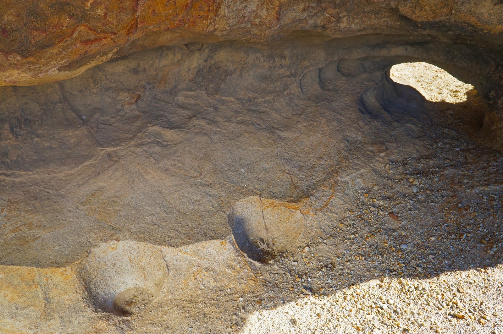
The grow site in these photos show the remains of the most elaborate of these operations I've ever run across. It always starts with finding the hose. In this case nearly a quarter mile of black vinyl water line snaked from an upstream pool (now bone dry). The downstream end of the hose terminated in a plastic lined, man-made catch basin (below).  Water was then gravity fed from this basin a short distance away to supply approximately two acres of cleverly camouflaged grow area. I say this with a bit of admiration because what this grower had done was manicure over 100 young manzanita plants, by trimming all but a single stalk, so that they grew straight up at a height of 6-8 feet, providing a light canopy which allowed just a bit of shadow for the marijuana plants while disguising the site from the air. 

Man-made, plastic lined catch basin. Cut branches laid over the hole disguised this from the air.

These trimmed manzanita cleverly allowed in enough light for the marijuana plants while allowing for some camouflage from the air. 

I found the actual campsite tucked under a scrub oak offering very crude living conditions for the grower. These remains included MiracleGrow, a sprayer, miscellaneous trash, a sleeping bag, a couple school backpacks, part of a propane burner and some cookware. No effort had been made to make the place anything more than barely livable. About 300yds away from the primary plantation I discovered more than 200 plastic cups filled with local soil. These cups were neatly arranged in a patch of sunlight and were clearly intended as planters for seedlings (below).

This valve was the terminus of the irrigation hose. The marijuana plants were watered by hand.

This cheapo sleeping bag had been blown or dragged away from the actual campsite and into the pot farm.

This is what remains of the grower's camp.

Solo cups used to start seedlings. He used local soil, and the 5 gallon bucket was probably used to haul water to the site, which was well away from the actual grow site.

Inevitably some of you will want to ask wether I carry a weapon when I go off-trail. The answer is, "Rarely." Carrying a weapon is a highly individual thing. I'm enough of a snob to think that most people have absolutely no business owning a hand gun, all while adamantly asserting my own right to the same. I have a range of hand guns and at times I have indeed carried, but only while solo hiking in deep dark places like the Dick Smith Wilderness, places where the wildlife is big and unpredictable and a lot of things can go sideways in a hurry. In that sense, I view a hand gun as a tool and something I have no intention of using... but I'm glad it's there for the "Just in case." factor. They say you never need a gun until you need one. As this subject pertains to stumbling into narcos, my feeling is that when two people with guns meet under these conditions it dramatically increases the odds that a confrontation will result, and those results could be deadly. For either side. Remember, these guys don't want to be seen and/or discovered, which creates dueling circumstances and choices for both involved. I lean to the side that says I should play it cool and act like exactly what I am, just a guy out for a walk who happened to run into this other guy. All that being said, these instances are each unique and unpredictable in their own way. I am convinced that the average drive-in campground is a far more dangerous place than the situation I described earlier. I am always prepared for that particular scenario.

Wednesday, January 15, 2014

Remember when it used to rain?

Rain gauge totals for Ventura County since October 2013. 

I think the title of this post says it all when discussing the current state of the Tri-County area and the drought which has got us by the short hairs. Our local civic leaders are not openly acknowledging this crisis as yet, or asking for greater public conservation of such a scarce resource, even though the most dim-witted butterfly could understand that we haven't had any rain this season (indeed, herbicides and climate change have decreased the monarch butterfly population by as much as 50% in recent years). California in general has been in a drought for the last three years and the trend is unlikely to forseeably change based on projections by NOAA. Surface temperature fluctuations in the Southern Pacific Ocean dictate El Nino/La Nina conditions. Those conditions in turn, affect the jet stream, and where resultant Eastern Pacific zones of high pressure will occur and for how long. This whole fall and winter season Southern California (and the State in general) have been plunked under one enormous and persistent high pressure system. This is bad news for those of us that visit the Southern Los Padres National Desert and rely on those diminishing water sources to stay alive.

To illustrate our predicament I have put some alarming water resource tables on this post. This is current and historical data for Ventura and Santa Barbara Counties that should instill a healthy fear in those of us who like to use the local woods. Last summer I wrote a post which included water data (to the degree possible) of all SLPNF drainages and springs which we hikers rely on. Many of you contributed to that writing and the overall message, when all was said and done, was pretty depressing. Things were already bone dry a year ago, much more so now. I invite you to spend a few minutes studying these charts. It's scary. As with any post here, you can click on any image to enlarge it.

To those of you that still argue that 95% of climate scientists are dead wrong (the folks with years of post-graduate education and research to back their findings), or have bought the oil companies' propaganda lie that our gleaming plastic, hydrocarbon fueled wonderland is completely unrelated to the phenomena of climate change, I invite you to watch Collapse, with Michael Ruppert. As with all things in life, take his words with a grain of salt (he is not perfectly right about everything, but it is also a good idea to judge the man by the quality of his enemies). He does present a cogent argument for those of you with your brain in "On" mode. Those of you who understand that the western U.S. is drying up and have concerns about the greater water supply and what you're doing to it, I suggest seeing Last Call at the Oasis, which is viewable in it's entirety on NetFlix. If you find yourself further intrigued by humanity's model for self-destruction, Zeitgeist may provoke some soul searching. Note that, with these recommendations, some may wish to label me a conspiracy/black helicopter type. I am not. I am simply a free-thinking, knowledge hungry human being who recognizes that every life system on our planet is under stress, and our species' entire model of living is unsustainable.


Monday, January 13, 2014

Cara Blanca (attempted) 01/09/14


There is a big difference between quitting and being a quitter. It's about being able to say to yourself, with 100% honesty, that you gave it your best shot. Attempting something and failing is a part of life, and if you don't occasionally fail to meet your own goals, then you haven't set the bar high enough. I didn't get my summit this time out. That doesn't mean I didn't try my damnedest, nor does it mean that I've conceded defeat. It just means that my route didn't work out. But Cara Blanca and I aren't done with each other just yet.

Green=Up/Red=Down


After blazing through the standard Matilija trail I started up West Falls Canyon and the day really got underway. This was my second time up there in recent days, and though my first trip up this remote canyon had been interesting and entertaining, I had not neglected to closely scrutinize the south face of Cara Blanca while there. This 60 degree pyramid of gleaming white sandstone had always captured my attention and was a peak I felt deserved to be climbed. At home I studied my own photos, topo maps, and wildly out of date satellite imagery with an eye toward ascending her. I concluded that there might be a way to climb the peak from it's southeast flank. 

West Falls Canyon

The ravine on the eastern side of the south face. Ugly.

Bring on the brush. About a half mile up West Falls Canyon I departed the creek and started up a loose, steep, and alarmingly brushy slope. Progress was difficult pretty much from the get-go. Loose rock skittered away beneath me, forcing me to cling to the overhead brush. In the thicker brush I basically hand-over-handed myself upward from one bush to the next. At times I had to tunnel under the brush, or back-track when I hit a wall so tangled and interwoven that passage was essentially impossible. This stuff was as bad as any I had ever encountered. I found some daylight in a rocky patch of the slope and planned my next push, which would bring me into the primary ravine on the eastern side of the peak and from there the slope, while steeper, looked a bit less of a mess. 


It took me the next half hour to traverse into and out of that ravine, a distance of only about 500 feet. It was just brutal. I took a thorn to the ear and a gnarly scratch to my right eyelid. I got tangled up in brush, took a spill and ended up in yucca which penetrated my leather gloves and the US Army BDU pants I was wearing. My shirt was torn, and the exposed skin of my wrists between the shirt sleeves and my gloves was getting pretty shredded. On the west side of the ravine I took a break to dig out the yucca thorns. That done, I took a good long look up the peak from where I was and wasn't all that encouraged by the view. I had a loose scree slide, talus, and yucca in the immediate future but above that I could see only brush.


I found a rib of highly untrustworthy sandstone and ascended that for about 150 feet before I had another band of brush to deal with. Ever since clearing the ravine the grade had been a consistent 50 degrees and the going had gotten increasingly tough. I cleared the brush again and encountered a long stretch of Class IV sandstone which was so decayed as to have the solidity of a dirt clod. This was disappointing. I'd hoped to have better stone higher up but it wasn't meant to be. I exited the slabs to the right and got back into the totally horrendous brush. I managed to ascend another 200 feet by utilizing brush as hand and footholds on the steep slope, not the most reliable climbing medium. To make things even harder, I had to bludgeon my way higher through that brush. Before long I was really getting exhausted. By this time I was maybe a 100 feet below being even with the top of the white face of Cara Blanca. This wasn't working.

The top of the white slabs of the south face of Cara Blanca behind the yucca, and where I quit.

I used my heels to kick out a shelf of dirt that I could sit down on and rest for a bit while I took stock of where I was and what I was going to do. I finally conceded that the brush between me and the summit was too much for me. I recall thinking that if the peak was going to get ascended from this direction it would take a harder man than me. I made peace with the peak (for now) and set out to find a better way down than the one I ascended. This would prove impossible, and my descent route was, in fact, even more of a mess than the way up.

Monte Arrido Peak and Old Man Mountain from the steeps of Cara Blanca.

A look down the Matilija watershed. Divide Peak and Peak 4864 center right. SubPeak 2 in the immediate Left foreground.
Before descending I traversed east across the south side of the peak, passing under rotten slabs and ascending again until I was under what I've labeled "SubPeak 1", which is a point made of the same sandstone that decorates the pyramid of the South Face. The eastern edge of SubPeak 1 terminated in a sheer drop onto the sixty degree gullies of the east face of the peak and offered a view into the north branch of Matilija Creek. I descended this sheer edge until I'd reached the nob of SubPeak 2. From here I dropped into what is possibly the worst brush I've ever encountered, which is saying something. It was bad. On the way down that hellish slope I tried to think of various descriptors, cuss words, and adjectives I could link together to create an image for you. All of them fell short of the magnitude of the seething hell this descent was. Eventually I broke through the brush and crashed into the creek below. Pull all the sticks out of me and insert a fork instead. I'd had enough for one day. It was a good fight. You just gotta love the LPNF.
The steep slab face of SubPeak 1.
The South Face of Cara Blanca from the east.
Two weeks later I got the summit (Trip Report).


Saturday, January 4, 2014

Chumash Site: The Halfway House


Here's an odd one. I was led to understand that deep in the heart of the No Man's Land behind Santa Barbara could be found a Chumash site that very, very few people have ever seen. All indications pointed to the fact that getting into that part of the forest would be extremely difficult, never mind actually finding the site. I was given a very general idea of the site's purported location, only that there was something Chumash there and that it could be found roughly midway between two other significant sites. The beta was second or third hand and the source that passed this information along did not know what could be found at the site. It sounded like a problem that was right up my alley. 


I did an in-depth analysis of potential routes which might improve the odds of success. Out of four potential possibilities one emerged as the single best option. Then it was time to hit up Jack Elliott to see if he'd be interested in joining me for the search. He was, of course, game. He's the guy I usually turn to when I want a solid off-trail partner, and this route was most definitely going to be that. In fact, though the other three options included portions of trail, most of the day would be in the sticks whichever way we took. I had every reason to expect that this day would be a bloody brush fight, otherwise known as "another day at the office".


Jack and I got a good thrashing on the way up to the site, but not as severe as I had expected. On the way in we had to negotiate typical scrub conditions, lots of yucca (with its occasional "Ow! F*ck!"), plenty of spiky young manzanita (...more cursing), and several interesting geological obstacles. Eventually we entered a relatively recent burn area and things got a bit easier. Soon we had climbed into the right zip code and it was time to begin our search. 

Jack in the rocks.

We started with a series of cave riddled sandstone formations on the western edge of our search area. At first we were disappointed to find that all of the pockets we were working were incredibly eroded. The rock was of such poor quality that floors of these caves were inches deep in fine sand. One could blow on this rock and watch it disintegrate. Jack and I split up and I found a series of wind caves that required some grit-sand climbing skills to get into. The floor of one such cave had a number of flat rocks on the floor which indicates a Chumash dry cache site. A dry cache is a cave or pocket, well off the ground, that usually requires some trickiness to reach. The Chumash would use these hard to reach pockets to store baskets or wraps with dry goods such as acorns, seeds, dried meat and other items. The point was to store these items in a place that rodents and other scavenging critters couldn't get to. Flat stones would be placed over these items to prevent them from suffering wind and rain damage, and to spare them from ravens and other birds. I have never found a dry cache with any artifacts in them, just the stones. When Jack and I linked back up he reported that he had also found a cache cave (we discovered a third cache later in the morning, photos below). Well, at least we were in the right neighborhood. We turned our search eastward, thoroughly scouring more sandstone stacks.

We found several water-channeled slots as we worked to the other side of our grid. Some of these were dangerously deep and contained tall drops. Hawk nests adorned the side walls of these mini gorges. Eventually, we stood on the rim of one such arroyo and as I peered at a single blob of sandstone a short distance away, something just clicked. Jack pointed out that the pockets in those small caves just across the way held some of the darker, browner type of stone that tends to hold up better over time, the type commonly associated with rock art. We wandered over for a look see and hit pay dirt.

The red sandstone pestle next to the BRM is not native to the immediate surroundings and was found exactly as shown. The other two stones showed signs of wear. We also found some fragments of brittle soapstone and a vein of highly crystalized quartz in the area.


This small site was unique in several ways. First, we found nine or so bedrock mortars, all highly eroded. The rims of several of these mortars had disintegrated entirely, leaving only shallow, half cups. Then there was the complete lack of any reliable water source any where in the vicinity, though the drainages I mentioned earlier had deep tanks which would have held rainwater for a time. Finally,  only a single pictograph adorned the site. Not even a fragment of any other art was visible. The first thing I thought when I saw this scrawling, red-lined picto was that I was looking at a map. Later I would compare it to a larger overview of the area using a topo map, and guess what? I still think its a map. The lines correspond very well with two major drainages and two of the outlying points are an almost exact fit with the two major Chumash sites I mentioned earlier, assuming that the primary center point of the pictograph represents "You are here.". I am 90% sure this pictograph is a simple line map. 


The third cache of the day. Note the flat stones that don't belong there. Three small man-made dishes in the soft sandstone aided in climbing up to the cache.

The cache above is the darker, left hand pocket.

For the sake of being thorough we continued through the rest of our self assigned search area but found nothing other than the third cache shown above. I did, however, notice a single set of scratch marks from an enormous bear. The claw lines were close to two inches apart. Eventually we had explored the entire area and decided there was nothing else to find. Time to turn it around and close the book on another interesting day in the Southern Los Padres.


Bear claw scratches.