Thursday, April 25, 2013

Indian Creek Narrows, 04/20/13


Back in the drink with Jack Elliott. Once more we found ourselves waist deep in some backwater drainage (this seems to be a recurring theme). Our target this time was the upper reaches of Indian Creek. We were on the scout for waterfalls, a remote stretch of creek called Indian Narrows, and a long decommissioned campsite far up the canyon. This little foray turned into a really rough and rewarding overnight, the type of trip that I wished had lasted a couple days longer.

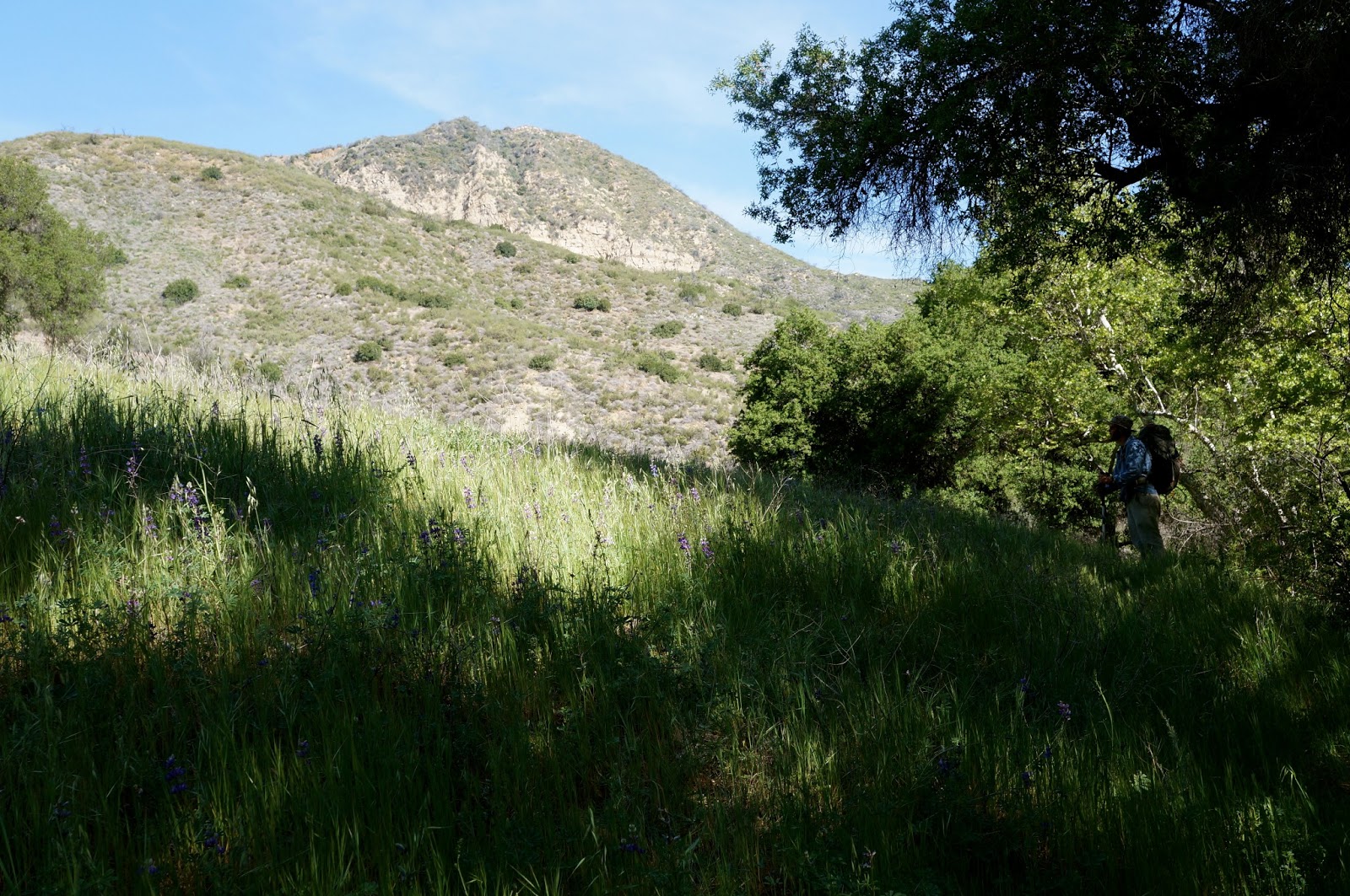
The Meadow, a junction of trails.
My only experience with Indian Creek had ended one frozen, sleeting and sick-buddy December weekend. Ended precisely at Indian Creek Camp, and not one step further did we take. That was eight or nine years ago and I've always wanted to return, lured by the promise of waterfalls on a wild and remote drainage. Jack had been up IC that far and a bit further, but hadn't gotten as far as the fabled "Perfect Ten Falls" (per Conant's map). Clearly we needed to go see what that falls and an area called "The Narrows" was all about. And maybe we'd go see if we could find an old campsite that used to lie at the upper end of the IC Narrows.
Jack in Indian Canyon.
Our weekend started with a strange animal sighting on the road down to Los Prietos. The headlights caught a glimpse of a fleeing canine, but this one seemed to big to be a fox and didn't look right to be a coyote. In the end Jack decided it must have been a large fox. I still insist that it was a rare North American Spiny Eared Chupacabra. Keep an eye out. Those chupacabrae are coming back in a big way.
We started from the Mono trailhead, wandering up the lower part of Indian Creek. The route took us through a mixture of brushy drainage and grassy hill country. Eventually we encountered a large meadow which is the junction for a couple trails. Continuing north we followed trail through oak forests and rocky creek bed until reaching a pretty camp sitting on a bench above the west side of the creek. There are a couple nice sites here under tall old oaks. One of the sites has a picnic bench and a few camp tools. This is Indian Creek Camp.

After a brief break at IC Camp Jack and I got going again, headed upstream into new territory for both of us. Within minutes of leaving IC Camp our use trail petered into the creek and it became obvious that it was time to get wet. Giving up on staying dry in such circumstances often makes the going so much easier. Even so, this is a rugged and overgrown drainage. Nothing about ascending this creek is particularly easy, though Jack and I have experienced worse.

After a couple hours of creek slogging and rock hopping we found ourselves approaching a distinctly narrow creek passage (below). Wading through a long and deep pool put us under a thirty foot cascade pouring from a beautiful pool and waterfall. After a short scramble up this falls put us at the deep upper pool, across from which streamed a very nice little waterfall. I initially called this Perfect 10 Falls but have since learned that this two-tiered falls is called the Maiden Pools (thanks for the correction, Brian). 

Jack, approaching Maiden Pools.
Upper Maiden Pools.

We continued upstream from those falls, pushing ahead through pool after pool, scrambling over numerous creek obstacles. We found that poison oak and stinging nettles are prevalent in this drainage. Sadly, we weren't seeing much in the way of wildlife in this otherwise pristine aquatic wilderness. We saw a couple ducks, lizards, and a couple water snakes and turtles, but no big fish and no tracks of any larger mammals. I've been told that this pretty creek used to host some large and crafty land-locked native steelhead, and that those fish didn't fare too well in the aftermath of the 2007 Zaca Fire. Some good news I can report is that all the fire silt which was filling up the deep holes seems to have been flushed out.


Our upstream odyssey continued through the increasingly narrow and difficult drainage. This upper creek was challenging, a lot like work. We kept at it, wading, jumping, sloshing and climbing. The higher we ascended the prettier this drainage got, though "pretty" didn't make the journey any easier. We eventually approached a distinct narrowing in the canyon that correlated with what the maps call Indian Creek Narrows, or at least the lower gate of said narrows. From this gate on we'd be in a tight little canyon. A short time later we encountered what I thought was the best waterfall/swimming pool on the creek (below).
The lowest gate of Indian Creek Narrows.
This was my favorite falls on IC. I erroneously named it Cobblestone Falls due to the band of cobbled rock crowning the falls but in fact, this is Perfect 10 Falls. I feel a bit relieved and vindicated in thinking that this gorgeous falls was the only water feature on the creek that really deserved the name Perfect 10.


Leaving that pretty waterfall behind Jack and I continued our upstream progression. We eventually arrived at the confluence of a small branch canyon down which a poor stream emptied into Indian Creek. This then must be the long decommissioned Indian Narrows Camp. We climbed out of the creek to a small bench forested with oaks and scattered with the iron remains of this very old site. After a bit of R&R I tore down the remains of the fire ring, cleared out about four inches of oak leaves and set to work rebuilding the camp while Jack did a bit of looking around. By the time he returned the campsite sort of looked like it would work.
Indian Narrows Camp at our time of arrival.

Firewood was abundant and as we set up shop for the evening we got some flames going to dry out our shoes. This was essentially a pointless exercise as we'd be getting back in the water immediately upon leaving in the morning, but it made me feel better to put on dry shoes for the evening. As the sun set and the light fell we were subjected to an enormous uproar of frogs, owls, and evening birds. We listened to the crescendo of frog calls while grilling filet mignon over the oak fire. The side dishes were sourdough with butter and baked beans with coffee. Not a bad menu after the day we'd slogged through.


We stayed up til around ten, feeding the fire and chatting about the day between lulls into silence. The evening was absolutely perfect and clear, warmish. I retired to my nest of leaves and stared up at the stars, tracked a couple satellites across the eastern sky. We both crashed out hard for the night, a night so dreamlessly perfect that I only used my bivy sack as a pillow. This was the type of outdoor night we always wish for but seldom get.

I rose shortly after sunlight and got the coffee going. We got ourselves put together in an unhurried fashion while enjoying the brew with a little breakfast. We rolled out at 8am and got back in the water right off the bat. We resumed our endless, sloshing, hopping river dance. The rest of it goes just that way. We did encounter a few people in the lower canyon, other waterfall hunters.
Like I said earlier, this was one of those little trips that I wish had lasted a bit longer, however the company was good, the route challenging and fun, and Indian Creek was a place I look forward to returning to.


Wednesday, April 24, 2013

Cedar Peak [SVS], 04/23/13

There's a certain kind of person who is compulsively driven to go where few travel. Several years back, a bloke I'll refer to as KC started collecting particularly remote and troublesome peaks that nobody else in our forest even knew how to approach. This gentleman left his SVS mark on some very unique and challenging peaks, and Cedar is one of four of these summits that I've hit. The first time I encountered one of his registers I saw the SVS thing and thought, "Now, what could this be about?". I've since learned that SVS stands for "Seldom Visited Summit", and when you see these letters on a summit register in the Southern Los Padres it means you worked your ass off to get there. These peaks don't have trails, it's up to you to figure it out... and I think that's great. So KC, if you read this I'm drawing a complete blank in my hunt for the final two (I was certain that there would've been one on Devils Heart) and just a hint would be nice. And I like your taste in peaks.

The most sensible way to reach Cedar Peak is to walk up the beautifully forested Cedar Creek until it's time to leave the trail for the summit. Unfortunately, the trailhead for Cedar Creek lies within the Grade Valley/Mutau part of the SLP, and the USFS seldom opens Grade Valley Rd before Memorial Day. Another way for crazy people (Jiroch, KC) to get here is by traversing the crest northwest from Thorn Point. That route looks entertaining. And then there's the way I went, straight the hell up from the Gene Marshall Trail.


I took off from the Sespe/Piedra Blanca Trailhead at 6am. It was a cool and gusty morning, cold enough for gloves. I crossed the desperately low Sespe and turned up the Gene Marshall, headed into Piedra Blanca rocks as the eastern sky was lightening. An atmospheric haze washed out the morning colors and as I descended the north side of PB rocks and turned upstream I was greeted with a persistent blast of wind that gusted down the Piedra Blanca drainage. I made good time and soon passed Piedra Blanca camp and a couple minutes later I took a time out at Twin Forks to charge up before tackling the gnarly climb up to Pine Mountain Lodge.

I put my head down and paced out the 2,400ft climb out of Twin Forks. I somehow managed to pick a pace which I was able to hold the entire way to Pine Mountain Lodge. Not one stop, not even for a minute. This is a hell of a hill, good training for whatever makes you feel good. Before long I was cooling off in a stiff breeze, enjoying the sounds of the wind in the cedars. As I rolled into Pine Mountain Lodge I breathed in the scent of pine and cedar and purely clean air. I was back in the high country and loving it.


After a nice break at Pine Mountain Lodge I picked up the Cedar Creek Trail and settled in for the next mile of uphill. I hadn't yet walked this portion of the Cedar trail and was curious what I was in for. This mile climbed through a beautifully forested ravine, passing between large sandstone formations while rising to a saddle. The Cedar Creek trail continues east over the saddle and descends into that even prettier drainage. From the saddle I turned SSE, climbing a poorly defined ridge through brush and forest. 


After some initial route finding I picked up a poor excuse for a use trail. The most recent traveller on this "path" was a big bear, the same bear I'd followed up the hill from Pine Mtn Lodge. This path wended through manzanita and deadfalls, cedars and pine. The ridge line dropped a couple times before a last, steep and rocky scramble to a bald summit. I rolled up on the summit and paced a wide circle around the peak, taking in all those familiar landmarks from this new perspective. I enjoyed reading the very brief list familiar names in the SVS summit register. The last visitor had been KC himself, in September of 2010. "Seldom Visited" is right!


Click the image bigger to see Thorn Point Fire Lookout, from Cedar Peak.


After some time on summit I descended back toward PM Lodge, taking time to explore some of the caves and overhangs on the numerous rock formations. Done poking around I finished the walk down to the camp and took a nice, long break in the shade. A half hour later I got going again, certainly not looking forward to the long and punishing down grade back to PB. 


Cool rock formations along the Cedar Creek trail. Reyes Peak in the distance.


This is all the water you get at Pine Mtn Lodge.
I basically blasted out of that place, trotting and jogging the whole way out. Just as I crossed the Sespe I saw a big and beautiful grey fox, kind of the icing on this day's cake.


The Rain Rock at Twin Forks needs a better view.


Here's the way the day went. Starting at 06:00 I reached Pine Mountain Lodge at 09:15, and summited at 11:05 (5:05). Was back at the trailhead at 15:40 for 9:40 on the day. That's not too far off what I thought it would be, considering that there's 5,000 feet of gain and loss on this 16.5 mile day. 


Tuesday, April 16, 2013

Southern Los Padres Drought 2013 [Updated 06/24/13]

It's spring again in the Southern Los Padres and wouldn't you know it? Our back yard is dry. This is the third year in a row of below normal rainfall totals for this part of the state and as we proceed into the later part of spring and into summer we will once again find ourselves questioning the reliability of various watersheds. What I'd like to do with this post is give and receive accurate and up to date information regarding specific creeks, springs, and drainages. So now I am asking you all to send me a quick note which I will update to this post. To do this I need audience participation so please let me know how our backcountry watersheds are doing and I'll hopefully be able to cobble together a pretty clear picture of what areas have water and what areas to avoid.

What I'll do with this information is to rate each creek or spring as one of the following:
-Good: normal, reliable flow of clean water
-Fair: decent water with some flow, but well below normal
-Poor: intermittent or spotty water, unreliable flow
-None: Non-filterable or nonexistent flow, dry creek
So how about I start things off with areas I know from recent travel, and from drainages that I've received reports on from friends of this blog. So please take a little time to email or comment with updated info on our local water situation.

Ventura County
-Upper Sespe Creek (Potrero Seco to Tule Creek): Poor with areas of subterranean flow
-Middle Sespe (Tule Creek to Willet): Poor (pools)
- Lower Sespe (Willet to Goodenough): Poor (pools)
-Ladybug: Poor to None
-Tar Creek: No flow (very green)
-Agua Blanca Creek: Poor to None
-Piru Creek: Poor
-Alder Creek: (Upper Alder and E Fork): Poor to None (reported)
-Alder Creek: (Lower Alder to Sespe): Fair to Poor (reported/Bardley)
-Cow Spring: None (reported/Craig & Bardley)
-Squaw Flat: None (reported/Craig)
-Dripping Springs: None
-Santa Paula Creek: Fair 
-Sisar Creek: Poor (pools)
-White Ledge Spring: Very Poor
-Cedar Creek: Poor
-Mutau Creek: Poor
-Fishbowls Creek: Poor
-Piedra Blanca Creek: Fair
-Potrero John Creek: Poor
-Chorro Grande Creek: None
-Chorro Springs: Fair to Poor
-Raspberry Sring: Fair (per Conant)
-McGuirre Spring: Poor (filter)
-Matilija Creek (Falls Trail): Poor (pools)
-Murietta Creek: Poor
-Murietta Spring: None
-Matilija North Fork: Poor to None
-Beartrap Creek: Poor (per Conant)
-Reyes Creek: Poor

Santa Barbara County
-Rancho Nuevo Creek: Poor (per Conant)
-Deal Junction: Poor (per Conant)
-Santa Barbara Canyon: Poor to None
-Madulce Station: Fair to Poor (per Conant)
-Chokecherry Spring: Fair (reported/Nico)
-Upper Sisquoc (Lower Bear): Fair to Poor (reported/Nico/Mateus)
-Lower Sisquoc: Fair to Poor from Bear to Sycamore (per Conant)
-Big Pine Spring: Poor (per Conant)
-Manzana Creek: Fair to Poor, worsening (per Conant)
-Twin Oaks: None (per Conant)
-Coche Creek: No Info
-Redrock Canyon: No Info
-Agua Caliente: No Info
-Lower Indian Creek: Fair to Poor
-Upper Indian Creek: Fair
-Mono Creek: Fair (reported/Nico)
-Jackson Spring/Montgomery Potrero: Poor to None (reported/DS)
-Other Sierra Madre Springs: Poor to None (reported/Nico)
-Oak Spring (Judell): Poor
-Camuesa Creek: Poor
-Escondido Creek: (at Camuesa Rd): Fair (reported/Nico)
-Middle Santa Ynez: Fair (at Juncal), otherwise Poor (reported/Nico)
-White Ledge Creek: Poor (per Conant/Mateus)

Thanks everyone for your help updating.
Take a moment to remember how it was in
2005

SP Creek Punchbowls.
Me, Tar Creek.
Matilija west falls
Davi Rivas, White Ledge Falls.