I took off on a nocturnal start to what became a "day", as in unforgettable, unregrettable, and never to be done again (by me). I'd been working myself up to this for years. I've even mentioned it to a few others and never was my idea met with even tepid enthusiasm. Going up Old Man for the sole purpose of going down it's most horrifying gully did not compute. As many times as I've walked through Matilija Ranch I've always glanced at that distant hulk to the west, Old Man Mountain, and I always let my eyes drift down its endlessly forbidding drainage. Since I'm here writing about this stupidity, indulge me in re-sharing one of my favorite quotes from the late, great Douglas Adams:
By definition, risk-takers often fail. So do morons.
In practice, it's difficult to sort them out.

High-Octane coffee coursing through my viens. Check. Watch reads 03:45. Check. Got my gear together. Check. Pre-medicated. Check. Stupid enough to try this? Clearly.
Positive attitude check?
I positively hate this fucking shit!
Right.
Into a black night pierced by a vault of diamond eyes, serenaded by crickets, accompanied by the soft calls of this morning's avian predators. I easily slip into a predatory mode of my own, a frame of mind that has been bred into me by years of martial arts and solo hiking. Five minutes into my walk a narrow set of eyes reflect off my headlamp, too far out to identify. About 20 paces past where I'd seen the animal eyes I flipped a fast U-ey and there they were, staring at my lamp. I ninja'd up to where I could better glimpse the critter, which turned out to be a long, lean and crafty looking fox.

I bypassed the narrow and rocky Murietta trail and continued up to the junction at Blue Heron Ranch. Walking up two miles of that Murietta connector in this blackness would be a stuttering ramble through Too Dark Park. No thanks. I blazed up to the Blue heron and made my left onto Murietta Rd and pushed down the accelerator. About a mile into this long grade up to Murietta Divide I ran into another pair of reflected animal eyes. These creepily reflected globes resolved into an anxious and uncertain young buck deer. I was able close to within 20 feet before he freaked out.
 |
| My first glimpse of Jameson Lake came at around 06;15. |
I pounded out this seemingly endless grade, Murietta Road. The walk is easy until just below Miuritta Spring, after which the grade gets a tad pumpy for the remainder up to Murietta Divide. One hour and twenty minutes to the Divide. Not bad. The Stillman seemed to be firing on all cylinders. I turned north onto Monte Arido road and immediately the nature of the road and it's route changed dramatically. No more nicely graded and pleasantly predictable footing. I ascended a rocky and curving track overgrown with dried grasses. It soon became clear that I'd much rather have a Jeep CJ than my 4WD Tacoma were I driving this road, or better yet, a 600 KTM. But I have the best gears of all, my legs. I earn my turns these days. I slipped into the cone of the headlight, that long train tunnel that goes somewhere. I paced it out, chasing the light up that road until the first of a gauzy dawn made it's glimmering guidance unnecessary.

With the coming dawn I was better able to get a feel for the rest of the route to the summit of Old Man, and that realization is a bit disappointing. A steep and winding track that more or less climbs a huge shoulder before wandering to the west. The trail loses over 400 feet of elevation as it skirts the southern flank of Old Man and it's easterly sister peak. Much elevation is gained, both in grades and in sprints so that you can lose this precious ground. The views are pretty nice though so you oughtn't mind too much. The trail turns north across the rounded apron of old Man, continuing a winding path northward but interrupted by a few twists and turns. On the north side of the peak, Monte Arido Road makes a hard left that puts one facing Monte Arido Peak. Stop here. I'll explain in a minute.
 |
| This sun-baked bear print may have been here since last spring. Not much traffic on Monte Arido Road. |

 |
| The sun caught up with me a bit after 7. |
 |
| A view to the northwest from high on Monte Arido Road. |
 |
| Monte Arido Road |
 |
| A view of Jameson lake fron the north-east. Taken on Monte Arido Rd. |


Okay, now it's time to explain the "Stop here." thing. "Here" means this dark and hard left corner towards the north and Monte Arido Peak. This corner is as close and north as you can be to the summit of Old Man while on Monte Arido Rd (See photo above). The hiker will not see anything in this corner that will indicate a summit trail. Given the quality of the summit trail just a few feet above this corner, once you find it, I think you will be led to agree as did I, that the actual take-off for this route seems to have been, dare I say, disguised? It took me six minutes to figure out. A few minutes later I was on a distinct, if neglected trail that pointed in the right direction. Comfortable now with my position, knowing the summit was in the bag, I paused for a bit of breakfast and took a twenty minute catnap in the morning sun.
 |
| Old Man Peak (left) from the summit trail. |
 |
| These cuttings could have been up to a year old. |
Somewhat recharged by the snooze, but stiff and sluggish, I started picking my way up the last of this big ole mountain. I was soon awake and charging it. There was a lot of growth on the trail but I also ran across generations of brush cuttings. Most of the time a careful glance could catch two trail ducks indicating the path through the brush and rusty rock on this steep little burn to the summit. I liked this brief climb to the top. It was steep, prickly and winding but the views got better and after miles of mostly uninteresting road I was digging the climb.
 |
| Several of these paleo-floric trail ducks guide the way to the summit. There are a dozen more traditional rock-stack ducks along the summit push. Getting lost would be hard. |
 |
| The last rocky climb to the summit. |
 |
| Old Man's unnamed eastern sister peak. |
 |
| On the summit of Old Man. |
The summit of Old Man is simply a pile of broken rock, weedy, way out in the nether regions of Egypt. It is a stand alone peak and the views are incredible. I really liked this summit. You know, the more of the local peaks I summit, the crazier my plans get. I think it it stems, in part from the vantage of really knowing what this canyon or that ridge is really about, where it goes, how evil it looks... it all adds to the geographical understanding that even a good map doesn't quite share. I liked the air up here, clean with blend of sea and sage.
 |
| The Sierra Club summit register for Old Man Mountain. |
The summit of Old Man has a typical Sierra Club coffee can register. The small spiral pad inside starts at 1991 and the most recent entry before I left my scrawl was dated 03/31/12. It's a good, honest piece of work getting here. Almost without exclusion the summit register was filled with Sierra Club 100 Peaks chasers. Many entries were simply long lists of signatures associated with the group that went up that day. A couple indicated continuing on to Monte Arido Peak. Bob Burd, of course. That kind of thing can wait for another day. I spent my minutes up top searching for something of more immediate relevance to my self-appointed mission of the day...to descend one of the steepest, brushiest, ugliest, nastiest and forbidding drainages in the Southern los Padres. You may ask, "Why?". To which I will quote Mallory,
"Because it's there."
 |
| A view into Wild Mare Canyon and the Upper Matilija Region. |
 |
| Monte Arido Mountain from atop Old Man Mtn. |

Having left my scrawl in the summit log it was time to pick my way back down the peak. Extensive cartographical studies, and prodigious use of Google Earth had convinced me that the best option for a launch into Old Man Canyon would be back where I'd taken my nap. Nothing I could see from the summit or on the way down changed my mind about where to put in. It would be what it would be.
And I would get down it because I try to live a life of patience, pain, and perseverance in all things. It's a buddhist philosophy and it applies in most situations, at least for me. I never whine and I never quit. Those are deal-breakers. And I never use the word "epic" until a pervasive and persistent threat of death hangs over one's disastrous misadventure. I hate how that word gets tossed around.
"Once more into the breach,
the last good fight I'll ever know."
That is epic. Not this.


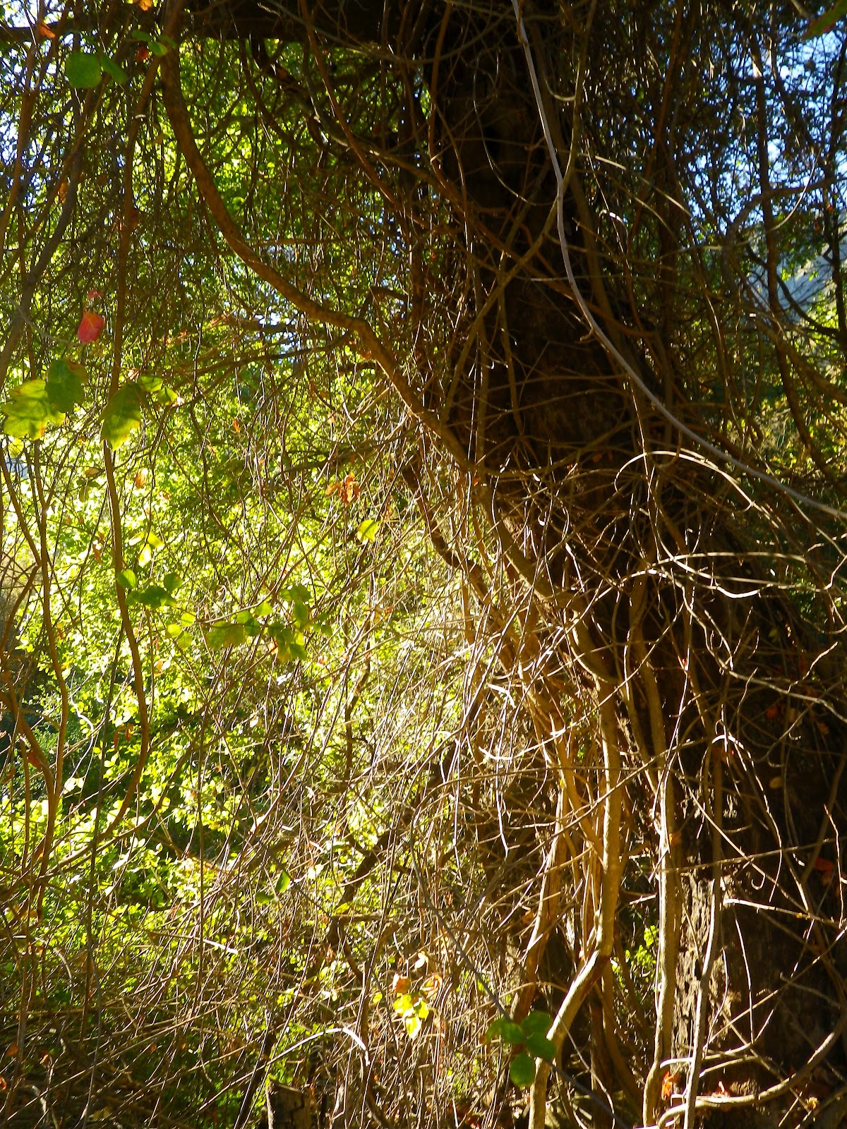
I stood at the lip of a 45 degree slide that terminated in miles of bionic plant life designed to prevent my passage. I had no illusions. I was entering Hell. This would truly suck. I would very likely hate myself for doing this. But I went anyway.
I skied down the slide for a bit before the brush arrived, after which it I was immediately engaged in full combat. I used brute force. I sacrificed limbs. I flowed like water. I wormed down hill like a snake. I crashed through stands of brush only to careen off trees and continue pin-balling downhill through the brush lest I lose my momentum. I broke through 60 year dried tree stumps. I down-climbed oak trees. I bounced off rocks and staggered through vines. It was hot and prickly work, and twenty feet of visibility was a godsend. At one point I actually used my trekking poles, held horizontal before me, to summersault over a hedge of brush. Branches and limbs audibly slapped at my eye protection. I lost my hat a dozen times. I was bleeding from a nick on my ear. Somewhere on that first 2,000 feet of descent, the brush had actually grabbed my day-pack, torn open the zippers and stolen my map and a windbreaker. I had to zip-tie my zippers. I took a couple good crashes down that hill and it wasn't soon before I was feeling pretty beat up. The brush was so thick and tall that I couldn't determine how far down this mess I'd come. This was a fight.

About a thousand feet below my jump-off point this slope angled into a trough which eventually resolved into a shallow dirt gully. Snapping ancient brush and dancing on loose shale I was able to make the most of this runnel. Some time and a million insults later it broadened as it met the drainage coming off the northeast side of Old Man. Broadway. Thank dog. Below I could see that my path would indeed turn into a real watershed similar to those in other Matilija canyons. It would still be tough going and long, but I believed then that I'd passed through the fire.
That hell I'd descended will forever be etched in my brain. I followed gravity. I used gravity. It was the most athletic and gymnastic piece of work I've done in years. Painful work. My wife has counted 28 distinct bruises and several true scratches. I had to use real pliers to dig a piece of wood out of my flank. I remain boggled. I may have PTSD. Nothing I've done of this nature could fully prepare me for that hall of horrors. Don't do it.


At last I was in a real creekbed. I switched into my more nimble and less abrupt nature and ninja'd down the dry drainage. I still had plenty of brush to dodge but this was a mere annoyance compared to that goatf**k up-canyon. I continued downstream, dancing off rocks and boulders, hopping fallen trees and downclimbing small dry waterfalls. I paused and recharged in the shade of tall old maples before continuing further down this endless canyon.

 |
| At one small and shady bend in the canyon I found a small stand of cedar mixed with maple and bear tracks. A very pretty place. |
 |
| Shortly after my shaded glen I was able to recharge and refill my water from a crystal clear and deep spring of ground water. I had plenty of water for the day but as a rule of I won't pass up a chance to fill up in unknown territory. It could make or break me if I got hurt. |


As I descended further I could sense that the canyon was widening and that I was closing in on the last rocky mile of dry creek. I negotiated a few minor waterfalls and a few more plant related obstructions before being unceremoniously dumped on the main trail up to Matilija Falls. I just lay there in the dirt and shade. I could have been mistaken for dead. I was wrecked. I was running on fumes.

 |
| Lower Old Man Canyon. |
 |
| The most significant water slide in Old Man Canyon. |
Eventually I dragged my ass out to the truck. I just sat in the cockpit for a while, adjusting to not moving anymore. Damn. That day had taken everything I had in the tank. Far greater than 4,000 feet of elevation gain, miles and miles of road (>10) followed by a trip down the thorny heart of darkness. I was done. Cooked.
Here's my disclaimer. I freely admit that most of you will think I was foolish for attempting this in the way I did. And from your perspective you are absolutely correct. I don't blame you a bit and that's completely fair. But you are not me.
 |
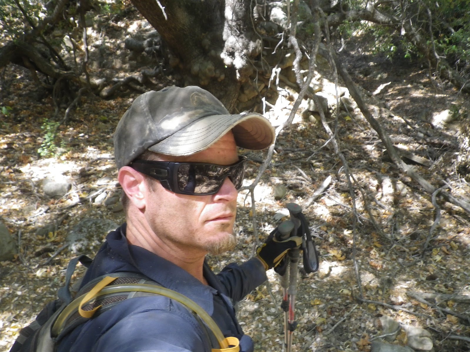
| C'mon. Let me see your bruises! |