Tuesday, December 27, 2011

Tar Creek 12/211


12/10/13: The US Forest Service will be enforcing access restrictions to Tar Creek soon. TC is part of the Condor Sanctuary established as critical habitat to this endangered bird and other wildlife. Epic numbers of visitors, and the trash and graffiti they have left behind, has led to the acknowledgment by the Forest Service that access must be curtailed and enforced. For more information on the impending action visit: Tar Creek Closure.

It had been a bit since I had last traveled down Tar Creek and I was curious how the place was holding up. The hordes of summer visitors have left the scene, but some scars remain. Too many people visiting one place is usually a bad thing, environmentally speaking, and my beloved Tar has not been immune.
On the way down to the bottom I collected a number of bottle caps and cigarette butts, which are just the kind of stuff that wildlife (namely CA Condors) tend to investigate by eating. I was disappointed to see my first signs of spray-paint graffiti in Tar Creek. Some asshole had tagged a rock in the unsanctioned campsite adjacent to the Land of the Lost pools. I mean, it didn't come as a surprise to me, but I'm disappointed.
I grew up in Santa Paula so I'm familiar with the type of low-life scum of a certain gender and heritage that have so little respect for anyone or anything that they feel compelled to act as if it all belongs to them. These are the (insert racial generalization)'s that tag and leave beer cans and diapers at the Punchbowls up SP Canyon.  Pisses me off somthin' fierce.

As for Tar itself, the falls are still running surprisingly well, which is merely a testament to last year's stellar rainfall totals. Mine were the first prints descending below the Land of the Lost since the most recent rains greater than 1 week ago.This, I thought, was a good sign. At least fewer people are traveling all the way to the bottom falls, or maybe I spoke too soon. On the way out I passed two parties: one had 5 rickety seniors with ropes and a bunch of canyoneering shit, obviously on a quest to finally unravel the mystery of Ponce De Leon's lost Fountain of Youth, the others were a few teen boys in sneakers. Eight people (not counting myself) on a Friday. Crazy. This is exactly the kind of thing that gets the USFS interested in restricting or denying access, that and stuff like trash, dead condors, grafitti, and more than 10 helicopter rescues in the canyon every summer. Mark my words, one day the government is going to shut this place down. It's just too sensitive an ecosystem to support the amount and type of traffic that visits that canyon.


As for the day itself, I had a good time. I saw myself a wooly coyote on Goodenough Rd and spotted the nice red-tail hawk that graces the top of this post. No big birds today, however. I love this place. Let's al ltry to save it.


Thursday, December 15, 2011

Piedra Blanca West 12/15/11

My route through the western rocks. It involved blood, sweat, climbing skills and determination to reach the summits of these, more remote and inaccessible formations. I have to guess that I did a solid 4 miles of  "anything it takes" to explore this side of the range.
I had promised you all that I'd finish up the entire Piedra Blanca tour and that time has come. Over the past several posts I've re-explored the entire area including the paintings in PB Creek and the bleached stone formations of PB East. To finish the circuit required a visit to the western formations which I've designated as Piedra Blanca West.

I knew that assaulting PB West would be far more difficult than my prior exploration of PB East. First of all, nobody goes there so there aren't any consistent trails to traverse this side of the range. Second, the formations on the west side are more distant from each other and much brush-busting is required to get anywhere. So, once more into the breach, up the mountain, under the brush and through thin air on my lonely travels to the remote. Today was not a good day to get hurt, I'd never be found.
This site is atop the first formation to the left (west) of the massive, central  PB formation.  This was a surprise, as in WTF?!? I saw no reason to believe that this rock design hadn't been sitting there, just like you see it, for years. First of all, just getting to this point was difficult (scary) and required considerable route finding skills.  On the way to this summit, I utilized some very old toe-holds that had been carved out of the soft sandstone. The holds were very eroded and I speculate that they had been there for a very, very long time. I saw no other evidence during the day that anybody ever goes to this side of PB.
Abandoned honeycombs. A large, fresh bear scat was situated very near by.
Sad rock.
In addition to the remote, untraveled nature of PB West, it is an older (geologically) set of formations. The elevation of the western-most rocks are a couple hundred feet higher than on the eastern rocks. The ancient sedimentary seabed, which is what the rocks of PB are made of, has risen more in the west and the decay and erosion of the formations is notable for the degree of difference between west and east. These rocks were far more crumbly, which made climbing up a couple of the formations pretty damn exciting. I thought, at least once, that I was a couple of grains of sand away from taking a slide.
The Citadel, western-most of the formations, viewed from the north.  I encountered absolutely zero indications that anyone had ever even been here. 
The Grand Vista, looking east from atop The Citadel.  
The snowy peaks in the distant right are Topa Topa and Hines Peak.
Sometimes a guy has to go the extra mile to get what he wants.

After a helluva slog. Miles to go.
Above and below: highly eroded formations.


Again, I reassert that any time you think you are truly in the sticks you will run across a beer can with a bullet hole in it. 
The Chumash High Dive. This rock, of some significance to the Chumash,  isn't too difficult to find, and makes a  great springboard. It can be found on the Sespe less than 0.25 miles from the PB/Sespe parking lot.
After today I can truthfully say that I've been to the top of every significant rock in Piedra Blanca, and that I circumnavigated the base of most of the formations. I didn't see anybody else the entire day, which is probably a good thing because I was covered in bloody scratches and spent the entire drive home picking sticks, spiders, and seeds out of my hair, ears, etc...
I feel pretty good about this most recent triad of trips. Piedra Blanca and it's environs are worth exploring. The place has a natural beauty and appeal. It has been in more or less continuous use by hominids since forever and a few relics of our ancestors passing can still be found on the old paths and forgotten corners of this Upper Sespe region. Take some time to just explore, scramble about and find the hidden gems tucked in Las Piedras Blanca

First runs of the season, 12/14/11


On the heels of the most recent round of winter weather, Ruth and I got up at 04:30, gased up and sped out to Big Bear for our season's first runs. We enjoyed bluebird skies and a couple inches of fresh stuff on top of the typical bullet-proof hard pack. Both of us were sporting new boots, both of them have the super-sweet BOA lacing system. Never again will I have to help lace down Ruth's boots. Way easier.


Let's see, what else? We owned the mountain, and as you can see, the crowds didn't show up. The weather stayed cold all day and the snow held up until they closed the lifts at 4PM. My Big Bear "rock board" is sporting a new 8 inch gouge that goes to the wood. That's the price for playing in the trees. Not a problem though, I used to repair skis and snowboards when I was in college. 

The whole way home we kept telling each other what a perfect day it had been.A very good way to start the season. 


Sunday, December 11, 2011

My crummy pictures of the Lunar Eclipse 12/10/11

Despite having been battling the common cold and end of week fatigue, I managed to persuade myself that a complete lunar eclipse on a clear and calm night was worth getting up for. I'm glad I did. It was just your ordinary, every day kind of celestial omen that would have had our ancestors feeling a bit uncertain about their futures. I took these admittedly crummy pictures from the bridge above Emma Wood St. Beach, Ventura. I looked on in envy of those with shiny new bad-ass camera's that have an f-stop and shutter speed and all that wizardry. You know who you are.


Monday, November 28, 2011

Piedra Blanca East, a scrambler's delight, 11/27/11

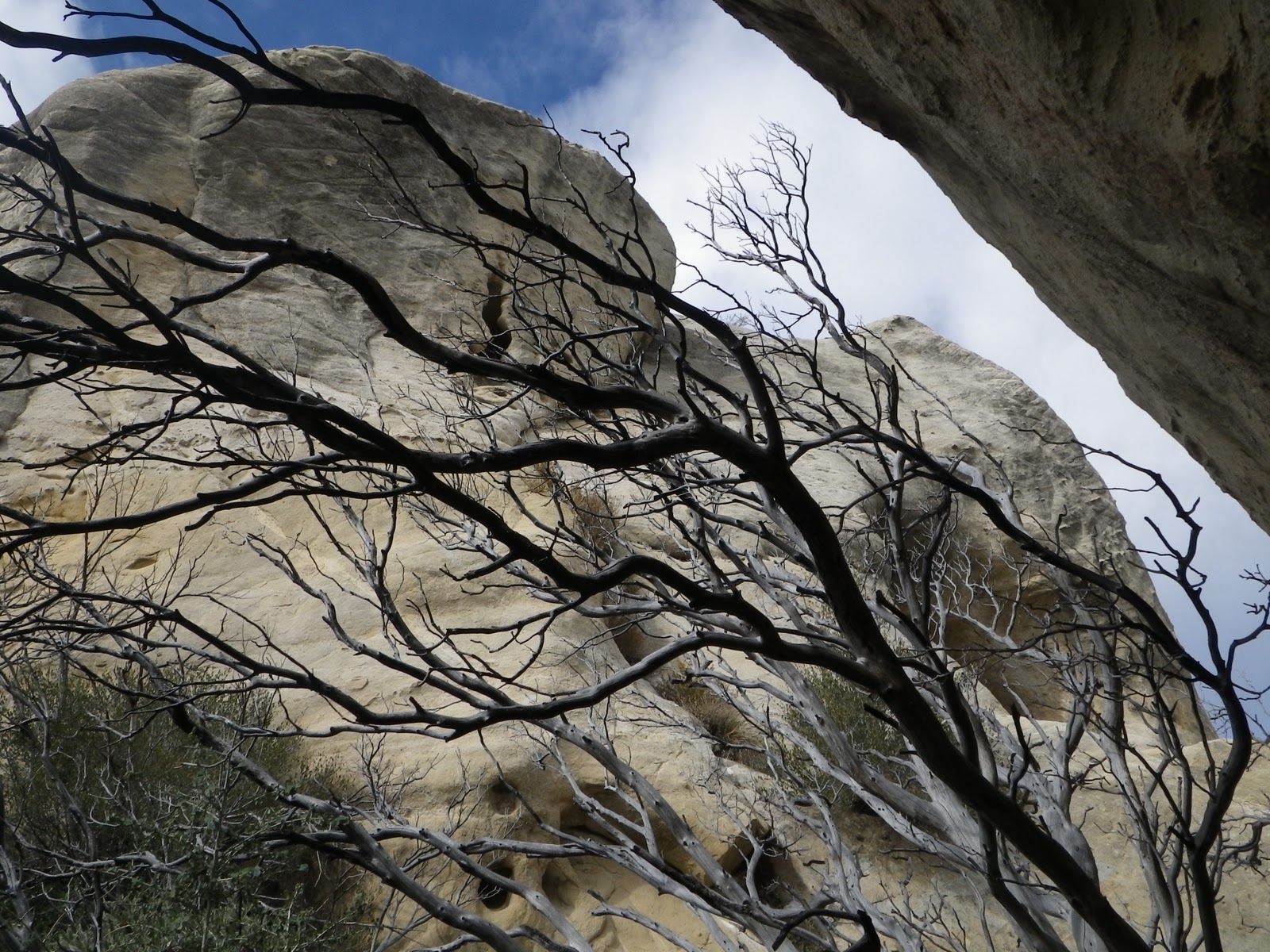
Free day! No demands, no responsibilities, no "to-do" list. What to do? I have planned for some time to re-visit an area of the upper Sespe River valley known as Piedra Blanca, or "white rock". PBlanca is a collection of crumbly sandstone formations most easily accessed from the Sespe trailhead at the bottom of Rose Valley Rd. PBlanca is just a fun place to hang out and explore. The rock formations are many and varied and the summit of each can be obtained with a little ingenuity and effort. One will likely donate some blood in the chaparral, but that can be said of most places in the Southern Los Padres.
The trail that brings one to the formations is called the Gene Marshall Piedra Blanca trail. According to Eric at Ventura County Canyoneering Club, this trail was named after a popular child's doll from the 1950's, of the same name. Apparently, in 1983 Congress decided to name the trail after either the doll, or a man of the same name who contributed to the creation of what is now considered to be the Sespe Condor Preserve. Eric is usually right about these things and I haven't found much to corroborate or refute these claims, so I will plagiarize him in regards to the progeny of the trail's name. This is an easy trail and a person will be among the formations in under a mile.
Below: Looking NW at Piedra Blanca Creek and an area called Twin Forks

The coolest thing about PBlanca, the thing that gets me is that this site has been used more or less continuously by humans and their ancestors for nearly 8,000 years. Pygmy Mastadon and Sabertooth Cat remains have been found the immediate area and numerous archeological artifacts from the Chumash era have been recovered. I personally know a man who has found 7 grinding dishes and other artifacts in the heart of Piedra Blanca. These, of course, have been reported to, catalogued and collected by the appropriate antiquities agency. This site was an absolutely ideal gathering locale for aboriginal hunter/gatherers offering fish, game, berries and acorns, year round water and plenty of sun/shade. A number of Chumash petroglyphs and at least one large petrograph can be found less that a half mile from the formations (but I don't tell). Parts of Piedra Blanca Creek are littered with ancient seabed fossils. It's a neat kind of place.
Needless to say, I have an affinity for rock formations and enjoy finding ways to get on top of them. During my travels this day I poked my head in any number of cracks and holes, just to see if I'd find something of interest, which is exactly what I got when a huge barn owl panicked and flew right by me (some day I've gotta write about my numerous, strange encounters with owls, and I could share the story of the large Inuit owl tattoo on my shoulders). This owl stuff has been happening to me all my life, it's worth sharing.
On today's exploration of PBlanca I was wishing to be thorough, so I have divided the area into two distinct sections which I am calling the East and West Spurs. I went East today. I ranged out to the distant eastern edge of the spur, working back to the middle. In the course of the morning I was able to get on top of every significant formation on that side of the area, circumnavigating most of the piles and large formations. Aside from the owl and the wild views I saw numerous doves and jays. Came across some pretty tracks in an arroyo, Mama coyote and her two pups.
I had a very enjoyable morning. Obviously the place is very photogenic and worth a visit. I'll come back soon with the West Spur, and in the near future I may share thos pictographs I mentioned.

Monday, November 7, 2011

Chorro Grande Trail to Reyes Peak, aborted. 11/05/2011

Last Friday SoCal got it's first taste of the coming winter. A trough of arctic air blew through with some disorganized precipitation leaving the high country coated in a rime of frost. On a very chilly Saturday morning, in the pre-dawn, Cliff Griffiths and I found ourselves crunching up the relentless uphill of the Chorro Grande trail. We aimed to do the 20 mile round trip to Reyes Peak. It wasn't to be, for a couple reasons, but I had a great morning regardless.

Above: Cold start. Cold trail.

It was cold, cold hiking. We blazed right up to Chorro Springs, our longest stop being no more than a couple minutes. As we banged out the steep miles I noticed that Cliff was starting to lag a bit. He was breathing a little hard and didn't look like he was having all that much fun. When we reached Chorro Grande Springs, Cliff admitted that he wasn't feeling real hot, and that his throat was scratchy. His wife has been sick for a few days so it was pretty obvious that he'd gotten typhoid or scarlet fever or something. Cliff hated to say it, but I could tell he wasn't up for much more.

We took a nice break in Chorro spring's sheltered dell. A hundred feet above our heads we could see frosted trees being blown about by a persistent forty mile per hour wind. We sat on a snowy stump next to the spring, having brunch. The muffled roar of the wind blasting the Pine Mtn ridge, just 2-300ft higher than where we sat, put the rest of the day in perspective. Even if Cliff had been feeling good, the constant icy gale would have cut us to ribbons. So it was just as well that weren't going up into that hell.
Above: Cliff grinding out the steep.
The temperature at the springs was in the high twenties and after a while the cold started to seep into our bones and it was time to roll back downhill. I was already thankful that we were headed out. Too damn cold for a rational person, which of course, I am not. But still...
Above: Frosted Pines above our heads.
Below: Chorro's spring trickles from under this giant boulder.
Below: Pine Mountain Ridge