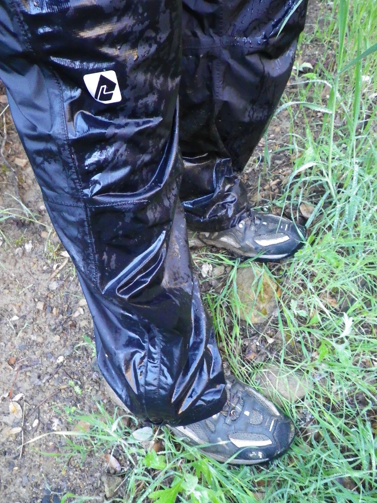
Another great day out on the dirt, kicking rocks with
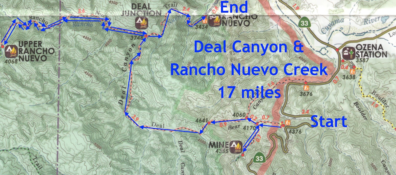
Jack Elliot. Today was a stab at a trail neither of us had any experience with, Deal Canyon. This trail starts high on the north side of Hwy 33 and descends into a series of canyon bottoms, all of which burned in 2007's Zaca fire. The route ends at the Rancho Nuevo trailhead off Tinta Rd. Aside from the fact that it's a local trail and I haven't done it, I got information prior to our trip that made me eager for a visit. A friend of the blog, Jack Clayton, has a buddy named Hank, an older guy who is a hydrologist for the county. Hank's apparently been all over these hills and gave Jack some info to pass along: first, I guess there is a "geothermal anomaly" up a branch of Deal Canyon that super heats the ground much like the one off Goodenough Rd above Fillmore, and second, he told me to look "under a brown rock" and I might find a lost Chumash pictograph. Okay... 17 miles to hike, look under brown rocks. Got it.

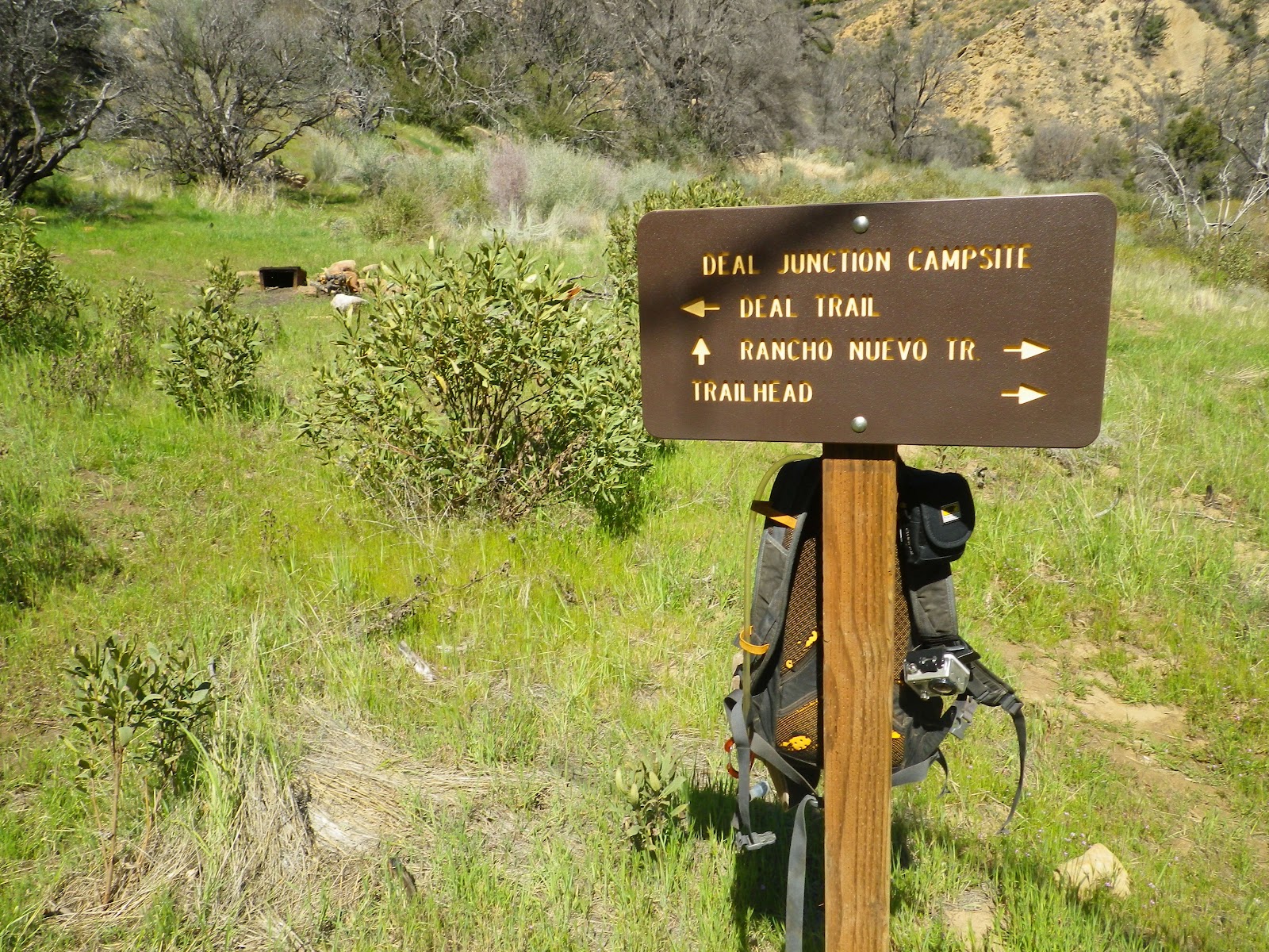
Jack and I dropped a vehicle at the trailhead for Rancho Nuevo Creek and drove another car back up the 33 to the Deal Connector trail (see map). We put in from the 33 and very quickly we met the trail junction for Mine Camp. Mine Camp has the feel of a place being used for beer drinking with guns. The camp itself is pretty nice, shady and secluded, but the nearby creek is intermittent, and shell casings litter the site. We poked around for a bit, looking for any sign that there had been any kind of working mine here but couldn't find any. I would have to theorize that if there ever was a prospecting operation in this location, it was likely panning or placer in nature. Moving on...

 |
| Strange, highly eroded sandstone formations litter the floor of these canyons. |
Back on the Deal Canyon trail we headed west with the rising sun at our backs. Bear sign came early and often as we eased into the day. The Deal trail, as I mentioned, passes through fire territory, and much of this hike reminded me of my recent foray to the Sisquoc. An explosion of all our favorite local chaparral has largely obliterated the route. Someone had been through this area 6-8 weeks ago with a pair of horses and tracking the horses made trail hunting largely unnecessary, but this was a mixed blessing. The horses had come through right after a storm and 8 hoofs had completely chunked up the trail, basically creating many miles of uneven terrain that became somewhat annoying as the morning progressed. We saw no evidence of foot travel for the first 14 miles of the day.
 |
| Mine Camp. |
 |
| Not much doubt about who owns Deal Cnyn. |
We passed through miles of broad valley, with charred cottonwoods and oaks for company. The valley floor is filling up with manzanita, sage, and grasses. Just another lonely canyon regressing to desert. Most of our local hills, especially if burned, are now becoming more and more "desertified". As the climate warms and California's water tables fall, fewer trees will replace the burned ones and the low-lands will revert to the desert chaparral we found ourselves hacking through.
Our route wound down the long valley, crossing Deal Creek many times. The creek wasn't much to look at, broad, shallow, and already greening with algae. One plus with creeks like these is that the muddy banks held the prints of just about every critter in the neighborhood (I ID'd the prints of bobcat, raccoon, coyote, bear, and numerous birds). Random piles of eroded sandstone marked the passing of the miles, without which the uniformity of the valley floor would have become rather monotonous. So far I hadn't seen any brown rocks worth looking under.
 |
| Another sign tagged by local bears. Bear Hooliganism. |
 |
| Numerous creek crossings, muddy kicks. |
As with the Santa Barbara and Sisquoc Canyons, this exuberant profusion of brush has benefited the local birds. These canyons are filled with dove and quail. We spotted several large red tail hawks during the morning. A pair of red tails, likely mated, called back and forth across the canyon for a time. Once, while approaching an arroyo, I startled a large Harris Hawk. This pretty raptor flapped up out of the gully and onto a tree branch about 20 feet from me. He decided I was still too close for comfort and took off for the other side of the canyon.
 |
| I mentioned a "geothermal anomaly", this creek of milky sulphur water might come from the source. We didn't investigate. |
We came to the point where Deal Canyon takes a right and flows north. This bend in the canyon narrows down to a hundred or so feet wide, not a true narrows, but the walls of the canyon became steeper, rockier, and passing through this gap, we saw a small series of little meadows, bordered by canyon walls. This section of trail is kind of pretty, and one does get the sense that they are in a narrowing canyon.
So, here I am, just kind of tooling along when I pause and look left. About 60 feet away is a big brown rock. Jack caught up to me and I said something like, "If I wanted to paint something under a rock, wouldn't that rock over there be ideal?" I decided to go have a look see. When I got to the boulder (brown rock) and made sure I wasn't going to get bit by something, I crawled underneath and Eureka! A fading 24" rattlesnake picto! Sweet. So far, I hadn't seen anything in this canyon worth coming back to, so finding this ancient painting was a big, unexpected bonus.
 |
| Though I got the sense that few people travel this way, this sign has to have been placed after the Zaca Fire. |
Jack and I left the pictograph behind and continued down Deal Canyon, eventually passing through a bottleneck in the creek (I hesitate to call it a "narrows"). This section of creek hadn't completely burned and most of the trees had held on. The trail stuck with the creek through this part, steep sandstone walls on either side. After this pinch in the creek we moved into a meadow, the junction of Deal Creek and Rancho Nuevo Creek. We took a nice little break here under a charred cottonwood. We both brushed off a half dozen ticks before heading up Rancho Nuevo Creek.
 |
| Jack, break time. |
 |
| Nobody had dated this geocache on Rancho Nuevo Creek. Silly game. |
 |
| Jack Elliot, Upper Rancho Nuevo Camp. |
Rancho Nuevo Creek is very similar to Deal, though it is a narrower canyon. It too, burned, and the brush is even worse through this area. Unlike Deal, the sides of Rancho Nuevo are studded with numerous, oddly eroded sandstone formations. This route heads west before turning south to pass through another choke point, which is where one finds the thoroughly unspectacular Upper Rancho Nuevo Camp. This is basically a flat spot under a torched cottonwood next to a wash. A bit above the camp is a small, brushy pothole valley.
I found a rusted old broadhead arrow tip, the kind used by deer hunters, but nothing else to indicate the need for this campsite. I can imagine, a hundred years ago, a few vaqueros heating branding irons over this crappy old fire ring in the middle of nowhere. And that's about it for this remote canyon, nothing to see or do. There. See how cool I am to you guys? Now you can just take my word for it and skip this one.
 |
| Upper Rancho Nuevo Camp |
|

We backtracked to the Deal/Rancho Nuevo Junction, then turned north to finish our route. We continued down Rancho Nuevo Creek and things actually started getting pretty. This canyon, for some reason, was spared the worst of the fire. This last 2.5 miles of our day passed through a deep, steep-walled gorge. The trail runs through the creek and now and then up into stands of jeffrey pine and oak. Both Jack and I agreed that this short piece of trail was scenic and worth the visit.
 |
| The Lower Rancho Nuevo Canyon. Pretty. |
So, check this one off the list and most likely never go back. I'm over what I've been calling "The Scorched Earth Tour", had enough of trudging through burn areas. So, this 17 mile route took us 8.5 hours with all the breaks, ticks, and heat. If you're going to go out and hunt for that picto, I'd just put in at Tinta and go up Rancho Nuevo to Deal Canyon. The rest of it isn't really worth anybody's time. Jack and I had a good day though, and like the man says, they can't all be winners.
 |
| I can't stand these new plastic signs. Plastic everywhere. Soon we'll be making people out of plastic. |
!*%#*^@!! Author's Editorial Privilege Alert! 04/24/12
First I'd ask that you all read Nico's comment (see comments section below).
So Nico, since I have no way to email you directly, allow me to express my high regard and offer salutations. I look forward to your comments. You usually hint at having undergone equally arduous ventures and I have come to understand that we probably share the same sickness.
Man, I was awfully critical of Rancho Nuevo Canyon, but just the upper part including the camp. I went as far as to use the descriptor, "crappy". I also declared, "Ain't worth the time, don't go there.". Sir, I stand by my words, but your suggestion that that upper canyon and the creek above it are a "special place" gave me pause. After a ruminative five minutes of self reflection, I concede that I was, perhaps, a touch hasty and a bit judgmental. Just a bit, mind you.
So, Nico, in lieu of even a partial retraction, I offer this, that the entire Rancho Nuevo Drainage is a place of historical significance, the various canyon bottoms are ruggedly beautiful, and I can admit that I felt the "age" of the place. Yes, it was peaceful, and your comment led me to wonder what else up there you might have seen that I didn't.
So here it is: Rancho Nuevo Canyon is a nice place to visit if:
- It's not 92 degrees Fahrenheit
- It's not a banner year for tick populations
- You didn't just walk through 10 miles of burn area to get there
- and only if you understand, like Plato, that beauty is in the eye of the beholder
Nico, drop me a line brother, or don't. Dig your style though.