Showing posts with label hiking santa barbara county. Show all posts

Thursday, May 15, 2014

Castro Canyon, A Game Of Lost And Found


I finally found it! Smilodon's fang! This fang measured roughly 16" from root to tip.

What blind luck! Total and complete chance!
Over a dozen years ago Dave Rivas told me a story his own father, David Rivas Sr, had told him. The gist of it went like this--somewhere in the Cuyama Badlands is a fossil of a Saber Tooth Cat. And that's it. That's all the information I could ever get. Those of you who've been out that way know what I mean when I say that my odds of finding this fossil with just that information were about the same as winning the lottery. Worse even. I never forgot about that short mention and it's nagged me for years, but with nothing to go on there wasn't anything to pursue. At times I started believing it was a myth. Well here it is. 

Back to the blind luck, I was traveling trans-badlands sans trail, got curious about a fin of rock up just another steep and unpleasant gully, clambered under it and eventually scrambled up to its top, and viola! Sabertooth tooth! I don't know why, in the middle of an otherwise difficult day, I would waste the energy to go up this gully and climb 100ft up to the top of this thing. I have no good answer for what my motivations might have been. Finding this has affected me in some weird karmic cosmotic conundrumial kind of way. I could theorize that I was meant to find it, which would be a load of horse shit. It was just plain ole dumb luck. Now, I was born lucky, and I recognize luck when I see it, and figuring this was my lucky day I bought a MegaMillions ticket later that afternoon. Naturally, my luck didn't reach quite that far, or even as far as a single winning number. 

This is a much prettier and better preserved Smilodon Fang.

Ice Age predators aside, what I actually came to this part of the planet for I did not find. There are a couple rock art sites in Castro Canyon which I intended to find, but I'll get to that later. Having received permission from a landowner to cross through Rainbow Canyon, I set off westward through that colorful country with the sun at my back. The day was already promising to be a warm one here on the north slope of Sierra Madre Ridge. Glossy cows and scampering calfs parted before me as I crossed a wide expanse of surgically cropped grass. Further on the canyon narrowed considerably. The southern wall of the canyon rose up in striations of brick red and tan soils. Nearing the impassable head of the canyon I followed an old trail up the southern rim. This short climb afforded a clear view of the colorful "V" of multicolored soils which marks the top of Rainbow.

Rainbow Canyon at sunrise.
The "V" at the top of Rainbow.
Cresting Rainbow gave me a good look at what lay in store, and that future looked like it was going to be a struggle. Before me was a landscape slashed by numerous deep and twisting gullies which drained off the northern slope of Sierra Madre Ridge. The next several miles would entail traversing laterally across these steep and brushy drainages, climbing over and down one after another. I groaned with displeasure. Having studied the map and those innocuous topo lines was one thing, but seeing it up close made the day more personal. Heading west would be a tough haul. Time to go to work.


The going was slow. I descended into the large tangle of gullies just west of Rainbow Canyon which come together at Tennison Springs. I picked my way through juniper, scrub oak, and prickly scrub which clung to each side of these deep gullies. Up then down, repeat process. There were occasional animal paths which zig-zagged up and down this maze of badland washes, though many were old and led straight into walls of scrub. The day heated up, dragged on through this tiring cycle of climbing and descending. After roughly three miles of this repetitive struggle I climbed out of a drainage and found myself on a small plateau upstream of Goode Spring. Though I was now on relatively easy terrain, the scrub oaks and juniper were thick and close which resulted in a drunkenly weaving sort of route, both time consuming and at times frustrating.

Past that initial flat I had another series of several drainages above Olive Springs to contend with, similar in nature but brushier than my earlier struggles. This went on for a bit and I soon climbed out of the final gulch and into a more open and airy flat land plateau. Later, a couple arduous gully crossings resulted in a short scramble up to a cracked and wind hollowed collection of brown boulders. Beyond these broken stones lay a vista of pointed hoodoos, sloped whalebacks, overslung cliffs and towers of pocked sandstone--Castro Canyon. I think I kind of gaped for a minute. Somewhere in this square mile of bizarrely sculpted landscape lay a couple rock art sites. That's all I knew. Jeez, I thought, they could be hidden anywhere in this jumble. I could spend days in this mess and never find them. Just gazing out at all this remarkable rock was somewhat dispiriting in that sense. Despite starting the day with 5.5L of water 4 hours ago I'd already cut that load in half. Additionally, I was already too worked for an extensive search. I sat in the shade of a giant boulder and started calculating, giving myself 1.5 hours to search the eastern edge of Castro. Sketching in the dirt beneath me I plotted out the lay of various formations and selected a route which would arc through the most amount of stone I could search in that time window. 

That hole opens to a flat cave large enough for a comfortable 2-man bivouac.

The first view west into Castro Canyon.

This middle terrain of Castro Canyon is tiring to get around in. Getting up to and under the rock formations for close inspection often took some doing, and all for naught. I must have stuck my head in 50 otherwise promising holes, peered intently at 75 alcoves, and traversed under every side of a couple dozen of these massive formations. No dice. Well into the second hour of my search I was reluctantly forced to accept that I'd used up my luck early in the day. Sure wish I could have borrowed a horse. This was definitely the country for it. But then I wouldn't have found that cat fang either. Guess it all worked out the way it was supposed to.

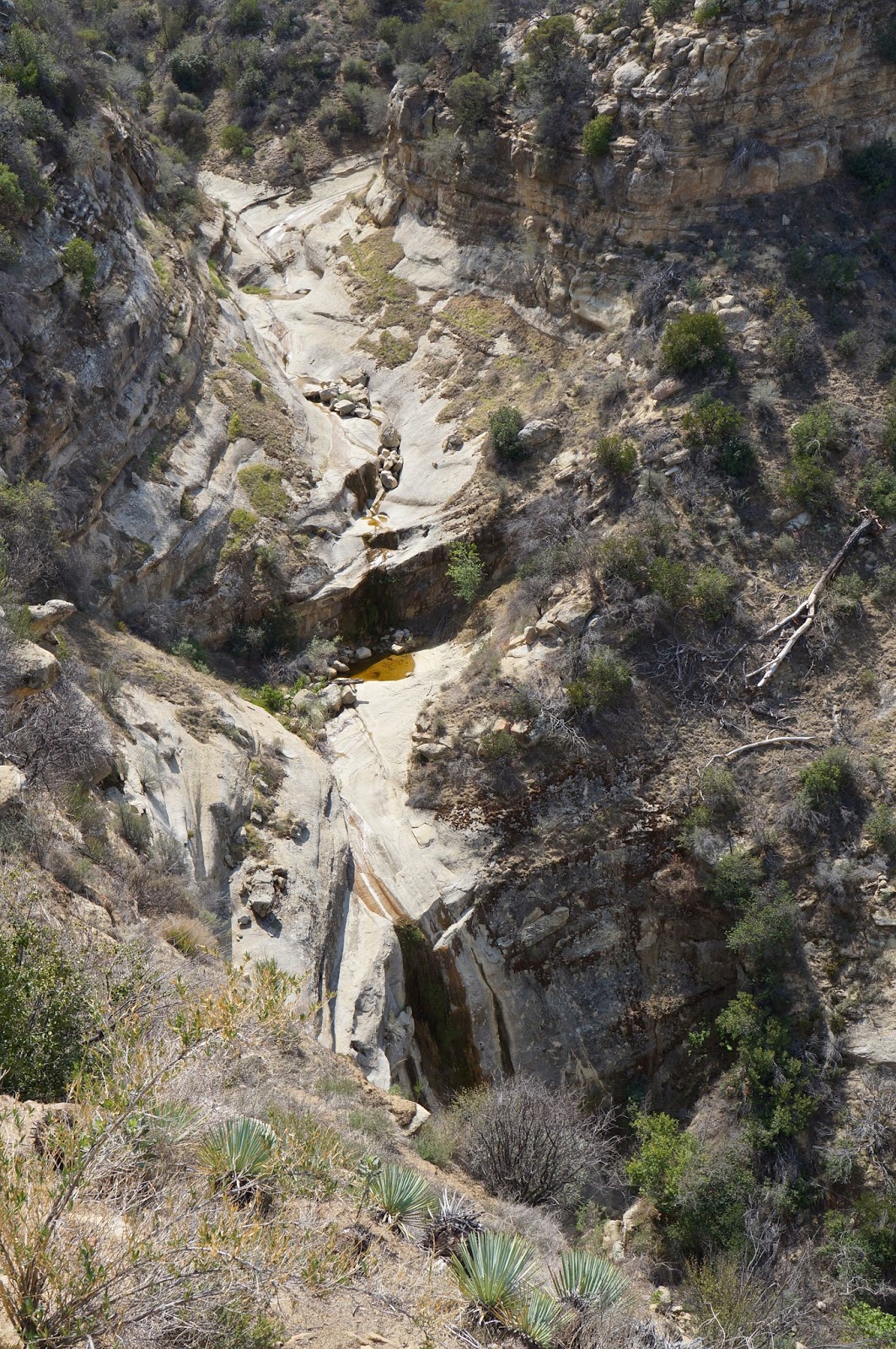
Typical of the badlands drainages off the north slope of Sierra Madre.

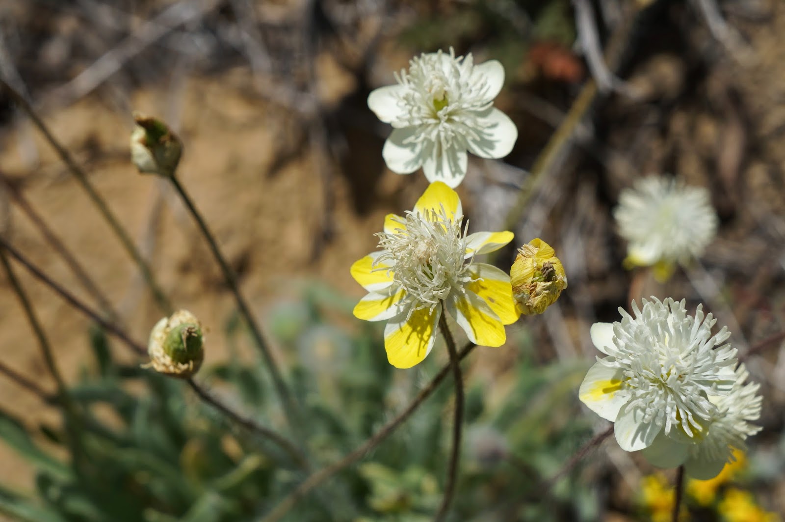
Fossil something or other.
View toward Santa Barbara Canyon from Rainbow Canyon.

Saturday, May 10, 2014

Dollar Canyon, Of Fossils And Flowers


This one was a tough nut to crack. Took me two real tries to find these fossils. Here's how it started.

A gent dropped an off-hand remark which piqued my interest. He said there was a big fossil at the top of Dollar Canyon. "What kind of fossil?", I asked, "Because there are fossil seashells all over the place." (as you'll see later). "And where the hell is Dollar Canyon? It's not on any map of the Los Padres I've ever seen." He said it was fossil remains of a large mammal. "Oh?", my eyes narrowed, "Do tell..."

This is going be fun for any of you with an adventurous spirit and a desire to go see something new. I'm going to share with you the same treasure hunt type info I was given, but with two additional and critical pieces of beta that I had to figure out on my own. First I'll explain why Dollar Canyon isn't on the map. The Reyes family purchased Santa Barbara Canyon Ranch in 1946, known prior to their ownership as Reeves Ranch. The name "Dollar" refers to a bet between two cow hands about wether or not there was water up this particular canyon. The wager was a dollar. There is water, but it's so scarce at this point as to be not worth the mention.

So if you've got a yen to find this fossil, here's your beta:
1.) Dollar Canyon is the first canyon/drainage past the first cattle guard on Santa Barbara Canyon Rd past turning onto that road at Reyes Ranch. It is narrow, hot, twisty, and not very friendly.
2.) The fossil is at the very top of the canyon.
3.) High in the canyon are several smaller tributary gullies. It may be important to bring a close up of a map detail in order to determine which of these is the correct one to follow.
4.) The fossil is to be found on the face of a dirty grey band of diatomaceous stone.
5.) The aspect of this rock band with the fossil faces due south.

And there you go. Armed with that info, some purpose and a good map, interested parties should be able to locate the fossil. It should go without saying that I'd be pretty disappointed to find that somebody went up there with a hammer and a rock chisel and tried to pry out some fossil bone. Please just enjoy it for what it is and take only photos. It's been there for millions of years, let it be. On the other hand, there are fossils of large seashells all over the place in a couple of the gullies which stream off the northern ridge of Dollar Canyon. After finding the primary fossil you should have a much better eye for the type of rock these fossils can be found in. Have at it.

I have a call out to a gent who has seen these fossils and may be able to shed some light on the identification of the critter.

This photo is one of your clues.
As I mentioned at the beginning, this one took me two tries to find. Having been up, down, and back up Dollar Canyon I decided to go back to the truck by way of the northern ridge of Dollar. Decades ago there was an old horse trail which climbed this ridge all the way up to Fox Mountain. Most of that trail has vanished over time, though remnants remain, but for the most part going up or down this ridge qualifies as cross country hiking. This ridge is essentially part of the rim of the Cuyama Badlands and the views from up there are spectacularly reminiscent of Kaibab National Forest in Arizona (west of Flagstaff). Splashed with red and white soils, dotted with juniper and pinyon pines, and cut through by hundreds of random arroyos, washes, and gullies, this is the kind of country that hides it's mysteries well. While descending the ridge I was treated to a full on flower show, with whole fields of the rounded ridge top in bloom with yellows, whites, purple, and blue hues. The air was crystal clear and silent but for a gentle, cooling breeze. The high desert can be cruel and coarse, but sometimes she's a giver.


Santa Barbara Canyon Ranch.
As I mentioned earlier, low on the ridge and nearing the bottom of Santa Barbara Canyon I dropped off the ridge and began descending back into Dollar Canyon. I passed through a strata of the same rock on which the fossil up high can be found. Here I found dozens of mollusk fossils sprinkled in large and small rocks. Additionally, I found a fossil with a tooth in it and one with a single exposed bone. If one had the urge to go fossil crazy for a day, this would be a place to do it. I really enjoyed myself.


Wednesday, April 2, 2014

A Descent of Sulphur Springs Canyon, San Rafael Wilderness


Another day spent scouring an untrammeled canyon.
The Sulphur Springs drainage [San Rafael](*not the drainage of the same name off Sierra Madre and Salisbury) caught my eye a few weeks back. Nico told me that Conant told him that there were some real drops in that canyon, and that Sulphur is sometimes used as a shortcut for those escaping the Hurricane Deck, but that was all the information I could glean about the place. I found this amusing because this canyon drains into the Upper Manzana, host to one of the region's most popular trails, and Sulphur Springs is literally just the next canyon west of the Manzana Narrows. Obviously Sulphur is not a going concern. I wasn't doing anything else so I thought I'd go have a look.


The arials of the uppermost portion Sulphur revealed an intriguing landscape of rocky bluffs of tiered sandstone strata channeled with dry watercourses which ceded into the familiar serpentine twists and turns of rock choked drainages throughout the Southern Los Padres. I banged out the miles leading up Manzana and through the Narrows, topping out on the mesa above Alcove Camp in 3:15. From this point it was all new territory. I stood on the rim of a steep drop overlooking a long and wide selection of crumbly slabs which ended in a broad and sandy drainage. In the middle distance that barren stream dissolved into a green haze of thick brush. Far downstream, the two dominant branches of the drainage came together in a clump of trees beneath a narrowing canyon. The dominant landscape feature from this vantage was the epic ridge of the Hurricane Deck. 

In the distance is the Hurricane Deck. Sulphur descends into the clump of trees below and continues from there.
The sandy wash, which cedes directly into thick young brush.

Descending the slabs was blessedly brush free, but it also required concentration. The angle wasn't that bad but the sandy surface of the rock was fairly treacherous. I navigated the descent without incident, coasting into a sandy wash and turning downstream. It wasn't all that long before I was having to bust through ceanothus and young manzanita intermingled with deadfalls and poison oak. Crap. I found, quite by accident, that the density and nature of the brush was pushing me ever more to the right of the branch I was descending. This turned out to be a blessing in disguise because, even though I couldn't see it through the brush, the drainage soon narrowed dramatically and plunged into a huge slide gorge. Staying to the right had led me across the crest of what had started as a small hill, but as the land fell away to my left I started to get glimpses of the gorge I had accidentally escaped, and this small hill became a narrowing prominence which overlooked not just this deep gorge to my left, but also into the northern, righthand  branch of this upper part of Sulphur. Finally I stood at the furthest point of this now ridge between two drainages and was able to really see downstream, or at least until the canyon came together and turned northwest. From this vantage it appeared that I was in for some work.


This is the deep gorge I narrowly missed. I'm okay with that.


Both upper branches met at a distinct and rocky narrowing. From this point forward the canyon was a narrow mix of brush and creek stones interspersed occasionally with pileups of massive boulders. The twisting nature of the creek limited views, swallowing my back trail and leaving me guessing what was just around the next corner. I proceeded between brush bouquets, ducking under sage sycamores and knotted oaks as the creek sank deeper and the canyons walls climbed higher. I found some creekside caves and terraced bands of rock overhanging the creek bed. At several turns in the middle of the descent I discovered pleasantly shaded and grassy benches along the creek, perfect respites from the persistent rock hopping, deadfall vaulting, brush busting descent. 


There was water in the creek, though it was not a real flow of any significance, and at times the water went underground for a time. The only wildlife I witnessed were a few frogs and turtles, a handful of birds. There were numerous animal tracks on the muddy banks of standing pools. Over the course of the descent I identified the prints of raccoon, bobcat, deer, and coyote. There were prints of a single medium sized bear, and those of a thirsty mountain lion, deeply imprinted paws side by side in the mud at the lip of a small pool. I did not identify any presence of man or his leavings until about the last half mile of the descent.


The last few miles of creek were identical to the preceding ones, monotonous really. I just took it for what it was and rambled on. Aside from amounting to a nice and varied collection miles, this day was much like many days I've had in similar settings throughout our forest. I took time to stop and enjoy the little things and appreciate being in a remote place, though there aren't any truly remarkable or particularly beautiful aspects of Sulphur Springs Canyon that are deserving of note.


Sunday, March 16, 2014

Manzana Narrows and Beyond


Twin falls at Manzana Narrows Camp.
What a magically delicious day!
I've never claimed to be an expert on the Santa Barbara backcountry so I'm just beginning to travel the trails that many of you already know and love. One of the discussions Nico and I recently shared centered on the Upper Manzana watershed and what lies beyond. I can read a map fairly well and understood a long time ago that this region of our forest was calling me. I think it first grabbed my attention when I did Cachuma, McKinley, and San Rafael Mtns. From those heights I could see down into Big Cone Spruce Camp and Fish Creek, and beyond that into the Manzana, and above Manzana into the upper portions of the path to White Ledge. The time had come for me to get off my duff and go see the area for myself. It was the right call for such a pleasant Southern California day.

The orange indicates the range of my travels for the day. Nine hours very well spent 

The price of admission to the Narrows comes in the form of five rather hot and boring miles. From the trailhead at Nira Camp the route progresses upstream, passing three campsites of varying quality; Lost Valley (nice-ish), Weavers (poison oakey, but otherwise nice, not on the topo), Fish Creek (a dive). These early miles are somewhat annoying, by which I mean that the trail randomly travels up and down slopes on either side of the drainage then dips back into the valley floor seemingly without reason or forethought. Sure, the trail was well traveled and nicely manicured but I had difficulty finding or maintaining my most efficient stride. This up-then-down-then-up routine was particularly insulting in the hot afternoon on the return trip.

On the way in I met a gent named Dan Hall who frequently posts trip reports to Santa Barbara Hikes.com. He's a salty dog, that one. He had done a fine job of collecting all the ticks between Alcove camp and where we met, for which I silently thanked him (literally, the dude had like two dozen ticks on his pants). He'd been out for a couple few days and launched into a vivid description of the devilish wind he'd experienced two nights before, a gale that had created a sandstorm within his tent, sleeping bag, ears, etc... Good times.


The Upper Manzana Trail, looking back towards the trailhead at Nira Camp.
The trail finally rounded a corner and turned upstream into a narrowing, arboreal canyon, shaded and very pretty. Before long I passed through Mazana Camp, a nice creekside site with two well separated picnic benches, shaded by oaks and sycamore. This is a pleasant place at the lower gate of the Narrows, a good spot for some breakfast while listening to the creek. Soon enough I strapped in and continued my upstream journey.


A portion of the creek through the Narrows. Very pretty.
Manzana Camp

The next mile or so were thoroughly enjoyable. The trail hugs the right side of the creek, sometimes climbing out of the drainage in short hops, which allow one to peer down through the trees into the stream bed before dropping back to the water. Between the mature and shady trees and the bubbling creek I found this stretch of trail to be one of the prettiest sections of forest I've experienced in the Santa Ynez backcountry.  Too soon I strolled into the Narrows Camp. This site is also very shady, creekside, and pleasant. There is a small pool showered by twin falls next to the camp. There are several distinct sites there, with more picnic benches, and the place even has a pit toilet up the hill above the creek.

Manzana Narrows Camp

A few minutes upstream of Narrows Camp the trail starts  climbing a short stack of switchbacks out of the west side of the creek. After the first few zig-zags I was able to see upstream to Manzana Falls, and above me on the western slope rose tall and pocketed bluffs of weathered sandstone sprinkled with bands of conglomerate cobbles. After banging out the remaining switchbacks I traversed a small plateau immediately above the falls. Here a well defined use trail cuts right to the top of the falls, and another cuts left to a small campsite called Alcove. The top of the falls offers a great view back down the Narrows, and above that, to Cachuma Peak

Alcove Camp is a pretty neat little site with great views, perched on a small bench under an ancient oak which has twisted it's way out from under a leaning boulder. There is a single bedrock mortar next to the tree. Under the bluffs behind Alcove Camp is a grotto and above that, a large overhang for which the camp is named. In normal years a narrow stream of water will pour off the lip of the alcove and down into the grotto, providing water for the camp. Today that stream was barely a trickle. 

The mesa country atop the switchbacks climbing out of the Narrows.


A look back down the Narrows from the top of Manzana Falls. That's Cachuma Peak in the background.
Lower Alcove Camp is tucked under those oaks. The lower alcove is just above and behind the camp.
Lower Alcove Camp. Note the great oak growing out from under and all over the boulder. There is a BRM next to this tree.
On a hunch I did some exploring above that small stream which trails into the grotto. I encountered a real alcove and a small campsite there. This would seem like a very private and secluded place to spend a night. There were a few puddles here, which will probably be gone shortly. There were also three shallow mortars, in an evenly spaced line. I'll just refer to this site as Upper Alcove Camp. Neat place.
Upper Alcove Camp.


Bedrock mortars (BRMs) at Upper Alcove Camp.
Back on the trail I turned north and headed for the mesa above Manzana Creek. As I ascended through twisty turns and around small rock formations I caught a glimpse of two high flying condors. Higher up the trail I encountered grassy meadows and low sandstone bluffs. Small watercourses wove downhill through the grasses and I observed numerous animal tracks: coyote, bobcat, deer, bear, and mountain lion. This high mesa is uniquely pretty. Further up to the high point, where the trail starts a long, mellow descent to White Ledge I was surrounded by large tiers of bluffs, each of varying height and riddled with pockets and caves. I selected a formation on the east side of the mesa and dropped pack for some lunch in the shade of a huge overhang which had been carved by years of wind and rain. There was a cool breeze up here and the mesa was silent but for the wind. I could see spruce growing out of the shadier sides of nearby formations, and small trickles of groundwater streaming down some of these bluffs. 
A pair of condors circling above the Alcove Camp area.
A large mountain lion print next to a standard business card for scale.


High on the mesa above the Narrows. The Hurricane Deck can be seen in the far distance.


After lunch I spent over an hour exploring this park. I scrambled up and over random formations just for an opportunity to gaze down into White Ledge and the Sisquac region. To the south I had views of McKinley Mountain and San Rafael Mountain (see Cachuma link above). I poked my head in dozens of caves and pockets and kept an eye out for arrowheads (not finding any) while walking the grasslands between formations. Before my little tour of the mesa ended I had concluded that this day was the best I had experienced in the Santa Ynez backcountry. Too soon it was time to turn things around and head back down to the Narrows and Nira.


Numerous small drainages coming off the mesa above the Narrows combine to become Manzana Creek.
One other note to share. I was briefly crestfallen early in the day upon discovering that somebody had forgotten to put the memory card back his camera, so all I had with me was an old iphone 4s which I use almost exclusively as an MP3 player. Duh. So all the shots on this post were taken with that (results not typical, I had to clean them up a bit at home). This trip done as a day hike comes to 20 miles, give or take.

Check out this weird gas-forming algae in a shallow stream of water.