 |
| Here's the route (in red) with extra mileage in orange for road miles walked before I got a ride. Click any image to enlarge. |
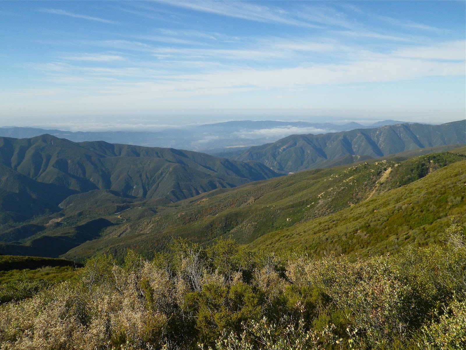
Here we go again. Headed out solo for 20 miles of backcountry, all of it new to me. I have always glanced up and left from Hwy 33 when approaching Rose Valley. The view is absolute, a massive wall of shale and scrub topped by a narrow ridge which runs west for miles. This is Dry Lakes Ridge. My plan was to hike the ridge, connect to the Ortega Motorcycle Trail and turn south down the Upper North Fork of Matilija Creek. The math on those miles came to 18.5, but I'm crediting myself with an even 20 miles because of all the weaving back and forth through brushy game trails on that crazy ridge (you would too, and that doesn't include the four more miles spent walking with a thumb out). As for the ridge, it's way tougher than I expected.
 |
| Full moon at sunrise. |
At 06:15 I started from the crest of highway 33, at about a mile past the Rose Valley exit. I ascended a steep and brush-choked 900 foot hill for breakfast. Yum. This hill rising from the 33 offers as trail the remnants of an old bulldozer track, overgrown and intermittent. The best that can be said for this climb is that it is direct. I climbed with the setting moon reflected in the rising sun, wisps of cirrus approaching from the west. The hill eased off near the crest of Dry Lakes Ridge, became increasingly brushy. Already it was 76 degrees. I was going to use a lot of water today. I noted that somewhere on that hill I'd lost all other people tracks leaving mine the only human prints on the entire ridge.
 |
| The first of the "Dry Lakes", with miles of ridge extending to the west. |
 |
| Walking the first, and larger of the two basins atop this ridge. |
Upon gaining the ridge I turned west, following a twisting-turning corkscrew through thick stands of brush. Below and west lay the first and larger of two "dry lakes", or sinks, or basins. This area is basically a meadow filled with weeds and a scattering of pines. There was no distinct trail so I wandered among the weeds, continuing toward a gap in the brush at this meadow's western end. The "gap" was (or used to be) the route through to the next of the "lakes". Instead it was close-quarters brush combat. While dodging yucca, boxing manzanita, and weaving through wild rose I had occasion to note that several of these plants I was fighting I did not recognize. This area of Dry Lakes ridge is supposed to be some kind of Botanical Area, a preserve for some rare and unique flowering plants. It's worth saying that just because some of these weeds are rare and unique does not mean that they are any different from all the other chaparral. The flora of the Southern Los Padres come in four types:
Those that stick,
those that grab,
those that prick,
and those that stab
 |
| The second, smaller sink on Dry Lakes Ridge. |
I descended into the second of two dry lakes on the ridge, this one being a round depression of about five acres in size. This area was much more of a meadow than the first, being knee high with desiccated grasses and dry, spiked weeds. Among a stand of pines on the western side of the meadow I found the remains of an ancient ice-can stove, riddled with the required bullet holes. Among these pines I found multiple sites where large animals had bedded down. I could not even begin to estimate the amount of time gone by since this site was last used by people.
 |
| The remains of an old ice box stove in the second meadow heading west across Dry Lakes Ridge. |
 |
| An itsy-bitsy baby dinosaur |
 |
| Animals have bedded down here. |
After a breakfast break in the sun I found my way though the wall of brush which ringed the valley. I battled through intermittently impassable brush, emerging from one brush match to find ten feet of trail and another bionic hedge. After a time the trail more of less resolved into a weeded and rocky track that was almost easy to follow. With the Dry Lakes and the worst of the brush behind me I resolved to make up for lost time spent hacking the brush. This was a tall order. If you look at Conant's map of the area, the scale is such that most hills under 100 feet tall from the mean don't even register. Understand that I ended up ascending a dozen of these "demi-summits" on the way across that ridge. This ridge trail is scenic, and it's beautiful, and it's hard. There are numerous short, but gruesome steeps on the ridge. The 96 degree air was thick and close with suffocating humidity and I was climbing hills, heart rate 150. I burned up the rest of this ridge, happy as hell to make it to an organized and travelled route, the Ortega Motorcycle Trail.

 |
| Miles of ridge. |
 |
| Click me. |
 |
| Trail. |
I like motorcycle trails, not just to ride but also for walking. These trails are often in pretty good shape, even if they are dusty. I'd ridden this Ortega trail once before, from Cherry Creek to just above Wheeler Gorge. I don't remember the trail (going too fast that day), but I sure enjoyed being out of the brush and on a high-speed route. Same today. I was finally able to shift into a consistent gear and the miles started falling behind me.


After a couple miles of dirt track I reached Ortega OHV Camp. This site has a pair of deep fire pits and two tables, one in disrepair. The day was really hot now, sultry. There was no relief from the sun on this endless ridge, no shade. The trail climbed over small hills, looped around on itself. I just kept walking. Once in a while I'd get a glimpse of what I thought might be Upper Matilija Canyon. It was still so far away. Already scratched up, and trying not to cave under the thick air, I swallowed salt and calories and water. Out of that hazy furnace I was confronted with a particular thought, that this route is a lot tougher than I'd anticipated.
 |
| Ortega Vieja OHV Campsite. |

A short distance west of Ortega Vieja Camp I encountered a punishing grade. This thing is about as steep as that section of trail above White Ledge Camp, and just as exposed to the summer sun. I just put my head down and started chugging up the thing. This climb is a real bastard and I was glad to put it behind me. By now those morning cirrus clouds had formed into gauzy puffs of cotton marching across an azure sky. I watched a large red-tail hawk fly below me across the face. He was having to work at it. No thermals, no breeze, just the close and heavy heat.
 |
| The steep and dusty Ortega trail. |
 |
| Above Upper Matilija. |
I was finally done with the uphills for the day (...and there was much rejoicing). I moseyed down the short drop to the take-off for the Upper North Fork of Matilija Creek. I was kind of flogging it going up that last hill and I needed a decent break soon, but I just wasn't going to stop in the sun. I made a deal with myself, that I'd descend this unmarked but obvious trail until I hit shade and water, then take my break. Those criteria came together 1.7 miles down the route at a very pretty spot called Maple Camp.
 |
| Center-Left one can see the switchbacks descending into the Upper North Fork Matilija Creek. |
 |
| Gate by "Pt. Mugu 4WD Club". Doesn't say what year it went up. |
 |
| Dropping into Upper Matilija Canyon. There is no trail sign at this junction. |
 |
| Maple Camp, the prettiest and least used of the camps in this canyon. |
It was twelve o'clock on the dot when I rolled into Maple. I'd started at 06:15 and was now around 12 miles into the day. Time for a break. I drank of the cool stream and refilled my kit, washed layers of dirt, sweat and salt from me. I dunked my head until I could feel my skull shrinking with the loss of heat. I sat in the shade and evaporated. Some time later I realized that I'd fallen asleep for a bit. After 45 minutes of recovery I pulled it together and got off my butt. I switched into pants before leaving. My previous walks up the canyon from below had proven to be informative in regard to poison oak.
 |
| The grand twin maples of Maple Camp. |
 |
| Trail. |
 |
| Bears! |
 |
| Bears! |
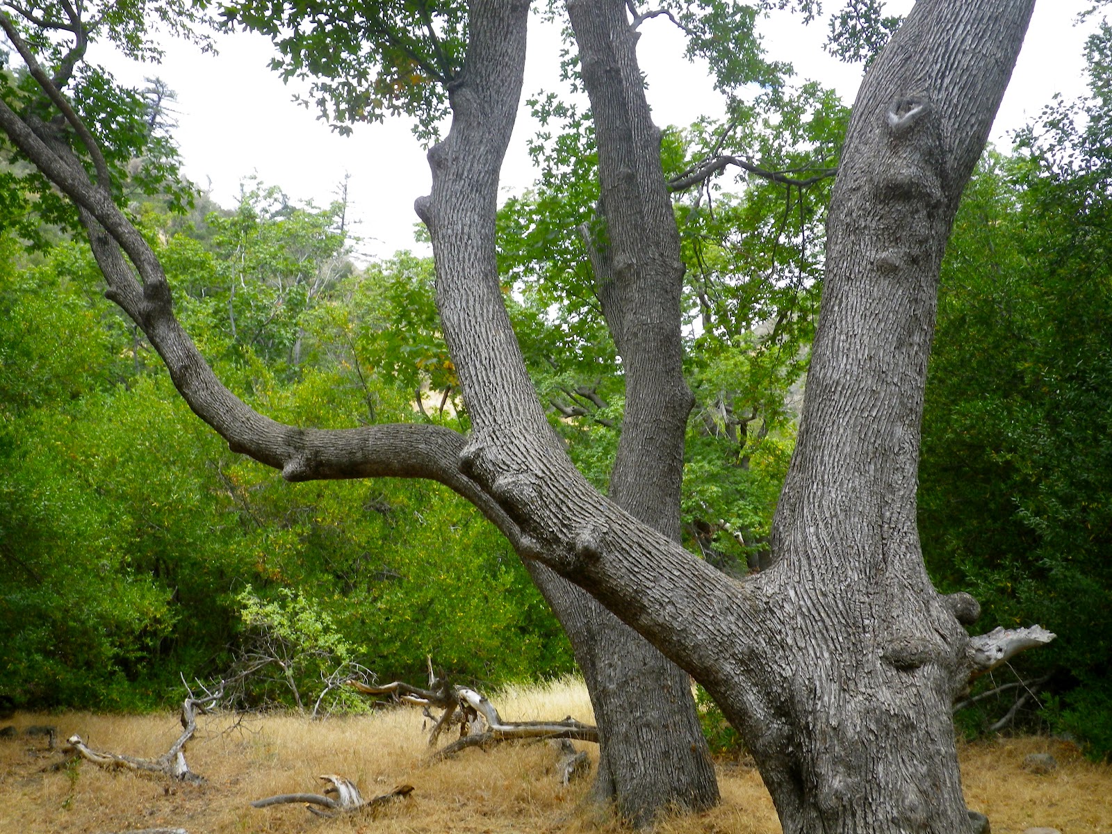
I resumed walking down this upper part of the canyon. The trail was in great shape however the brush was pretty bad through the open, un-shaded spaces. For the most part this route passed through stands of maple, willow, sycamore and oak. It was shady and pleasant, despite the thick humidity. I startled a sleeping deer somewhere off to my right. It crashed away through the undergrowth and when the general silence of the day returned I understood that I was the only critter out here without the good sense to find some shade and park it. As I rolled into Upper Matilija Camp I was confronted by a large, lightning-struck pine that was scored by years of bear activity.
 |
| Upper Matilija Camp |
Allow me a word about the poison oak problem in Upper Matilija Canyon, it's bad. I first encountered the vile stuff above Maple Camp and it got worse lower down. If I was given an opportunity to ask god a question, any question, I am sure mine would be, "Why mosquitos and why poison oak?"(I know, that's two). The oak was particularly prevalent, profuse, pervasive, prolific and potent on the stretch between Upper Matilija Camp and Middle Matilija Camp. If you can fly over this part of the trail I would encourage you to do so. And I am deeply envious if one of you has that power. Anyway, wear pants in this canyon.
 |
| Middle Matilija Camp. |
 |
| Click Me. |
 |
| Middle Matilija Falls, dry today. |
I continued down the long and winding canyon. The sky had turned into a grey-white haze and the heat seemed to hug the canyon bottom like a wet blanket pulled from the dryer too soon. Sweat poured off me in rivers. I just kept walking, past perfect little swimming holes and pretty shale cliffs, through sun-dappled forest, between the thickets of poison oak. I enjoyed this long downhill stroll. Just before exiting the canyon and entering the Matilija Ranch I slipped into the creek for a long, cooling soak. I switched back into shorts and gingerly folded my poison-oaked pants into my pack. I did my best to cleanse and scrub, but I've still ended up with a small patch of the stuff on my arm.
 |
| Hot, dry trail. |

Man, what a day. I got out of the hills and walked out the Matilija Ranch gate at 4 PM (20 miles/09:45), and just kept on walking for the next four miles. The sky rumbled with thunder, lightning flashed somewhere, the sky spared a cool shower of fat raindrops. I finally got a chance to stick my thumb out and was carried to the 33 by a nice couple from Austria by way of L.A. Back on the highway I walked another mile before catching a ride with Joe from Ojai, who was headed up Pine Mountain way for some bouldering.
Well, it was a long and damn tough day. Cool though, in a hot way.
 |
| and going, and going... |


Yet another epic adventure. Good work and a nice read.
ReplyDeleteD, thanks for keeping up and I appreciate your comments. That was a hard day.
ReplyDeleteNice adventure DS!
ReplyDeleteThe Dry Lakes are a really neat area. Apparently they're a geologic formation caused by thrust faults grinding up all the rock in that area. They were never actually lakes. I believe the Potholes and some of the other "basins" we were able to see in the southern Sespe area from atop Cobblestone are geologically related.
I know a few folks who hike and even camp in one of the basins or the other come winter/spring.
You're an animal for connecting that with a walk down Matilija in that hot weather. I guess the other adventure that has been tried, unsuccessfully, as far as I know, is to hike the Dry Lakes and then drop down into Tule Creek and follow that back to the 33. I think Craig Carey tried that on or two occasions.
Cheers,
Nico
Nico,
ReplyDeleteI agree, Dry Lakes is a neat, if completely overgrown area. I'm planning to revisit this ridge in the spring. I have heard that the place goes off with wild flowers. Stay in touch as we head into the fall.
I've been quite a ways up Tule Creek from the 33, and I did think about trying to find a way into that drainage from Dry Lakes. It doesn't look good. Which is okay. I've got another descent of another backcountry drainage percolating in my "idea file", so maybe after I clear that one out...-Stillman
I know I'm pretty late to the party here...
ReplyDeleteGotta agree with Nico about the "animal" designation. I've been to the places you describe here. But over the course of like 5 different trips over a decade or so. All but one on foot.
Most recently I took a "dual-sport" down the Ortega trail. (Key word "down".) Fun but really gnarly. I think I prefer foot travel through here.
Question: Someone from the Matilija ranch told me they have a problem with motorcyclists coming down from the Ortega trail to the Murrieta road (5N13). How could this be possible? Google earth does show some side trails going south from the Ortega Vieja OHV campsite. I could barely manage the beaten OHV trail. Think anyone could really do that? Definitely an a**hole move if possible. Hard to believe though.
Phil...guys ride that stuff all the time. I ride up and down Ortega in 75 minutes with a break at the 33 on top. There is a lot of illegal riding going on in our back county. Dual-Sports are heavy beasts to wrestle, but it can be done.
ReplyDeleteYeah. I'm a noob I know. But I doubt anyone could really get any bike from Ortega trail to Murrieta road without using the 33. I think she's confusing Potrero Seco road with the Ortega trail.
DeletePhil