Showing posts with label southern los padres hikes. Show all posts

Thursday, December 18, 2014

Busting Sticks Over Frazier Park

Last week, before this latest series of rains, I wanted to do a little exploring in the high country north of Frazier Park (AKA Tecuya Ridge). Of course the roads that ascend to the ridge will be closed for the next several months so getting up there is a bit of a hike in itself. I looked the maps over a bit before settling on a direct but steep climb straight up from Frazier. 

The morning air was crisp and cold at the time I set out, the sun just climbing over the eastern hills. After a mile of mixed road and motorcycle trails I had hit the wall atop my selected canyon. This little bit was where things would begin to feel like work. The climb was stiff, gained 1,000ft in 0.5miles, but after clearing the canyon I had a gentle ascent through rolling grasslands and deadfall trees which led to the ridge crest.

This portion of Tecuya Ridge had burned in a brief wildfire which started in late October of 2011. Though the fire had been quickly contained, a large swath of the ridge had gotten scorched and now, three years later, the grasses and desert scrub were retaking the south facing parts of the ridge while those mature ponderosa and jeffrey pines that had survived the blaze on the shady, north side were rebounding with greenery. I landed on the motorcycle track that traverses the ridge and paused for a little breakfast.

The birds were out, the breeze was cold, and I didn't have much of a plan other than to explore a bit. So that's what I did. I kind of roamed here and there, over hilly shoulders and into shadowed canyons, stopping frequently to admire trees or to listen to the breeze, to watch paired ravens play on the wind. The day was perfect that way, no need for a plan or a trail, time spent simply ghosting through the woods.

Looking down on Frazier Park from where I started, the fire station on West End Way.


Wednesday, October 22, 2014

Munson Creek and Unnamed Drainage

Jack Elliott traversing out of upper Munson Creek.

This short day of off-trail shenanigans turned into a bit of a blood-letting. The point was to go explore  a lengthy band of jutting sandstone which transects Munson Creek, explore the creek itself, and descend back to Hwy 33 using an adjacent unnamed drainage. We managed all that and uncovered a bit more.

First, I need to say that I'm so friggin happy it's Fall that I could pee myself. So nice to feel a briskness in the early morning air and a chill in the deeper shadows, to know that the day isn't going to be hampered by heat, and to sense that weird quality of autumn where the shadows are a little longer and the angle of the sun is a little lower. There's an essence in our forest that changes with the Fall, the air and light and animal sounds and crackling grasses and dribbling creeks all speak of a hope for rain. I'm almost ready to commit to saying that this is my favorite time of year in these parts. 

Click image to enlarge.

Munson Creek has been on my list for quite a while. I'm not sure why I've put it off for so long. Maybe it is because I've never heard anything spectacular about the place. Maybe it's because of a pronounced history of illegal marijuana farming. It might be because there aren't any real trails or intriguing mysteries to resolve. Whatever, it is but a fond memory and some superficial scratches now. These days I lean toward appreciating the experience as much or more than whatever destination may await me.


Jack and I hit it at sunrise, meandering up a short stretch of brushed up creek bed. After a bit we came to a subtle fork, a thinner branch of the creek that snuck in from the northeast. I'd already identified this branch as something i'd like to explore as it took a easterly route to a fantastic stack of sandstone. We trudged through the brambles until reaching a small flat. Immediately above us were two towers of stone which were bisected by a disorganized trough of large boulders. We had a merry time busting through brush and scrambling over and around the rocks. At the top of this mess we slipped into a gaping crevice, the result of a huge face of stone which had calved off the larger formation. This crevice was a natural passage between the larger formations. We exited into an oak forest on the north side of this lower band of Munson formations.

The "crevice" which ushered us through to the north side of this lower band of rock.

Immediately upon stepping out of that narrow slot we stumbled upon an abandoned marijuana operation. Further investigation revealed a large area that had been under cultivation either within the this most recent season or a year previous. I'm leaning toward thinking that this had been recent based on the lack of leaf litter on all the trash and implements we discovered.

Tools of the trade (and below).
We did a bit of exploring to the east. I rock climbed into an alcove eighty feet off the deck, and found myself having difficulty reversing those moves. Got the ole adrenal glands pumping, that's for sure. After that episode we turned west, following a huge rock formation down to the proper Munson Creek. From a high point over the creek we had fantastic views to the east and west of this same band of jutting rock as it continued parallel across the foot of Reyes Peak. 


We dropped into Munson Creek again and turned upstream. Things got mighty brushy and unpleasant despite the existence of an old narco trail to follow. We zigged and zagged through the drainage, busting brush in places, getting busted by brush in others. This went on for a fair bit before we came upon a small and sheltered waterfall. Naturally, this clear little falls had black irrigation line draped out of it, presumably the same line that fed the pot grow well downstream. Beyond the falls the brush thinned out and the drainage climbed up under Reyes. Here we backtracked and started the process of climbing out of Munson and into another canyon just to the west.

The falls on upper Munson Creek is tucked beneath these rocks.
A look back down Munson Creek.
Jack, climbing out of Munson.

Our scramble out of Munson was inelegant, a clawing climb until we reached another series of huge rock fins. Atop these, and safely out of Munson, we stood gazing down into a distant potrero framed by the same band of jumbled sandstone which transects lower Munson Creek. The next question was how to get down there. From the looks of it we'd have to go full brush ninja. So we did. The racket of brush snapping, hurled insults, imaginative curses, fleeing wildlife, all of it would have been hilarious to hear from a safe distance. By the end of it I was bleeding from a dozen places and looked forward to enduring a week's worth of the usual questions and the resulting comments in my dealings with everybody else who's not me. I usually just say I spent the day off-trail, this is both foreign and unfathomable to people. It's like saying you spent the weekend juggling fourteen ginsu knives. People just don't get it.

In the sights, that pretty little meadow below.
Donated blood at the office.

Even amusing descents come to an end, and we shook the sticks out of our ears as we strolled into that large meadow. There is one really unusual feature about this little valley, that any water draining off the potrero drips over a series of white slabs, funneled into a narrow slot which terminates in a decent waterfall, but it's what's in the water that grabs the attention. I've seen several natural salt seeps in the forest but nothing on this scale. Everywhere these slabs are crusted over by an eighth inch frosting of granulated salt crystals. All around are stagnant pools of brine, so salty that the water glares white in the sun. The salt content of some of these pools is so high that the actual salt has precipitated out and settled on the bottom. This was a fascinating type of place. Additionally, I explored back east a ways, checking out the ever present rock towers. Later, we found a way down the waterfall at the bottom of the meadow and continued a short jaunt downstream to the highway. 

Well it was another fine day out there in our wilds. Go out and get some.


Salt, salty salt.
Salt slabs beneath the meadow.
The falls beneath the potrero, just a shallow pool of stagnant water beneath.


Saturday, September 27, 2014

Black Bob Canyon


While scrolling through maps, hunting for obscure places I haven't yet visited, the name "Black Bob Mine" caught my attention. Even more interesting, a study of satellite imagery showed several small structures and a primary building at the site. Furthermore, there appeared to be a trail which descended from the summit just west of Tecuya Mountain. This point could be accessed via Forest Rte 9N21, and though numerous questions remained, I felt I had enough beta to make the jump.


The first thing I noticed upon arriving at that "trailhead" just west of Tecuya was that there wasn't any trail. I found this strange because the trail shown on the topo had indicated that this was where I ought to start. Whatever. I dropped over the edge and started a rapid, steep, dusty and loose descent into a mixed forest of scrub oak and jeffery pine. 15 minutes later I stumbled upon a narrow and twisty motorcycle track which I guessed was what had become of the trail.  Following this route led deeper into the forest, down the spine of the eastern ridge of Black Bob Canyon. Visibility was consistently obscured by the density of the forest, though at several points I had partial views right (E) into Dead Man Canyon and deep into Tecuya Canyon. The track continued to descend at a very steep rate, and I came to appreciate that getting a motorcycle up or down this route would require considerable skill, and would be pretty damn athletic.


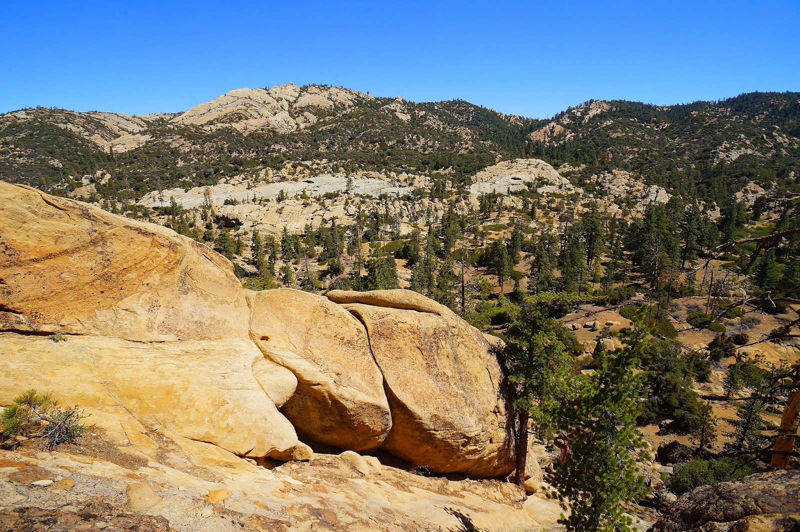
A look (kind of) into Tecuya Canyon
After forever the ridge sort of settled down into a rolling bit of hilly scrub and yucca. At a break in the brush I was able to lean over the lip and get a glimpse into Black Bob and was heartened to see, far below,  a tin roofed structure that looked an awful lot like what I expected to find. I continued down the ridge on the MC trail, long after the point that I felt I had passed the cabin somewhere below, and now behind me. I had started wondering if this MC trail actually went down to the cabin when I came a cross a short stretch of barbed wire stranded on ancient wood posts. Following the fence line led to a small clearing where the trail continued north down the ridge, but to the left I saw a smaller track take off into the forest. Aha!, I thought, here we go.


This slender thread of a trail cut back to the south, steeply descending across the rippling eastern slope of Black Bob Canyon.  I dropped through yucca spotted desert, a steep angle falling away beneath my feet, following the curves of the canyon. This went on for a good bit before I rounded another barb wire festooned turn and there below me, tucked under some oaks, lay a tin roofed two story cinder block shanty and two out-buildings. 


Approaching the house I passed the remains of an old table saw.  The small out-building I had initially taken for an outhouse was actually a generator shack.  The lower level of the cabin was actually a double bay of garage type space. Rusty mining equipment, spare parts, wire, barrels, and several dozen 5ft drills were strewn about the space. I hiked upstairs for a look. 

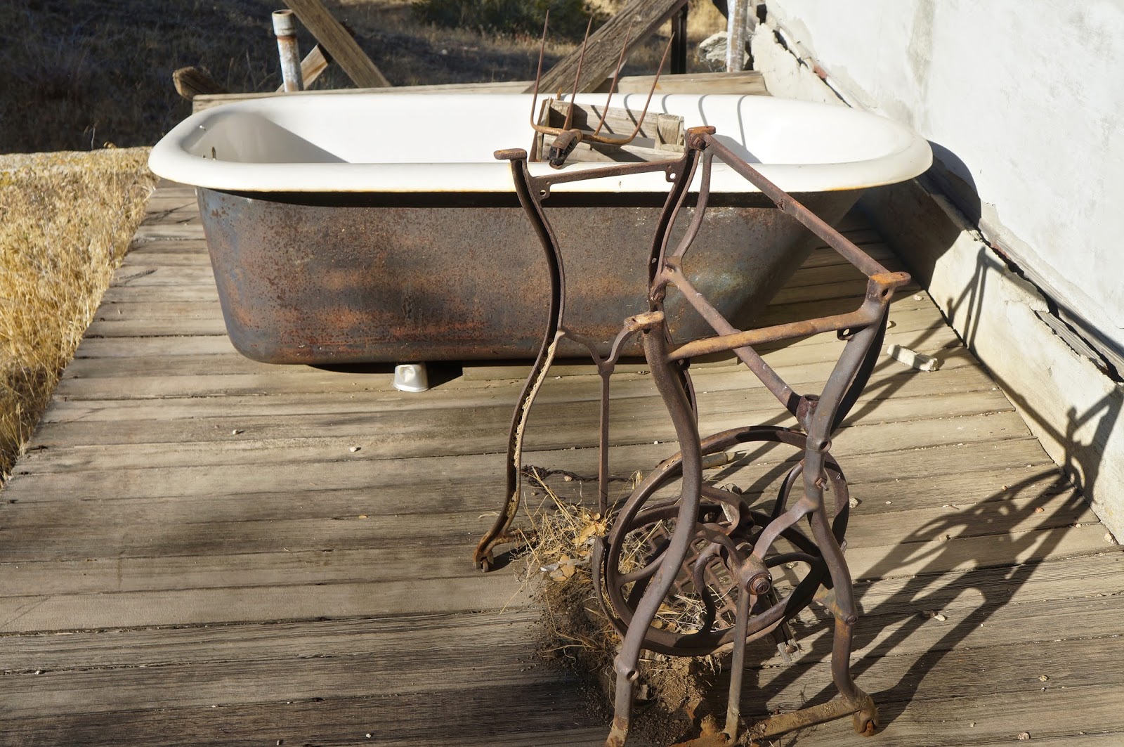
An old tub and a stand for a push-pedal sewing machine.

The house was a simple affair, one small bedroom, a tiny living space, a kitchen and a cramped bathroom. The whole house was strewn with the mouse tattered remains of a life long abandoned. Ancient publications, old spice jars, box springs, busted furniture, a pot belly wood burner, can openers, coffee cans, rat poison... I could go on and on. The old wood burning stove had been modified in an ungainly MacGyverism so that it used propane. Half-assed electrical work dangled from the ceilings. A 1960s fridge tilted into a corner. Mouse droppings everywhere. I stepped outside to an adjacent cold storage, cut into the hillside just behind the house. In this space were numerous intact jars of visibly recognizable foodstuffs, preserved by hand. Home-canned cauliflower, beans, carrots, fruit, etc..., still recognizable through the dust of ages. 

Having looked all over the place I concluded that the last time anybody had actually resided here had been right around 1970.


This is the stove that had been converted to LP. See the gas line running just in front of the burner top.
[Lorinda has informed me that this gas conversion was a new phenomena in stove tops beginning in the late 1920's]


What this old contraption could be was beyond me. (Lorinda informed me it is a road grader)


I had passed an old iron sign as I walked up to the house, and during the whole time I'd been poking around this sign had been tickling the back of my brain because I knew nothing about any "hiking trail" out of this canyon other than the route I took to get there. Such a route was not to be found on current topo maps. But this sign was firmly sunk in the ground in the opposite direction I'd approached from. Hmmm. The trail beyond the sign headed up canyon in the direction I wanted to go, and looked at first glance like a real phenomena. What the hell... I gave it a go, and was quite pleased with the result, for a while at least.


So my new exit trail meandered into the forest, headed straight up the floor of a narrowing Black Bob Canyon. The first "plus" was that I was climbing the canyon under a canopy of old oaks, and the shade was much appreciated. The second "plus" was that this hike out was kinda pretty. I'd been enjoying myself for quite a while when the track suddenly broke out of the forest and threaded through a small vale of chokecherry, the berries ripe on thorny vines. Minutes later the track to an abrupt right hand turn and started clawing a direct line up the western ridge of Black Bob. This climb was a haul, gnar, 2,000ft in less than 2 miles. I trudged up from the canyon floor, exchanging oaks for pines, and popped out on the forest road just a short 3rd of a mile from where I'd parked.

This had been an interesting little day. There is essentially zero information on-line about the who/what/and when of this mine, though it sure made for a remote excursion.


Chokecherry meadow.
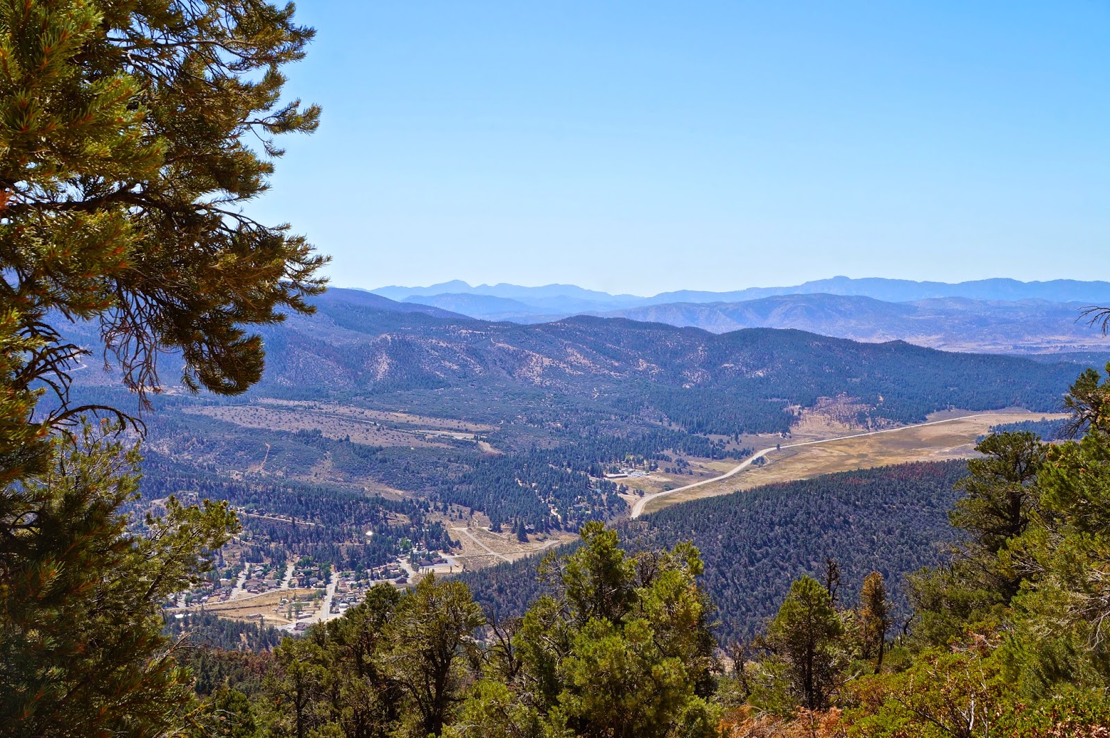
Cuddy Valley from Tecuya Mtn Rd.


Wednesday, August 6, 2014

Pine Mountain Lodge for Brunch


I do apologize for taking July "off", but I've got three good excuses for doing so: 1.) My house is undergoing a remodel to about 45% of the livable space, 2.) Everybody but me at my workplace has taken a vacation this month, and 3.) it's just been too damn hot to be anywhere back there. But I get a little nutty if too much time goes by without mountain time. To pacify the incipient insanity I decided on a late breakfast at Pine Mountain Lodge.

Starting at 0700 from the Sespe River trailhead I blazed a good run up Piedra Blanca Creek Canyon, arriving at the forested campsite by 0930. I spent some time wandering a short distance up the adjacent creek while nibbling on my breakfast. This vale is one of those little Los Padres gems I'm always seeking out. The creek is a foot deep channel bordered by tree roots and electric green moss. Overhead a pair of squirrels chattered at each other, hummingbirds chittered and doves cooed. As the sweat cooled I took a nice 20 minutes being a silent observer, simply present in the moment. 

A bit later I meandered south to "Real" Pine Mountain Lodge, the site where the original camp was located. This can be found by heading back down the trail from PML until reaching a large USFS sign and hanging a right (W) for a few minutes. Real PML rests in a forested bowl surrounded on all sides by rugged formations of weathered sandstone. The campsite here is infinitely nicer and more scenic than the latter camp at the junction of the Gene Marshall and Cedar Creek trails, however there is seldom any water here. In the rocks around the camp are many small caverns and bear hollows, indeed, the whole area is crawling with bear sign. I enjoyed scrambling around the area for a while before crawling under a large overhang for a nice rest in the shade. I stretched out on the cool stone and spent some time feeling, hearing, and watching the breeze swish through the cedars and jeffrey pine. I enjoyed a simple, gorgeous day.

At noon I turned away from the forest and descended back into Piedra Blanca Canyon. I jogged about 50% of the way out and returned to the truck by 2pm. A nice day out was just the prescription. I'm going to focus on some plans I've got in the pipe, but for now I've got these photos to share.


Rolling over the hill, the last few steps up to PML.


"Real" PML Camp