|
| Lower Lion Canyon from the crest separating Branch Canyon and Lion Canyon. |
Another day in the Los Padres furnace, this time on the north (Cuyama) side of the Sierra Madre Ridge. For those who've correlated the presence of large rock formations and nearby water sources with the presence of rock art, the formations tumbling out of Lion Canyon might stimulate some speculatory salivation. This is how Jack Elliott and I came to find ourselves melting in the glare of a desert sun, trudging up, down, over, and under glaring white sandstone slabs in a seldom visited corner of our forest.
 |
| The yellow track describes this day's perambulations. |
Somehow we were able to thread our way into Branch Canyon without encountering a "No Trespassing" sign. This involved some zig-zagging shenanigans but we just kept getting lucky. We encountered several gates which were chained but not pad-locked. Not seeing the expected signs prohibiting entry we remarked on our fortune and took this as an invitation to scooch on through with both a clear-ish conscience and no one the wiser. With lady luck on our side we drove well into Branch Canyon and began our rambling day at advantageous vantage.
 |
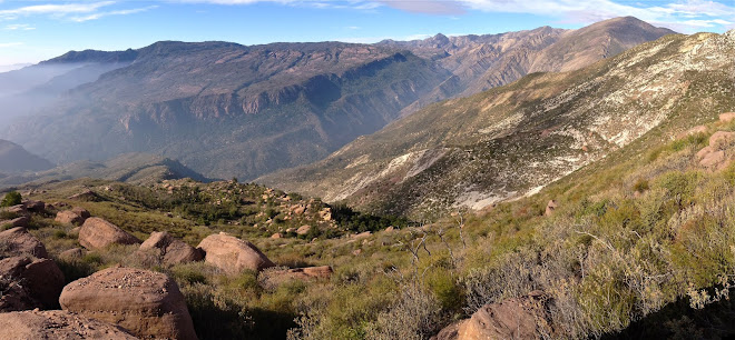
| An overhead view of the Lower Search Area. |
With an unexpectedly good head start on the day we set out, headed further up Branch Canyon for a ways before climbing cross-country over a ridge which separates Branch from Lion Canyon. At the crest of the ridge we had a great view up and down the lower half of Lion. Well down canyon from where we stood were several collections of large white sandstone formations. Looking diagonally up canyon was another low bluff of sandstone with a nearby butte. We continued southeast across a large slope of low brush, dipping into and out of several arroyos along our way to this upper set of formations.
 |
| The butte mentioned above. |
 |
| A deep slot, cut by run-off, in the upper part of our search area. |
We reached the butte with relative ease and ascended a sloping apron of rock beneath it. Nearby was a deep water worn cleft, and beyond that were long aprons of decaying white sandstone. I climbed east out of the canyon to a small rise and got my first good look at the rock jumbles spilling out of Upper Lion Canyon. From the top of Sierra Madre Ridge looking down this upper part of the canyon one gets a sense that some adventurous country lies below. Looking up from below was no less interesting. For those with an affinity for rocky canyons and slots, this looks like an exciting sort of place. Unfortunately, an exploration of this upper part of the canyon would probably be best attempted from above, descending through the canyon. Still, I'd always wanted a close look at this part of the forest. It's an impressive piece of terrain.
 |
| The formations of Upper Lion Canyon. |
 |
| This is not rock art. This particular boulder was tiered with thin strata of a more iron-rich rock. As various lumps on the boulder eroded with wind and rain these strata were exposed, leaving the spectacular whorls seen above. |
Returning to the canyon bottom we turned downstream. I was only late morning but the day was already viscously hot. There was little shade to be had in this upper part of our morning but as we descended toward Lower Lion Spring we encountered several large and lush cottonwoods. Lounging in the shade of these beauties we let the sweat evaporate and watched heat shimmer off the surrounding canyon. The day was stifling, quiet, devoid of movement. We moved from tree to tree until the trees ran out. Given the choice of following a cow path another .25 miles down to more cottonwoods and the spring we decided it was just too cookin' hot to move further from the exits. Sometimes you just have to think in terms of self interest. It was one of those little "I want to but I don't want to." decisions. A factor in this choice was that neither of us had read anything which indicated anything of interest at this lower spring.

Instead, we turned uphill and west, headed for a large assortment of rock formations which had looked intriguing on the satellite. This was a somewhat remarkable pile, consisting of hollowed run-offs, shaded alcoves, steep slippery slabs, jagged towers and misshapen hoodoos, pockmarked owl cliffs and shallow caves. If it hadn't been so dang hot I would have enjoyed this acreage more. As it was we were forced to repeatedly move from shade to shade, retreating from the blinding sun like some vagrant species of vampire cavemen. We did our best to poke around but our search wasn't thorough. I found evidence of a spring which had dried out, just a hollow under some scrub oak. A blue jay and some type of magpie fluttered off as I approached, and a jack rabbit bounded away from beneath the trees. The place smelled like water and I bet if I'd dug deep enough I could have produced a trickle of moisture. Still, I'm glad that wasn't even remotely in the cards. We had cold drinks on ice waiting at the truck, so we crawled out of the shade, traversed over a low ridge and completed the loop by turning a short distance back up Branch Canyon. We arrived somewhat nuked but no worse for wear.
 |
| Jack bearing the weight of the sun. |