Showing posts with label santa barbara county hikes. Show all posts

Tuesday, July 15, 2014

Exploration of Lower Lion Canyon

Lower Lion Canyon from the crest separating Branch Canyon and Lion Canyon.
Another day in the Los Padres furnace, this time on the north (Cuyama) side of the Sierra Madre Ridge. For those who've correlated the presence of large rock formations and nearby water sources with the presence of rock art, the formations tumbling out of Lion Canyon might stimulate some speculatory salivation. This is how Jack Elliott and I came to find ourselves melting in the glare of a desert sun, trudging up, down, over, and under glaring white sandstone slabs in a seldom visited corner of our forest.
The yellow track describes this day's perambulations.
Somehow we were able to thread our way into Branch Canyon without encountering a "No Trespassing" sign. This involved some zig-zagging shenanigans but we just kept getting lucky. We encountered several gates which were chained but not pad-locked. Not seeing the expected signs prohibiting entry we remarked on our fortune and took this as an invitation to scooch on through with both a clear-ish conscience and no one the wiser. With lady luck on our side we drove well into Branch Canyon and began our rambling day at advantageous vantage.


An overhead view of the Lower Search Area.

With an unexpectedly good head start on the day we set out, headed further up Branch Canyon for a ways before climbing cross-country over a ridge which separates Branch from Lion Canyon. At the crest of the ridge we had a great view up and down the lower half of Lion. Well down canyon from where we stood were several collections of large white sandstone formations. Looking diagonally up canyon was another low bluff of sandstone with a nearby butte. We continued southeast across a large slope of low brush, dipping into and out of several arroyos along our way to this upper set of formations. 

The butte mentioned above.
A deep slot, cut by run-off, in the upper part of our search area.


We reached the butte with relative ease and ascended a sloping apron of rock beneath it. Nearby was a deep water worn cleft, and beyond that were long aprons of decaying white sandstone. I climbed east out of the canyon to a small rise and got my first good look at the rock jumbles spilling out of Upper Lion Canyon. From the top of Sierra Madre Ridge looking down this upper part of the canyon one gets a sense that some adventurous country lies below. Looking up from below was no less interesting. For those with an affinity for rocky canyons and slots, this looks like an exciting sort of place. Unfortunately, an exploration of this upper part of the canyon would probably be best attempted from above, descending through the canyon. Still, I'd always wanted a close look at this part of the forest. It's an impressive piece of terrain.

The formations of Upper Lion Canyon.
This is not rock art. This particular boulder was tiered with thin strata of a more iron-rich rock. As various lumps on the boulder eroded with wind and rain these strata were exposed, leaving the spectacular whorls seen above.


Returning to the canyon bottom we turned downstream. I was only late morning but the day was already viscously hot. There was little shade to be had in this upper part of our morning but as we descended toward Lower Lion Spring we encountered several large and lush cottonwoods. Lounging in the shade of these beauties we let the sweat evaporate and watched heat shimmer off the surrounding canyon. The day was stifling, quiet, devoid of movement. We moved from tree to tree until the trees ran out. Given the choice of following a cow path another .25 miles down to more cottonwoods and the spring we decided it was just too cookin' hot to move further from the exits. Sometimes you just have to think in terms of self interest. It was one of those little "I want to but I don't want to." decisions.  A factor in this choice was that neither of us had read anything which indicated anything of interest at this lower spring.


Instead, we turned uphill and west, headed for a large assortment of rock formations which had looked intriguing on the satellite. This was a somewhat remarkable pile, consisting of hollowed run-offs, shaded alcoves, steep slippery slabs, jagged towers and misshapen hoodoos, pockmarked owl cliffs and shallow caves. If it hadn't been so dang hot I would have enjoyed this acreage more. As it was we were forced to repeatedly move from shade to shade, retreating from the blinding sun like some vagrant species of vampire cavemen. We did our best to poke around but our search wasn't thorough. I found evidence of a spring which had dried out, just a hollow under some scrub oak. A blue jay and some type of magpie fluttered off as I approached, and a jack rabbit bounded away from beneath the trees. The place smelled like water and I bet if I'd dug deep enough I could have produced a trickle of moisture. Still, I'm glad that wasn't even remotely in the cards. We had cold drinks on ice waiting at the truck, so we crawled out of the shade, traversed over a low ridge and completed the loop by turning a short distance back up Branch Canyon. We arrived somewhat nuked but no worse for wear.

Jack bearing the weight of the sun.


Sunday, June 29, 2014

Hildreth Peak from Hwy 33 via Potrero Seco [29.6mi]


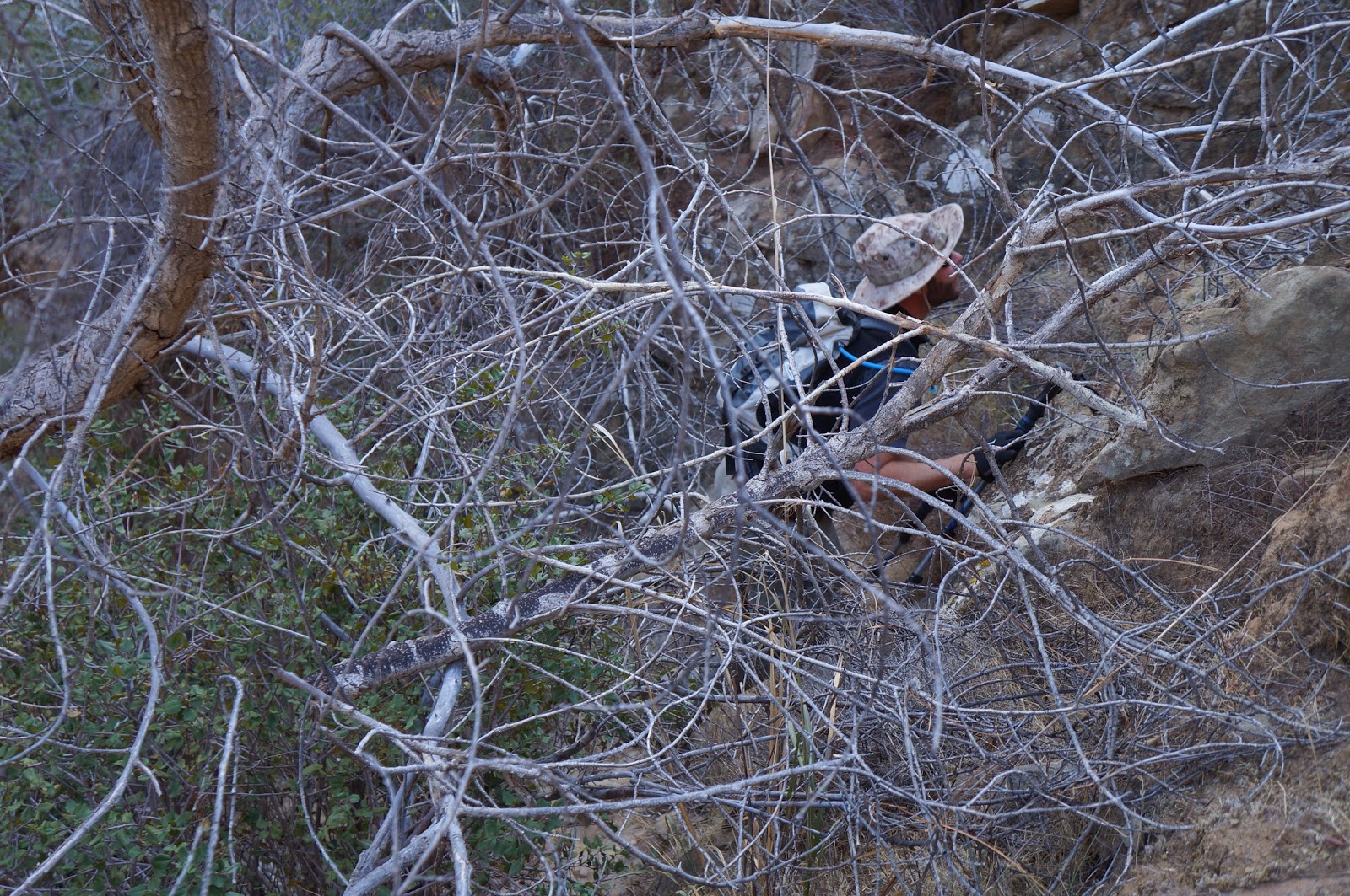
I'll concede up front that this wasn't necessarily the smartest thing I've ever done. Taking "the long way" to Hildreth Peak has been on my mind for over a year. I guess I thought it would be a pretty gnarly challenge. I was right about that. 

Detail of the day's route.
What's so special about Hildreth Peak? Nothing, except that it's way the hell out in the middle of the Dick Smith Wilderness. It's also a Sierra Club Peak, and when done as they suggest, starts from the Agua Caliente trailhead behind Santa Barbara, going as a 16 mile round trip hike with 4,700ft of elevation gain. Frankly, that sounded pretty reasonable. In other words, I wasn't interested.

By contrast, this thing I'd been planning to do came in at 29.6 miles with 8,100ft of elevation gain on the day.


Elevation profile for the round trip.

I started the day a bit concerned about the heat index. I thought, "Please just let them be wrong." I took off from Hwy 33 weighed down by 7.5 liters of water and very little else. The first four miles were generally downhill into Potrero Seco. There's a hidden ranch back here, a small, family owned operation. They aren't running any cattle this year, probably on account of the drought. I think there are only two wells on the entire place. One neat fun fact about this ranch is that, on wet years the water flowing down from these meadows becomes Sespe Creek. This is where it all starts.

I did some mental gambling and left 1.5 liters near the ranch and kept on truckin'.
Madulce Peak from somewhere west of the 3 Sisters
The road down to the ranch continues south for the next 4 miles, generally climbing toward a jagged ridge called the 3 Sisters. There are some elevation losses in this stretch, part of the cumulative ups and down that were going to become the theme of the day. The road crests at a pile of weathered sandstone boulders where the junction for the jeep trail to Hildreth Peak departs Potrero Seco Rd. Here I took a couple minutes to cool down. The day was getting hot and it hadn't even gotten hard yet. I'd done 8 miles and had 6+ to go to reach the summit. I put 500ccs of water in me, left a liter in the shade of the rocks, and got back in it. Headin' west.  

Hildreth Peak is way out in the distance and a little left.
A little closer in this shot.
And again...

The jeep track heads pretty much due west, riding the crest of an arid ridge for 6.+ miles to the summit. This ridge...well, it sucks. It goes up and down an awful lot. For more than an hour I got to watch the peak get incrementally closer. I'd crest another rise on the ridge and there it would be, seemingly no closer. This up/down stuff just went on and on. Eventually I rounded the summit of another high point and before me lay an unobstructed view to the peak. Oddly, I wasn't just looking across a huge gap at it, but was actually looking down on it to a degree. Getting there looked awful, but first I'd have to lose a 1,000ft just to get under it. Why the hell had I done this to myself? Best to leave that one alone as I wasn't even halfway through the day yet. I shrugged and started downhill.

On the way down I made a mental note that parts of this descent were the steepest angle I'd been on all day, and that I'd have to somehow get back up all this. Also, the day was starting to feel wickedly hot by this time. Having bottomed out below the summit I proceeded to climb the peak. The road twisted steeply, very steeply in places. I was pouring sweat, tachycardic, and only about half way up this last push to the summit when I felt myself getting overheated. Raw heat radiated off my face and body. I crawled under a manzanita and let my heart rate come down. This was no good. One thing I did while in the shade was strip off my underwear, giving myself better venting through my shorts. Going commando has helped me dump heat before. Grim news, my gauge showed the temp in the low 90's. I needed to slow things down. Knowing that the hardest and hottest part of the day would be the return trip, I checked on my water situation. It could have been better. 

Here's where the mental aspects of this game took on a new color. I'd have to find a way to keep on the move but not push so hard that I ran too hot, which would increase my water needs. While parked in the shade I made some disciplined choices about water rationing, a big part of which was to deny myself what I and and my body most craved.  I made a decision to be the cruelest quartermaster, also denying myself food for the next several hours (digestion requires water, water I didn't have to spare). I made a deal with myself, 5 sips through the tube every 15 minutes, 8 sips on a strictly as needed basis. I'd have to work this out, but first, the summit.

I trucked up the rest of the peak at a slower speed than usual, controlling my heart rate and respiratory pattern. I rejoiced in any transient breath of a breeze. At last I was only a couple hundred feet away from the summit, with a short brush climb from the road to go. On top I opened my shirt to the breeze and took what help I could. In the summit log I saw the usual suspects, names I should have expected based on experience. It's not a lovely place, this summit. It reminded me somewhat of the top of Chief Peak above Ojai, except that from here Madulce loomed large in the north. Big Pine, Little Pine, and Alexander Peak rose in the west, and to the south I could see Santa Cruz and Santa Rosa Islands over the crest of the Santa Ynez range. I did my thing and got out of there, not without a little apprehension for what my future held.  

View north
View west
Looking down Potrero Seco Road, Mt Reyes in the distance.

I reached the bottom of the peak and began the brutish 2.5 mile climb back up to the ridge. This climb, challenging in it's own right, was complicated by the heat. I did not have fun. I spent the entire climb walking a fine tightrope between running hot and overheating. I dreamt of anything shady but had to accept that there'd be none until I was back at the rocks at 3 Sisters. The sun bore down like an anvil, and the heat just reflected off the track beneath me. My feet felt ablaze. I held my emotions in a crushing grip. I couldn't afford self pity, nor could I cave into the insatiable urge to drink what I needed. I developed a new mantra, one which looped in my heat addled brain, "I will not stop. I will not fail. I will not stop. I will not fail". At times I felt my pace slip away from me, my soul reduced to one heavy step at a time. This ridge was trying to kill me. And it went on without end. 

Finally I hit a downhill that dropped me into the rocks at 3 Sisters. There I grabbed my liter of life and collapsed in the cool shade of a huge boulder. I lay with my back on the cool stone, completely wrecked. I put down half my water and lay back, sipping the rest of it down while my temperature normalized. At last I opened my pack to judge how well I'd managed my water on the trip out and back. I was literally down to 2 ounces of warm water. And the disciplinarian seized hold of the day again. There'd be no joy until I made it back to the ranch. I was freshly recharged, but in no way was I fluid resuscitated. I was still dehydrated, and had 4 miles to travel before reaching my next water. I forced myself to my feet and made myself do it.

Miles to go...
That water had been enough to keep me in the game. The next hour was unpleasant but I pulled it out. I made my way back to cache #1 and bolted down a liter, saving the other 500cc for the final four miles. I don't remember those miles very well, just a seemingly endless trudgery of pain, heat, and the same all consuming thirst that had been the hallmark of this hike. I was alive and moving in the right direction. I staggered up to the truck, yanked open the door and pulled an ice cold gallon of life from the cooler. Somehow I got my shoes off and turned the ignition. I'd left here 11:05 hours ago. I was only half dead by the time I got home. Want some advice? Don't do this to yourself.


Saturday, June 21, 2014

Las Cuevas de SueƱos Perdidos


"Never again!"

This being said with extreme prejudice and four uplifted middle fingers upon our exit from this botanical nightmare. Mike had coaxed me into a drainage that has no name. If it were up to me I'd call it "Don't Go Here Creek". The fact that there was at one time both a hunting cabin and pictographs up there was the sole reason for this unpleasant journey. Sure, you're going to look at the photos here and think that it doesn't look so bad, but then you're also not being plagued by nettles, gnats, horse flies, humidity, poison oak, deadfall trees, and miles of rocky creek bed... all of it compressed into a singular parcel from Hell. Somewhere in there I kept looping the ironic part of the Gilligan's Island theme song, "...a three hour tour. A three hour tour.". I started thinking of Colonel Percy Fawcett, the great Amazon explorer who ultimately disappeared in Brazil, and of the difficulties he described. In short, this one sucked and we are never going back.


The plan was pretty simple, go upstream, climb past a large waterfall, locate the remains of a WWI era hunting cabin, and then find three caves with rock art in them. A quarter of a mile into this mess the complexion of the day changed. No longer was this a broad and open creek bed. Fun time was over. By the time we reached the waterfall I had become convinced that if there were a cabin (or its remains) upstream, then it wasn't the remains of somebody's hunting shack but was in fact the reclusive hermitage of Ted Kazinsky's great-grandfather. I couldn't imagine a time when this narrow gully of brush and trees had been conducive to hunting. I still can't.


The above photos belie the difficulty of the terrain. This photo is more illustrative of what the day was like.
The waterfall. One might imagine this would be a sight when running. Of course that would mean that just getting there would be even that much more difficult.
Looking back downstream, from above the waterfall. With the exception of the first 3rd of a mile, this was the most navigable part of the day.
We finally overcame what came, reaching the cabin site. Scattered about were pieces of rusted roofing, parts of a bed frame, a shovel head, a huge saw, tin boxes and pots and pans. Next to this rusty pile was a flat spot where the cabin had stood, and at the back of this was a low rock wall. Coming in from somewhere up the creek was a rusty water pipe that terminated in a spigot. I could not fathom how all this stuff had been brought here. The site made no sense, and it remains a somewhat baffling mystery to me. There isn't any way a horse, mule, or burro could have gotten up this creek even as far as the waterfall. A five acre flat below the waterfall would have been the only place one could hunt. The creek near the cabin was shallow and broken up by small waterfalls, not the kind of place that one would associate with good fishing (not that we even saw any fish). The site just didn't make a damn bit of sense. The more I ponder the cabin and its location, the more I wish to know the motives of the man who built it.

Roofing materials and other implements.
An old saw.
A pot and fry pan.
A canteen with bullet holes in it.
Next we tried finding these caves that supposedly had rock art. While trying to locate them we came across the remains of yet another Narco pot grow site. This one was northwest of the cabin in thick undergrowth and under a canopy of leaves. We discovered 9-10 cheap sleeping bags, a pellet gun, tools, lots of plastic sheeting, buckets, and of course there were the ubiquitous irrigation hoses. This operation looks to have been abandoned 2-3 years ago. I've arrived at the conclusion that if there's water in the forest, and there isn't a well used trail next to it, there's bound to be evidence of a grow site. I don't know how many of these I've run across but I'm currently trying to think back and mark them on my Google Earth page, just to have a frame of reference for how many are out there.


And now we get to the real motivation for being here, rock art. This site was studied in 1973, and later by an archaeologist named Hyder (1984, 1987). He described three large wind caves in the vicinity of the cabin site. Two of these caves had three or four elements each. The third cave was described as holding as many as forty rock art elements (a lot). These pictograph sites were somewhat unusual in the sense that only about a quarter of them were actually painted, the rest of the art having been drawn in charcoal. So what we were looking for was a vibrant and busy cave with many charcoal drawings and some painted elements. Well, things have changed.

There were a dozen caves in the neighborhood which matched the overall description of what we were searching for. I singled out the three most likely of these and gave each a good looking over. This is a case where the mind doesn't see what it actually sees, only notes the absence of what it expected to see. I looked at each of these caves and called out to Mike, who was searching elsewhere, that these were empty. I did say that one of the caves I'd scoped might possibly have had a charcoal scratch but there sure weren't multiple elements of art there. 

We continued our search. The day got hot. We'd seen one dry hole after another. We'd busted through overgrown brush, thinking these caves might be hidden behind a screen of the stuff. We even left the search area and travelled further upstream a bit on the chance that the pictographs weren't as close to the cabin as implied. We did this for 2-3 hours before I sat down in the shade to rezero my thinking on the day. Mike and I were pretty used up by this point so we just sat there for a bit. Finally I said "What if it's just gone?". Mike just looked at me for a moment. "Seriously," I continued, "this stuff hasn't been seen since the '80s. What if it's just all gone? Most of it was charcoal anyway. I mean, if the charcoal wasn't bound with seed oil it wouldn't last. And the caves around here are eroded wind caves. What if it's all just blown away?"

Mike chewed on that for a bit. I think he said that we should still have been able to see some of the painted elements. I didn't disagree. We sat there some more, swatting flies and chewing. Finally I said, "You know, I hate to say this, but I think maybe I should go back and look at that cave that might possibly have had a charcoal scratch in it. I just can't help thinking that something's not right." Of course this meant another uphill slog in direct sunlight. We headed back uphill and I reached the first of the caves before Mike. After my eyes adjusted to the dimmer light I crawled right up to the walls of this cave. Suddenly I saw the sketchyest sketch of what was probably a star, and nearby was a stick figure man. Eventually we discovered some other elements, but for all intents and purposes this site has effectively blown away with the wind. It was the same story with the other two caves, fragments of fragments. With two sets of eyes we could not find a single flake of the painted pictographs which were supposed to be present. I apologized to Mike for all the troubles my missing these drawings had caused. He was gracious about it, acknowledging that what we'd found wasn't what we thought we were looking for. 

Well, having flipped the bird and said "Never again!" I can rewind the day and say without reservation that this is no place I want to see again. I'm just glad we were able to resolve the rock art question if only for the reason that it won't plague me in the future. I can go to sleep with that particular skeleton safely kicked to the closet. 

Concentric water rings on a creek stone.

Wednesday, January 15, 2014

Remember when it used to rain?

Rain gauge totals for Ventura County since October 2013. 

I think the title of this post says it all when discussing the current state of the Tri-County area and the drought which has got us by the short hairs. Our local civic leaders are not openly acknowledging this crisis as yet, or asking for greater public conservation of such a scarce resource, even though the most dim-witted butterfly could understand that we haven't had any rain this season (indeed, herbicides and climate change have decreased the monarch butterfly population by as much as 50% in recent years). California in general has been in a drought for the last three years and the trend is unlikely to forseeably change based on projections by NOAA. Surface temperature fluctuations in the Southern Pacific Ocean dictate El Nino/La Nina conditions. Those conditions in turn, affect the jet stream, and where resultant Eastern Pacific zones of high pressure will occur and for how long. This whole fall and winter season Southern California (and the State in general) have been plunked under one enormous and persistent high pressure system. This is bad news for those of us that visit the Southern Los Padres National Desert and rely on those diminishing water sources to stay alive.

To illustrate our predicament I have put some alarming water resource tables on this post. This is current and historical data for Ventura and Santa Barbara Counties that should instill a healthy fear in those of us who like to use the local woods. Last summer I wrote a post which included water data (to the degree possible) of all SLPNF drainages and springs which we hikers rely on. Many of you contributed to that writing and the overall message, when all was said and done, was pretty depressing. Things were already bone dry a year ago, much more so now. I invite you to spend a few minutes studying these charts. It's scary. As with any post here, you can click on any image to enlarge it.

To those of you that still argue that 95% of climate scientists are dead wrong (the folks with years of post-graduate education and research to back their findings), or have bought the oil companies' propaganda lie that our gleaming plastic, hydrocarbon fueled wonderland is completely unrelated to the phenomena of climate change, I invite you to watch Collapse, with Michael Ruppert. As with all things in life, take his words with a grain of salt (he is not perfectly right about everything, but it is also a good idea to judge the man by the quality of his enemies). He does present a cogent argument for those of you with your brain in "On" mode. Those of you who understand that the western U.S. is drying up and have concerns about the greater water supply and what you're doing to it, I suggest seeing Last Call at the Oasis, which is viewable in it's entirety on NetFlix. If you find yourself further intrigued by humanity's model for self-destruction, Zeitgeist may provoke some soul searching. Note that, with these recommendations, some may wish to label me a conspiracy/black helicopter type. I am not. I am simply a free-thinking, knowledge hungry human being who recognizes that every life system on our planet is under stress, and our species' entire model of living is unsustainable.


Saturday, January 4, 2014

Chumash Site: The Halfway House


Here's an odd one. I was led to understand that deep in the heart of the No Man's Land behind Santa Barbara could be found a Chumash site that very, very few people have ever seen. All indications pointed to the fact that getting into that part of the forest would be extremely difficult, never mind actually finding the site. I was given a very general idea of the site's purported location, only that there was something Chumash there and that it could be found roughly midway between two other significant sites. The beta was second or third hand and the source that passed this information along did not know what could be found at the site. It sounded like a problem that was right up my alley. 


I did an in-depth analysis of potential routes which might improve the odds of success. Out of four potential possibilities one emerged as the single best option. Then it was time to hit up Jack Elliott to see if he'd be interested in joining me for the search. He was, of course, game. He's the guy I usually turn to when I want a solid off-trail partner, and this route was most definitely going to be that. In fact, though the other three options included portions of trail, most of the day would be in the sticks whichever way we took. I had every reason to expect that this day would be a bloody brush fight, otherwise known as "another day at the office".


Jack and I got a good thrashing on the way up to the site, but not as severe as I had expected. On the way in we had to negotiate typical scrub conditions, lots of yucca (with its occasional "Ow! F*ck!"), plenty of spiky young manzanita (...more cursing), and several interesting geological obstacles. Eventually we entered a relatively recent burn area and things got a bit easier. Soon we had climbed into the right zip code and it was time to begin our search. 

Jack in the rocks.

We started with a series of cave riddled sandstone formations on the western edge of our search area. At first we were disappointed to find that all of the pockets we were working were incredibly eroded. The rock was of such poor quality that floors of these caves were inches deep in fine sand. One could blow on this rock and watch it disintegrate. Jack and I split up and I found a series of wind caves that required some grit-sand climbing skills to get into. The floor of one such cave had a number of flat rocks on the floor which indicates a Chumash dry cache site. A dry cache is a cave or pocket, well off the ground, that usually requires some trickiness to reach. The Chumash would use these hard to reach pockets to store baskets or wraps with dry goods such as acorns, seeds, dried meat and other items. The point was to store these items in a place that rodents and other scavenging critters couldn't get to. Flat stones would be placed over these items to prevent them from suffering wind and rain damage, and to spare them from ravens and other birds. I have never found a dry cache with any artifacts in them, just the stones. When Jack and I linked back up he reported that he had also found a cache cave (we discovered a third cache later in the morning, photos below). Well, at least we were in the right neighborhood. We turned our search eastward, thoroughly scouring more sandstone stacks.

We found several water-channeled slots as we worked to the other side of our grid. Some of these were dangerously deep and contained tall drops. Hawk nests adorned the side walls of these mini gorges. Eventually, we stood on the rim of one such arroyo and as I peered at a single blob of sandstone a short distance away, something just clicked. Jack pointed out that the pockets in those small caves just across the way held some of the darker, browner type of stone that tends to hold up better over time, the type commonly associated with rock art. We wandered over for a look see and hit pay dirt.

The red sandstone pestle next to the BRM is not native to the immediate surroundings and was found exactly as shown. The other two stones showed signs of wear. We also found some fragments of brittle soapstone and a vein of highly crystalized quartz in the area.


This small site was unique in several ways. First, we found nine or so bedrock mortars, all highly eroded. The rims of several of these mortars had disintegrated entirely, leaving only shallow, half cups. Then there was the complete lack of any reliable water source any where in the vicinity, though the drainages I mentioned earlier had deep tanks which would have held rainwater for a time. Finally,  only a single pictograph adorned the site. Not even a fragment of any other art was visible. The first thing I thought when I saw this scrawling, red-lined picto was that I was looking at a map. Later I would compare it to a larger overview of the area using a topo map, and guess what? I still think its a map. The lines correspond very well with two major drainages and two of the outlying points are an almost exact fit with the two major Chumash sites I mentioned earlier, assuming that the primary center point of the pictograph represents "You are here.". I am 90% sure this pictograph is a simple line map. 


The third cache of the day. Note the flat stones that don't belong there. Three small man-made dishes in the soft sandstone aided in climbing up to the cache.

The cache above is the darker, left hand pocket.

For the sake of being thorough we continued through the rest of our self assigned search area but found nothing other than the third cache shown above. I did, however, notice a single set of scratch marks from an enormous bear. The claw lines were close to two inches apart. Eventually we had explored the entire area and decided there was nothing else to find. Time to turn it around and close the book on another interesting day in the Southern Los Padres.


Bear claw scratches.