Showing posts with label Kern County Hikes. Show all posts

Saturday, September 27, 2014

Black Bob Canyon


While scrolling through maps, hunting for obscure places I haven't yet visited, the name "Black Bob Mine" caught my attention. Even more interesting, a study of satellite imagery showed several small structures and a primary building at the site. Furthermore, there appeared to be a trail which descended from the summit just west of Tecuya Mountain. This point could be accessed via Forest Rte 9N21, and though numerous questions remained, I felt I had enough beta to make the jump.


The first thing I noticed upon arriving at that "trailhead" just west of Tecuya was that there wasn't any trail. I found this strange because the trail shown on the topo had indicated that this was where I ought to start. Whatever. I dropped over the edge and started a rapid, steep, dusty and loose descent into a mixed forest of scrub oak and jeffery pine. 15 minutes later I stumbled upon a narrow and twisty motorcycle track which I guessed was what had become of the trail.  Following this route led deeper into the forest, down the spine of the eastern ridge of Black Bob Canyon. Visibility was consistently obscured by the density of the forest, though at several points I had partial views right (E) into Dead Man Canyon and deep into Tecuya Canyon. The track continued to descend at a very steep rate, and I came to appreciate that getting a motorcycle up or down this route would require considerable skill, and would be pretty damn athletic.


A look (kind of) into Tecuya Canyon
After forever the ridge sort of settled down into a rolling bit of hilly scrub and yucca. At a break in the brush I was able to lean over the lip and get a glimpse into Black Bob and was heartened to see, far below,  a tin roofed structure that looked an awful lot like what I expected to find. I continued down the ridge on the MC trail, long after the point that I felt I had passed the cabin somewhere below, and now behind me. I had started wondering if this MC trail actually went down to the cabin when I came a cross a short stretch of barbed wire stranded on ancient wood posts. Following the fence line led to a small clearing where the trail continued north down the ridge, but to the left I saw a smaller track take off into the forest. Aha!, I thought, here we go.


This slender thread of a trail cut back to the south, steeply descending across the rippling eastern slope of Black Bob Canyon.  I dropped through yucca spotted desert, a steep angle falling away beneath my feet, following the curves of the canyon. This went on for a good bit before I rounded another barb wire festooned turn and there below me, tucked under some oaks, lay a tin roofed two story cinder block shanty and two out-buildings. 


Approaching the house I passed the remains of an old table saw.  The small out-building I had initially taken for an outhouse was actually a generator shack.  The lower level of the cabin was actually a double bay of garage type space. Rusty mining equipment, spare parts, wire, barrels, and several dozen 5ft drills were strewn about the space. I hiked upstairs for a look. 
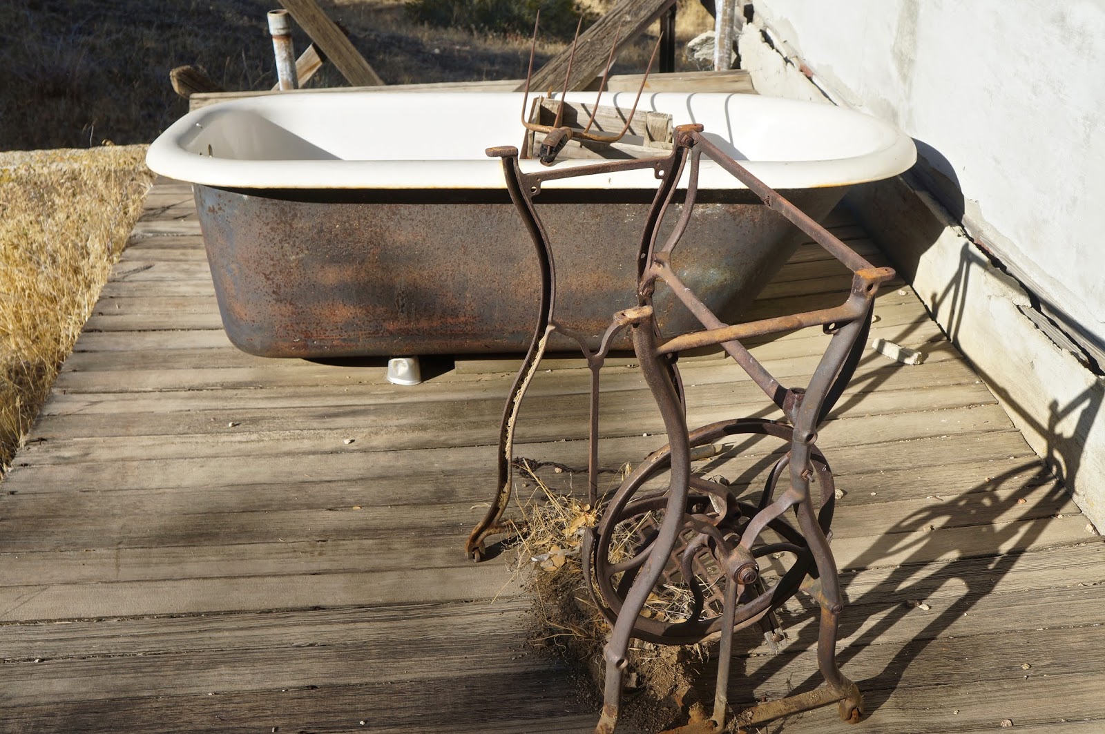
An old tub and a stand for a push-pedal sewing machine.

The house was a simple affair, one small bedroom, a tiny living space, a kitchen and a cramped bathroom. The whole house was strewn with the mouse tattered remains of a life long abandoned. Ancient publications, old spice jars, box springs, busted furniture, a pot belly wood burner, can openers, coffee cans, rat poison... I could go on and on. The old wood burning stove had been modified in an ungainly MacGyverism so that it used propane. Half-assed electrical work dangled from the ceilings. A 1960s fridge tilted into a corner. Mouse droppings everywhere. I stepped outside to an adjacent cold storage, cut into the hillside just behind the house. In this space were numerous intact jars of visibly recognizable foodstuffs, preserved by hand. Home-canned cauliflower, beans, carrots, fruit, etc..., still recognizable through the dust of ages. 

Having looked all over the place I concluded that the last time anybody had actually resided here had been right around 1970.


This is the stove that had been converted to LP. See the gas line running just in front of the burner top.
[Lorinda has informed me that this gas conversion was a new phenomena in stove tops beginning in the late 1920's]


What this old contraption could be was beyond me. (Lorinda informed me it is a road grader)


I had passed an old iron sign as I walked up to the house, and during the whole time I'd been poking around this sign had been tickling the back of my brain because I knew nothing about any "hiking trail" out of this canyon other than the route I took to get there. Such a route was not to be found on current topo maps. But this sign was firmly sunk in the ground in the opposite direction I'd approached from. Hmmm. The trail beyond the sign headed up canyon in the direction I wanted to go, and looked at first glance like a real phenomena. What the hell... I gave it a go, and was quite pleased with the result, for a while at least.


So my new exit trail meandered into the forest, headed straight up the floor of a narrowing Black Bob Canyon. The first "plus" was that I was climbing the canyon under a canopy of old oaks, and the shade was much appreciated. The second "plus" was that this hike out was kinda pretty. I'd been enjoying myself for quite a while when the track suddenly broke out of the forest and threaded through a small vale of chokecherry, the berries ripe on thorny vines. Minutes later the track to an abrupt right hand turn and started clawing a direct line up the western ridge of Black Bob. This climb was a haul, gnar, 2,000ft in less than 2 miles. I trudged up from the canyon floor, exchanging oaks for pines, and popped out on the forest road just a short 3rd of a mile from where I'd parked.

This had been an interesting little day. There is essentially zero information on-line about the who/what/and when of this mine, though it sure made for a remote excursion.


Chokecherry meadow.
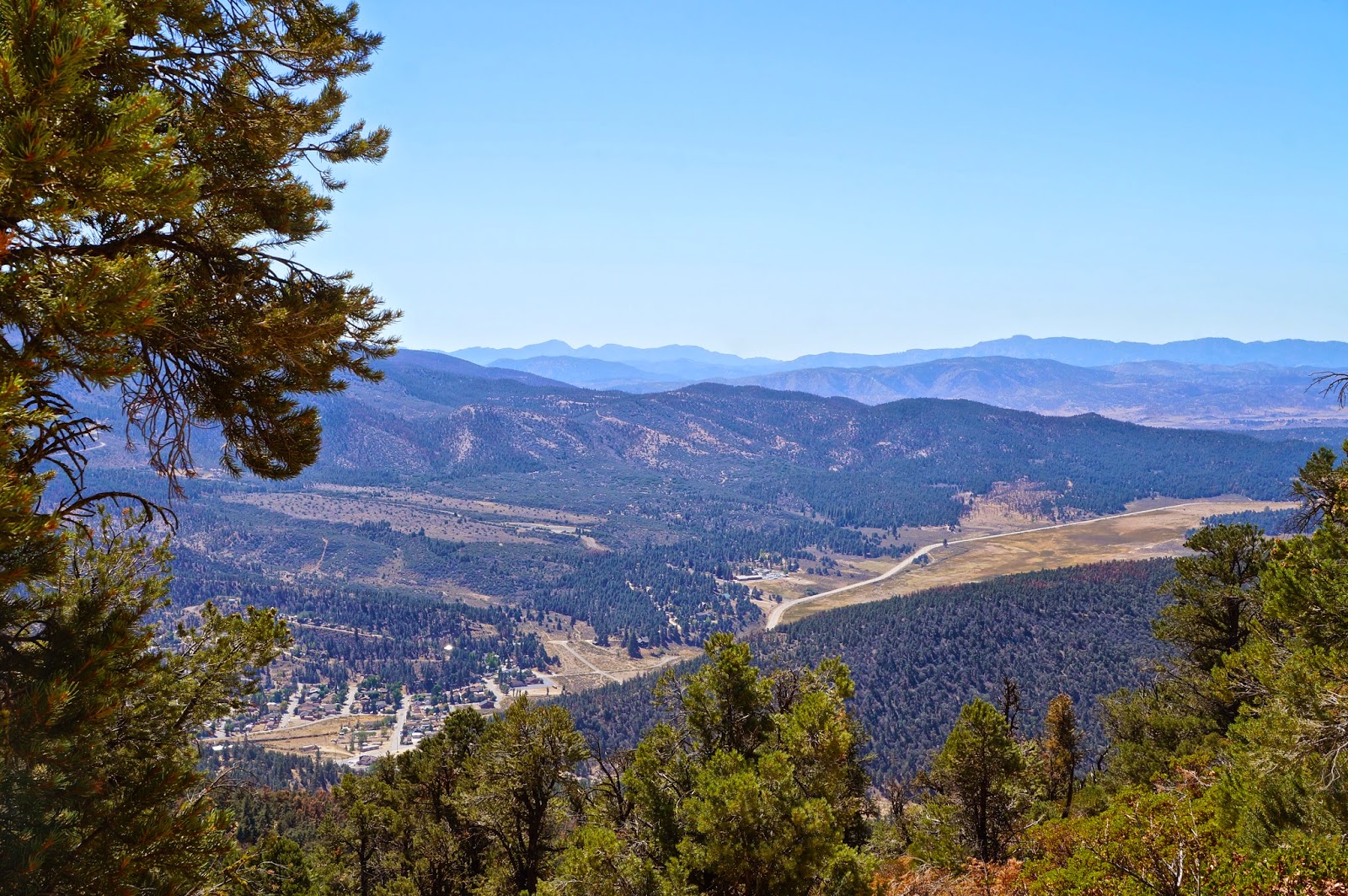
Cuddy Valley from Tecuya Mtn Rd.


Monday, June 16, 2014

Antimony Peak, Eagle Rest Peak

Antimony Peak
It's been a bit since I've been in a position to throw a couple "local" peaks at you. Here's the antidote, Antimony Peak and Eagle Rest. With names like these they'd both made my to-do list, and they'd sat there for a bit too long. I've been a bit busy with life stuff, like a 3-room house expansion which is now well under way. As a consequence of all the ruckus I've felt myself getting soft, weak, a shining example of American sloth. I needed to arrest the slide. I teemed with Jack Elliott for this one.

These two summits can be found in the San Emigdio Range just north of Mt Pinos. They are connected by a forested ridge which descends a fairly respectable unsanctioned trail. This day is deceptively tough for a number of reasons. The trailhead to Antimony starts high, and on exiting the truck at the trailhead I was immediately struck by the understanding that everything in this neighborhood is big, big and steep. As I've noted before, sometimes it's not the number of miles but what's in them that matters.

A detail of the day's work. The elevation profile is below.

Departing the Antimony trailhead we rapidly descended a densely forested ridge. In a couple places the forest parted and the bleached white face of the peak gleamed brightly in the rising sun. At the bottom of the base of Antimony we settled in for a pretty darn steep 900ft climb to the summit. The trail didn't waste any time going up, zig-zagging toward the sky. We soon topped out on a small flat, kind of a saddle, and a thin use trail headed up hill a short hop to the summit. Much of the view from the top is obscured by pine trees, but to the south a view of the Mt Pinos ridge is on full display. Back at the saddle we had a great view of Eagle Rest Peak.

The summit on Antimony, and the view south toward Mt Pinos, which can be seen in the distance.
Looking northeast from Antimony.
The Antimony Peak register.
Eagle Rest, from the saddle under Antimony.
Taking off from Antimony we descended a very steep trail through the forest. When I say "steep" I mean that this part of the morning descended more than 1,300ft in less than a mile. By the time we reached the bottom of this stretch we'd passed through the pines and into the scrub oak and juniper zone. Both of us stood there at the bottom for a minute, both of us commenting on quivering quads and expressing gratitude that we had no intention of going back the way we'd come. We switched gears and climbed 500ft up a brushy knob before descending another thousand feet to a saddle directly beneath Eagle Rest. I have to say, getting to Eagle Rest and returning by the same route seems like a recipe for suffering. 

Looking west into San Emigdio Canyon from beneath Eagle Rest.
Looking east toward the Plieto Hills and the Wind Wolves Preserve.
And finally, looking straight up Eagle Rest.
From the saddle we faced another murderous little climb, this one ascending a bit over 1,000ft in just a half mile. That doesn't leave a lot of room for switchbacks. Essentially, this thing just goes straight up to the summit. It's a sporty little thing, a little steep, a little loose, some high stepping through the rock bands up high. This climb got my heart taching right along. We knocked it out quickly and were soon standing amongst a collection of weathered boulders which crown the summit. I was awash in sweat and after dropping pack I turned my back to the cooling breeze. Moments later I clambered to the top of the tallest summit rock and was greeted by a remarkable view. Much of the horizon was dominated by the vast expanse of the Central Valley. Looking northwest I could make out Maricopa and Taft, and could even see the glimmer of Soda Lake on the Carrizo. Somewhere northeast, snuffed by agricultural haze, lay Bakersfield. Just a few shadows above the haze represented the Tehachapi Mountains. Looking south I was reminded once again that no matter what our exit route might hold in store, at least we weren't going back up to Antimony. 

Looking east toward the Plieto Hills and the Tehachapis.
Jack, on the summit of Eagle Rest.
A view down lower San Emidio Canyon toward Maricopa, Taft, and the Carrizo. 

Done with the summit we descended a couple hundred feet off the peak and departed the trail, heading down a northwest ridge coming off the peak. The idea was to descend this all the way into San Emigdio Canyon, a drop of over 2,500ft. We found indications of a use trail, seldom traveled and somewhat overgrown, that traversed the edge of this steep and slender ridge. We committed to the trail and it took us all the way down, though the going wasn't always easy.

Looking back up toward Eagle Rest from the descent ridge.
Lower San Emigdio Canyon, aka the Devils Kitchen.
Our route out and up to Pine Mountain Club, San Emigdio Canyon.
Eagle rest from a few feet above the canyon.
Once more my quads were sparking with complaint at the steep descent, but here we were at the bottom of it all with just 4.5 miles of hot, brushy canyon to go. We set off immediately and without preamble. After fighting through about a mile of chest high chamissa we heard water in the creek to our right. We broke right and took a good cool down on a shaded gravel bench next to a happy little creek. After another couple miles of arduous and brushy creek bed navigating we hit an old trail which climbed us the rest of the way out. Good day, tough but enjoyable. Recommended. 


Gratuitous old guy selfie. 

Tuesday, May 21, 2013

Tumamait Trail, 05/18/13

Ever kick yourself for not having been somewhere? That's how I felt while walking the vista-licious Tumamait Trail last weekend. This route connects Mt Abel/Cerro Noroeste with Mt Pinos and offers brief side excursions to the summits of Sawmill Mountain and Grouse Mountain. A nice high walk in the pines, what could be better?
Lockwood Valley at sunrise
Since this is a ridge walk, there are two directions which this trail can be done from: Mt Pinos Rec Area east to west, or from Mt Abel east toward Pinos and back (leaving a car at both ends would be a significant hassle). Since I was planning on spending the night at the beautiful Campo Alto atop Abel/C. Noroeste (Mt Abel is the old name for this mountain. The name was changed to Cerro Noroeste ({northeast mountain}), I figured I'd do the route from Abel and return the same way. This was a good call as I prefer to get as much uphill out of the way at the beginning of the day as possible, and there's a good bit more of the steep stuff on the way to Pinos than there is on the return trip. This ridge is about the southern most remnant of the Sierras and the flora and geology are very reminiscent of the Edison Lakes, Bass Lake, and many other parts of the Southern Sierra. Pretty country. 

Tumamait Trail
From the Abel side of things the trail is accessed from a trailhead around half a mile back down the road from the mountain top environs of Campo Alto. I dropped in at sunrise and descended through the cedars and Jeffrey Pine. It was pretty cold and windy already, with a 10-15mph breeze blowing out of the north. The trail bottomed out at Puerto Suelo and started climbing a burly track up the west side of Grouse Mountain through increasingly dense and rugged pine forest. So far I was loving this trail, where it went and how it got there. 

I figured on just walking all the way to the summit of Pinos and hitting the side dishes on the way back. The sporty little climb up Grouse ceded to a rolling, pine crusted ridge. As far as the forest scenery goes, the best of it lies in this Grouse Mtn neighborhood. I blew by the well marked take-off (cairn) for the summit of Grouse, continued downhill for a bit and started up the gentle climb to Sawmill.

Sawmill Mtn from Mt Pinos
I rolled past the junction for the Sawmill summit (also obvious) and started a long and steep downhill off the peak's east side. A last gentle climb put me over the top of Pinos. I walked over to the communication tower where two USGS markers can be found. After that I headed back to the "wildlife viewing area" where I hunkered out of the wind for a few minutes before turning back the way I'd come. The summit of Pinos is sparsely forested and the views are expansive. It took two hours to do the 4.5 miles from Abel to Pinos, after which I stopped paying any attention to the clock. Total mileage on the day for this round trip route comes to around 11 miles.


San Emigdio Peak (originally mis-ID'd as Tecuya) and Pine Mountain Club from Sawmill
I reversed my route down Pinos, climbed back up the short grind to the take off for Sawmill, and proceeded over to the summit which is only about five minutes off the Tumamait Trail. The novelty of this summit's decor sets it apart from all other SLP peaks, the main feature being a tall summit cairn very reminiscent of the Buddhist prayer cairn at the Everest Base Camp. Tibetan prayer flags catch the wind and carry prayers away, strands of the flags draped from the cardinal points. This cairn and the prayer flags kind of touched me. I completely understood the impulse behind its creation. Some of you may know that I'm a true blue atheist but I am also a long time devotee of Buddhist philosophy. Harmony and acceptance are hard states to achieve, but places like this summit are gateways to higher thought and this cairn is an expression of non-deified spirituality.  

Sawmill Mountain 8,518'
I spent at least an hour sitting by myself in the lee side of the cairn. This is a good place. I emptied my mind of all but the sound of the wind in the trees and the manic flapping of the prayer flags. It became a peaceful, restorative hour. Everybody needs something. I found mine that sunny morning on Sawmill. Guess I'm easy to please. I really liked the energy of this place. Some time later I reluctantly left Sawmill, catching the beautiful forest trail back toward Grouse.
Sawmill Mountain summit cairn


Grouse Mountain summit cairn
The short climb up Grouse is a trip through pristine forest. Huge old pines dot the hillside and the needles are inches thick. The use trail to the top is pretty easy to follow, short and scenic. The top of Grouse is very forested and the views are somewhat limited. Grouse Mtn's real treat lies in the getting there. this is a very pretty little slice of forest. The top is graced by a small rock pile and a register can be found at the base. After a break on Grouse  I headed back to the main trail and continued out to Mt Abel where I was spending the night. I liked everything about this trail.

Grouse Mountain 8,582'
A few words of advice to those interested in doing this dayhike. The average elevation of this route is about 8,500 feet, so if you're driving up from sea level it's likely that you'll notice the altitude. Another thing to keep in mind is that there's probably a 30 degree temperature differential between Frazier Park and the top of Pinos, so just understand that even in summer it can get cold up here. And I already mentioned that I personally think the best way to enjoy this route is to start at Abel.


Coms tower, Mt Abel

Campo Alto on Cerro Noroeste
The other part of the day I wanted to mention has to do with sunsets. More specifically, the best place to watch one. Sunset Point at Campo Alto has got to be one of the best places to catch the last light of day. From anywhere in the campground just wander west to that end of the mountain. There you'll see a huge pine with an equally huge branch coming off it's left side. Beyond the tree is a small grassy meadow, a beautiful place to plant your butt for the show.
Approaching Sunset Point
Sunset view due west toward Santa Maria and the Pacific.
Many more photos from this weekend at Flickr.
The end.