

The day before Thanksgiving I went back to Ojai and had a second go at the Sisar Rd>Hines Peak>Topa Topa Peak>Sisar Rd loop. Last week's attempt was called on account of the weather, but this day was ideal and I was feelin' mustard.
Below: the end of Nordoff Ridge Rd., entry to the wilderness.

As you can see, it was cold: 32F@07;30, 33F@11:00, 38F@12:15, 35F@14:00. Cold yes, but the dire warnings of high winds in the mountains and passes never materialized, and not that I was under-prepared, but I'm not a big fan of wind, so I was very pleased that I wasn't getting blasted by freezer air the whole day.

I decided that, unlike the last time I did this hike, I would take a more moderate approach to this hideous trek. In other words, I took more breaks on the ascent. Last time I was feeling pretty worked for several days post-slog. Not this time. By adding on 45 minutes to my prior time of 8.5 hours I was able to get back to the truck in pretty good shape. No delirium, no nausea, and with considerably more energy than on my prior go.
FYI, some years ago I gave the Topa Topa trail the name "Suffer Machine". I had time to think it over and have decided to call this Hines/Topa loop "The Unrelenting Bitch".

I encountered snow early, about half-way between White Ledge and the ridge road. By the end of the day I estimated that I had spent at least 50% of it trudging through the stuff. Snow is good for tracks and I saw a whole range of them: coyote, weasel, rodents, deer, birds. The critter tracks gave me a good idea of the amount of wildlife in the neighborhood, most of which one never actually sees.
Below: the approach to Hines Peak


Above: I secretly hope my sticker genuinely confuses someone
Below: looking southwest toward Topa Topa Peak

Below: The summit ridge up Hines, usually 2nd Class, but not this day!

I reached the Hines Peak/Lady Bug Trail junction at around 11:30 and after refueling went after it. In my mind I was already behind schedule and only half way through the day. Also, some rather dark clouds had started building up on Topa Topa just a couple miles away, which can be a cause for concern. I kept a close eye on those clouds as I ascended the summit of Hines and after a while I realized that the clouds weren't really doing anything I needed to worry about, so I just concentrated on what was in front of me.

Like I mentioned, what route exists up the west ridge of Hines usually feels like a tough scramble. Not so today. I spent a good amount of time kicking steps upward. A few spots, even if just for a few moves, were fairly dicey. In other words, not a great place to fall. Once in a while, when I'm on uncertain terrain with an elevated degree of danger, the voice of my guardian angel will pipe in with a friendly warning. It is the voice of veteran actor Sir Michael Caine. He says to me, in his calm and deliberate voice, "Now, mate. Don't muck this up.". Words to live by when kicking steps up 45 degree snow in trail-runners, with a long slide to the rocks if you choke.

Above: Hines Peak Summit
Below: Hines Peak, 6,704 feet

I arrived on the summit of Hines at 12:15, took a few pictures, checked on the ominous clouds over Topa (no real threat), adjusted a couple of things, and started down. The descent was a bit easier than the up because I had already done the hard work kicking steps. I raced down the peak, picked up the trail, and enjoyed walking in the sun before entering the shadow of the aforementioned clouds. It took exactly 1:30 hours to reach the next summit on this torture loop, Topa Topa Peak.


Above: dead manzanita on Hines
Below: dead manzanita under Hines

Below: Tracks of animals, myself included.

That final trudge up the north side of Topa was the last significant uphill for the day, which suited me fine. The summit of Topa was cold, dark, and icy, which was not fine, which explains why I spent even less time on top than I did on Hines. I signed the book for the 20-somethingth time, fired off a text to Ruth, shot the pics below, and turned my sights on getting back to the truck.

Above: Topa Topa summit bivy, Hines Peak in the background
Below: rather chilly on Topa's summit

I have noticed, numerous times, the phenomena of a stray cloud bank just seeming to find it's way to Topa Topa. They have the entire atmosphere to explore but some clouds just want to smash up against Topa's Bluffs, where they park for the afternoon. This usually creates some great light shows as the afternoon progresses. Today was one of those days.
Below: The view north toward Pine & Reyes Peaks

Below: God-rays over Upper-Ojai
Like I said, I made it back to the truck in one piece and better. Make no mistake, this is a hard hike. It's just about at the limit of what I'm willing to put myself through for a day-trip. As a comparison, consider that a marathon is 23.6 miles over generally flat terrain. Here's the stats on this hike:
- Miles: around 22
- Elevation gained over the course of the day: over 6,000 feet
- Number of steps: don't ask
- Calories burned: would be interesting to know
- Advil consumed: 1,000 mgs
- Start time & elevation: 07:30, 1,700 feet
- Max elevation: 6,704 feet
- Total time for the day: 9:15 hours


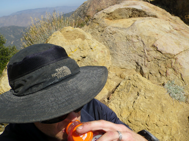


 Must start 2011 with a bang. My sick mind devises a linkage of peaks which, perhaps has been done, but I've never heard of it. This route starts in the dark at the Sisar Road trailhead and ends in the dark at Thatcher School, between which, I will ascend Hines Peak, Topa Topa Peak, and Chief Peak. These peaks are all very familiar to me and to the blog, but lately I have been thinking about high mileage linkages and it occurred to me that these three peaks could be put together as a 28 mile one-day walk with 7,000 feet of ascent for a little spice. Crazy right? Yesterday I did it.
 The day started at 03:00 when I woke up and couldn't go back to sleep. So I got up and hydrated. Drank a bunch of coffee too, of course. A bit after 04:00 I left the house and drove up to Thatcher School in Ojai. My good friend Cliff Griffiths is an early riser and he agreed to meet me at Thatcher and give me a ride into Upper Ojai and all the way up to the Sisar Rd trailhead. Thanks again, Cliff! As we bounced up Sisar in his pick-up we got a sign that this would be a great day. A pair of handsome juvenile foxes crossed the road in the glare of the headlights. Cliff went on to Tar Creek that day and I started what I'm now calling The Triple Crown.
 I started in pitch black, walking through an eerie wood, the cold breeze creating a multitude of small noises. Little things stirred outside the cone of light from my lamp. It was chilly and I moved quickly. I made good time as the sun rose. I stopped only briefly at White Ledge before moving ever upward to the bench on the ridge. Here I stashed some hi-tech muscle recovery drinks. My plan was to pick them up on the return trip toward Chief Pk.
 I continued east up the fire road to the saddle and started strolling toward Hines, the plan being to knock out the toughest and the tallest peak first. After a break at the Ladybug junction I made short work of the climb up Hines, which was mostly free of snow. I did the usual summit thing: pictures, logs, texts and such while taking in the incredible panorama on this extraordinary January day. The descent was uneventful and I was on my way to Topa Topa.


 I trudged through the endless miles of ridge road until at last I was at the ugly base of Chief Peak. It's pointy summit protrudes into the fading sky. It tries to look bigger and tougher than it really is. Chief peak is a fraud, it ain't hard. It's just one step after another like this whole damn day has been. My mind is in control. I climb the peak, sit on it's summit, breath it's air. 7 miles to go.

 With a bright light over my left shoulder I decided to walk the remaining 3 miles to the truck without using my headlamp. It was just too fine an evening to use artificial light, even in the darkest forest bottoms. I walked quietly to the accompaniment of frogs and crickets and even negotiated Horn Canyon's 4 creek crossings without difficulty, which considering my proclivity for falling in moving water is surprising. This was a really nice night walk.
 Well, I done it! Here's the time-line:

 The day before Thanksgiving I went back to Ojai and had a second go at the Sisar Rd>Hines Peak>Topa Topa Peak>Sisar Rd loop. Last week's attempt was called on account of the weather, but this day was ideal and I was feelin' mustard.
 As you can see, it was cold: 32F@07;30, 33F@11:00, 38F@12:15, 35F@14:00. Cold yes, but the dire warnings of high winds in the mountains and passes never materialized, and not that I was under-prepared, but I'm not a big fan of wind, so I was very pleased that I wasn't getting blasted by freezer air the whole day.
 I decided that, unlike the last time I did this hike, I would take a more moderate approach to this hideous trek. In other words, I took more breaks on the ascent. Last time I was feeling pretty worked for several days post-slog. Not this time. By adding on 45 minutes to my prior time of 8.5 hours I was able to get back to the truck in pretty good shape. No delirium, no nausea, and with considerably more energy than on my prior go.
 I encountered snow early, about half-way between White Ledge and the ridge road. By the end of the day I estimated that I had spent at least 50% of it trudging through the stuff. Snow is good for tracks and I saw a whole range of them: coyote, weasel, rodents, deer, birds. The critter tracks gave me a good idea of the amount of wildlife in the neighborhood, most of which one never actually sees.
 Above: I secretly hope my sticker genuinely confuses someone
 I reached the Hines Peak/Lady Bug Trail junction at around 11:30 and after refueling went after it. In my mind I was already behind schedule and only half way through the day. Also, some rather dark clouds had started building up on Topa Topa just a couple miles away, which can be a cause for concern. I kept a close eye on those clouds as I ascended the summit of Hines and after a while I realized that the clouds weren't really doing anything I needed to worry about, so I just concentrated on what was in front of me.
 Like I mentioned, what route exists up the west ridge of Hines usually feels like a tough scramble. Not so today. I spent a good amount of time kicking steps upward. A few spots, even if just for a few moves, were fairly dicey. In other words, not a great place to fall. Once in a while, when I'm on uncertain terrain with an elevated degree of danger, the voice of my guardian angel will pipe in with a friendly warning. It is the voice of veteran actor Sir Michael Caine. He says to me, in his calm and deliberate voice, "Now, mate. Don't muck this up.". Words to live by when kicking steps up 45 degree snow in trail-runners, with a long slide to the rocks if you choke.
 Above: Hines Peak Summit
 I arrived on the summit of Hines at 12:15, took a few pictures, checked on the ominous clouds over Topa (no real threat), adjusted a couple of things, and started down. The descent was a bit easier than the up because I had already done the hard work kicking steps. I raced down the peak, picked up the trail, and enjoyed walking in the sun before entering the shadow of the aforementioned clouds. It took exactly 1:30 hours to reach the next summit on this torture loop, Topa Topa Peak.


 Below: Tracks of animals, myself included.
 That final trudge up the north side of Topa was the last significant uphill for the day, which suited me fine. The summit of Topa was cold, dark, and icy, which was not fine, which explains why I spent even less time on top than I did on Hines. I signed the book for the 20-somethingth time, fired off a text to Ruth, shot the pics below, and turned my sights on getting back to the truck.
 Above: Topa Topa summit bivy, Hines Peak in the background
 I have noticed, numerous times, the phenomena of a stray cloud bank just seeming to find it's way to Topa Topa. They have the entire atmosphere to explore but some clouds just want to smash up against Topa's Bluffs, where they park for the afternoon. This usually creates some great light shows as the afternoon progresses. Today was one of those days.
 Below: God-rays over Upper-Ojai
 Below: Afternoon light on the bluffs


