Showing posts with label Tar Creek. Show all posts

Tuesday, December 10, 2013

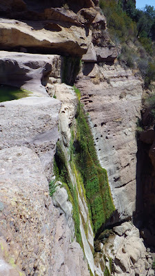
Tar Creek: Closing Soon

"None shall pass."

On December 6th I received this email from a representative of the US Forest Service Los Padres:


The Ojai Ranger District proposes to install two steel signs, closed parking area signs, and a wooden informational kiosk above Fillmore, CA.  The signs inform the public of the closed parking areas and the Sespe Condor Sanctuary (Tar Creek Falls area) is closed to public entry.  The wooden information kiosk provides current public information and flyers.  The signs will be located beyond Goodenough Road on Dough Flat Road (FS Road 6N16) at milepost 0.25 and at milepost 4.8 (the unauthorized trailhead parking).  Boundary signs will be posted along the road for enforcement. (See attachment and http://goo.gl/maps/ZrXmV)
The Sespe Condor Sanctuary (Sanctuary) within the Sespe Wilderness has been closed to public entry since November 1947 (1952 USDA, Management Plan for Sespe Wildlife Area).  Since its establishment, the Sanctuary is known to most people as a protected area for the propagation and growth of the California condor.  Listed on official agency websites as ‘closed to public access’, most other websites promote unauthorized access to the Sanctuary, specifically the Tar Creek Falls area.  The illegal access has escalated since 2008 and continues.  There is a high incidence of unauthorized access into the Sespe Condor Sanctuary via the Tar Creek Falls access trail.  Since November 2012, the Forest Service Law Enforcement Officers have documented over 100 people a day entering this location on weekends.  Weekly, people are leaving 100-150 lbs. of trash along the trail and Tar Creek Falls area.  Microtrash is scattered in the parking areas.  Bonfires and nighttime illegal activities conflict with Forest regulations.  The human presence and the unauthorized recreation activities create stressors and impacts to the California condor and its habitat, listed as a federally endangered species in 1967.  Condors are known to roost and utilize the Tar Creek Falls area, which is protected critical habitat.  Active nest sites exist in the vicinity of the falls.  Under the 2005 Los Padres NF Land Management Plan (Forest Plan) to avoid disturbance to breeding and roosting California condors, no activities or human uses are authorized within 1.5 miles of nesting sites and 0.5 miles of active roosts (Forest Plan, Part 3, p. 8, Standard 28).
Forest Service staff, cooperators, and volunteers will educate the public about the history and closure of the Sespe Condor Sanctuary.  Public outreach and education includes a press release, handing out flyers, making public contacts before enforcement fines are initiated.  Communicating detailed Sanctuary closure and information through social media and websites is necessary.


If you have any comments, please email, call, or stop by before Dec. 31st.  After reviewing and incorporating public input, we will begin the New Year with a project to protect California condor habitat.  Many residents and volunteers have spent countless hours picking up trash at the Tar Creek Falls area after busy public weekends.  Those efforts are greatly appreciated and recognized.  The Forest Service endeavors to harness that stewardship to keep the area clean.  If you are interested in assisting with public outreach for the project, please let me know.

Irvin Fox-Fernandez
Resource Officer
Ojai Ranger District, Los Padres National Forest
1190 E. Ojai Avenue
Ojai, CA 93023
Office: (805) 646-4348, ext. 312
Fax: (805) 646-0484


I have warned for quite a while of impending access restrictions at Tar Creek. I first visited the canyon in 1994 and have been down there well over 100 times. Over the years I have bemoaned the persistent and accelerating destruction of the habitat in the canyon. In recent years the pace of visitation and the resultant impact (trash, graffiti, etc...) has gotten completely out of control. I have hauled out a tremendous amount of trash over the years, collected at least 1,000 brash shell casings, and yes, it's been me who has repeatedly chopped the climbing bolts in the canyon and hauled out rope, hardware and webbing. One summer I observed two guys repeatedly riding down to the canyon on highly maneuverable 125cc motorcycles, and the third time I encountered their bikes at the bottom of the trail I had come armed with a crescent wrench. I took their front wheel lugs and left those lugs on a rock at the parking area above. I have not seen the motorcycles since.

After the advent of YouTube I noticed an uptick in visitation and determined that keywords such as "waterfall jumping" had contributed to the increasing traffic (I have never used that keyword in relation to Tar). And then Tar Creek was included in a second or third edition of "Day Hikes of Ventura County", and since that time the place has become like a Disneyland for disrespectful tourists. I do take a degree of responsibility for the increased exposure to the place but have always strived to represent in photos and in words a feeling of respect and awe for Tar Creek and the habitat contained therein.

I have replied to the USFS with my own opinion on this matter which is that I am 100% on board with denying access to Tar Creek. I have taken the view that this a place far better left to the birds. I have been invited to participate in the process of public outreach regarding the impending closure and look forward to being involved.

To end this post I'd like to share some photos never seen before on this blog. These shots were taken by me and David Rivas Jr on 02/24/2008 when Tar Creek was in flood. It was a dangerous and exhilarating day. Enjoy. Also, just to relive what we'll all be missing you may want to visit a video tribute I did: Tar Creek Vimeo


Friday, November 22, 2013

Tar Creek 11/22/13

12/10/13: The US Forest Service will be enforcing access restrictions to Tar Creek soon. TC is part of the Condor Sanctuary established as critical habitat to this endangered bird and other wildlife. Epic numbers of visitors, and the trash and graffiti they have left behind, has led to the acknowledgment by the Forest Service that access must be curtailed and enforced. For more information on the impending action visit: Tar Creek Closure.

On this cold and blustery day I was joined by Chris Ferrier, he of the condor's wingspan and giant's stride. We enjoyed a simple day of exercise and conversation, with topics ranging from layman's astrophysics to the rise and fall of civilizations. Tar may not be much of a creek right now but I never lose my fascination with that canyon. We came armed with trash bags but found to my great delight that some person(s) had already been through, clearing 98% the summer's litter away. A huge tip of my hat goes to them. They have my gratitude. 


Tuesday, May 28, 2013

I cannot believe how many people I just saw at Tar Creek 05/27/13

12/10/13: The US Forest Service will be enforcing access restrictions to Tar Creek soon. TC is part of the Condor Sanctuary established as critical habitat to this endangered bird and other wildlife. Epic numbers of visitors, and the trash and graffiti they have left behind, has led to the acknowledgment by the Forest Service that access must be curtailed and enforced. For more information on the impending action visit: Tar Creek Closure.

Monday. May 29. Memorial Day, in the year of someone's Lord, 2013. 
Ruth and I needed sun and water and exercise. She picked Tar Creek. I hmmmed on that for a bit and made it clear that there would be at least a few dozen people in the canyon. We went anyway (this is kind of like Steven Wright's classic one liner, "My wife and I tried a new restaurant, we had reservations but we went anyway.") and boy, was I wrong! Way wrong.
Extra. Wrong.
How about well over 100 people! In that little place! 
So I'm starting this post with nice happy pictures before getting to the unchecked masses.
As for Tar, I've never seen it this dry before July, but it isn't even June yet. Essentially, Tar has no flow. And after this weekend I'm not sure anybody'd want to swim in it anyway.

I spooked this boy back into the trees before some jerk came along and threw a rock at him.

This photo is undoctored. That is the actual nuclear waste green going on at Tar this week.
The bottom falls has become a vertical flower garden.


There are 52 people and 1 dog in this picture.
There are 31 people in this shot.
30 in this shot.
31 vehicles in just this shot. 


Thursday, November 29, 2012

Sulfer Peak [SVS], 11/28/12


Alright, now here's a peak that I hadn't done. I'd looked at it a million or so times but hadn't gotten around to ticking it off the list. Sulfer Peak sits squarely above Tar Creek and is accessed via the old Tar Creek Trail which continues down to the Sespe. This was a really cool peak. A great climb culminating in one of the best "view summits" in our neighborhood. This is an adventurous climb, not too big on mileage, but mean enough to make up for that. This peak is, in hiker parlance, a "Seldom Visited Site", or in this case "Seldom Visited Summit" (SVS). The most recent signature in the summit register was dated 05/2009.
The weather forcast had improved a bit and the latest rainy system wasn't scheduled to hit SoCal until the afternoon. I figured I could get in and out before the rain hit. I got an uncharacteristically late start, began walking from the Tar Creek TH at 0645. I jogged down to the creek and continued across to pick up the trail on the other side. This portion of the route climbs out of the creek and heads roughly north before heading west across the foot of Sulfer Peak. This trail is in pretty good shape, though some portions are a bit brushy and there are a few washed out parts. If you find this part of the day to be brushy and unpleasant then maybe Sulfer Peak isn't your cup of tea.

Left to Right: Bear Haven, sun on Topatopa Peak and Devil's Heart, and Sulfer Peak on the far right.

Bear Haven and the West Fork Sespe.


I banged out a quick couple miles under Sulfer and I was soon beneath the largest and longest ridge descending from the summit. I jumped off the trail and started heading up. Here's where the day gets interesting. There is no trail up this peak. I can say this with authority. On my ascent I found several trail ducks but these didn't correlate to anything I'd call trail, historic or otherwise, so how about a nice big serving of brush, rocks, and charred manzanita? The ridge climbs for roughly 2 miles, gaining around 2,200ft of elevation. It's not a nice climb, but it is entertaining. 


I hung a right and started uphill shortly after passing this culvert and that rock.


Looking back down the "Brush Buffet" toward Tar Creek.


Ridge to the summit, which is visible way in the distance.

The first mile or so ascending from the old Tar Creek Trail is 100% brush busting. No bueno. Fortunately I have experienced the absolute worst the the SLP can dish up so I wasn't unduly impressed by the brush. It's brush. It's in my way. Figure it out. As I climbed this ridge it became rockier in areas and I was able to connect a series of rock slabs together. Ascending these slabs is easy and direct, sure there's stands of brush to bust through but on the whole I'd say that the middle third is the easiest portion of the summit run (if you can get onto the rocks). These slabs are on the eastern side of the main ridge to the summit and are clearly visible on Google Earth imagry.  

Find the rock slabs through the middle of the summit slog. It'll help considerably.


Easy street. Find the slabs.
Eventually the rocky slabs of purple sandstone terminate and it's back to brush munching. The last several hundred yards to the summit are pretty tough, very brushy and extra unpleasant. In fact, I'd say the whole thing, starting from the trail below, is pretty burly. Those of you who have a good sense of what I define as "burly" will understand. Nothing for free. It was a good fight.


Summit.


I achieved the summit in 2hours:58minutes from the truck. This is an open and rocky summit, perfect for taking in grand views of Topa, Hines, Cobblestone and Whiteacre peaks. I was a bit surprised to find a small cairn at the high point. Inside the cairn was a summit register with a handfull of scribblings dating to 2004. Like I said, not many folks have come this way. I really enjoyed this summit, the whole day really. Tough Peak. Good stuff. After a 40minute summit sojourn it was time to turn it around, especially if I didn't want to get rained on. 
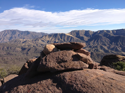
The summit cairn with Whiteacre Peak immediately behind it.


Topatopa Peak from the west, if you enlarge the picture you can see a hint of the old fire tower on the summit.

I started down, reversing the path that took me here. My recomendation for those who might want to do this peak is to bring a GPS and keep the track open all the way up and down. Getting off route on the descent can put you on the wrong arm of the mountain or even worse, in a drainage. Use care on the descent and it will save you from ending up in a true briar patch. If all else fails, below is a white sandstone slab that drains into Tar Creek. This feature is visible from almost anywhere with a view on the south side of Sulfer Peak. Before getting there the trail back to Tar will be visible. It's all about how much abuse you incur in the process of getting down, a little or a lot.

When descending, aim for this prominent drainage which flows into Tar. The route back to Tar Creek can be seen on the left.

This peak is a great hike, probably not everybody's idea of fun but I certainly thought so. If you're looking for an amazing perspective of the Sespe backcountry I have to say that this summit should scratch that itch. I had a really good time up there. And I felt the first sprinkles and eventual rain as I crossed Tar Creek and headed back up to the truck. I got real dirty, ate some brush, garnered a new collection of scratches, and had a stellar day.


Sulfer Peak boasts some of the most dramatic views of our local backcountry.

Tuesday, October 16, 2012

Sespe Connect Stage III, Piedra Blanca to Fillmore. 10/13-14/12

The dreaded "Alpine Start". Walking at 04:00.
Back to work and back in the drink. It's time for another installment of the Sespe Connect {Sespe Connect is a project that Jack Elliott and I have teamed for, the aim being to walk the entire length of the Sespe watershed}. Time to knock off the big stretch, the 32+ miles separating Piedra Blanca and Fillmore.This stage traverses the real Sespe backcountry and 19 of those 32 miles we spent hop-scotching the creekbed. We had both been looking forward to this most remote and native portion of this 65 mile river system. In the end, we flashed through the thing in just 49 hours.

To see Stages I and II trip reports:

Click on any image to enlarge.

Ruth dropped me and Jack at the PB trailhead at 03:50 and we were strapped in and got going at exactly 04:00. It was a double dark morning with no moon to speak of. Just the stars overhead and the long tunnel of light from the headlamp. We soon hit our stride and the miles started falling away as we hiked toward the east. Unlike any of our work on this project, this early portion of Stage III sticks to a trail, the Sespe River Highway (Trail), and we made the most of the early hour and easy terrain.


Not quite sunrise.


Sespe/Ladybug Junction.
Soon the sun was on the way up and we were able to stow the headlamps and pick up the pace even a bit more. We just flew down that trail. We passed through Willet Camp/Willet Hot Springs (9miles from TH) at 08:15, and continued on for a bit before taking the first real break of the day. We sat in the sun and had a bit of breakfast before continuing eastward. 

Our plan had never been to do anything other than our stated goal, so skipping on past the hot springs at Willet didn't cost us. Of course this means that I still have never visited these hot springs, but if they are like others in the SLP, (sulfery, algae filled, muddy and buggy, too hot or too cold) then I can take a pass (as in all things, I prefer the Sierra). Besides, we had places to be, things to do. Onward to Coltrell Flat and our departure from the Sespe River Trail.

Passing through Willet, which lies on the north side of the creek.
Coltrell Flat.
After a half hour Jack and I saddled up and knocked out the remaining few miles to Coltrell, passed by the flat and continued east on the connector trail that continues over to Alder Creek. At the point where that trail starts climbing up and out of the Sespe, we did the opposite. We turned down the Sespe and started hopping rocks and busting brush (though we didn't really have to deal with a lot of brush, especially when compared to the previous two sections of the Sespe that we've completed).

Jack, trying to stay "feet dry".


It was almost a relief to be off-trail. Off-Road. No trail. It felt good to be back in the sticks, back in the drink. We had, I think, become pretty accustomed to the Sespe and it's aquatic tricks and I had always looked at the Sespe River Trail as more of an obstacle to be eliminated as quickly as possible than a truly enjoyable and easy stretch of our project. I was happy to be back on rocks and water. We had put down 13 miles before 11:00 and about a mile down the creek from our put-in we decided to take a siesta. We took a noon lunch on a shaded sandbar after which we both found places to curl up and get a bit of shut-eye. The entire plan that we had pre-formulated proposed getting as far as the junction where the Alder meets the Sespe on the first day. Any extra mileage on the day's clock would be gravy. We took our nap about a mile upstream of that junction and I figured on pulling a few more miles out of the hat before late afternoon. We got going again at 2pm.


Fossil seashells.

A bit recharged after our nap, it was time to strap in for another leg of our day. It took some time but eventually we reached, and skipped past the Alder Creek Canyon. We didn't pull out to investigate whether there was any flow dripping down the Alder (I wouldn't count on it until we get a good rain). We continued downstream, mostly hopping rocks but almost as frequently using the hundreds of braided game trails that follow the creek. We saw a fair bit of bear sign and about a zillion deer tracks. There are places along this portion of the Sespe where one could argue that a use trail once existed, but that trail has been largely wiped out and what little remains is predominantly used by wildlife. It's a pick your own path, make your own way kind of drainage. So that's what we did.


Eventually the shadows grew long and we decided we'd had enough for one day. We took another break in the afternoon heat, during which we spotted a condor (too big to be anything else). We had a quick discussion about our plans for the evening before we got going again, that plan being to continue on until we found a comfortable place to camp for the night. And no further. I conservatively calculated our 1 day mileage at around 17. It was time to call a halt and save some juice for tomorrow.

We found our site shortly after deciding we were done for the day. Our camp was just a small sandbar on the creek next to a long and deep pool. There was an old, minimalist campfire ring and a stack of ancient deadwood at the site. This'll do. We dropped pack and went for a swim before doing any housework. It had been a great day, time to clock out for the night. After the swim we set up and brewed some coffee. there was a fair amount of discussion regarding the day's travels but our chatter generally tilted toward what we thought might be in store for us on the morrow. We each prepared simple meals and passed on a campfire. As the light fell we were treated to the evening bat show, little fellas carting and wheeling against a darkening sky, their sonic clicks echoing up and down the canyon. As night came we spotted a couple satellites and a few shooting stars. We were woken in the middle of the night by a loud and substantial rockfall just across the creek.
Me and my one luxury, the Crazy  Creek chair.

The pool at our sandbar camp.


Sandbar Camp.


We rose shortly after six and started packing up between sips of coffee. No doubt the day would be hard. We had so far barely penetrated into the Lower Sespe and today would see the lion's share of route finding difficulties, not because a canyon is easy to get lost in but because the Lower Sespe is chock-a-block full of house-sized boulders. We just knew it was going to be a tough day. So, coffee please. 

Eventually we had medicated the creaks out and we figured we were feeling about as good as can be expected after the day we'd just pulled. The morning had already warmed to tee-shirt weather. It was going to be a hot one. Time to get going. We left our sand bar at 07:00 and commenced with day 2 right where we'd left off.


A long way down-canyon.


Jack and I picked our way down the canyon, hopping rocks and sloshing through pools, thrashing through the occasional stand of brush which we couldn't bypass. Early in our day 2 travels we spooked a family of five deer (3 females, one small and one big buck). They fled the scene singly and in pairs, climbing up a steep slope of the canyon wall to get away from us. One of the deer dislodged a very large rock which loudly cartwheeled down into the canyon. At this point I reflected back to the rock slide in the middle of the night. Perhaps, I theorized, we had a militant tribe of deer out for our skins. After all, it is hunting season in D-13 right now. Maybe they're looking for a bit of payback.

As we descended we ran across lots more bear sign. We heard hawks and owls. We startled a great blue heron several times, the kind of situation where he'd see or hear us and fly downstream a bit before we'd catch up and the bird was forced to fly away again. We saw an additional pair of deer lower down the canyon and startled something big behind a stand of brush. We saw fish and turtles and a little water snake. We ran across several families of ducks. There is a lot of wildlife in this canyon. I felt, somewhat jokingly, that we were trampling fragile aquatic ecosystems.


Our Day 2 proceeded pretty well. We kept at it, pushing downstream. At places the canyon narrowed considerably, though not to the degree that would earn the name "gorge". These narrows usually meant that we were getting in the water. Speaking of water, I think that both jack and I were a bit surprised by the amount and flow of water back in the deep Sespe. We never had to worry about finding water because unlike our previous time in the Upper and Middle Sespe, we were on or in it all day. We were able to slosh through many obstructions and though we found many deep pools, we never had to take our packs off to get through them. All in all I was pretty impressed by the amount of water back there.


Spot Jack for some scale.


Less than a mile upstream of where Tar Creek flows into the Sespe is a similar, but smaller canyon that drains into the Sespe from the east, and here is where we entered the Sespe Rock Garden. Finding a way through the next several miles of building-sized boulders was at times fun, at times frustrating. Most of the time we found a way around these boulders by getting out of the creek and skirting the edge between rocks and brush. We did do a fair amount of scrambling and wading when possible. I found this serving of creek to be a climbers' playground, crammed with miles of untouched stone. The remoteness of the locale and the effort required to get here is the only reason this stretch of river hasn't become a bouldering mecca. That, and the fact that most climbers are generally pretty lazy until they get to where they're gonna climb, has kept the central Lower Sespe relatively untouched. I may have to mount a multi-day exploratory commission.


The old hand-painted sign on what used to be Tar Creek Rd.

We passed under the outflow for Tar Creek. Unsurprisingly, there was no water coming down the falls. I did get momentarily distracted by the old Tar Creek road, which is historic and horrendously overgrown with poison oak. Don't need to see that one again. Continuing on we continued to encounter more gigantic boulders, more clear and deep pools, more twists and pinches in the canyon.The day grew hot and the sun blazed off the white sandstone slabs. We purposely began spending more time in the water as the temps rose and that helped offset the heat. We still made great time descending and we soon stopped in the shade at the outflow of the West Fork of the Sespe. A clear and tasty stream of water flowed down this fork and I took advantage of the opportunity to refill my water (I very seldom use a filter and almost never carry one, which I don't recommend for anyone else but not filtering has worked flawlessly for me for years. I think it comes down to wisdom and common sense.).


A look upstream from below Tar Creek.

After a nice break at the West Fork we continued our unending slog down-canyon. By this point we had passed through the "Rock Garden" and were banging out the last stretch to Devils Gate. Eventually we were able to identify Cold Water Canyon coming off Bear Haven from the west. There was good clean flow coming down this little canyon. Once past that drainage we were entering the Devils Gate, which is just another narrows on a spectacular stretch of river that is full of such sights. Before long we were through the Gate and our creek hung a left to the east. We dropped out of the canyon and followed the river down a broadening wash.


Just passin' through.

A look upstream from within Devils Gate.

Finally we had made it to the lower-lower Sespe. The way out and the last miles of this stage. This portion of creek is somewhat monotonous and consists of more sand and more rocks. A final push led us to the big bend in the river where the Sespe angles straight south into Fillmore. We climbed up out of the creek and negotiated a couple of fence lines and one gate before we found ourselves on the pavement of Goodenough Rd. All done with Stage III. We dropped pack and I dug out my phone, but of course it wouldn't be that easy. We put our packs back on and walked another half mile before I could get service. A quick call to Ruth to come get us and this time the packs came off for real. We lay in the shade on the side of Goodenough for the next 40 minutes and then it was milkshakes at McDonald's. Another fine piece of work completed.
A view of Hopper Mountain from below Devils Gate.

Bear print in sand.
I'm pretty pleased with myself and Jack should be too. This was a tough piece of work to pull off in two days, but well worth the visit. We must have personally touched at least 250,000 rocks by the end of it, but the experience was totally enjoyable. What that place really needs is a few more decorative rocks.

Goodenough Ranch.

So that's it for Stage III. Coming down the pike will be the final tow installments. We've still got a bit of work to do before we can say we've walked the entire length of the Sespe. Stage IV will run from Goodenough Ranch through Fillmore all the way down to where the Sespe joins the Santa Clara River, and Stage V will be kind of like going out through the "in" door: Potrero Seco at the top of Hwy 33, the tippy top of the Sespe. We'll follow the creek down to where we started this whole thing, at Cherry Creek. Then and only then can we irrefutably say we know the Sespe.