Showing posts with label Thorn Point Fire Lookout. Show all posts

Monday, March 17, 2014

Lorinda Takes Us Back to the 1930s, Lockwood Valley (Part I)


Lorinda and her husband John, Frazier Park, 1971 (and below). Click any image to enlarge it.
It wasn't that long ago that Rinnie (Lorinda) introduced herself to us with her tale of serving two summers as the Lookout at Thorn Point. Those of you who've been up to the old lookout have seen a little piece of Rinnie in the carved engravings she left on the wood cabinets in the lookout cabin. For the rest of you, visiting The Lady From Thorn Point will give you some of the back story on Thorn and her history with that part of the forest.

Rinnie grew up in Stanislaus, near Yosemite. Her grandparents Herb and Ruth worked mining claims in the Lockwood/Frazier Park region starting in the late 1920's, as did her father Ned. Ruth worked intermittently to bring a little bit of the feminine touch to that rough world, sometimes cleaning a miner's cabin or taking in laundry (there is one funny tale from her story that I'll share at a later date). Ned helped construct the Thorn Point tower where, somewhat by chance, Lorinda was able to "man" the lookout. Here, she has sent additional family photos which give us a glimpse back to a time which precedes even the idea of the the Los Padres as a region deserving of National Forest regulation and management, a time when one could quietly discover some "color", and just as quietly file a claim with the nearest Land Office (what would now fall under the purview of the California Division of Mines and Geology). 

Placer mining started in the Frazier Park area as early as the 1840's. This was a wild and wooly time, with the US Cavalry at Fort Tejon chasing marauding indians, and white cattle rustlers fattening stolen Spanish cattle in the rich meadows at Mutau Flat before pushing them east to Santa Maria. Mining in that day was an even rougher sport than it is today, conducted between personalities instead of corporations, as is the case in modern times. Placer mining requires controlling the water, and I imagine that more than a few unfriendly feuds erupted over that resource, especially as ranchers moved into the area. 

Real mining in Lockwood Valley began in the late 1800s when the Frazier brothers set up shop in Lockwood Valley. Of the early mining operations, the only one to produce any significant quantity of ore was the Frazier Mine, which was producing 300lbs of rock a day at it's peak (equalling about $100 of gold per ton). That ore was milled with an old style wheel turned by a mule (called an arrasta). Warren Frazier (who was the brother principally responsible for developing the mine) was a binge drunk and lost the mine to some investors from San Francisco on a bad deal. The mine was blasted shut in the late 1890's.

Ore mining operations moved into the area in the 1930's and though nobody ever hit a rich lode, the local press was breathless with excitement about the possibilities. There were a number of mines which sprang up overnight (Stauffer, Esperanza, Gold Dust, Bunker Hill, Harris, Sibert, Hess, Maule, Fairview, etc...). At the same time Cuddy Valley, Pine Mountain Lodge, and Frazier Park were being marketed in Bakersfield and Los Angeles as a mountain resort for hunting, fishing, camping, and recreation. This generation of mining operations continued through the 1930's. The resort and recreation investments never really took off either, and were never a financial threat to similar communities in Big Bear and Arrowhead. Very little remains of those mines as the US Forest Service removed much of the old equipment and mine works in the early 1970's (destroying history in the interest of public safety). All that remains is talings piles and various namesake roads.

Lorinda's grandfather Herb and his son (her father Ned) both worked the Gold Hill Mine. Let's all give her a big "Thanks!" for the pictures and a taste of local history.


Rinnie's grandmother, Ruth, Seymore Creek, Stauffer Mine, Frazier Park 1931.
Stauffer Mine works, 1932.
Ned Poole in the middle (Rinnie's father), and grandma Ruth. Ned helped build the Lookout at Thorn Point, where Lorinda eventually spent two seasons on fire watch. Taken at Penn State Mine, Frazier Mountain, 1938.
Stauffer Post Office, Frazier Park, 1925.
The Stauffer Mine, Frazier Park, 1932.

Ruth, Lockwood Valley, 1931.

Lockwood Valley's first Ranger Station, 1931. The region's first ranger was named Reyes. A peak was named for him, and his descendent, Bob Reyes, still runs cattle on the family ranch in Santa Barbara Canyon.
Imagine this. Lockwood Valley's first schoolhouse.


Wednesday, April 24, 2013

Cedar Peak [SVS], 04/23/13

There's a certain kind of person who is compulsively driven to go where few travel. Several years back, a bloke I'll refer to as KC started collecting particularly remote and troublesome peaks that nobody else in our forest even knew how to approach. This gentleman left his SVS mark on some very unique and challenging peaks, and Cedar is one of four of these summits that I've hit. The first time I encountered one of his registers I saw the SVS thing and thought, "Now, what could this be about?". I've since learned that SVS stands for "Seldom Visited Summit", and when you see these letters on a summit register in the Southern Los Padres it means you worked your ass off to get there. These peaks don't have trails, it's up to you to figure it out... and I think that's great. So KC, if you read this I'm drawing a complete blank in my hunt for the final two (I was certain that there would've been one on Devils Heart) and just a hint would be nice. And I like your taste in peaks.

The most sensible way to reach Cedar Peak is to walk up the beautifully forested Cedar Creek until it's time to leave the trail for the summit. Unfortunately, the trailhead for Cedar Creek lies within the Grade Valley/Mutau part of the SLP, and the USFS seldom opens Grade Valley Rd before Memorial Day. Another way for crazy people (Jiroch, KC) to get here is by traversing the crest northwest from Thorn Point. That route looks entertaining. And then there's the way I went, straight the hell up from the Gene Marshall Trail.


I took off from the Sespe/Piedra Blanca Trailhead at 6am. It was a cool and gusty morning, cold enough for gloves. I crossed the desperately low Sespe and turned up the Gene Marshall, headed into Piedra Blanca rocks as the eastern sky was lightening. An atmospheric haze washed out the morning colors and as I descended the north side of PB rocks and turned upstream I was greeted with a persistent blast of wind that gusted down the Piedra Blanca drainage. I made good time and soon passed Piedra Blanca camp and a couple minutes later I took a time out at Twin Forks to charge up before tackling the gnarly climb up to Pine Mountain Lodge.

I put my head down and paced out the 2,400ft climb out of Twin Forks. I somehow managed to pick a pace which I was able to hold the entire way to Pine Mountain Lodge. Not one stop, not even for a minute. This is a hell of a hill, good training for whatever makes you feel good. Before long I was cooling off in a stiff breeze, enjoying the sounds of the wind in the cedars. As I rolled into Pine Mountain Lodge I breathed in the scent of pine and cedar and purely clean air. I was back in the high country and loving it.


After a nice break at Pine Mountain Lodge I picked up the Cedar Creek Trail and settled in for the next mile of uphill. I hadn't yet walked this portion of the Cedar trail and was curious what I was in for. This mile climbed through a beautifully forested ravine, passing between large sandstone formations while rising to a saddle. The Cedar Creek trail continues east over the saddle and descends into that even prettier drainage. From the saddle I turned SSE, climbing a poorly defined ridge through brush and forest. 


After some initial route finding I picked up a poor excuse for a use trail. The most recent traveller on this "path" was a big bear, the same bear I'd followed up the hill from Pine Mtn Lodge. This path wended through manzanita and deadfalls, cedars and pine. The ridge line dropped a couple times before a last, steep and rocky scramble to a bald summit. I rolled up on the summit and paced a wide circle around the peak, taking in all those familiar landmarks from this new perspective. I enjoyed reading the very brief list familiar names in the SVS summit register. The last visitor had been KC himself, in September of 2010. "Seldom Visited" is right!


Click the image bigger to see Thorn Point Fire Lookout, from Cedar Peak.


After some time on summit I descended back toward PM Lodge, taking time to explore some of the caves and overhangs on the numerous rock formations. Done poking around I finished the walk down to the camp and took a nice, long break in the shade. A half hour later I got going again, certainly not looking forward to the long and punishing down grade back to PB. 


Cool rock formations along the Cedar Creek trail. Reyes Peak in the distance.


This is all the water you get at Pine Mtn Lodge.
I basically blasted out of that place, trotting and jogging the whole way out. Just as I crossed the Sespe I saw a big and beautiful grey fox, kind of the icing on this day's cake.


The Rain Rock at Twin Forks needs a better view.


Here's the way the day went. Starting at 06:00 I reached Pine Mountain Lodge at 09:15, and summited at 11:05 (5:05). Was back at the trailhead at 15:40 for 9:40 on the day. That's not too far off what I thought it would be, considering that there's 5,000 feet of gain and loss on this 16.5 mile day. 


Monday, August 13, 2012

To Thorn Point Fire Lookout for the Persied Shower, 08/11/12

Last Saturday evening was supposed to have been the most active night for the Persied Meteor Shower in years. I figured on a clear night with little moon, but I didn't figure on the afternoon thunder showers hanging around for the rest of the night...but I get ahead of myself. While planning to get out and see the light show it occurred to me that the best viewing would undoubtedly be from a high point well away from city lights. I thought about camping in Rose Valley somewhere but that didn't really have any adventure involved so I cooked up a plan to get Ruth up to the old fire lookout at Thorn Point.

In ten years of marriage Ruth has never backpacked into the wilds for a night under the stars. Car camping, no problem. Real woods, different story. As we hiked up the steep 3.6 miles to the point I made sure to remind her of all the cat tracks I'd seen on my last trip this way, and I pointed out several bear-clawed trees. You know, to set the mood. We'd started from the trail head sometime after six pm and we used up all the remaining light getting to the fire tower.

Notice Ruth's pack...(smiling)
...and mine (not smiling so much).
Ruthie in the ferns.
On the way in through Frazier Park we'd driven through the remains of a late afternoon shower and the skies were afire with sunset on the clouds. The air was warm and thick, laced with the scent of damp sage. Towering thunderheads caught the light. God rays beamed down into Lockwood Valley and the clouds cast dark shadows across the mountains.The hike up was hot and humid but the temperatures were coming down by the time we topped out on the point, arriving on top at full dark. I quickly set up a tent and we retired to the comforts of the fire tower. Ruth hadn't ever been to a place like this and she was pretty blown away by the entire arrangement. We lit some candles, set up some tunes on the i-pad and broke out a small take-out feast of tandoori shrimp and chicken tikka, some San Peligrino with lemon, a chocolate torte. The stars came out and we used the phenomenal i-pad app "Night Sky" for some advanced star-gazing, though the sky to the north (where the Persieds were visible) remained clouded over. That northern cloud cover obstructed our view of the event but we stayed up late and ended up seeing a couple dozen of the meteors.
 

Ruth was more into dancing with Ziggy Marley than taking pictures.
 
We had a beautiful sunset and a very, very nice night.


Thursday, June 7, 2012

**Ammended 06/08**Thorn Point & the Fishbowls Loop, 06/02/12

***Okay, before anybody else reads this and tells me: a.) that I didn't get to the actual Fishbowls, and b.) that I was mistaken about there being a fire tower on Alamo Mtn, let me get a chance to get my act together. In regards to the Fishbowls, I very much failed to get to the actual pools, a lapse I will correct shortly. I admit that I did zero research for this hike, no internet, no consultation with someone who's been through there, and didn't look at a map other than to calculate milage. Duh. As for the Fire Tower which I said can be found on Alamo Mtn, let's revise that to Frazier Mountain (thank you Red). I used to ride a dirt bike all over those hills but it's been a while since I went through there, got my peaks mixed up, easy to do from the back of a motorcycle at 60mph. So yeah, I am guilty of not only single-minded hubris (concentrating primarily on miles and speed) but misinformation (about Alamo/Frazier), which is not a happy place for me to be. I'll correct the post and revisit this area after consulting a map. How's that for an idea? Get your shit right, Davo. Sorry about this, and thanks for the correction. I take this sort of thing, getting my facts wrong,  pretty seriously so I'm a wee ticked at myself. I will endeavor to do better in the future.


Faithful friends, I apologize for the lack of recent material. Rest assured, I have some good stuff in the pipe, but for today I do have this little 22 miler to share. Mostly I've spent recent weeks cranking up my cardio at the gym, tightening other parts of me in preparation for this thing Davi Rivas and I do every June, and I've been spending a lot of quality time with my lovely wife Ruth.

So, how's this sound? Twenty-two miles of backcountry in nine hours flat. Just a quick little walk with a new friend to the blog, Chris Ferrier. Chris is fresh off a 50 mile trail race which he was able to complete in 12 hours and change. I hike fast, and when paired with somebody I am usually out front. Not today. Not with Chris. The sonofagun is 6 feet 6 inches tall! Being 6ft tall myself, I can appreciate how much difference a longer stride can make. I now know how Ruth feels when we hit the trail, and I can better understand why she always seems to be running to keep up with me.

I wasn't struggling to keep up with him, but I don't like having people on my ass so I just let Chris take point. In fact, I pretty well out-paced him on the steeps. There's not many people I know of who can catch me on the long hills yet ( I turn 40 in a few weeks, which, as everyone knows, begins the long downhill slide to arthritic, senile oblivion).

We start this post with a short, but steep hike to an old fire lookout called Thorn Point (I freely admit that I knew nothing about any lookout tower on the Point. It was just a trail and a high spot on the map to me, so this ended up being like, a bonus discovery, which I have now denied you because you just read about it). Both of the routes in today's post start from trailheads off Grade Valley Rd above Lockwood Valley. Thorn Point is a fun hike that climbs 2,000 feet in 3.6 miles. Steep. Chris and I paced it out in 70 minutes. 

This route is a pleasant, well established and well traveled trail. The trail was designed for horses and was crafted back when people knew how to create a trail that lasts.  This area, Grade Valley and Johnson Ridge, were not spared in the 2006 Day Fire, but the recovery has been impressive. We climbed through open, grassy, flowering spaces separated by stands of pine, cedar, and the occasional oak. Most of the trees have shed their charred lower limbs, and the upper portions are a riot of green. Large sandstone formations dot the higher reaches of this route, some of them ending on dramatic points with their own special views. A mountain lion had passed through over night, headed the way we were coming from. The cat had a 4-4.5" print, a fair sized cat, and we later encountered the same track and followed it through most of our second trail of the day, the Fishbowls Loop.

Thorn Point fire lookout.

The lookout tower on Thorn Point was part of a system that was created in the 1930's. There used to be fire lookouts on Reyes Peak, Santa Paula Peak, Frazier Mountain and here at Thorn. Several other towers existed in the SLP but I haven't been to those sites. During WWII these towers played a dual role as observation posts for civil air defense. The Japanese had developed weather balloons that could carry a 100 pound bomb off the Pacific and when the balloons lost lift, the bomb would fall where gravity and the breeze took it. Several of these bombs successfully landed and detonated in southern California, though damages were negligible (these balloon bombs and a single torpedo to the Goleta Pier were the only physical attacks by the Japanese Navy on the US mainland).  Sometime in the late '60's this site were upgraded with a raised steel structure upon which the lookout cabin was built.    


Atop the Point, one can ascend the stairs and get inside this old tower. As expected, the place is a bit of a mess inside, but the furnishings and fixtures are remarkably intact. In one corner squats an old cast-iron stove of unknown age, while a few feet away is a Sears gas range that I'd say came from the 70's. Several cabinets and desks in the structure have a home-made feel, and these have been filigreed with hand carved images of squirrels, deer, and mountain lion. Among the scattered trash we were able to find incident report forms from 1962. The 360 degree views are impressive: Cobblestone and Alamo to the east, Lockwood Valley and Mt Pinos to the north, Reyes Ridge to the west, and to the south one is afforded views of the Sespe and the front range peaks such as Topa Topa, Santa Paula, Nordoff Peak, and Hines. This is a pretty cool place, one I'd like to revisit for a mellow overnight. Based on the hour we spent there, I think that spending an evening in the lookout would be a pretty cool thing.

Old wood burning stove.
One of several carvings found on cabinet doors.


Looking SSW from the north wall of the lookout.


Looking ENE toward Cuyama.
Chris, leaving Thorn Point.


The upper reaches of Thorn Point are peppered with interesting formations.
Chris, high above Grade Valley.


Prints of the cat we followed for most of the day.


Having descended from Thorn Point, Chris and I relocated several miles to the Fishbowls trailhead, a route neither Chris nor I had done. This is a relatively flat, well defined trail which transits through a small valley through which runs the headwaters of Piru Creek. This route's early miles pass through stands of scorched pine and flowering meadows alive with birds. The day could not have been more perfect, blue-bird skies, temps in the low 80's, with a steady breeze. This open, rolling high country was super friendly and we averaged well over 3 miles per hour, though Chris's ridiculous stride kept him out front. We crossed Piru Creek several times on this journey to Fishbowls Camp, the creek being wide and shallow, water levels below par. We did spy many brook trout, the biggest being about 7-8 inches.

More matchstick forest. Seems to be a theme lately.


The Fishbowls Trail.


Upper Piru Creek.


After roughly seven miles of high and piney country one reaches Fishbowls Camp, which isn't a place  I'd say was accurately named. I think that with a name like "Fishbowls" I very reasonably assumed that there'd be some deep, cool swimming holes in the neighborhood. Nope (Wrong! Wrong! I plain ole missed it!). Piru Creek is a shallow trickle of ground water this high up so we settled for a bird bath, a good dunking of the head. The campsite itself is pretty nice, creekside with several large boulders crowded under tall cedars. A nice little place, until the bugs arrived. By the time I'd swept aside my fourth mosquito it was time to go. 

A short time after leaving Fishbowls we encountered the only significant grade this route has to offer. This hill climbs about 800 feet to a saddle before beginning the descent into the adjacent, and appropriately named Cedar Canyon. Personally, I enjoyed Cedar Canyon more than I liked the Fishbowls trail. First off, most of the canyon escaped the Day Fire so the trees and undergrowth are more mature, the route shadier with much more of what makes these old forests enchanting. This canyon is home to some incredibly old and magnificent cedars. Cedar Creek is cold and crystal as opposed to the ground water trickling down the headwaters of the Piru. The birds and squirrels of this canyon seem even happier than their cousins one valley over, chirping, cheeping, and calling as we passed through their domain. I really enjoyed this stretch of our day. 
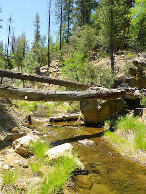


Chris at the high point separating Fishbowls Canyon from Cedar Canyon.
We paused on Cedar Creek for a pleasant lunch before moving downstream toward Grade Valley. These miles are shady and scenic. Chris resumed his position out front and we blazed our way through. As we approached Grade Valley Road the trees thinned and we were back in the afternoon sunlight. On the road we turned north for a circuitous mile before the truck came back into view.  

Primordial fungus gnawing away at a fallen giant.


I can't tell if this old cedar was machine gunned by woodpeckers before or after it came down, Probably both.


Chris staring up at a 150 feet of old growth cedar.


Cedar Creek nearing Grade Valley Road.
This was a great first outing with Chris. He came as advertised, full of juice for the long miles. We got along well and I look forward to teaming for future endeavors. As for both Thorn Point and the Fishbowls Loop, both routes are thoroughly enjoyable and make a good pairing for an extended trail day. The views from Thorn are well worth the walk, and the fire tower is a treat. The Fishbowls trail is an easy route through beautiful forests and pleasant meadows, again, well worth your time. And I look forward to going back and visiting the actual fishbowls of Fishbowls Canyon.