Part deux, the second stage of our descent of the Sespe River. Back in the drink with
Jack Elliott for a second dose of whatever the Sespe had to offer. This portion of our
Sespe Connect project takes off from Tule Creek where we'd ended Stage I (Cherry Creek to Tule Creek), and travels roughly 10 miles to the Piedra Blanca trailhead. I can't speak for Jack but I figured we were in for another day of brush, cattails, murky ponds and bone dry creek bed. Stage II had plenty of each, but much more besides. This was a sweet stretch of relatively untouched native aquatica. Stage II turned out to be a surprisingly fun and interesting walk.
 |
| Stage II in blue. A portion of Stage I in yellow. |
 |
| The Sespe at Tule Creek in the morning light. |
As we did during Stage I, we opted to take the creek the whole way to our destination even though there was an option to get out of the creek and take the Middle Sespe trail. Neither Jack nor I had any interest in walking a hot and brushy trail when given the chance to wade downstream through Cottonwood Lane. We dropped into the creek and immediately began rock-hopping into the rising sun. Within minutes we were in the drink, sloshing down a wide and shallow stream shaded by willows and maple. As we neared the Feser Cold Springs ranch site the creek abruptly went underground, leaving us only a dry and rocky creek bed fenced by drying, dying cattails.
The phenomena of the "vanishing creek" is fairly common throughout our region during the dry season. Below a sun bleached creek bottom the ground water remains, drawn downhill and reconstituted later as a shady avenue of tree lined pools. This was the case for most of this stage, arid and treeless rock garden ceding to a lush water world. I'd say that the day was 50% one or the other, but unlike on many portions of Stage I, we encountered less of the marshy and mucky in-between stuff. It was served up neat, wet or dry, bartender's preference.
 |
| The glare on a wake of pond film. |
 |
| All the plants out there look dried up, just not the ones that live on the creek. |
 |
| Shady lanes of cottonwood. |
We snuck past the Feser site, which is mostly a barn and a double-wide on a shelf above the creek, and entered what is known as Middle Sespe. More time in the water walking the twists and turns of the creek. More foot-dragging through ankle deep sand, hopping rocks and dodging yucca. But for all that, it was surprisingly pretty and Jack and I both remarked that this place felt pretty native, un-messed with. This stage started from Hwy 33, but that road climbs up and away from the Sespe and the further into our morning we got, the more remote our surroundings felt. Which was perfectly okay with us. The going today was surprisingly easy (much less brush than on Stage I) and by mid-morning we had blown past what used to be Beaver Camp. Somewhere in that sunny and perfect day I came to the conclusion that I was really having fun. It just turned into that kind of day. We'd pull out of the creek and scramble up a stack of boulders just to see the view, or stop to investigate something that caught our eye. It was a very low stress day, and as I say, fun.
 |
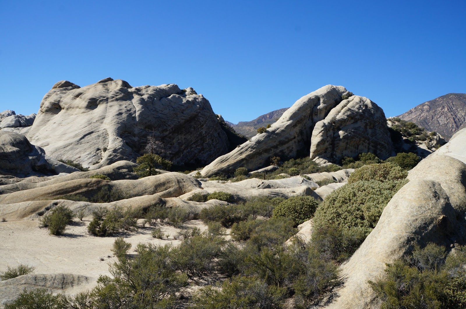
| Rock formation, Middle Sespe. |
 |
| A bone dry section of the creek. The trees know where this creek goes seasonally dry. Far fewer trees through the drought sections. |
 |
| Jack, somewhere in Middle Sespe. |
 |
| A sluggish, filmy section of Middle Sespe. Looks like bayou. |
As with our experience on Stage I, we had some interesting wildlife encounters on this portion of the Sespe. First of all, I got to see a Red-breasted Merganser Mergus serrator. As the name implies, this colorful duck does have a robins red chest. It has a flare of white on the wing tips, a white collar at the throat, and beautiful almost iridescent dark blue back feathers. A very pretty duck, and rare I think, in Southern California (I could easily be wrong on that). Somewhere through Middle Sespe we had a pair of giant bullfrog encounters. Neither of the 6-7inch long, 5 inch wide monsters were especially impressed with our presence. I spotted a heron, a huge red tail hawk, several pair of mallards, numerous small birds. We often were accompanied by one or two butterflies of various species. They seemed to stick with us for a ways and then hand us off to the next guy in line, sort of like state troopers escorting a troublesome out-of-stater straight down to the border (been there, didn't get a teeshirt). Let's see, oh yeah! A gorgeous and fully grown doe lept into the creek just 30 feet ahead of us and stopped there, looking at us for a second before bounding across the creek and into the trees where it vanished. That was cool. I dig that. Didn't see one snake today. I thought that was kind of weird but whatever.
 |
| Super Bullfrog #1! |

 |
| Super Bullfrog #2! You can use the willow leaves that he's so artfully arranged to get an idea how big this dude is. |
 |
| Super Bullfrog #2! Close-UP! |

 |
| I was immediately reminded of some battle-ground water hole in the Serengeti. Check out all the tracks, not one of them human. |
The rest of the day remained fun and interesting, and pretty easy travelling. The route was consistently pretty but few parts of this section of the creek really stand out in my memory. This was one of those "It's the journey..." days. We found ourselves pretty much done by noon and out to Jack's truck by 13:00. Easy Peezy.
Now, as for stage III, I think we will end up using the Sespe River Trail. That stretch, from Piedra Blanca to about Goodenough Rd at Fillmore, will be taxing enough without adding 17 miles of creek bottom to the route. It will take some scheduling but that is already sort of in the works.
 |
| Jack in the drink. |
 |
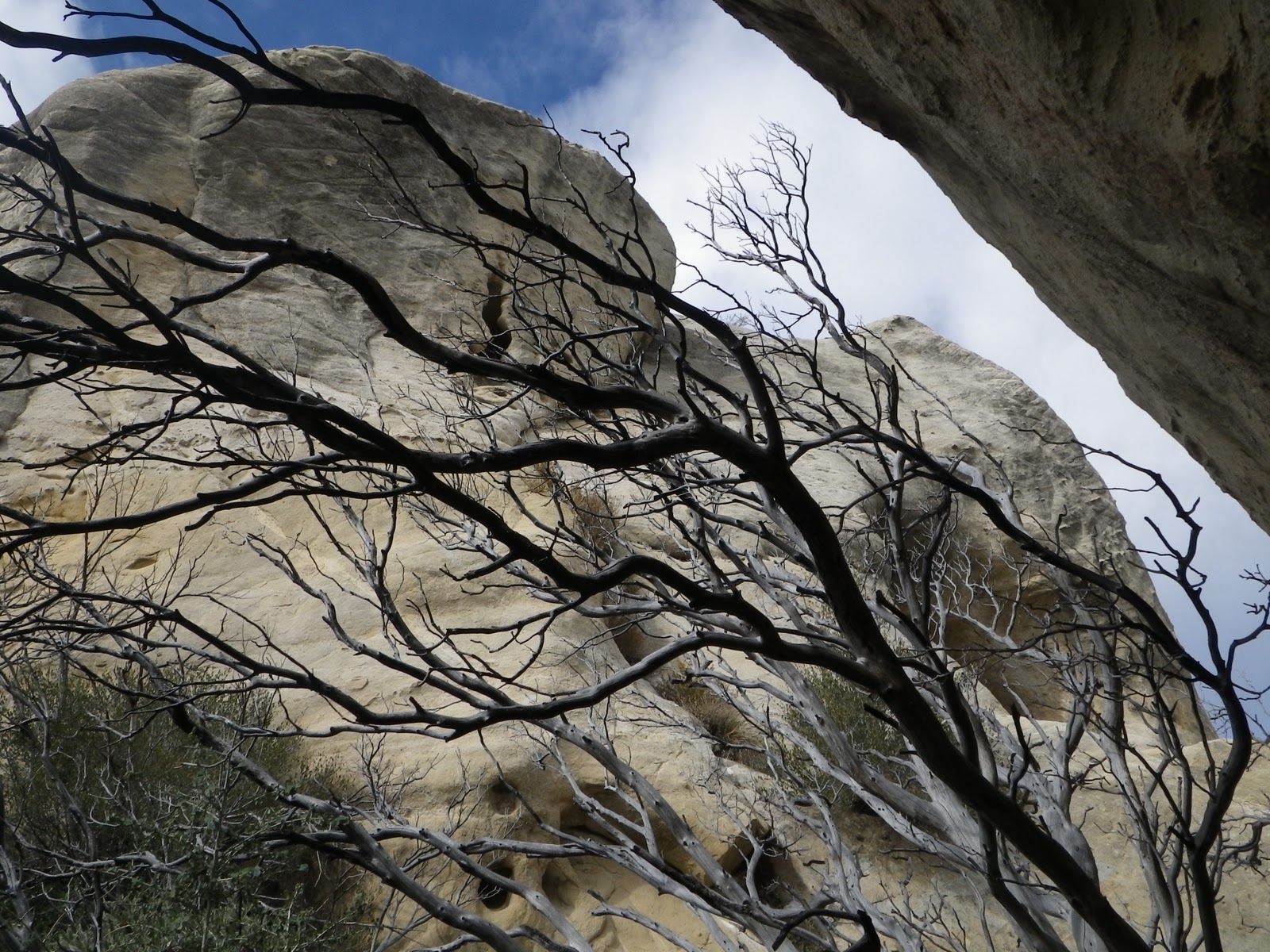
| This formation can be seen from the flat below the Piedra Blanca trailhead. |