Showing posts with label chumash rock art. Show all posts

Saturday, January 4, 2014

Chumash Site: The Halfway House


Here's an odd one. I was led to understand that deep in the heart of the No Man's Land behind Santa Barbara could be found a Chumash site that very, very few people have ever seen. All indications pointed to the fact that getting into that part of the forest would be extremely difficult, never mind actually finding the site. I was given a very general idea of the site's purported location, only that there was something Chumash there and that it could be found roughly midway between two other significant sites. The beta was second or third hand and the source that passed this information along did not know what could be found at the site. It sounded like a problem that was right up my alley. 


I did an in-depth analysis of potential routes which might improve the odds of success. Out of four potential possibilities one emerged as the single best option. Then it was time to hit up Jack Elliott to see if he'd be interested in joining me for the search. He was, of course, game. He's the guy I usually turn to when I want a solid off-trail partner, and this route was most definitely going to be that. In fact, though the other three options included portions of trail, most of the day would be in the sticks whichever way we took. I had every reason to expect that this day would be a bloody brush fight, otherwise known as "another day at the office".


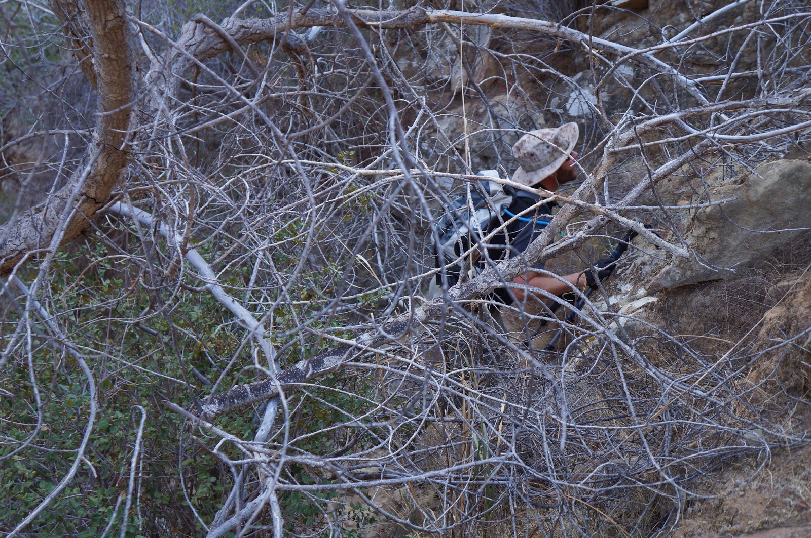
Jack and I got a good thrashing on the way up to the site, but not as severe as I had expected. On the way in we had to negotiate typical scrub conditions, lots of yucca (with its occasional "Ow! F*ck!"), plenty of spiky young manzanita (...more cursing), and several interesting geological obstacles. Eventually we entered a relatively recent burn area and things got a bit easier. Soon we had climbed into the right zip code and it was time to begin our search. 

Jack in the rocks.

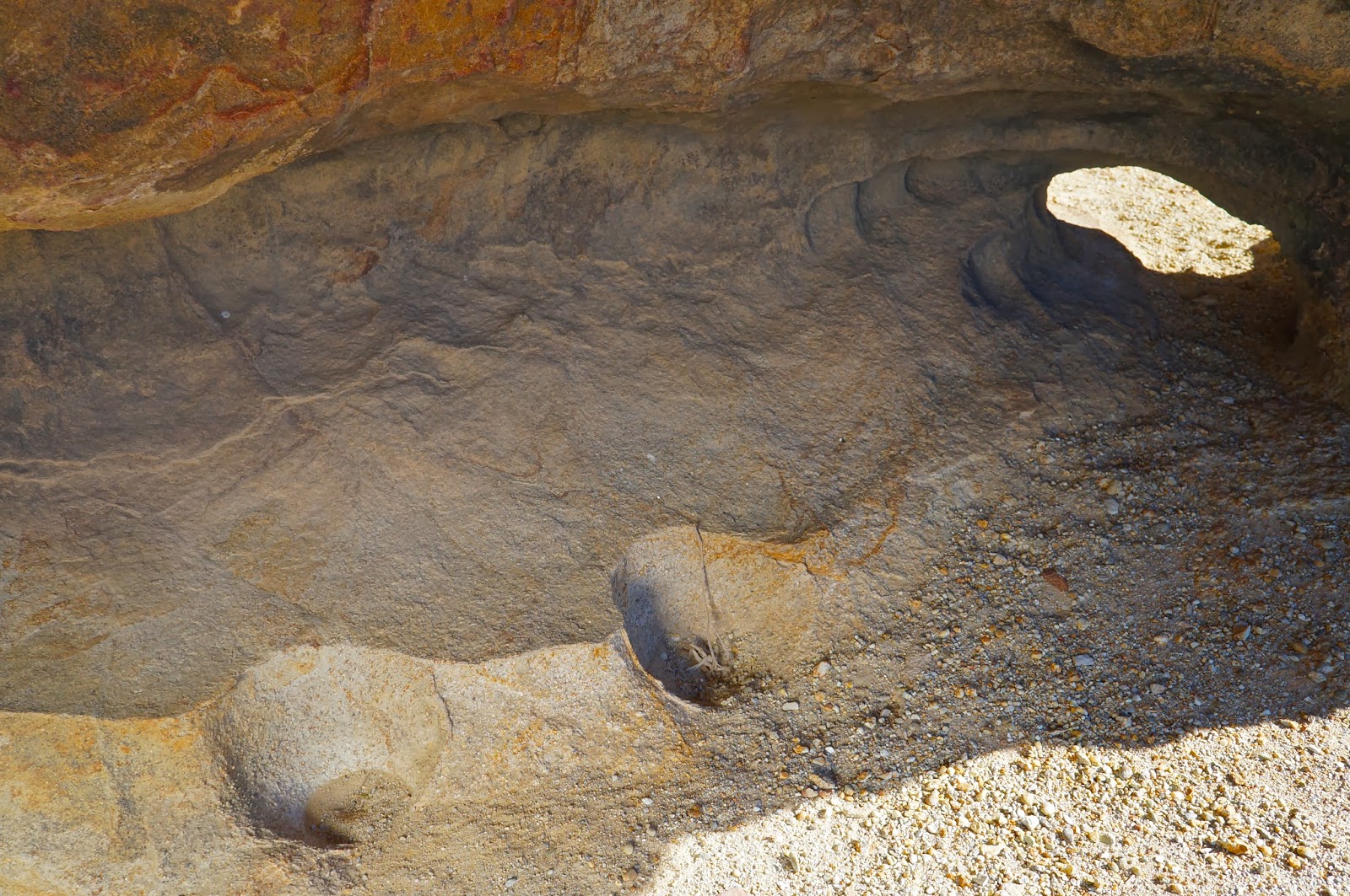
We started with a series of cave riddled sandstone formations on the western edge of our search area. At first we were disappointed to find that all of the pockets we were working were incredibly eroded. The rock was of such poor quality that floors of these caves were inches deep in fine sand. One could blow on this rock and watch it disintegrate. Jack and I split up and I found a series of wind caves that required some grit-sand climbing skills to get into. The floor of one such cave had a number of flat rocks on the floor which indicates a Chumash dry cache site. A dry cache is a cave or pocket, well off the ground, that usually requires some trickiness to reach. The Chumash would use these hard to reach pockets to store baskets or wraps with dry goods such as acorns, seeds, dried meat and other items. The point was to store these items in a place that rodents and other scavenging critters couldn't get to. Flat stones would be placed over these items to prevent them from suffering wind and rain damage, and to spare them from ravens and other birds. I have never found a dry cache with any artifacts in them, just the stones. When Jack and I linked back up he reported that he had also found a cache cave (we discovered a third cache later in the morning, photos below). Well, at least we were in the right neighborhood. We turned our search eastward, thoroughly scouring more sandstone stacks.

We found several water-channeled slots as we worked to the other side of our grid. Some of these were dangerously deep and contained tall drops. Hawk nests adorned the side walls of these mini gorges. Eventually, we stood on the rim of one such arroyo and as I peered at a single blob of sandstone a short distance away, something just clicked. Jack pointed out that the pockets in those small caves just across the way held some of the darker, browner type of stone that tends to hold up better over time, the type commonly associated with rock art. We wandered over for a look see and hit pay dirt.

The red sandstone pestle next to the BRM is not native to the immediate surroundings and was found exactly as shown. The other two stones showed signs of wear. We also found some fragments of brittle soapstone and a vein of highly crystalized quartz in the area.


This small site was unique in several ways. First, we found nine or so bedrock mortars, all highly eroded. The rims of several of these mortars had disintegrated entirely, leaving only shallow, half cups. Then there was the complete lack of any reliable water source any where in the vicinity, though the drainages I mentioned earlier had deep tanks which would have held rainwater for a time. Finally,  only a single pictograph adorned the site. Not even a fragment of any other art was visible. The first thing I thought when I saw this scrawling, red-lined picto was that I was looking at a map. Later I would compare it to a larger overview of the area using a topo map, and guess what? I still think its a map. The lines correspond very well with two major drainages and two of the outlying points are an almost exact fit with the two major Chumash sites I mentioned earlier, assuming that the primary center point of the pictograph represents "You are here.". I am 90% sure this pictograph is a simple line map. 


The third cache of the day. Note the flat stones that don't belong there. Three small man-made dishes in the soft sandstone aided in climbing up to the cache.

The cache above is the darker, left hand pocket.

For the sake of being thorough we continued through the rest of our self assigned search area but found nothing other than the third cache shown above. I did, however, notice a single set of scratch marks from an enormous bear. The claw lines were close to two inches apart. Eventually we had explored the entire area and decided there was nothing else to find. Time to turn it around and close the book on another interesting day in the Southern Los Padres.


Bear claw scratches.


Wednesday, December 25, 2013

Winter Solstice Site? "Expert" says no: Ferre Pedem Speluncam

Photo of this sun mandala taken Spring 2013
Having seen this particular pictograph in what I assumed was perpetual shade, you can imagine my surprise at learning that this painting is actually fully exposed to light for about one week per year, and that that only occurs during the week of the winter solstice (Which apparently does not make this site an "official" winter solstice sit, though obviously the timing of the sunlight on this pictograph is not coincidental. Please read comments below.). This was something I had to see for myself. To that end I met several good gentleman for a trip out to the site. In the late afternoon this "bullseye" of concentric rings was gradually revealed in the full light of the western sun. Pretty cool, but I'm kicking myself for not having brought a video setup. A time lapse clip would have been pretty neat. Maybe next year.


This shot was taken at around 14:45
at 15:20
at 15:45
and the following three were taken at 16:00


I also learned a few new things while out with these foul old dudes. For instance, in looking back through photos of mine taken at multiple sites there seems to be some truth to the theory that the "bullseye" mandalas only seem to crop up at sites that catch afternoon or sunset light (there is one exception that I've noted, but that mandala is attached to another element I call "the dark lord" and resides in year-round shade, to be found on the Carrizo). The flip side of that is that those sites that catch the morning sun tend to have mandalas formed around pointed star figures and have triangular rays somewhere in/or enclosing them. Looking at my own photos I smacked my forehead at the obvious truths of this revelation, truths which, it turns out, are possibly not so true. The person whose comments follow this post has insisted that he has all the answers and has invested a great deal of time  researching and promoting his theorie . If you're interested in learning more you can read the comments below and read his paper on the subject of solstice sites. I still say that the timing makes this bullseye a solstice phenomenon.

The image that I call "The Dark Lord" with a concentric ring sun mandala. There are a number of astronomy based elements at this Carrizo site including multiple "sunrise mandalas", half moons, star and planet designs, so it is pretty clear to me that this site had strong ties to the heavens.

An example of a "sunrise mandala" (and below). Both these paintings face east, the direction of the rising sun.

A half moon, star, and either a planet or full moon, from the same Carrizo site as the three preceding photos.

That's all I got today, and Merry Christmas.

Wednesday, November 20, 2013

Fresh Vandalism: Piedra Blanca Camp Pictographs


As disciplined as I'm trying to be about negative emotions and not saying things that imply judgement of others, some people just suck and deserve a brick to the head. While on an otherwise excellent day of rediscovering a long ignored friendship with Leo Genet (Asst. Scoutmaster Troop 302 Santa Paula) we ran into evidence of fresh vandalism to the pictographs at Piedra Blanca Camp. The upper image needs no explanation. The bottom image shows markings that indicate to me that this person or persons stood back and threw rocks at the art. I have a loose connection to the Site Monitor and sent him these images yesterday so he can report them to the appropriate authorities.


Monday, April 23, 2012

Deal Canyon and Rancho Nuevo Creek, 04/20/12 **with Author's note

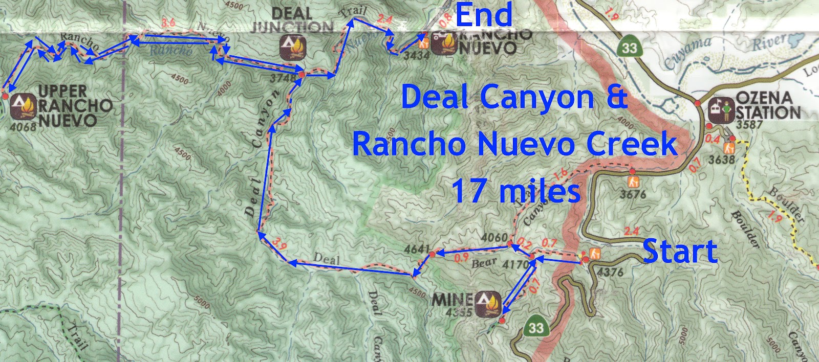
Another great day out on the dirt, kicking rocks with Jack Elliot. Today was a stab at a trail neither of us had any experience with, Deal Canyon. This trail starts high on the north side of Hwy 33 and descends into a series of canyon bottoms, all of which burned in 2007's Zaca fire. The route ends at the Rancho Nuevo trailhead off Tinta Rd. Aside from the fact that it's a local trail and I haven't done it, I got information prior to our trip that made me eager for a visit. A friend of the blog, Jack Clayton, has a buddy named Hank, an older guy who is a hydrologist for the county. Hank's apparently been all over these hills and gave Jack some info to pass along: first, I guess there is a "geothermal anomaly" up a branch of Deal Canyon that super heats the ground much like the one off Goodenough Rd above Fillmore, and second, he told me to look "under a brown rock" and I might find a lost Chumash pictograph. Okay... 17 miles to hike, look under brown rocks. Got it. 

 Jack and I dropped a vehicle at the trailhead for Rancho Nuevo Creek and drove another car back up the 33 to the Deal Connector trail (see map). We put in from the 33 and very quickly we met the trail junction for Mine Camp. Mine Camp has the feel of a place being used for beer drinking with guns. The camp itself is pretty nice, shady and secluded, but the nearby creek is intermittent, and shell casings litter the site. We poked around for a bit, looking for any sign that there had been any kind of working mine here but couldn't find any. I would have to theorize that if there ever was a prospecting operation in this location, it was likely panning or placer in nature. Moving on...


Strange, highly eroded sandstone formations litter the floor of these canyons.
Back on the Deal Canyon trail we headed west with the rising sun at our backs. Bear sign came early and often as we eased into the day. The Deal trail, as I mentioned, passes through fire territory, and much of this hike reminded me of my recent foray to the Sisquoc. An explosion of all our favorite local chaparral has largely obliterated the route. Someone had been through this area 6-8 weeks ago with a pair of horses and tracking the horses made trail hunting largely unnecessary, but this was a mixed blessing. The horses had come through right after a storm and 8 hoofs had completely chunked up the trail, basically creating many miles of uneven terrain that became somewhat annoying as the morning progressed. We saw no evidence of foot travel for the first 14 miles of the day.
Mine Camp.


Not much doubt about who owns Deal Cnyn.
We passed through miles of broad valley,  with charred cottonwoods and oaks for company. The valley floor is filling up with manzanita, sage, and grasses. Just another lonely canyon regressing to desert. Most of our local hills, especially if burned, are now becoming more and more "desertified". As the climate warms and California's water tables fall, fewer trees will replace the burned ones and the low-lands will revert to the desert chaparral we found ourselves hacking through. 

Our route wound down the long valley, crossing Deal Creek many times. The creek wasn't much to look at, broad, shallow, and already greening with algae. One plus with creeks like these is that the muddy banks held the prints of just about every critter in the neighborhood (I ID'd the prints of bobcat, raccoon, coyote, bear, and numerous birds). Random piles of  eroded sandstone marked the passing of the miles, without which the uniformity of the valley floor would have become rather monotonous. So far I hadn't seen any brown rocks worth looking under.

Another sign tagged by local bears. Bear Hooliganism.


Numerous creek crossings, muddy kicks.


As with the Santa Barbara and Sisquoc Canyons, this exuberant profusion of brush has benefited the local birds. These canyons are filled with dove and quail. We spotted several large red tail hawks during the morning. A pair of red tails, likely mated, called back and forth across the canyon for a time. Once, while approaching an arroyo, I startled a large Harris Hawk. This pretty raptor flapped up out of the gully and onto a tree branch about 20 feet from me. He decided I was still too close for comfort and took off for the other side of the canyon.
I mentioned a "geothermal anomaly", this creek of milky sulphur water might come from the source. We didn't investigate.


We came to the point where Deal Canyon takes a right and flows north. This bend in the canyon narrows down to a hundred or so feet wide, not a true narrows, but the walls of the canyon became steeper, rockier, and passing through this gap, we saw a small series of little meadows, bordered by canyon walls. This section of trail is kind of pretty, and one does get the sense that they are in a narrowing canyon.

So, here I am, just kind of tooling along when I pause and look left. About 60 feet away is a big brown rock. Jack caught up to me and I said something like, "If I wanted to paint something under a rock, wouldn't that rock over there be ideal?" I decided to go have a look see. When I got to the boulder (brown rock) and made sure I wasn't going to get bit by something, I crawled underneath and Eureka! A fading 24" rattlesnake picto! Sweet. So far, I hadn't seen anything in this canyon worth coming back to, so finding this ancient painting was a big, unexpected bonus.
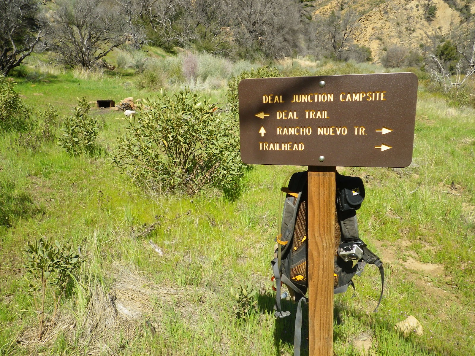
Though I got the sense that few people travel this way, this sign has to have been placed after the Zaca Fire.

 
 Jack and I left the pictograph behind and continued down Deal Canyon, eventually passing through a bottleneck in the creek (I hesitate to call it a "narrows"). This section of creek hadn't completely burned and most of the trees had held on. The trail stuck with the creek through this part, steep sandstone walls on either side. After this pinch in the creek we moved into a meadow, the junction of Deal Creek and Rancho Nuevo Creek. We took a nice little break here under a charred cottonwood. We both brushed off a half dozen ticks before heading up Rancho Nuevo Creek.

Jack, break time.


Nobody had dated this geocache on Rancho Nuevo Creek. Silly game.


Jack Elliot, Upper Rancho Nuevo Camp.

Rancho Nuevo Creek is very similar to Deal, though it is a narrower canyon. It too, burned, and the brush is even worse through this area. Unlike Deal, the sides of Rancho Nuevo are studded with numerous, oddly eroded sandstone formations. This route heads west before turning south to pass through another choke point, which is where one finds the thoroughly unspectacular Upper Rancho Nuevo Camp. This is basically a flat spot under a torched cottonwood next to a wash. A bit above the camp is a small, brushy pothole valley.
I found a rusted old broadhead arrow tip, the kind used by deer hunters, but nothing else to indicate the need for this campsite. I can imagine, a hundred years ago, a few vaqueros heating branding irons over this crappy old fire ring in the middle of nowhere. And that's about it for this remote canyon, nothing to see or do. There. See how cool I am to you guys? Now you can just take my word for it and skip this one.
Upper Rancho Nuevo Camp


We backtracked to the Deal/Rancho Nuevo Junction, then turned north to finish our route. We continued down Rancho Nuevo Creek and things actually started getting pretty. This canyon, for some reason, was spared the worst of the fire. This last 2.5 miles of our day passed through a deep, steep-walled gorge. The trail runs through the creek and now and then up into stands of jeffrey pine and oak. Both Jack and I agreed that this short piece of trail was scenic and worth the visit.

The Lower Rancho Nuevo Canyon. Pretty.


So, check this one off the list and most likely never go back. I'm over what I've been calling "The Scorched Earth Tour", had enough of trudging through burn areas. So, this 17 mile route took us 8.5 hours with all the breaks, ticks, and heat. If you're going to go out and hunt for that picto, I'd just put in at Tinta and go up Rancho Nuevo to Deal Canyon. The rest of it isn't really worth anybody's time. Jack and I had a good day though, and like the man says, they can't all be winners.
I can't stand these new plastic signs. Plastic everywhere. Soon we'll be making people out of plastic.

!*%#*^@!! Author's Editorial Privilege Alert! 04/24/12

First I'd ask that you all read Nico's comment (see comments section below). 

So Nico, since I have no way to email you directly, allow me to express my high regard and offer salutations. I look forward to your comments. You usually hint at having undergone equally arduous ventures and I have come to understand that we probably share the same sickness.

Man, I was awfully critical of Rancho Nuevo Canyon, but just the upper part including the camp. I went as far as to use the descriptor, "crappy".  I also declared, "Ain't worth the time, don't go there.". Sir, I stand by my words, but your suggestion that that upper canyon and the creek above it are a "special place" gave me pause. After a ruminative five minutes of self reflection, I concede that I was, perhaps, a touch hasty and a bit judgmental. Just a bit, mind you. 

So, Nico, in lieu of even a partial retraction, I offer this, that the entire Rancho Nuevo Drainage is a place of historical significance, the various canyon bottoms are ruggedly beautiful, and I can admit that I felt the "age" of the place. Yes, it was peaceful, and your comment led me to wonder what else up there you might have seen that I didn't. 

So here it is: Rancho Nuevo Canyon is a nice place to visit if:
  • It's not 92 degrees Fahrenheit
  • It's not a banner year for tick populations
  • You didn't just walk through 10 miles of burn area to get there
  • and only if you understand, like Plato, that beauty is in the eye of the beholder
Nico, drop me a line brother, or don't. Dig your style though.