
Below: click on the pic to see where I went, and will not need to go visit ever again.
 Back on the 27th of July I went up Topa for a preliminary recon of the top of the Bluffs. This was to be the first step in a plan to find a way to the bottom of the bluffs, and then establish a climbing route back to the top. This was actually a serious idea to me, for some time. I have now been thoroughly disabused of that notion (hubris?). Suffice it to say, that after today that plan has been scratched.
Yesterday I drove up to Ojai and the overweight bureaucrat behind the desk at the USFS office gave me a permit and the gate combo for Nordoff Ridge Rd. This morning I drove up and hiked all over the top of Topa. I can now say that I know the top of that mountain as well as any and better than most. I descended to the edge of Topa Topa's three major prominences and descended the two drainages that bisect them. I can assure anyone with the same crazy idea I had that just getting down the bluffs will end in bloodshed and frustration, as it did for me.
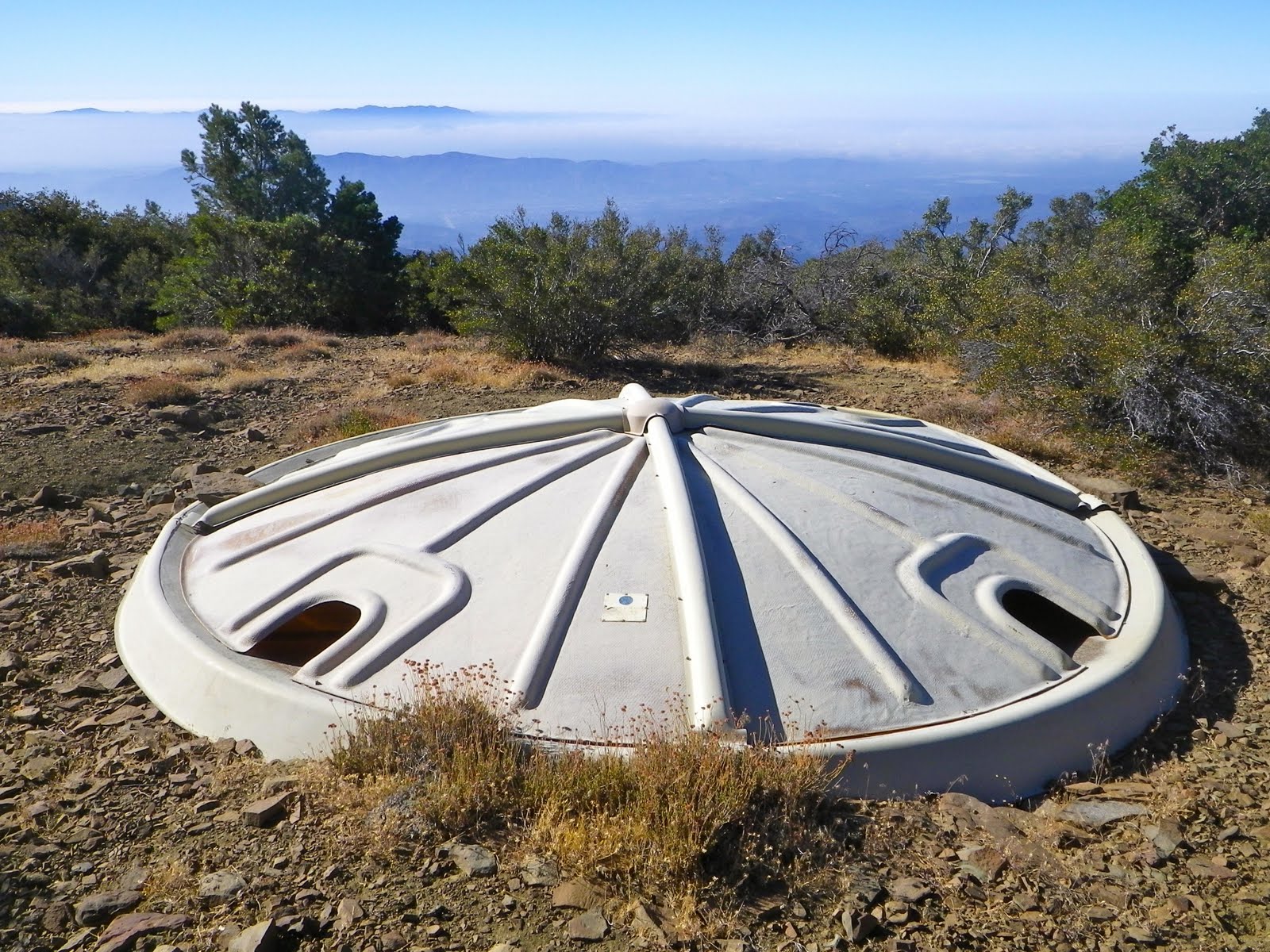
Below: back in 1983 an equestrian club put this UFO looking water trap up on top. I'd known about this for years, even though it is now off the beaten path and can be difficult to find.
Below: Every way I tried to get down became a brush fight that I eventually lost, and I'm a tenacious guy. Who is now covered in scratches.


Below: Just one of the day's numerous insults.

So what did I learn today? First, I'm not doing that again. Second, and obvious (now), I am not going to put up a new route on the face of Topa. And third, all deer trails end with you wondering what the hell the deer was on when they went there. This is an apt lesson, and the irony does not escape me.


dave i heard you can use this road to get to last chance trail and then bear heaven. do you have any idea of a route? or trail map?
ReplyDeleteBeen fantasizin bout'a route up tha ridgeline E of Sisar Crk...
ReplyDeletehttps://goo.gl/maps/1jovqfSpVuhXhFX97
Imagery's clearly "post-fire", and I realize it's had time to grow back. I also realize that that last section, right below tha bluff looks "dicey", at best, and TREACHEROUS, at worst, but I figure I'd be able to traverse thru that bowl, n come up that chute to connect w/the more "user-friendly" (Apparently!) ridgeline, to the E to access tha top'a tha bluff...
https://goo.gl/maps/R9AZoVDdJ9nZfuDh7
My goal is to findaway down to the upper falls on Santa Paula Crk...
https://goo.gl/maps/UNkLyYb9xtydJon89
Any recent exp up there? Any thoughts on tha feasibility of my "fantasy"?
I'm from San Diego, so I gotta makit count if I come up there!
Thx!
Joe