Here's an odd one. I was led to understand that deep in the heart of the No Man's Land behind Santa Barbara could be found a Chumash site that very, very few people have ever seen. All indications pointed to the fact that getting into that part of the forest would be extremely difficult, never mind actually finding the site. I was given a very general idea of the site's purported location, only that there was something Chumash there and that it could be found roughly midway between two other significant sites. The beta was second or third hand and the source that passed this information along did not know what could be found at the site. It sounded like a problem that was right up my alley.


I did an in-depth analysis of potential routes which might improve the odds of success. Out of four potential possibilities one emerged as the single best option. Then it was time to hit up Jack Elliott to see if he'd be interested in joining me for the search. He was, of course, game. He's the guy I usually turn to when I want a solid off-trail partner, and this route was most definitely going to be that. In fact, though the other three options included portions of trail, most of the day would be in the sticks whichever way we took. I had every reason to expect that this day would be a bloody brush fight, otherwise known as "another day at the office".


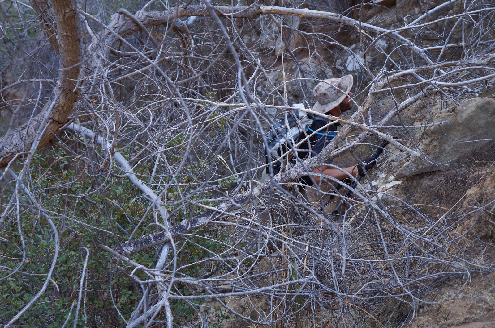
Jack and I got a good thrashing on the way up to the site, but not as severe as I had expected. On the way in we had to negotiate typical scrub conditions, lots of yucca (with its occasional "Ow! F*ck!"), plenty of spiky young manzanita (...more cursing), and several interesting geological obstacles. Eventually we entered a relatively recent burn area and things got a bit easier. Soon we had climbed into the right zip code and it was time to begin our search.
 |
| Jack in the rocks. |
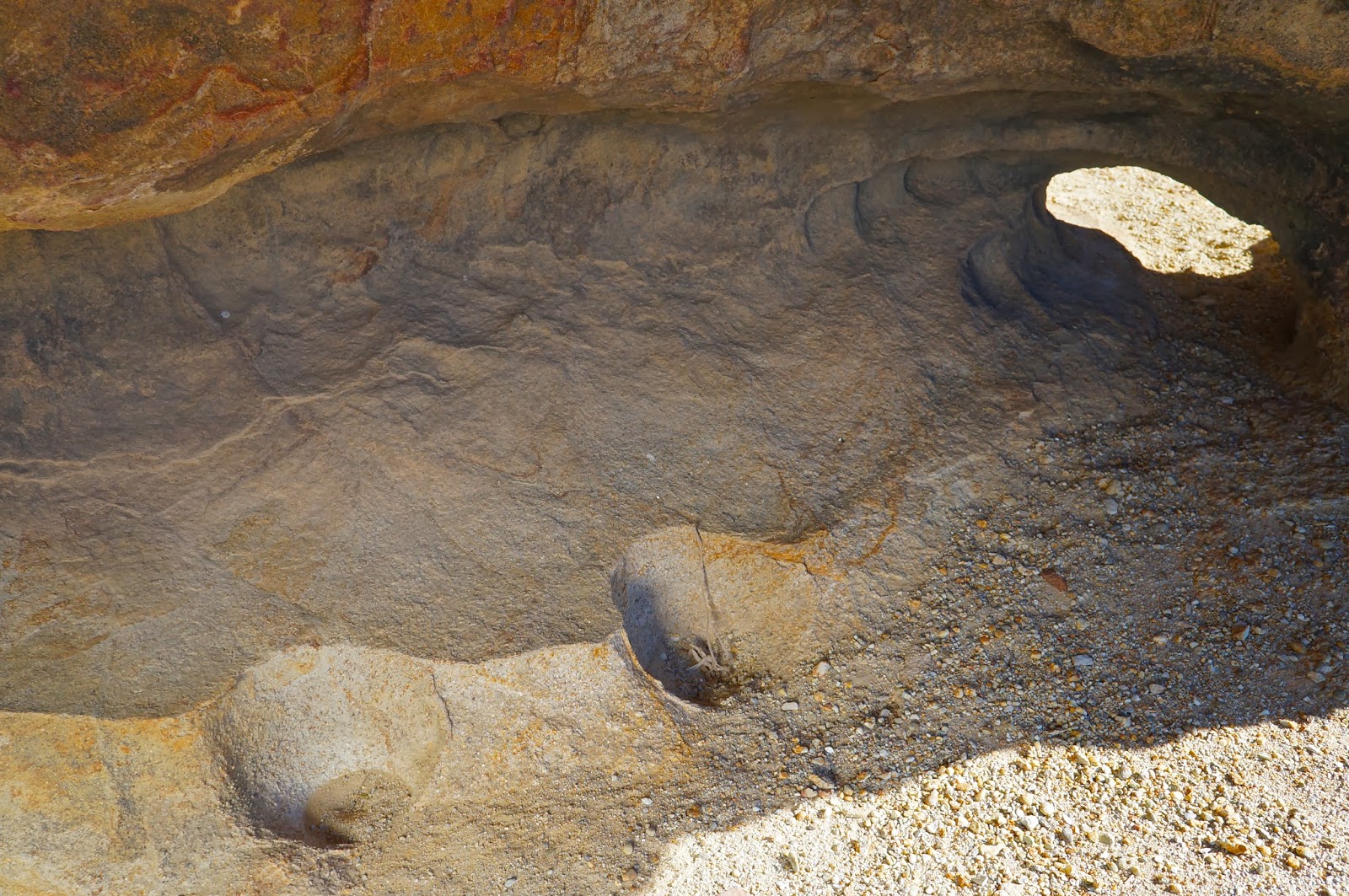
We started with a series of cave riddled sandstone formations on the western edge of our search area. At first we were disappointed to find that all of the pockets we were working were incredibly eroded. The rock was of such poor quality that floors of these caves were inches deep in fine sand. One could blow on this rock and watch it disintegrate. Jack and I split up and I found a series of wind caves that required some grit-sand climbing skills to get into. The floor of one such cave had a number of flat rocks on the floor which indicates a Chumash dry cache site. A dry cache is a cave or pocket, well off the ground, that usually requires some trickiness to reach. The Chumash would use these hard to reach pockets to store baskets or wraps with dry goods such as acorns, seeds, dried meat and other items. The point was to store these items in a place that rodents and other scavenging critters couldn't get to. Flat stones would be placed over these items to prevent them from suffering wind and rain damage, and to spare them from ravens and other birds. I have never found a dry cache with any artifacts in them, just the stones. When Jack and I linked back up he reported that he had also found a cache cave (we discovered a third cache later in the morning, photos below). Well, at least we were in the right neighborhood. We turned our search eastward, thoroughly scouring more sandstone stacks.
We found several water-channeled slots as we worked to the other side of our grid. Some of these were dangerously deep and contained tall drops. Hawk nests adorned the side walls of these mini gorges. Eventually, we stood on the rim of one such arroyo and as I peered at a single blob of sandstone a short distance away, something just clicked. Jack pointed out that the pockets in those small caves just across the way held some of the darker, browner type of stone that tends to hold up better over time, the type commonly associated with rock art. We wandered over for a look see and hit pay dirt.
 |
| The red sandstone pestle next to the BRM is not native to the immediate surroundings and was found exactly as shown. The other two stones showed signs of wear. We also found some fragments of brittle soapstone and a vein of highly crystalized quartz in the area. |


This small site was unique in several ways. First, we found nine or so bedrock mortars, all highly eroded. The rims of several of these mortars had disintegrated entirely, leaving only shallow, half cups. Then there was the complete lack of any reliable water source any where in the vicinity, though the drainages I mentioned earlier had deep tanks which would have held rainwater for a time. Finally, only a single pictograph adorned the site. Not even a fragment of any other art was visible. The first thing I thought when I saw this scrawling, red-lined picto was that I was looking at a map. Later I would compare it to a larger overview of the area using a topo map, and guess what? I still think its a map. The lines correspond very well with two major drainages and two of the outlying points are an almost exact fit with the two major Chumash sites I mentioned earlier, assuming that the primary center point of the pictograph represents "You are here.". I am 90% sure this pictograph is a simple line map.

 |
| The third cache of the day. Note the flat stones that don't belong there. Three small man-made dishes in the soft sandstone aided in climbing up to the cache. |
 |
| The cache above is the darker, left hand pocket. |
For the sake of being thorough we continued through the rest of our self assigned search area but found nothing other than the third cache shown above. I did, however, notice a single set of scratch marks from an enormous bear. The claw lines were close to two inches apart. Eventually we had explored the entire area and decided there was nothing else to find. Time to turn it around and close the book on another interesting day in the Southern Los Padres.

 |
| Bear claw scratches. |


It makes me very happy to know that there are still spots like this out there. Great post! Thanks...
ReplyDeleteIntriguing!! The Chumash precursor to modern day mapquest. Nice Theory.
ReplyDeleteMichael
To Pat: Me too!
ReplyDeleteTo Mike: as with all rock art related to the Chumash, it remains only a theory, but in this one case it makes a helluvalotta sense when compared to a real map. I think it's a good guess (in this case).
Loved readiing this thanks
ReplyDelete